Derryvree Between Two Tills31856 BCE
At 31,856 BCE, Ireland was in Marine Isotope Stage 3, a climatically unstable later Pleistocene phase rather than a precisely recoverable year. Derryvree, County Fermanagh, preserves freshwater organic sediments between tills, demonstrating locally ice-free conditions before renewed glaciation. Its mosses, sedges, insects and other remains indicate treeless, wet tundra with shallow water, seasonal growth and severe winters. Cave and fossil evidence shows diverse cold-stage animals reached Ireland, although local dates and species distributions remain uncertain. No secure archaeological evidence proves resident humans. Lower sea levels altered landscapes, but expanding Irish ice later transformed habitats, drainage and shorelines across the island.
Dateline
“31,856 BCE” is a modern numerical label, not a date that can be recovered from the Irish evidence with year-by-year precision. In radiocarbon terminology it falls roughly 33,800 years before AD 1950, but calibrated ranges at this depth are broad and sometimes revised as methods improve. The responsible frame is therefore not an event in one calendar year, but a phase of the later Pleistocene, within Marine Isotope Stage 3, when Ireland’s climates, ice margins and living landscapes changed repeatedly over millennia.
An Island Between Glaciations
This was long before Irish written history, agriculture, monuments or identifiable peoples. It also preceded the climatic low point conventionally called the Last Glacial Maximum, dated globally to about 26,500–19,000 years ago. Ireland was not yet uniformly buried beneath the ice sheet that later reshaped much of the island. Evidence from sediments, fossil remains, cave deposits and ice-sheet reconstructions instead indicates a varied and unstable world: some districts were ice-free, conditions were cold and strongly seasonal, and the growth of the last Irish Ice Sheet still lay ahead.
It is misleading to imagine a fixed national landscape. “Ireland” here means the landmass and surrounding shelf that would eventually form the modern island. Sea level was lower than today, so shorelines and estuaries lay farther out in places; yet the precise arrangement of land, sea, glaciers and seasonal ice changed through time. The island stood at the ocean-facing north-western edge of Europe, exposed to abrupt North Atlantic climatic shifts. Its history at this date is consequently environmental before it is political: it is the history of water, sediment, plants, animals and advancing ice.
Derryvree’s Freshwater Record
The most useful Irish evidence for the broad period comes from Derryvree near Maguiresbridge in County Fermanagh. Road works in 1969 cut through a drumlin and revealed organic freshwater silts and fine sands enclosed between two distinct sheets of till. That sequence matters because till records glacial deposition, while the intervening organic bed records an interval in which the locality was not covered by glacier ice. Its position between tills supplies a relative history: glaciation, an ice-free freshwater landscape, then renewed glaciation.
The Derryvree organic deposits produced a conventional radiocarbon age of about 30,500 radiocarbon years BP, with published uncertainty. Calibration has placed the deposit broadly between about 36,900 and 31,700 calibrated years BP. The modern year 31,856 BCE falls within that wide interval, rather than marking its beginning, end or a sampled day. Other Fermanagh evidence is older: organic material beneath till at Greenagho has been calibrated to approximately 37,200–35,700 years BP. Together, such deposits support the conclusion that north-central Ireland contained ice-free ground until at least around 34,000 years ago, before the major late-glacial build-up of the Irish Ice Sheet.
That conclusion must retain its limits. Derryvree is a local sedimentary archive, not a weather station for all Ireland. Its radiocarbon measurement is also a legacy determination, and modern work rightly scrutinises older samples and chronologies. Nevertheless, the combined stratigraphy, biological remains and calibrated range make it powerful evidence for an open, cold freshwater setting in Fermanagh during the relevant part of Marine Isotope Stage 3. It rules out a simple picture in which the entire island was continuously ice-covered at this point.
Moss, Sedge and Open Water
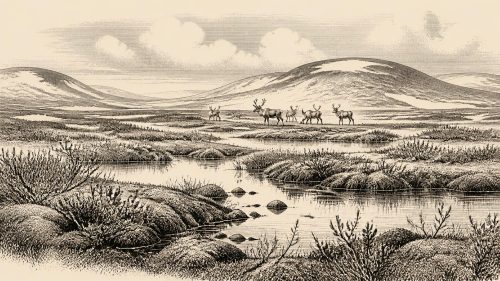
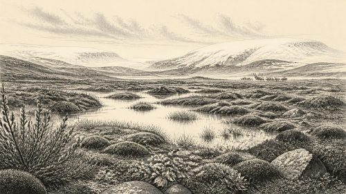
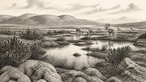
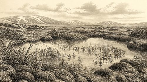
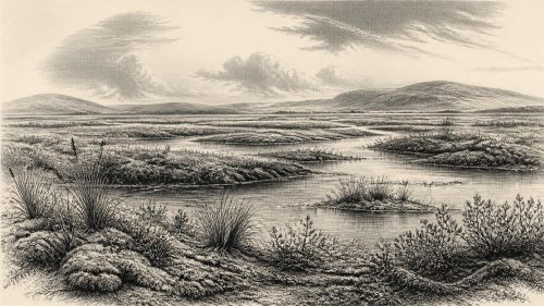
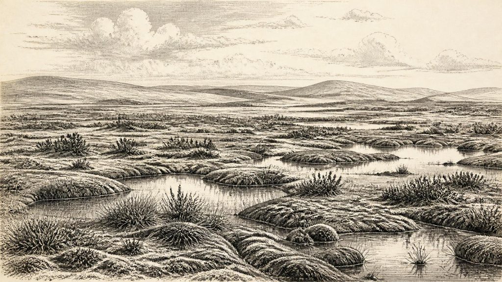
Pollen, plant macrofossils and insects from Derryvree provide the closest view of everyday ecology. They indicate treeless tundra or muskeg: wet, moss-rich ground with sedges, grasses, herbs and scattered low shrubs, broken by shallow pools and waterlogged channels. The pollen was poorly preserved, so it cannot yield a neat map of every plant community. Yet the wider assemblage consistently points to sparse, open vegetation rather than forest. Pine and hazel pollen grains need not demonstrate local woodland; they may have travelled far or been reworked.
The implied climate was harsh, especially in winter, though not a featureless permanent deep-freeze. Freshwater sediment accumulated, plants grew during the short productive season, and insects occupied wet ground rich in decaying vegetation. In south-west Ireland, uranium-thorium dating of speleothems at Crag Cave shows that calcite formed episodically during Marine Isotope Stage 3. Since such formation requires liquid water moving through the cave, it independently confirms that milder interludes occurred within the long cold stage. It does not mean that Crag Cave and Derryvree experienced identical local weather, but it reinforces the picture of rapid climatic variability rather than unbroken glaciation.
Frost weathering, seasonal thaw, waterlogging and shifting drainage would have shaped a difficult terrain. Later ice would erode, bury and redistribute much of this older surface, which explains why direct surviving evidence is so patchy. The drumlins familiar in parts of modern Ireland are themselves reminders that subsequent ice movement heavily modified the land. The Derryvree silts survived precisely because they were protected within a complex glacial sequence.
Animals on a Changing Margin
Irish cave deposits show that sizeable mammals entered Ireland at various times during Marine Isotope Stage 3. Castlepook Cave, near Doneraile in north Cork, is especially important. Its faunal collections include remains attributed to woolly mammoth, reindeer, giant deer, spotted hyaena, brown bear, wolf, Arctic fox, hare and lemmings. These animals should not be assembled into a single, timeless tableau. Cave floors can mix deposits, carnivores can move bones, and nineteenth- and early twentieth-century excavations did not always preserve the stratigraphic detail expected today.
Even so, radiocarbon programmes and later reassessments establish that a diverse cold-stage fauna reached Ireland during the long span from at least roughly 45,000 to 20,000 years ago. Re-dating has made some Castlepook specimens substantially older than their original determinations and suggests that animals such as giant deer and spotted hyaena may have disappeared locally before the Last Glacial Maximum. The secure lesson for 31,856 BCE is modest but important: Ireland could support, or be visited by, mobile animal populations in suitable ice-free intervals. It is not possible to say which species stood in Fermanagh, or in Cork, in this particular notional year.
There was no economy in the later historical sense. No evidence demonstrates herding, cultivation, managed hunting territories, exchange routes or permanent settlements in Ireland at this date. Animal movement was ecological, following forage, snow conditions, predators and changing corridors across the wider north-west European landscape. Caves may have served as dens, traps for accumulating bones, or short-lived shelters for animals; they are not automatically campsites.
The Human Question
There are no securely dated houses, hearths, stone-tool assemblages, burials or occupation surfaces in Ireland from around 31,856 BCE. Accordingly, political affairs, warfare, diplomacy, named communities, religious practice, language, art and formal learning cannot responsibly be described. They are not merely unknown details of an otherwise known society: the existence of a resident human society on the island at this time remains unproven.
A reindeer femur from Castlepook has been interpreted as bearing a mark made while butchering fresh bone with a stone tool, and its proposed age has attracted understandable attention as possible evidence for a very early human visit. But one modified bone, detached from a secure excavated occupation context, cannot establish a settled population, social organisation or an annual human presence. The National Museum of Ireland continues to state that clear evidence for human presence in Ireland during the Palaeolithic has not emerged. That caution is appropriate, particularly because cave assemblages and older radiocarbon dates have required repeated reassessment.
The absence of confirmed people should not be turned into a claim that people could never have reached Ireland. Human groups were present elsewhere in north-west Europe during the Upper Palaeolithic, and lowered sea levels altered regional geography. But possibility is interpretation, whereas Derryvree’s freshwater sediments and Castlepook’s animal bones are material evidence. For this year, the historical record is better served by keeping that distinction sharp.
Before the Ice Sheet’s Expansion
What came next gives the interval its wider importance. Reconstructions indicate that the bulk of the last Irish Ice Sheet expanded from broadly ice-free conditions around 34,000 years ago, reaching much greater extent later, with maximum advances in different sectors during the later part of the glacial cycle. By roughly 27,000–24,000 years ago, ice had extended across major offshore shelves and towards the south coast. That later expansion transformed drainage, shorelines, habitats and the survival prospects of plants and animals.
Thus 31,856 BCE belongs not to an Irish “year of events” but to a fragile interval before the island’s most extensive late Pleistocene glaciation. In Fermanagh, water, mosses, sedges and insects recorded a cold open landscape between episodes of ice. Across Ireland, the fossil record preserves glimpses of animals moving through an unstable frontier. The principal fact is uncertainty bounded by evidence: a living but severe environment, locally ice-free, with no demonstrable human polity or settled community, soon to be overtaken by the expanding ice-sheet world.
Primary Sources
- A Middle Midlandian Freshwater Series at Derryvree, Maguiresbridge, County Fermanagh, Northern Ireland
- Middle Midlandian Interstadial Deposits at Greenagho, Near Belcoo, County Fermanagh, Northern Ireland
- Trimlines, Blockfields and the Vertical Extent of the Last Ice Sheet in Southern Ireland
- A Reconsideration of the Radiocarbon Dating of the Marine Isotope Stage 3 Fauna from Southern Ireland
- The Irish Quaternary Fauna Project
- Episodic Speleothem Deposition Tracks the Terrestrial Impact of Millennial-Scale Last Glacial Climate Variability in SW Ireland
- Late Pleistocene Chronostratigraphy and Ice Sheet Limits, Southern Ireland
- Timing and Pace of Ice-Sheet Withdrawal Across the Marine–Terrestrial Transition West of Ireland During the Last Glaciation
- Maximum Extent and Dynamic Behaviour of the Last British–Irish Ice Sheet West of Ireland
- Dimensions and Chronology of the Last Ice Sheet in Western Ireland
- Stratigraphic and Palaeo-Geomorphological Evidence for the Glacial-Deglacial History of the Last British-Irish Ice Sheet in the North-Western Irish Sea
- New Data for the Last Glacial Maximum in Great Britain and Ireland
- The Timing and Magnitude of the British–Irish Ice Sheet Between Marine Isotope Stages 5d and 2
- Advance and Retreat of the Marine-Terminating Irish Sea Ice Stream into the Celtic Sea During the Last Glacial: Timing and Maximum Extent
- Character of Advance and Retreat of the Southwest Sector of the British-Irish Ice Sheet During the Last Glaciation
- The Colonization of Ireland: A Human Ecology Perspective
- Prehistoric Details: Mell Flint Flake
- Introduction to the Late Quaternary and Holocene of Northern Ireland
- Palaeoecology
- The Subdivision of the Quaternary Period in Ireland
- Castlepook Caves
- Castlepook Cave Excavation Report 2022
- New Insights on the Fauna of Ireland's Younger Dryas and Early Holocene from Alice & Gwendoline Cave
- The IntCal20 Northern Hemisphere Radiocarbon Age Calibration Curve (0–55 cal kBP)