
Maguirebridge Mossland31820 BCE
31,820 BCE is a modern approximation within Marine Isotope Stage 3, not a recoverable historical year. Ireland then experienced unstable Ice Age conditions before the Last Glacial Maximum. Derryvree’s buried freshwater sediments in Fermanagh reveal locally ice-free, open tundra or mossy wetland supporting herbs, sedges, insects and seasonal animal life. Castlepook Cave in Cork preserves remains of diverse cold-stage mammals, accumulated across different periods rather than as one community. A marked reindeer femur may indicate butchery by people, but lacks secure archaeological context and cannot demonstrate settlement. Later glaciation destroyed much evidence; environmental change, not human history, is securely documented.
Dateline
The label 31,820 BCE is a modern chronological convenience, not a year that anyone in Ireland could have named, recorded or experienced through a calendar. It corresponds only approximately to 33,800 calendar years before present, conventionally counted from 1950. At this depth of time, radiocarbon dates require calibration and are normally expressed as probability ranges; cave deposits and buried sediments are rarely precise enough to isolate one year, season or generation. The responsible subject is therefore Ireland during the later part of Marine Isotope Stage 3 (MIS 3), a fluctuating interval of the last Ice Age before the Last Glacial Maximum.
This was not an Ireland of farms, monuments, kingdoms or even securely demonstrated resident communities. Its history is read principally through sediments, pollen, mosses, insects, animal bones and the geological traces of ice. Those materials illuminate changing environments and the presence of animals; they cannot provide a year-by-year chronicle of human affairs. A single controversial indication of possible human activity at Castlepook Cave in County Cork deserves attention, but cannot bear the weight of a conventional origin story.
Dating a Landscape
Marine Isotope Stage 3, broadly dated to about 57,000–29,000 years ago, was neither uniformly frozen nor climatically stable. Greenland ice cores and North Atlantic records show repeated abrupt changes over centuries and millennia. Ireland lay on the western edge of that North Atlantic world, where temperature, precipitation, vegetation, sea level and the position of glaciers could alter substantially. Around the notional date used here, the great maximum expansion of the last British–Irish Ice Sheet still lay in the future: evidence from land and sea places the principal Late Midlandian maximum broadly after about 27,000 years ago, with many Irish offshore ice margins reaching their greatest extent later still.
That sequence matters because Ireland’s surviving evidence is fragmentary. Subsequent ice sheets scoured and rearranged much of the earlier landscape, while acidic soils seldom preserve bone. A cave can preserve remains for tens of millennia, but it is not automatically a habitation site: it may be a carnivore den, a trap, a drainage route or a place into which sediment and bones were washed. A buried freshwater deposit, meanwhile, records conditions at the place and time it formed, not the whole island. The archaeological task is consequently to distinguish a securely observed deposit from the larger environmental interpretation built from it.
Derryvree’s Buried Wetland
The most informative Irish environmental archive relevant to this broad period was exposed beneath a drumlin at Derryvree, near Maguiresbridge in County Fermanagh. Road works in 1969 revealed organic silts and fine sands lying between glacial tills. The deposit was laid down beside freshwater during an ice-free interval and was later sealed by renewed glaciation. A radiocarbon determination of 30,500 ± 1,170/1,030 radiocarbon years BP gave the sequence its historic importance, although it must not be converted into a falsely exact calendar date or treated as a direct date for 31,820 BCE.
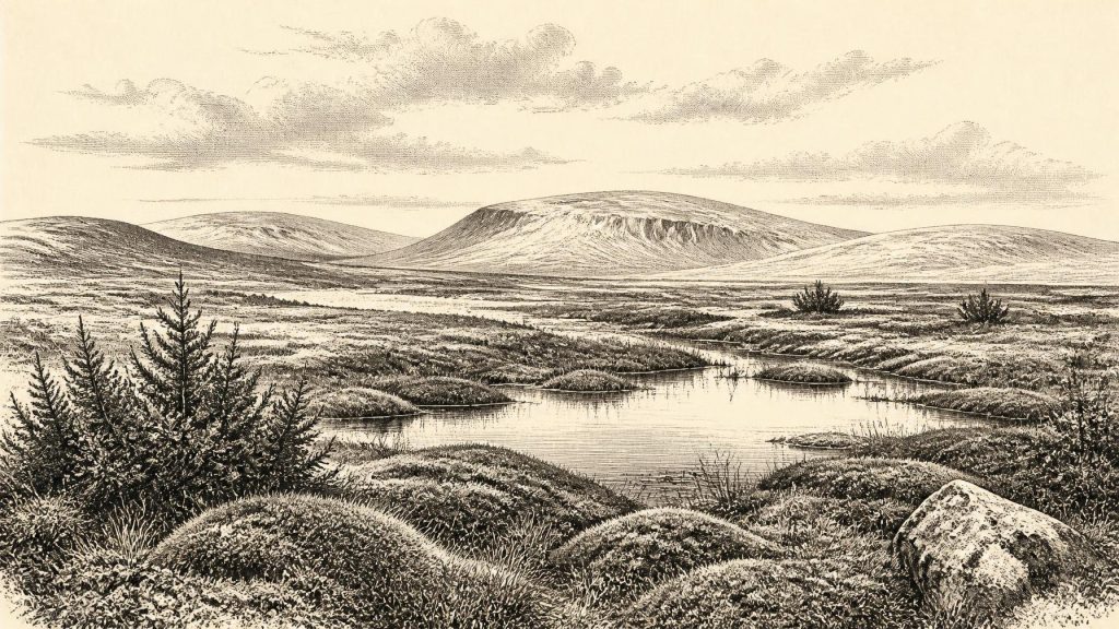
Its fossil contents nevertheless offer the strongest picture of an Irish cold-stage landscape. Pollen was dominated by herbaceous plants; plant macrofossils and a notable moss assemblage survived; insect evidence added detail. Together these support the interpretation of open, largely treeless tundra or muskeg-like ground: wet, mossy and sedgy in places, interrupted by shallow pools and affected by frost. Juniper and low-growing herbs belonged to this sparse vegetation, but there is no basis for imagining continuous forest. Dry ground may itself have carried only thin plant cover.
This was a productive landscape in its own hard seasonal way, not a sterile white void. Mosses, sedges, grasses and herbs could sustain invertebrates and grazing animals during favourable months, while waterlogged patches offered different habitats from exposed mineral ground. Yet the evidence does not tell us exactly what the weather was on a particular day, nor whether every part of Ireland looked alike. Derryvree gives a carefully bounded local window onto an interval of severe, open-country conditions in south Fermanagh. It demonstrates that biologically active ice-free terrain existed in Ireland during part of MIS 3; it does not map the precise edge of ice across the island in 31,820 BCE.
The Castlepook Fauna
In southern Ireland, Castlepook Cave near Doneraile in north County Cork preserves the richest known Irish cave archive for pre-Last Glacial Maximum vertebrates. Excavated mainly in the late nineteenth and early twentieth centuries, and investigated again in more recent projects, it has yielded remains attributed to reindeer, red deer, giant deer, woolly mammoth, brown bear, wolf, fox, hare, lemmings and spotted hyaena. These animals show that Ireland formed part of a wider north-west European cold-stage ecological zone at different times during MIS 3.
The word “different” is essential. It would be misleading to place all of these species in one illustrated herd or to assume that they were contemporaries at Castlepook in the year under discussion. Early excavations did not always record context to modern standards, and renewed radiocarbon work has transformed the chronology. In 2020, improved bone-collagen pretreatment produced dates for southern Irish fauna that were in some cases thousands of years older than earlier determinations. The reassessment suggested that giant deer and spotted hyaena may have disappeared locally before the Last Glacial Maximum, perhaps around 40,000 calibrated years BP. Castlepook is therefore evidence for successive animal episodes, carnivore activity and preservation within a cave system, rather than a single frozen tableau.
The cave’s fauna also cautions against simple claims about animal movement. Mammals plainly reached Ireland during favourable phases of the Late Pleistocene, but the routes, duration and frequency of those movements remain difficult to reconstruct. Low sea level exposed broader coastal plains and altered the geography of the Irish Sea, but a useful land connection depended on changing local topography, water depth, ice and relative sea level. It is safer to say that Ireland was ecologically connected at intervals to the wider region than to draw a definite land bridge for this particular date.
A Marked Reindeer Bone
The possibility of people in Ireland at this date centres on a reindeer femur from the Castlepook collection. The specimen has been reported as about 33,000 years old and bears a deep mark interpreted by zooarchaeologist Ruth Carden as damage made with a sharp stone tool while fresh bone was being butchered. County Cork heritage material presents the object as a possible trace of Palaeolithic hunters handling reindeer, an interpretation that would greatly extend the island’s human story beyond the securely attested post-glacial record.
The find is important precisely because the claim must remain cautious. The date concerns the animal bone, not a named person, a camp or a settled population. The mark’s identification as a tool cut is a specialist taphonomic interpretation, distinct from the radiocarbon measurement; its significance depends on excluding other forms of damage. Moreover, the femur derives from an old cave collection rather than an intact excavation surface with associated hearths, stone tools, dwelling features or repeated food debris. Recent excavation at Castlepook has sought better contextual evidence, but it has not yet supplied a published, securely stratified Upper Palaeolithic settlement.
If the tool-mark interpretation is ultimately confirmed, the most that can responsibly be inferred is a brief human encounter with a reindeer carcass, perhaps by mobile hunter-gatherers. It does not establish permanent occupation, continuous ancestry, the number of visitors, their language or their route to the island. The National Museum of Ireland’s wider caution that clear Palaeolithic human presence has not yet emerged remains an important corrective to headlines. A potentially butchered bone is a remarkable clue, not a complete society.
What Cannot Be Recovered
For this reason, political affairs, warfare, diplomacy and institutions have no evidential history in Ireland for 31,820 BCE. There are no named groups, rulers, boundaries, treaties or conflicts. Equally, there is no Irish evidence from this date for households, clothing, formal learning, ritual places, art, burials, monuments, farming, herding, markets or long-distance trade. It would be tempting to import the rich art and varied stone-tool traditions of Upper Palaeolithic Europe into Ireland, but neighbouring evidence supplies context, not proof of equivalent practice on the island.
Even an economy of hunting cannot be confidently described as Irish at this point, because a resident human population remains unproven. The fauna does demonstrate potential animal resources and ecological relationships: herbivores exploited seasonal vegetation, while predators and scavengers followed prey, carrion or vulnerable animals. Caves may have been used by hyaenas and other carnivores, which could have transported bones from elsewhere. Such processes explain why cave bone collections require detailed study before they are treated as records of human meals or settlement.
Approaching the Ice Maximum
The largest development visible around this nominal year was environmental change. Ireland occupied an unstable cold-world margin, with open wetland-tundra habitats in some places and ice advancing, retreating or persisting elsewhere over long timescales. The later growth of the British–Irish Ice Sheet would cover and reshape much of the island, destroying or burying many earlier traces. That geological legacy helps explain why the record is so uneven: Derryvree’s silts and Castlepook’s bones survived as exceptional archives, while open-air landscapes and any short-lived camps were far less likely to endure.
Ireland at 31,820 BCE is therefore not a blank page, but neither is it a human historical chapter in the ordinary sense. The evidence securely supports a changing Ice Age environment, freshwater wetlands in Fermanagh during a broad cold-stage interval, and a diverse succession of mammals in southern Irish caves. It also permits a carefully qualified possibility that people briefly reached the island. Beyond that point, honesty about uncertainty is not a failure of knowledge; it is the essential achievement of reading such a distant past responsibly.
Primary Sources
- A reconsideration of the radiocarbon dating of the Marine Isotope Stage 3 fauna from southern Ireland
- The Irish Quaternary Fauna Project
- A Middle Midlandian Freshwater Series at Derryvree, Maguiresbridge, County Fermanagh, Northern Ireland
- Irish Pleistocene Biostratigraphy
- Palaeoecology
- Figure 6.— The Subdivision of the Quaternary Period in Ireland
- Prehistoric Details
- Heritage Artefacts of County Cork
- 2022:564 — Castlepook Cave, Castlepook South, Cork
- Castlepook Cave
- Occurrence of Mammalia Relicts at Site Castlepook Cave
- Maximum extent and dynamic behaviour of the last British–Irish Ice Sheet west of Ireland
- Trimlines, blockfields and the vertical extent of the last ice sheet in southern Ireland
- Oscillating retreat of the last British-Irish Ice Sheet on the continental shelf offshore Galway Bay, western Ireland
- The timing and magnitude of the British–Irish Ice Sheet between Marine Isotope Stages 5d and 2
- Deglaciation, Earth Crustal Behaviour and Sea-Level Changes in the Determination of Insularity: A Perspective from Ireland
- Phylogeographic, ancient DNA, fossil and morphometric analyses reveal ancient and modern introductions of a large mammal: the complex case of red deer (Cervus elaphus) in Ireland
- Origin of British and Irish mammals: disparate post-glacial colonisation and species introductions
- The IntCal20 Northern Hemisphere Radiocarbon Age Calibration Curve (0–55 cal kBP)
- The IntCal20 Northern Hemisphere Radiocarbon Age Calibration Curve (0–55 cal kBP)
- Gulf Stream variability during Marine Isotope Stage 3
- Initial Upper Palaeolithic humans in Europe had recent Neanderthal ancestry
- New insights on the fauna of Ireland's Younger Dryas and Early Holocene from Alice & Gwendoline Cave
