
Archived: 26 September 2026
Abstract
In 1219, Ireland’s power remained fragmented among Gaelic kings, Anglo-Norman lordships, churches and Henry III’s wider dominions. William Marshal died, prompting a managed succession in Leinster under Isabel de Clare’s continuing inheritance, supported by officials including seneschal Walter Purcell. In Munster, Diarmait Mac Carthaig captured Henry Butler’s Timoleague castle and its hostages, exposing colonial vulnerabilities. Domnall Mór Ó Domnaill secured submissions in northern borderlands, while Cathal Crobderg Ua Conchobair exercised authority in Connacht amid Richard de Burgh’s competing claims. Ecclesiastical deaths and succession, alongside papal involvement in the Ferns dispute, underscored church influence. Events revealed shifting, contested lordships throughout Ireland.
Read Article

Archived: 26 September 2026
Abstract
In 1217, Ireland was a fragile lordship governed for the child Henry III from Dublin, alongside powerful Anglo-Norman magnates and resilient Irish kingdoms. Royal orders promised liberties to loyal subjects, promoted markets, Waterford settlement, land claims, engineers, castle defence and exchequer control. Strategic tensions surrounded the Lacys, Carrickfergus and Carlingford. Government policy sought English dominance in senior church appointments, despite continuing local influence. Annals record Irish fishermen killed on Man, Anglo-Norman raiding near Armagh, retaliatory cattle seizures and a favourable harvest. Marriage, commerce, ecclesiastical links and maritime travel connected communities, but coercion, exclusion and contested authority exposed the Crown’s reach.
Read Article

Archived: 26 September 2026
Abstract
In 1216, Ireland remained divided between Gaelic lordships, the Anglo-Norman Lordship and wider Plantagenet rule. King John’s final orders concerning Walter de Lacy’s estates illustrated royal administration and cross-channel aristocratic ties. After John died, the child Henry III inherited the Lordship, governed through councillors, William Marshal and Dublin justiciar Geoffrey de Marisco. Castle-building and Robert Travers’s disputed appointment at Killaloe exposed coercive colonial expansion. Church affairs linked Ireland closely to Rome through vacancies, papal interventions and diocesan reform. Gaelic rulers maintained authority, including Cathal Crobhdearg’s Ballintubber foundation, while annals recorded killings and legal scholarship, revealing overlapping jurisdictions, allegiances and cultures.
Read Article
Archived: 26 September 2026
Abstract
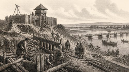
In 1213, King John’s submission of England and Ireland to Pope Innocent III altered the lordship’s international status, while Henry of London became archbishop of Dublin and justiciar. Royal and settler forces campaigned in Mide, defeating Cormac Ó Máel Sechlainn’s allies and building castles at Athlone, Birr, Durrow and Kinnitty to control crossings and routes. Cormac nevertheless recovered influence, illustrating frontier instability. Ulster saw Gaelic feuds, Anglo-Norman attacks, church plundering, Coleraine Castle’s construction and Áed Ó Néill’s raids. Clerical deaths highlighted enduring ecclesiastical centres. Ireland remained politically plural, as castles, warfare, alliances and royal administration reshaped contested regions across Ireland.
Read Article

Archived: 26 September 2026
Abstract
In 1211, King John’s Irish lordship remained fragile despite his previous campaign against the de Lacys. John de Gray, royal justiciar, sought to consolidate control through castles, garrisons, revenue collection and alliances, as recorded in the Irish Pipe Roll. At Athlone, Richard de Tuit and eight others died when a new tower collapsed, highlighting frontier tensions and disputes over church land. In the north, Áed Méith Ua Néill repelled foreign forces at Narrow Water, demonstrating organised resistance. Irish rulers negotiated through hostages and temporary agreements. Royal power expanded through administration and fortification, but Ireland remained a patchwork of competing jurisdictions.
Read Article

Archived: 26 September 2026
Abstract
In 1208, conflict within the Anglo-Norman lordship undermined royal authority in Ireland. William Marshal’s allies captured justiciar Meiler fitz Henry at Thurles, prompting King John to restore Marshal’s lands and appoint John de Grey. These settlements strengthened supervision but did not end rivalry among colonial magnates. Gaelic rulers remained independent actors: northern dynasties fought and later negotiated, while English influence shaped succession in Breifne. In Munster, dynastic disputes involved Limerick’s English community and church guarantors, despite breaches of protection. Ecclesiastical life continued amid violence and uncertainty. The year revealed a fragmented Ireland, governed through local alliances, force, charters and negotiation.
Read Article

Archived: 26 September 2026
Abstract
In 1207, King John’s Irish government faced armed opposition from Anglo-Norman magnates and continuing Gaelic rivalries. Justiciar Meiler fitz Henry’s disputes with the Lacys and William Marshal escalated into warfare across Leinster and Meath. Hugh de Lacy’s allies besieged Ardnurcher for five weeks, captured Firceall and forced Meiler from Ireland. Raiding and successions reshaped northern and western lordships, while Cathal Crobhdearg redistributed Connacht territory. Churches at Lismore and Armagh suffered attack, prompting ecclesiastical appeals to England. John promoted control through coinage rules, land grants and fortification, but these measures exposed rather than resolved fragile authority, foreshadowing his later 1210 intervention.
Read Article

Archived: 26 September 2026
Abstract
In 1205, Ireland remained a patchwork of Gaelic kingdoms, Anglo-Norman lordships, church jurisdictions and Irish Sea alliances. Severe winter weather disrupted rural life. King John created Hugh de Lacy earl of Ulster, but John de Courcy’s Manx-backed invasion showed the region remained contested. In Connacht, William de Burgh’s disappearance reduced pressure on Cathal Crobderg, who negotiated an emerging tributary accommodation with the Crown. Theobald fitz Walter founded Woney Abbey in Limerick, while annals recorded ecclesiastical appointments, local deaths and violence. These events demonstrate that authority depended on negotiation, warfare, kinship, patronage and maritime connections, with ordinary communities bearing political disruption.
Read Article

Archived: 26 September 2026
Abstract
In 1204, Ireland remained politically fragmented, with King John’s authority strongest in Anglo-Norman towns, castles and lordships. Justiciar Meiler fitz Henry curbed William de Burgh’s Connacht ambitions, while Cathal Crobhdearg Ua Conchobair negotiated terms to preserve part of his kingdom. In Ulster, John de Courcy’s displacement enabled the de Lacys’ rise, though royal law sought to regulate the outcome. Annals record raids, church plundering, Doire’s burning and Domnall Mac Carthaig’s southern victory. Ecclesiastical disputes at Iona demonstrated clerical power. Dublin fortifications, authorised fairs, and Duiske’s foundation linked royal administration, commerce, settlement and religious patronage amid continuing local conflict across Ireland.
Read Article

Archived: 26 September 2026
Abstract
In 1199, Ireland remained a fragmented landscape of Gaelic lordships, church lands and expanding Anglo-Norman seigneuries rather than a uniform English possession. King John’s accession united the English crown with the lordship of Ireland, though power remained uneven. In Connacht, Cathal Crobhdearg and Cathal Carrach made an uneasy peace as William de Burgh pursued his grant. Northern campaigns exposed colonial limits when Áed Ua Néill defeated foreign forces. Raids damaged communities and churches, including Armagh. Richard de Tiúit built Granard’s motte-and-bailey, strengthening Meath’s frontier. Annals record famine, capture, deaths, cattle-raiding and hostages, revealing conflict’s burden on ordinary populations throughout Ireland.
Read Article

Archived: 26 September 2026
Abstract
1198 in Ireland saw contested succession, ecclesiastical change and continuing regional conflict, though annalistic sources disagree over dates. Ruaidrí Ua Conchobair died around 1198–99 after retirement, symbolising the decline of an older high-kingship amid divided Connacht and entrenched English lordship. Cathal Carrach killed a dynastic rival, while a temporary peace with Cathal Crobderg sought to restrain their struggle. Gilla-Crist Ua Cernaigh succeeded Gilla Mac Liac Ua Brenáin as comarba of Colum Cille, affirming northern church authority. A castle at Ardpatrick reflected expanding lordship. Gaelic rulers, churches and Anglo-Norman magnates retained competing power across a politically fragmented island during this period.
Read Article

Archived: 26 September 2026
Abstract
In 1196, Ireland comprised competing regional lordships, churches and Anglo-Norman centres rather than a unified polity. Armagh’s canonry and precinct were burned, while conflict nearby saw Ruaidrí Mac Duinn Shléibhe’s mixed force defeated and Muirchertach Mac Lochlainn killed despite sacred guarantees. Sanctuary violations, retaliatory killings and dynastic successions demonstrated insecure local power. In Munster, Domnall Mac Carthaigh defeated English forces, challenged Limerick, attacked castles and negotiated over Cork, amid conflicts involving Irish and settler allies. Raids reached Louth and the midlands. Religious institutions remained politically influential, providing oaths, burial and retirement. Annalistic evidence depicts uneven disruption, not an island-wide crisis.
Read Article

Archived: 26 September 2026
Abstract
In 1193, Ireland’s competing Gaelic and Anglo-Norman lordships were reshaped by conflict, patronage and local alliances. Annals record killings among northern, Munster and Leinster rulers, violence by John de Courcy’s followers, and uncertain reports of a castle at Brí Uis authorised against Domhnall Mac Carthaigh. Affrica, wife of de Courcy, founded the Cistercian Grey Abbey on Strangford Lough, linking Ulster to Cumbria and the Irish Sea world. Prince John endowed Crumlin church for St Patrick’s, while Derbfhorgaill died at Mellifont. Inchcleraun was plundered, though sources disagree over the raiders, illustrating fragmented authority and contested evidence across the island's varied regions.
Read Article

Archived: 26 September 2026
Abstract
In 1192, Ireland remained politically fragmented, with Irish rulers retaining broad authority despite expanding lordship from Dublin and Leinster. John’s Dublin charter, dated 15 May, confirmed civic jurisdiction, trading privileges, guilds and burgess rights, strengthening colonial urban government. Ecclesiastical claims around Glendalough reflected contests over church revenues and authority. Leinster forces raided Thomond, built mottes at Kilfeakle and Knockgraffon, but Domnall Mór Ua Briain resisted successfully. Further castles at Horseleap and Kilbixy, and Geoffrey fitz Robert’s planned Kells settlement, advanced territorial control. Annals also record local killings, resistance, religious construction and an uncertain Dublin fire, illustrating resilient nationwide regional societies.
Read Article

Archived: 26 September 2026
Abstract
In 1191, Ireland experienced political fragmentation, local violence and severe environmental disruption. Ruaidrí Ua Conchobair, the displaced former king of Connacht, travelled north and apparently sought wider support to recover power after dynastic conflict, but gained land rather than a decisive coalition. In Munster, Muirchertach son of Cathal Odar was treacherously killed by incoming Anglo-Norman forces, illustrating unstable frontier relations. Annals also record construction of Rath-cuanartaigh castle and deaths of prominent churchmen. Most notably, a great wind destroyed churches, homes and woodland, killing people and livestock, exposing communities’ dependence on vulnerable material resources amid competing Gaelic and foreign rival lordships.
Read Article
Archived: 26 September 2026
Abstract
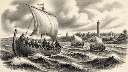
In 1190, Ireland’s politics combined dynastic conflict, local warfare, diplomacy and religious patronage. In Connacht, Cathal Crobderg and Cathal Carrach Ua Conchobair negotiated an inconclusive truce at Clonfert, mediated by churchmen, before a storm on Lough Ree drowned Cathal Crobderg’s son and leading followers. Rival branches of the dynasty remained violent. In Desmond, Domnall mac Carthaig defeated foreign raiders, recovered their spoil and secured peace with Domnall Mór Ua Briain of Thomond. Foundations or endowments at Knockmoy and possibly Killone demonstrated rulers’ religious and political ambitions. Anglo-Norman lordships expanded, but Gaelic rulers and institutions remained decisive across much of Ireland.
Read Article
Archived: 26 September 2026
Abstract
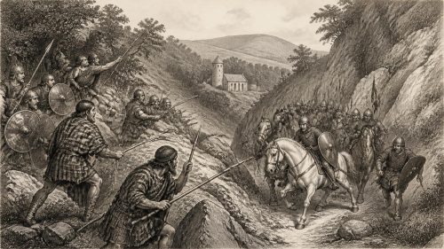
In 1188, John de Courcy led a broad Anglo-Norman expedition into Connacht, supported by Conchobar Ua Diarmata, but Conchobar Máenmaige Ua Conchobair and Domnall Mór Ua Briain defeated it near the Curlew Mountains after destructive raids through north Connacht. The failure confirmed limits to settler power and strengthened Conchobar briefly before his murder in 1189. Elsewhere, raiders from Magh Coba killed Ailech’s king Domnall Ua Lochlainn despite defeat, while Ruaidrí Ua Canannáin was murdered. Annals also record clerical deaths, pilgrimages, and domestic tragedy. Gerald of Wales’s Topographia circulated, promoting colonial assumptions challenged by annalistic evidence of complex, resilient Irish society.
Read Article

Archived: 26 September 2026
Abstract
In 1187, Ireland remained politically divided between Gaelic kingdoms and Anglo-Norman lordships, whose frontier was weakened after Hugh de Lacy’s death. Conchobar Máenmaige Ua Conchobair and Máel Sechlainn Bec destroyed Killare castle in western Meath, gaining arms and challenging colonial expansion. Northern dynastic warfare included Ruaidrí Ua Flaithbertaig’s death and reprisals after Drumcliff’s plunder by a mixed Gaelic-Norman force. Lightning or fire devastated the Rock of Lough Key, killing many inhabitants and straining Moylurg’s ruling family during succession. Churchmen, scholars and monastic foundations reflected reform and regional connections, while trade, agriculture and cross-cultural alliances shaped life amid conflict and recovery.
Read Article

Archived: 26 September 2026
Abstract
In 1185, eighteen-year-old John, Lord of Ireland, landed with an Anglo-Norman expedition intended to strengthen royal authority and curb magnates such as Hugh de Lacy. His poor diplomacy, disputed by Gerald of Wales in detail but evident in outcome, alienated Gaelic rulers and settlers alike. Castles in Munster provoked resistance and military losses, while dynastic wars continued across Connacht and Ulster independently of John’s aims. Town charters, notably Cork’s, and grants to newcomers including Theobald Walter encouraged lasting colonial institutions. Churches, learning, trade and cattle-based livelihoods persisted amid warfare. John’s December departure secured no general obedience, but strengthened royal footholds.
Read Article
Archived: 26 September 2026
Abstract
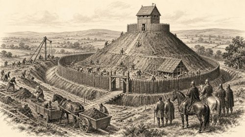
Ireland in 1181 remained politically fragmented among Gaelic kingdoms, Norse-Irish towns, church lordships and expanding Anglo-Norman territories. Henry II recalled Hugh de Lacy, fearing his autonomous power and Connacht marriage alliance, before restoring him under closer scrutiny. Flaithbertach Ua Máel Doraid defeated Connacht forces at Carbury, while killings, campaigns and cattle raids intensified Ulster rivalries. Tommaltach Ua Conchobair asserted Armagh's authority through Cenél Eógain; Henry influenced John Cumin's election to Dublin. Earth-and-timber castles supported settlement and land redistribution. Rural wealth depended on livestock and agriculture, while trade, monastic institutions and Gaelic learning endured. Rulers, churches and colonists contested regional frontiers.
Read Article
Archived: 26 September 2026
Abstract
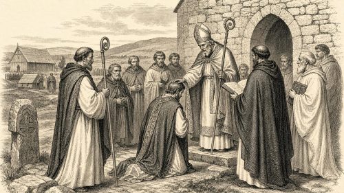
In 1180 Ireland remained politically fragmented, as Ruaidrí Ua Conchobair’s weakened high-kingship, Henry II’s overlordship and expanding Anglo-Norman lordships overlapped with resilient Gaelic dynasties. Hugh de Lacy’s marriage to Ruaidrí’s daughter demonstrated frontier diplomacy, despite royal suspicion. Connacht’s Battle of the Conors strengthened Ruaidrí’s family but devastated Uí Maine leadership, while local killings reflected persistent instability. Ecclesiastical politics shaped events at Derry and Armagh, where Tommaltach Ua Conchobair’s appointment required negotiation. Archbishop Lorcán Ua Tuathail died in Normandy during diplomacy with Henry. Castles at Carrickfergus and Meath advanced settlement, although Gaelic communities, pastoral economies and established ports retained substantial influence.
Read Article

Archived: 26 September 2026
Abstract
1179 Ireland remained politically fragmented despite Henry II’s overlordship, Ruaidrí Ua Conchobair’s western influence, and expanding lordships under Hugh de Lacy and John de Courcy. Laurence O’Toole attended the Third Lateran Council, became papal legate, secured Dublin’s privileges, and convened Clonfert synod to advance church reform against lay control. Henry reprimanded de Lacy following Irish complaints, but settlement continued. In the north, a relic-sworn peace at Ardstraw ended in treacherous killings and devastation. Fires damaged Armagh and several church centres. Annals recorded famine, warfare and destructive snow, exposing vulnerable rural communities amid religious reform, diplomatic engagement, and enduring political instability.
Read Article

Archived: 26 September 2026
Abstract
By 1178, English lordship in Ireland remained limited to Dublin, parts of Leinster and eastern Meath, while Gaelic kings retained most territories amid rivalries and shifting alliances. Hugh de Lacy raided Clonmacnoise and the midlands, but Connacht resistance constrained him. John de Courcy suffered heavy defeats during northern raids, showing Anglo-Norman arms were vulnerable to terrain, ambushes and supply problems. Warfare across Connacht and Munster damaged settlements, churches and livestock. Dynastic conflicts, ecclesiastical deaths, monastic foundations and learned culture continued alongside violence. Annals also recorded wind damage at Derry and the drying of the River Galway, as conquest remained undecided.
Read Article

Archived: 26 September 2026
Abstract
In 1177 Anglo-Norman expansion widened beyond footholds in Leinster, Meath and ports. John de Courcy secured Downpatrick, raiding eastern Ulaid but not conquering Ulster. Henry II’s Oxford council assigned Ireland to his son John and redistributed strategic lordships and speculative grants in Cork and Limerick, asserting authority. Anglo-Norman expeditions into Connacht and Munster encountered resistance, scorched supplies and limited success. Irish dynastic rivalries continued alongside invasion, while church institutions mediated violence and suffered attack. Synodal activity, disasters and deaths of learned figures illuminate religious and economic life. Ireland remained politically fragmented, yet conquest’s frontier and ambitions decisively expanded across Ireland.
Read Article

Archived: 26 September 2026
Abstract
In 1176, the Treaty of Windsor proved fragile as Anglo-Norman and Irish rulers pursued competing interests. Raymond le Gros relieved Limerick but later surrendered it to Domnall Mór Ua Briain, who destroyed the city after the invaders withdrew. Campaigns in Munster restored Diarmait Mac Carthaig in Desmond, while raids and castle-building provoked resistance in Meath and the north. Strongbow’s death in Dublin transferred his lordship into Henry II’s custody, increasing royal oversight. Maurice fitz Gerald also died. Warfare damaged churches, settlements and livelihoods, revealing unstable conquest amid dynastic conflict, shifting alliances, hostages, and cattle raiding across a politically plural island.
Read Article
Archived: 26 September 2026
Abstract
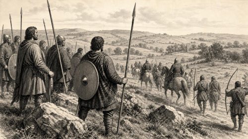
In 1174, Strongbow’s Anglo-Norman army suffered a decisive defeat near Thurles when Domnall Mór Ua Briain and Conchobar Máenmaige led Munster and Connacht forces against an expedition ravaging Munster. The reverse exposed the fragility of Henry II’s new lordship, already weakened by overseas commitments and uneven control beyond coastal towns. Heavy losses forced Strongbow to Waterford, where Hiberno-Norse inhabitants killed garrison members before Raymond le Gros brought reinforcements from Wales. Alliances remained temporary, while dynastic violence continued elsewhere. Church life endured: Gelasius, archbishop of Armagh, died, was succeeded by Cornelius, and a synod met at Birr. Warfare burdened rural communities
Read Article
Archived: 26 September 2026
Abstract
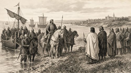
In 1171 Diarmait Mac Murchada’s death intensified conflict over Leinster, as Strongbow claimed succession through marriage while Irish dynasties supported Diarmait’s son. Dublin repelled Hiberno-Norse and Irish-led challenges, though Anglo-Norman settlements remained vulnerable. Henry II invaded in October to restrain Strongbow, received his submission, reserved major ports for royal control, and accepted submissions from several Irish rulers. At Dublin he held court, promoted Bristol settlement and displayed Angevin power. Church reform predated his arrival, but royal authority became linked to it. Henry neither conquered Ireland nor displaced Gaelic government, yet transformed a private expedition into enduring English intervention in Ireland.
Read Article

Archived: 26 September 2026
Abstract
In 1170 Diarmait Mac Murchada’s restoration in Leinster escalated through Anglo-Norman intervention. Raymond le Gros secured Baginbun, then Richard Strongbow captured Waterford, married Diarmait’s daughter Aífe, and seized Dublin, ending its independent Hiberno-Norse rule. The ports supplied strategic links to Britain, trade and military resources. Allied forces campaigned across Leinster and Mide, devastating ecclesiastical centres, while Ruaidrí Ua Conchobair retaliated by killing Leinster hostages, including Diarmait’s son. Wider conflicts persisted in Munster and the north. Rural communities, towns and religious houses suffered warfare, although commerce and reform continued. By year’s end, eastern conquests transformed power without establishing durable settled lordship.
Read Article

Archived: 26 September 2026
Abstract
In 1169 Diarmait Mac Murchada, seeking to recover Leinster, recruited Cambro-Norman mercenaries from Wales. Robert FitzStephen’s force landed at Bannow, joined Irish allies, captured Wexford and received land, creating a fortified coastal foothold. Diarmait’s subsequent campaign devastated Osraige and secured renewed submission, but prompted High King Ruaidrí Ua Conchobair to negotiate hostages and require dismissal of the foreigners. Ireland remained politically sophisticated, with competing kingdoms, active ports, rural economies and reforming Church institutions. The newcomers initially served an Irish king, not Henry II. Yet grants of territory and Diarmait’s continuing ambitions established a durable bridgehead, enabling larger interventions after 1169.
Read Article

Archived: 26 September 2026
Abstract
In 1168 Ruaidrí Ua Conchobair strengthened his contested kingship of Ireland through military interventions, hostages, tribute and public assembly. In Meath, he enforced heavy compensation for a protected king’s killing, contributing to political upheaval, and presided over the Óenach Tailten. In Munster, he arbitrated the Ua Briain succession, secured submissions and divided authority between Domnall Mór Ua Briain and Mac Carthaig. Diarmait Mac Murchada remained constrained in Leinster, although overseas alliances were developing. The deaths of Donnchad Ua Cerbaill, churchmen and cultural figures marked the year. Reported prosperity contrasted with divisions that made Ireland vulnerable to the landings of 1169.
Read Article

