
The Fermanagh Tundra Ledger31780 BCE
Nominally 31,780 BCE, this period cannot be reconstructed as a historical year, but falls within the climatically variable Late Pleistocene MIS 3. Inter-till deposits at Derryvree and Greenagho, County Fermanagh, show episodes of ice-free, wet, treeless tundra before later glacial expansion. Cave records confirm environmental fluctuation, while lower sea levels altered coasts and buried or eroded potential sites. Castlepook Cave, County Cork, preserves MIS 3 fauna including mammoth, reindeer, giant deer and predators. A marked reindeer bone may indicate human butchery around 31,000 BC, yet lacks secure archaeological context. Ireland’s evidence therefore documents ecosystems and a possible, transient human presence.
Dateline
The label “31,780 BCE” is useful for placing this entry in a long chronological sequence, but it must not be mistaken for a date in the historical sense. There is no Irish written record, named person, settlement, battle or calendrical event for this point. Nor can archaeology identify what happened in one particular year nearly 34,000 years ago. In conventional archaeological terms, the nominal date falls at about 33,730 calendar years before AD 1950, in the Late Pleistocene and broadly within Marine Isotope Stage 3 (MIS 3), an unstable middle phase of the last Ice Age. The responsible story is therefore one of dated ranges, sediments, animal bones and environmental change, rather than a year-by-year narrative of human affairs.
Dating a Deep Past
The difficulty begins with chronology. Radiocarbon measurements are expressed in radiocarbon years before present, where “present” conventionally means AD 1950; they are not direct calendar dates. Atmospheric carbon-14 varied through time, especially during the Ice Age, so measurements require calibration against curves assembled from independently dated records. At this antiquity the resulting calendar ranges can be broad. A deposit may overlap 31,780 BCE without showing that it formed during that exact notional year. It is better to say that evidence illuminates an interval around the date.
The closest important environmental archive is at Derryvree near Maguiresbridge, County Fermanagh. Roadworks in 1969 exposed organic freshwater silts and fine sands trapped between two layers of glacial till within a drumlin. This sequence establishes a relative order: ice deposited the lower till; an ice-free freshwater environment followed; later ice laid down the upper till. Organic material from the intervening deposits produced a conventional radiocarbon age of 30,500 years BP, with a substantial published uncertainty. Modern calibration places the deposit within a wide span broadly overlapping the later part of MIS 3, approximately 36,900–31,700 calibrated years BP. The numbered date belongs within that large window, not at a securely identifiable point inside it.
Wet Ground in a Cold Land
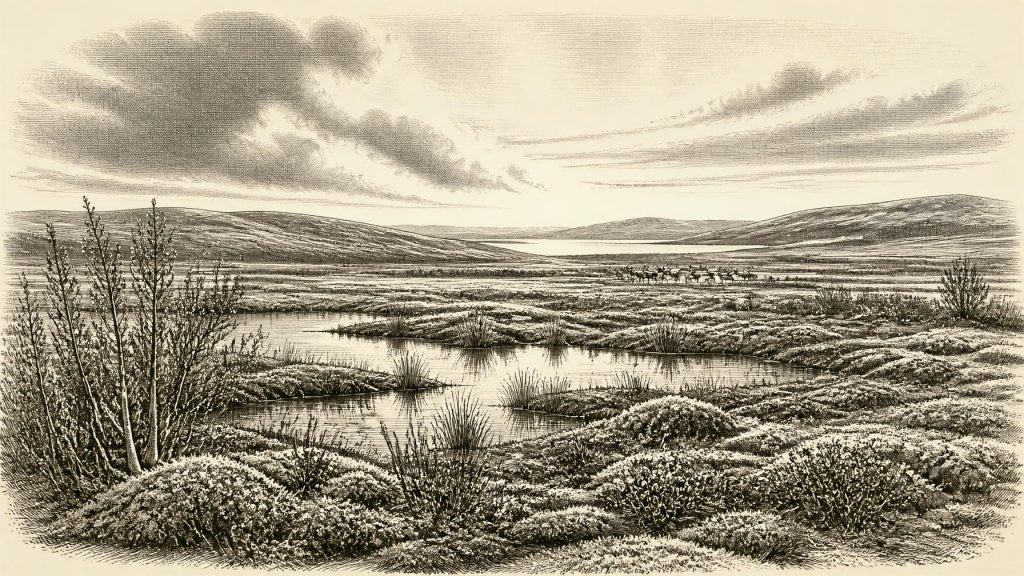
Derryvree provides the clearest evidence for what at least one Irish locality could have looked like around this period. Plant remains, pollen and invertebrate evidence indicated open tundra vegetation and a periglacial climate: one governed by severe freezing and thawing, rather than by a permanent woodland cover. Mosses, sedges, grasses and hardy herbs grew around shallow freshwater pools, wet hollows and silty channels. Low shrubs may have occurred in favourable places. This was not a featureless sheet of snow or ice. Liquid water, seasonal plant growth and organic sediment accumulation show that the landscape had a productive, if short, growing season.
That local evidence should not be made to stand for every corner of the island. Derryvree was a particular freshwater basin in what is now Fermanagh, and pollen can include material carried long distances or reworked from older deposits. Nevertheless, the combined botanical and insect evidence strongly supports an open, treeless and wet landscape there. Similar inter-till deposits at Greenagho, near Belcoo in County Fermanagh, reinforce the larger conclusion that parts of north-central Ireland were ice-free during intervals before a later glacial advance overrode and preserved these fragile deposits.
The distinction matters. “Ice Age Ireland” was not a single unchanging condition. MIS 3 included marked shifts in temperature, moisture and ice extent. Speleothems in Crag Cave, County Kerry, formed episodically during parts of this wider period, indicating phases when water could percolate through the limestone and deposit calcite. Such cave records cannot tell us the precise weather at Derryvree in 31,780 BCE, but they independently demonstrate that the long cold stage contained environmental fluctuations. Ireland’s landscapes changed over generations and millennia, not according to a simple march from warmth to total ice cover.
Before the Greatest Ice Advance
The later Last Glacial Maximum is much better known than this earlier interval. Reconstructions of the British–Irish Ice Sheet indicate that the great expansion which covered most of Ireland belongs chiefly to a later phase, with maximum ice extent reached after the period considered here. At about 31,780 BCE, the island was approaching, rather than already enduring, the fullest expression of that later glaciation. Ice margins may have advanced and retreated regionally, while considerable areas remained open or periglacial. The eventual ice sheet would erode older land surfaces, redistribute sediment and conceal many potential archaeological sites beneath till or offshore deposits.
Sea level was lower than today because immense volumes of water were held in northern ice sheets. Ireland’s coastlines, river mouths and surrounding shelf therefore differed greatly from the modern map. But it would be overconfident to draw a precise shore, assert a particular land crossing, or assume continuous access from Britain or continental Europe in this exact period. Changing sea level, local ice, rivers and marshes created a shifting geography. The archaeological importance is plain: many of the landscapes on which animals or people might have travelled are now submerged, eroded or buried, while caves and protected sediment pockets have become disproportionately important archives.
The Animals of Castlepook
In north County Cork, Castlepook Cave near Doneraile—historically called Mammoth Cave—offers a contrasting window onto Ice Age Ireland. Early twentieth-century excavations recovered a large, mixed accumulation of animal remains. Later study and radiocarbon dating have shown that some of its fauna belongs to MIS 3. The assemblage includes woolly mammoth, reindeer, giant deer, brown bear, wolf, fox, Arctic fox, mountain hare, lemmings and spotted hyaena. Not every species necessarily occupied the valley at the same moment, and bones from different cave passages or deposits need not be contemporary. Yet together they demonstrate that southern Ireland was intermittently part of a wider north-west European world of cold-adapted large mammals, predators and scavengers.
This was an ecology of open ground, seasonal movement and risk. Reindeer were suited to sparse, cold environments; lemmings and Arctic fox point towards severe conditions; hyaenas and wolves indicate a landscape in which carcasses could be contested and transported. Mammoth and giant deer evoke large-bodied herbivores capable of ranging across broad terrain, though their presence at a cave does not prove that the cave lay beside a herd route. Caves are not neutral sample boxes. Carnivores may carry bones underground, animals may die in passages, water can shift remains, and nineteenth- and early twentieth-century excavators did not record contexts to modern standards. Castlepook is exceptionally rich evidence, but it is not a frozen scene preserved intact.
A Reindeer Bone and a Question
A reindeer femur from Castlepook has made the period especially significant for Irish prehistory. Zooarchaeologist Ruth Carden identified a deep mark on the bone as consistent with cutting or chopping by a sharp stone tool during carcass processing. County Cork heritage material has consequently presented the specimen as evidence for Palaeolithic hunters around c. 31,000 BC. If that interpretation is confirmed, it would push evidence for human activity in Ireland dramatically earlier than the securely established Late Upper Palaeolithic evidence from County Clare, dated to roughly 12,800–12,600 calibrated years BP.
The conclusion must remain carefully limited. The Castlepook femur comes from an old collection, not from a newly excavated occupation floor with a recorded hearth, stone-tool assemblage and associated food waste. A radiocarbon result dates the animal’s death, not necessarily the instant a mark was made, the place where it was killed, or the duration of any human visit. Specialists must also distinguish intentional tool damage from carnivore modification, sediment abrasion and later handling. Current work at Castlepook is rightly examining surviving deposits and older museum collections with improved methods. The bone is a compelling lead and a potentially transformative object; it is not proof of a permanent population, a village, or continuous Irish settlement at this date.
What Cannot Yet Be Recovered
For political affairs, diplomacy and conflict, there is no direct evidence. No named communities, territories, leaders, alliances or battles can responsibly be assigned to Ireland around 31,780 BCE. If people did reach the island, the most restrained interpretation is a small and highly mobile party, perhaps exploiting animal resources during a brief visit. Comparisons with Upper Palaeolithic groups elsewhere in north-west Europe suggest that such people could have possessed sophisticated knowledge of stone, animals, weather and seasonal routes. But comparison is not evidence that the same practices occurred in Ireland. No securely dated Irish stone tools from this interval have yet been published.
The same restraint applies to everyday life, religion, culture, learning, economy and trade. There is no basis for describing houses, clothing styles, ritual sites, exchange systems, kin groups or languages. There was certainly no agriculture, livestock husbandry, metalworking, writing or formal political institution evidenced on the island. The economy demonstrable from Irish material is ecological rather than human: plants drawing sustenance from wet ground, herbivores moving through open country, and predators and scavengers using carcasses and caves. The most important regional development was environmental instability itself, as ice-free tundra wetlands and animal habitats existed before later ice-sheet growth transformed the island.
Thus Ireland around this nominal year is best understood as a sparsely documented Ice Age landscape, not as an empty stage but as a living environment whose traces survive unevenly. Fermanagh’s inter-till freshwater silts and Cork’s cave bones show that cold open habitats supported varied life. Castlepook’s marked reindeer bone raises the serious possibility of a human encounter with that world. Future excavation, refined dating and taphonomic analysis may alter the balance of evidence. For now, the historical integrity of the period lies in preserving the difference between what the deposits demonstrate and what they merely invite us to investigate.
Primary Sources
- Middle Midlandian Freshwater Series at Derryvree, Maguiresbridge, County Fermanagh, Northern Ireland
- Middle Midlandian Interstadial Deposits at Greenagho, Near Belcoo, County Fermanagh, Northern Ireland
- Irish Pleistocene Biostratigraphy
- The Irish Quaternary Fauna Project
- A Reconsideration of the Radiocarbon Dating of the Marine Isotope Stage 3 Fauna from Southern Ireland
- Archaeology Research Excavation Grant 2022: Final Report
- 2022:564 – Castlepook Cave, Castlepook South, Cork
- Heritage Artefacts of County Cork
- Growth and Retreat of the Last British–Irish Ice Sheet, 31,000 to 15,000 Years Ago: the BRITICE-CHRONO Reconstruction
- Pattern and Timing of Retreat of the Last British-Irish Ice Sheet
- Maximum Extent and Dynamic Behaviour of the Last British–Irish Ice Sheet West of Ireland
- Oscillating Retreat of the Last British-Irish Ice Sheet on the Continental Shelf Offshore Galway Bay, Western Ireland
- Episodic Speleothem Deposition Tracks the Terrestrial Impact of Millennial-Scale Last Glacial Climate Variability in SW Ireland
- The IntCal20 Northern Hemisphere Radiocarbon Age Calibration Curve (0–55 cal kBP)
- New Insights on the Fauna of Ireland’s Younger Dryas and Early Holocene from Alice and Gwendoline Cave
- First Evidence of a Late Upper Palaeolithic Human Presence in Ireland
- Revisiting Alice and Gwendoline Cave, Co. Clare: New Light on the 1902 Excavations
- Early Midlandian–Middle Midlandian, Pleistocene, Northern Ireland
- Ireland’s Palaeolithic Archaeology – Fleeting Footprints in a Frozen Land
- UCD School of Archaeology Research Day 2022
