

BIRM-166 and Crag Cave31380 BCE
31,380 BCE is not a recoverable Irish historical year but a broad Late Pleistocene MIS 3 horizon. At Derryvree, County Fermanagh, organic deposits between glacial tills, including BIRM-166, indicate an ice-free interval with cold, open freshwater tundra environments, though radiocarbon calibration prevents precise dating. Crag Cave, Kerry, records milder episodes allowing calcite growth. Castlepook Cave, Cork, preserves diverse Ice Age fauna, demonstrating varied cold-climate ecosystems. A reportedly butchered reindeer bone may signal early human visitation, but remains disputed and cannot establish settlement or continuity. Subsequent expansion of the British–Irish Ice Sheet transformed and obscured this fragile environmental record in Ireland.
Dateline
A Date Beyond Annals
“31,380 BCE” is a useful modern label, but it cannot be treated as a recoverable year in Irish history. No people in Ireland kept a calendar that can be aligned with it; no settlement, grave, tool assemblage or historical event can be assigned to those twelve months. In radiocarbon convention, the label lies roughly 33,330 years before AD 1950. It belongs to the Late Pleistocene, in Marine Isotope Stage 3 (MIS 3), a long and climatically unstable part of the last Ice Age. The responsible subject is therefore an archaeological and environmental horizon, not an annual chronicle.
The strongest Irish evidence close to this position on the timeline comes from a small number of geological deposits, caves and fossil collections. They reveal episodes of cold, open country, freshwater habitats and substantial animal populations, interrupted and eventually overwhelmed by renewed glaciation. They do not reveal an Irish people, a tribe, a polity, a religion or an economy in the usual historical sense. Much of what can be said is evidence from sediments and bones; any reconstruction of movement, hunting or social life remains interpretation, and must be marked as such.
Derryvree Between the Tills
The key local archive is Derryvree townland, near Maguiresbridge in County Fermanagh. Roadworks in 1969 cut through a drumlin, exposing a remarkable sequence: a lower layer of till, deposited by glacier ice; freshwater silts and fine sands with organic material; and a second, overlying till. The order is decisive. An earlier ice advance had crossed the ground, then an interval without glacier cover allowed a wetland or shallow-water environment to develop, before later ice buried the deposits beneath fresh debris.
Organic material from this intervening series, sample BIRM-166, produced a conventional radiocarbon determination of 30,500 years BP, with a large uncertainty. Subsequent calibration places the result broadly at about 36,900–31,700 calibrated years BP, approximately 34,950–29,750 BCE. The modern date used here falls within that wide span. It does not identify the exact year in which a particular pond, plant or animal existed. Calibration is essential because atmospheric carbon-14 has not been constant through time; at this age, both laboratory uncertainty and the shape of the calibration curve make false precision especially misleading.
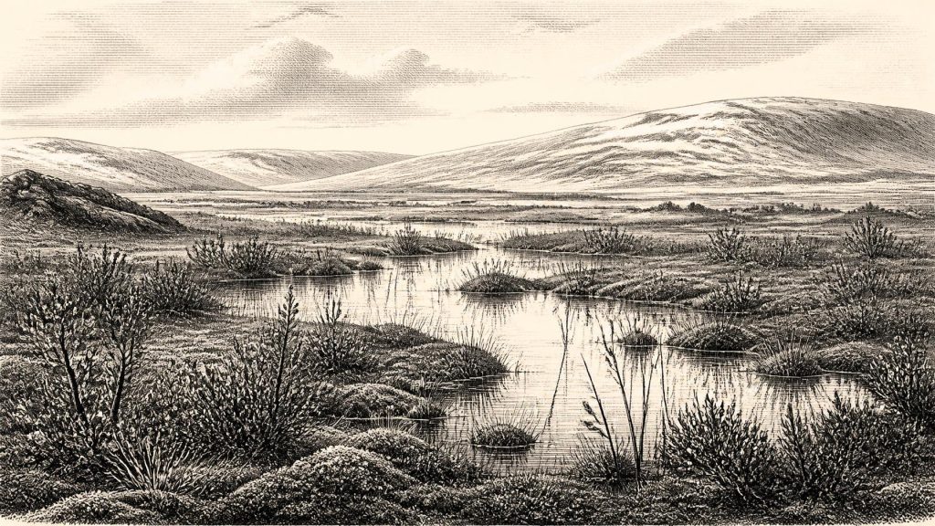
Nevertheless, Derryvree is exceptionally important. Its pollen, plant macrofossils, mosses and insect remains indicate open tundra or tundra-like muskeg rather than woodland. Sedges, dwarf shrubs and cold-adapted plants occupied wet ground around pools and marshy margins. The landscape was periglacial: intensely cold, affected by seasonal freezing and thawing, yet not simply a featureless desert of snow. Liquid water, vegetation and invertebrate life persisted locally. This is direct evidence for one part of Fermanagh during an interval between ice advances; it is not proof that every region of Ireland was simultaneously ice-free or ecologically identical.
An Unsteady Ice-Age Island
At around this broad date, Ireland was not yet in the fullest grip of the Last Glacial Maximum, when the British–Irish Ice Sheet expanded greatly between roughly 27,000 and 23,000 calibrated years BP. But neither was it a stable, temperate island. MIS 3 was marked by abrupt climatic oscillations recorded particularly clearly in Greenland ice cores. Irish evidence indicates that its ice masses advanced and retreated in complex, regionally varied ways. The Derryvree sequence demonstrates one ice-free interval; other evidence, including marine records and glacial landforms, shows that sizeable Irish ice masses existed before the later maximum.
Crag Cave in County Kerry adds a different sort of evidence. Uranium-thorium dating of broken and displaced calcite formations has shown episodes of speleothem growth through MIS 3. In a shallow cave, such growth requires infiltrating liquid water and is most plausible when average annual conditions were above freezing. The record does not supply a weather report for 31,380 BCE, nor does it date a human presence. It does, however, support the conclusion that south-west Ireland experienced repeated climatic ameliorations within the larger cold stage. Derryvree and Crag Cave therefore complement one another: one preserves a northern freshwater and tundra environment, the other registers periods in which cave water again deposited calcite in the south-west.
Sea level was far below that of the present world, exposing extensive continental shelves around north-west Europe. Yet it is unsafe to turn this into a simple map of an easy overland route into Ireland. Research on relative sea level, crustal movement and the Irish Sea has produced competing reconstructions, while ice cover itself could block, transform or connect landscapes. The correct conclusion is more cautious: Ireland’s physical geography, coastlines and possible approaches were radically different, but the exact accessibility of particular routes at a particular moment remains uncertain.
Animals in the Limestone Caves
In the south, Castlepook Cave near Doneraile, County Cork, preserves a striking Late Pleistocene animal record. Antiquarian excavations, later reassessment of museum collections and more recent fieldwork have identified remains including woolly mammoth, reindeer, giant deer, brown bear, wolf, Arctic fox, hare, lemmings and spotted hyaena. These animals did not necessarily all live together or enter the cave in one episode. Cave assemblages accumulate through many processes: animals die or den there, carnivores drag in prey, water moves bones, and nineteenth- and early twentieth-century excavation practices may have disturbed the original associations. Direct dates and careful taphonomic study are therefore more valuable than a simple species list.
Even so, Castlepook makes clear that Ireland formed part of a wider north-west European Ice-Age ecological world. Reindeer and lemmings suit cold, open habitats; mammoth, giant deer and horse-like grazing animals elsewhere in the region point towards varied grassland, herb-rich steppe and wetland mosaics. Spotted hyaena is especially evocative, but it should not be imagined as an African animal transplanted unchanged into modern Cork. Pleistocene hyaenas occupied very different climates and were powerful scavengers and predators. Their presence is evidence of a food web capable of supporting large carnivores, not evidence of a continuous, settled animal population in every Irish county.
The National Museum of Ireland’s cave collections matter because they preserve the physical specimens on which these interpretations depend. A mammoth bone or hyaena skull can establish that an animal reached Ireland; it cannot by itself reveal the season of its death, the size of its herd, or a human story. Ice sheets and later erosion destroyed or redeposited much of the terrestrial record. The survival of sealed wetland layers and cave bone deposits is therefore partly a matter of geological luck.
The Reindeer Bone and Human Presence
A reindeer femur fragment from Castlepook has become central to discussion of the earliest possible human activity in Ireland. The bone, recovered in the early cave investigations and later examined in the National Museum collection, was reported in 2021 as about 33,000 years old and as bearing marks consistent with stone-tool butchery. If that interpretation is confirmed, it would indicate that one or more Upper Palaeolithic people processed a reindeer carcass in Ireland broadly close to the period considered here. It would be a major finding, pushing possible human activity far earlier than the well-attested post-glacial settlement record.
Its limits are equally important. The fragment was not recovered from a modern excavation of an intact camp surface alongside a diagnostic tool kit, hearth, dwelling or human remains. A modified bone is not evidence of a permanent settlement, a named culture, a migration route, or continuous occupation. Nor can a single find establish whether people hunted the animal, scavenged it, arrived briefly, or used the cave itself. Official museum summaries have continued to describe Palaeolithic human presence in Ireland as unproven, a reminder that the claim remains unusually consequential and that the evidential threshold should be high.
For this reason, it is wrong to populate 31,380 BCE with an invented band of Irish hunters. The most defensible interpretation is narrower. Upper Palaeolithic groups were present across parts of north-west Europe, with sophisticated stone technologies, social networks and symbolic cultures known elsewhere. A visit to Ireland during a relatively milder MIS 3 interval is plausible, especially if the Castlepook marks are anthropogenic. But no securely associated Irish artefacts permit a confident account of their language, ancestry, number, dwellings, clothing, beliefs or routes.
Society Without States
There were no known political institutions, rulers, diplomatic agreements, territories or organised conflicts in Ireland at this date. There is likewise no evidence for farming, livestock, fields, metalworking, markets, monuments, formal burial grounds, writing or schools. “Trade” cannot responsibly be described for Ireland itself: no securely dated imported material demonstrates regular exchange. If people did enter the island, their subsistence would almost certainly have depended on the flexible foraging economy characteristic of Upper Palaeolithic hunter-gatherers elsewhere—tracking seasonal animal and plant resources, making and maintaining portable equipment, and sharing knowledge across small social networks. That is a comparative inference, not an excavated Irish household.
Religion and culture are even less recoverable. European communities of broadly comparable age made ornaments, images, musical objects and elaborate burials in some regions, but none has been securely identified in Ireland around this time. It would be misleading either to deny that any visitors possessed culture and belief, or to attribute continental cave art and ceremonies to Ireland without evidence. The archaeological silence is not proof of human absence; it is also the consequence of later glaciation, erosion, submerged landscapes and the rarity of surviving sites.
A Fragile Window
What emerges around 31,380 BCE is not a conventional national past but a fragile environmental window. Fermanagh’s buried freshwater deposits show cold, treeless wetlands between glaciers. Crag Cave records intermittent conditions warm enough for water to make calcite. Cork caves preserve the bones of animals adapted to an open, demanding world, and perhaps one disputed but potentially momentous sign of human butchery. The next major development was not political change but environmental transformation: the growth of the British–Irish Ice Sheet towards its later maximum, which would erase, entomb and reorder much of this landscape.
That makes the surviving evidence all the more valuable. Ireland at this deep date cannot be described through kings, battles or communities. It can be approached through a drumlin cut, an organic silt layer, a cave formation and a marked bone—small survivals that establish the scale of what is known, and the much greater scale of what remains beyond recovery.
Primary Sources
- A Middle Midlandian Freshwater Series at Derryvree, Maguiresbridge, County Fermanagh, Northern Ireland
- Trimlines, blockfields and the vertical extent of the last ice sheet in southern Ireland
- Radiocarbon constraints on the history of the western Irish ice sheet prior to the Last Glacial Maximum
- Growth and retreat of the last British–Irish Ice Sheet, 31 000 to 15 000 years ago: the BRITICE-CHRONO reconstruction
- Maximum extent and readvance dynamics of the Irish Sea Ice Stream and Irish Sea Glacier since the Last Glacial Maximum
- Dimensions and chronology of the last ice sheet in Western Ireland
- Episodic speleothem deposition tracks the terrestrial impact of millennial-scale last glacial climate variability in SW Ireland
- The IntCal20 Northern Hemisphere Radiocarbon Age Calibration Curve (0–55 cal kBP)
- The problem of a late quaternary landbridge between Britain and Ireland
- Deglaciation, Earth crustal behaviour and sea-level changes in the determination of insularity: A perspective from Ireland
- Ireland: Submerged Prehistoric Sites and Lands
- The Irish Quaternary Fauna Project
- New insights on the fauna of Ireland's Younger Dryas and Early Holocene from Alice & Gwendoline Cave
- Archaeology Research Excavation Grant 2022: Final Report
- Archaeological Heritage of County Cork
- Spotted Hyena Skull
- Learn About: The Ice Age
- Ice Age Ireland: Cool Fossils!
- Prehistoric Details: Mell Flint Flake
- Introduction to the Late Quaternary and Holocene of Northern Ireland
- Irish Quaternary Association: Outreach and Education Resources
- Section 1: Introduction, South Fermanagh Quaternary Field Guide
- Figure 6: The subdivision of the Quaternary Period in Ireland
- Stoats (Mustela erminea) provide evidence of natural overland colonization of Ireland