Archive: Crag Cave

30480–30471 BCE

Crag Cave’s Thaw Signal

Crag Cave’s Thaw Signal

At this depth of time, even a radiocarbon measurement is not a calendar date. It measures the remaining radioactive carbon in organic material and reports an age in radiocarbon years before present, where “present” conventionally means AD 1950. Because atmospheric carbon-14 varied substantially through the Ice Age, results must be calibrated against curves such as IntCal20. The calibrated answers are ranges, sometimes broad ones, rather than a single secure year. Nor does a date on a bone, seed or silt automatically date every event represented in its surrounding deposit.

30550–30541 BCE

Crag Cave’s Interrupted Dripstone

Crag Cave’s Interrupted Dripstone

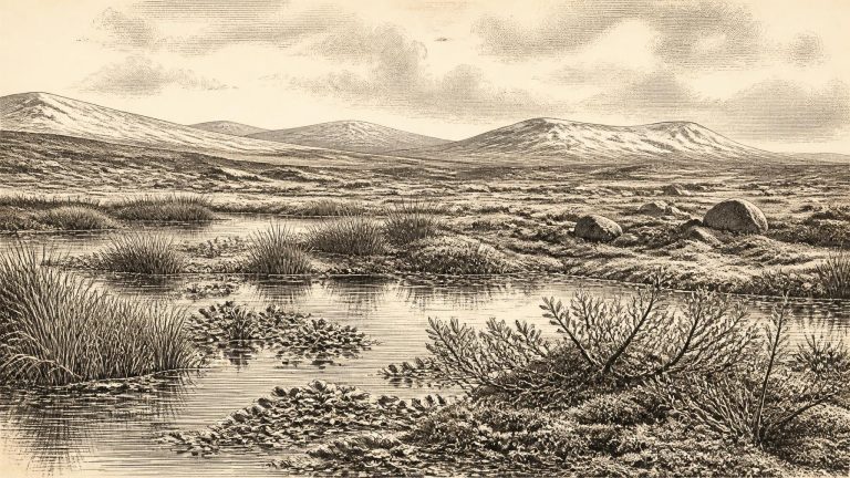
At this point in the last glacial cycle, Ireland was neither the familiar green, wooded island of later prehistory nor necessarily a single uniform wilderness of ice. It lay in an unstable northern Atlantic world in which climate could alter markedly over centuries and millennia. The Last Glacial Maximum, when the British–Irish Ice Sheet reached its greatest overall extent, lay ahead: its broad time window is conventionally placed around 27,500–19,000 years ago. Around 30,541 BCE, glaciers and ice sheets were building towards that later maximum, while their margins, thickness and timing varied regionally. It is therefore unsafe to colour every part of Ireland as either wholly ice-covered or wholly habitable at this single notional moment.

30580–30571 BCE

Crag Cave’s Winter Dripstone

Crag Cave’s Winter Dripstone

The closest securely relevant Irish chronology comes from Derryvree near Maguiresbridge, County Fermanagh. In 1969, a road cutting exposed a remarkable sequence within a drumlin: glacial till below, freshwater silts, sands and organic sediments in the middle, and a later till above. The arrangement matters more than any single laboratory number. It shows that ice had once occupied the locality, that an interval followed in which liquid fresh water and vegetation persisted, and that a subsequent ice advance buried and protected the deposit. The key radiocarbon determination, BIRM-166, was reported as 30,500 ± 1,100 radiocarbon years BP. Calibrated using modern curves, it spans broadly about 36,900–31,700 calendar years BP. The nominal year 30,572 BCE falls within that wide range, but cannot be matched to a particular sediment layer, living plant, animal visit or human action.

30830–30821 BCE

Crag Cave and Castlepook

Crag Cave and Castlepook

At this depth of time, the distinction between radiocarbon years and calendar years is essential. Radiocarbon dates measure the remaining carbon-14 in once-living material; because atmospheric carbon-14 has varied, laboratory results must be calibrated against independently dated records. IntCal20, the current Northern Hemisphere calibration curve, extends to 55,000 calibrated years before present, but uncertainty becomes substantial in this remote period. A date such as 30,830 BCE should therefore be treated as a modern filing label, not as an ancient date known to its inhabitants.

31050–31041 BCE

Crag Cave’s Broken Stalagmites

Crag Cave’s Broken Stalagmites

Ireland was in a severe glacial-age world, but it was not simply a single white expanse under permanent ice. The maximum development of the last British–Irish Ice Sheet lay in the future, broadly after about 27,000 years ago and especially around 25,000–23,000 years ago in many reconstructions. Around the date represented here, climate repeatedly shifted between colder and relatively milder episodes. The island’s landscapes, coastlines and routes for animals changed accordingly. Sea level was far lower than today, exposing broad areas of the Irish Sea basin; yet this did not necessarily create a simple dry-land bridge from Ireland to Britain or continental Europe. Travel, whether by animals or people, depended on the changing arrangement of sea, ice, shore, river valleys and seasonal conditions.

31070–31061 BCE

The Last Drips at Crag Cave

The Last Drips at Crag Cave

The apparent precision of “31,063 BCE” can mislead. Radiocarbon laboratories report ages in radiocarbon years before present, conventionally before 1950, rather than direct calendar years. Because atmospheric carbon-14 levels changed over time, those measurements must be calibrated, and the resulting calendar estimates are ranges with considerable uncertainty at this depth in time. The modern IntCal20 curve reaches back to 55,000 calendar years before present, but it does not turn an Ice Age deposit into a diary. An animal bone, plant-rich silt or cave calcite may illuminate a broad span of centuries or millennia; it cannot securely identify one winter, migration or human visit in 31,063 BCE.

31200–31191 BCE

Crag Cave’s Flowstone Record

Crag Cave’s Flowstone Record

Derryvree was exposed when roadworks in 1969 cut across a drumlin, a hill moulded by glacier ice. Beneath the surface lay two separate layers of till, the unsorted debris deposited by glaciers. Between them were freshwater silts, fine sands and organic material. The sequence establishes a clear relative history: ice had covered the site; an interval followed in which water, plants and insects accumulated in an ice-free landscape; then a later glacier advanced and sealed the deposit beneath a new layer of till. It is a remarkable survival, because later ice often erased or reworked the evidence of earlier landscapes.

31250–31241 BCE

Crag Cave’s Thawwater

Crag Cave’s Thawwater

Around this broad horizon, the British–Irish Ice Sheet was developing and changing, not simply sitting at a fixed edge. Modern reconstructions distinguish alternative minimum, optimum and maximum ice limits because the chronology and extent of early ice growth remain uncertain. The later Last Glacial Maximum, when ice covered all Ireland and extended across much of its continental shelf, belongs chiefly to roughly 27,000–23,000 calibrated years before present. At the earlier point represented by 31,243 BCE, it is safer to speak of a dynamic glacial world in which ice, permafrost, sea level and habitable ground varied from region to region and through time.

Crag Cave’s Thaw Pulses

Crag Cave’s Thaw Pulses

Ireland at this time was not the familiar green, wooded island of later millennia. It lay within the highly variable climate of the last glacial cycle. Conditions across the North Atlantic shifted repeatedly between colder stadials and relatively milder interstadials. Ice, permafrost, meltwater, bare ground and sparse vegetation each expanded or contracted in response. The Last Glacial Maximum, when the British–Irish Ice Sheet became much more extensive, still lay ahead; its peak is generally placed many thousands of years later, around 27,000–23,000 calibrated years BP. Yet this does not mean that Ireland was uniformly hospitable or ice-free in 31,249 BCE. Upland ice and glaciers existed in parts of the island during the broader period, while local conditions varied sharply with altitude, latitude, season and the advancing or retreating margins of ice.

31330–31321 BCE

Crag Cave and Derryvree

Crag Cave and Derryvree

At this point Ireland was part of the north-western fringe of Europe, but its geographical relationship with Britain and the continental shelf differed greatly from today’s. Global sea level was much lower during the Ice Age, exposing extensive coastal plains and altering routes between western Britain, Ireland and the wider European landmass. That did not mean that a simple, permanent land bridge joined every shore. Coastlines, estuaries, rivers and shallow seas changed repeatedly, while the Atlantic margin imposed formidable weather and travel conditions. Any animal or human movement into Ireland would have depended on a particular combination of sea level, local terrain, season and climate.

31340–31331 BCE

Crag Cave’s Waning Drips

Crag Cave’s Waning Drips

At this depth of time, even scientific dating is necessarily expressed as probability ranges. A radiocarbon age is not a calendar date: the amount of radioactive carbon in the atmosphere varied, so measurements must be calibrated against independently dated records. The modern IntCal20 calibration curve extends to 55,000 calendar years before present, but it does not transform a late-Pleistocene sample into a dateable day or year. Uncertainties in the sample, the calibration curve and the relationship between a specimen and its deposit all matter.

31350–31341 BCE

Crag Cave’s Distant Drips

Crag Cave’s Distant Drips

MIS 3, conventionally dated to about 57,000–29,000 years ago, was not one uniform freeze. Greenland ice cores and North Atlantic records show repeated, abrupt shifts between relatively milder interstadials and severe stadials. Ireland lay on the Atlantic margin of north-west Europe, where ocean circulation, sea level, snowfall and the growth of neighbouring ice masses could alter local conditions quickly. A map labelled 31,343 BCE would therefore be a reconstruction with substantial uncertainty, not a picture of a fixed country.

31380–31371 BCE

BIRM-166 and Crag Cave

BIRM-166 and Crag Cave

“31,380 BCE” is a useful modern label, but it cannot be treated as a recoverable year in Irish history. No people in Ireland kept a calendar that can be aligned with it; no settlement, grave, tool assemblage or historical event can be assigned to those twelve months. In radiocarbon convention, the label lies roughly 33,330 years before AD 1950. It belongs to the Late Pleistocene, in Marine Isotope Stage 3 (MIS 3), a long and climatically unstable part of the last Ice Age. The responsible subject is therefore an archaeological and environmental horizon, not an annual chronicle.

31390–31381 BCE

Crag Cave’s Winter Calcite

Crag Cave’s Winter Calcite

This was Marine Isotope Stage 3, a long interval of the last Ice Age, conventionally dated to about 59,500–24,000 years ago. It was not a single unchanging freeze. Greenland ice-core records reveal abrupt shifts between relatively milder interstadials and colder stadials, and Irish evidence suggests that these North Atlantic fluctuations affected conditions at the far western edge of Europe. The familiar Ireland of oak woods, pasture, fields and settlements was unimaginably distant. Much of the country was a severe, sparsely vegetated and environmentally unstable place, shaped by frost, meltwater, wind and the advance or retreat of glaciers.

31410–31401 BCE

Crag Cave’s Thaw Signals

Crag Cave’s Thaw Signals

The closest well-dated Irish environmental evidence comes from Derryvree near Maguiresbridge, County Fermanagh. Organic silts and fine sands were exposed there during road works in 1969, trapped between two separate sheets of glacial till within a drumlin. A conventional radiocarbon measurement, Birm-166, returned an age of 30,500 radiocarbon years before present, with substantial uncertainty. Later calibration places the deposit broadly between about 36,900 and 31,700 calibrated years before present, or approximately 34,950–29,750 BCE. That range includes 31,408 BCE, but it does not prove that the Derryvree sediments accumulated in that exact year.

31460–31451 BCE

Crag Cave’s Interstadial Dripstone

Crag Cave’s Interstadial Dripstone

The closest securely relevant Irish environmental sequence comes from Derryvree, near Maguiresbridge in County Fermanagh. Roadworks exposed organic freshwater silts and fine sands sealed between two tills: unsorted debris left by separate advances of glacier ice. The stratigraphic order is powerful evidence. Ice laid down a lower till; an interval without local glacier cover allowed water, sediment and organic matter to collect; then a later ice advance buried the deposit beneath fresh till.

31550–31541 BCE

Crag Cave’s Liquid Water

Crag Cave’s Liquid Water

Radiocarbon results must not be read as simple calendar dates. The amount of carbon-14 in the atmosphere has varied over time, so a measurement on ancient organic material has to be calibrated against independently dated records. At more than 30,000 years ago, the resulting calendar range can be broad. The important Fermanagh deposit at Derryvree, near Maguiresbridge, returned a conventional radiocarbon age of 30,500 years before present, with a substantial uncertainty. Published calibration places the deposit broadly between about 36,900 and 31,700 calibrated years before present. That wide window encompasses the modern date used here, but it does not demonstrate that the sediments formed in this exact numbered year.

31570–31561 BCE

Crag Cave’s Interstadial Water

Crag Cave’s Interstadial Water

This was an Ice Age world, but not simply an island sealed beneath one unchanging blanket of ice. The greatest expansion of the last British–Irish Ice Sheet came later, principally during the Last Glacial Maximum, when ice covered Ireland and extended across parts of the surrounding continental shelf. Around the date represented by 31,562 BCE, conditions were already severe and ice margins were dynamic, yet evidence shows that some Irish districts had earlier or intermittent ice-free landscapes. The exact extent of ice at any one moment remains uncertain, because glaciers advanced, stagnated and retreated on differing regional schedules, while much relevant terrain now lies offshore or beneath younger deposits.

31580–31571 BCE

Crag Cave Calcite Pulses

Crag Cave Calcite Pulses

Ireland at this depth of time was not the familiar wooded island of later prehistory. It lay at the north-western edge of Upper Palaeolithic Europe, exposed to rapid climatic shifts across the North Atlantic region. Sea levels were far lower than today, so the modern coastline did not define the land available to animals or, potentially, people. Yet lower seas did not automatically create an easy, permanent route to Britain or continental Europe: the form of land, water, ice and estuaries changed repeatedly as glaciers grew and decayed. Any arrival in Ireland would have required movement through a difficult and mutable north-west European landscape.

31660–31651 BCE

Crag Cave’s Thaw Windows

Crag Cave’s Thaw Windows

The nearest useful terrestrial evidence comes from Derryvree near Maguiresbridge in County Fermanagh. Roadworks exposed a freshwater deposit of organic silts and sands trapped between two bodies of glacial till. Such a sequence matters because it indicates an interval in which water, vegetation and sediment accumulated before later ice overran the area. A radiocarbon determination from the organic material, once calibrated, has been presented as a broad range of roughly 36,900–31,700 calibrated years before present. The nominal year considered here lies within that window, but Derryvree does not document a particular year, season or human generation. It is a time-depth record spanning many centuries or millennia, with uncertainties inherent in both dating and correlation.

31700–31691 BCE

Castlepook’s Incised Femur

Castlepook’s Incised Femur

“31,694 BCE” is a useful modern filing point, not a date at which an event can be assigned to Ireland. No written record, named individual, settlement sequence or archaeological layer can resolve a particular Irish year so far back. In scientific terms the point falls at roughly 33,600 calibrated years before present (cal BP, where “present” is AD 1950), within Marine Isotope Stage 3, a long and climatically unstable portion of the last glacial cycle. At this depth of time, radiocarbon dates come with substantial ranges and are periodically revised as laboratory methods and calibration curves improve. Modern IntCal20 calibration extends to 55,000 cal BP, but it does not turn a bone, pollen sample or silt bed into a diary entry.

31710–31701 BCE

Crag Cave’s Interrupted Calcite

Crag Cave’s Interrupted Calcite

Ireland was in the long approach to the Last Glacial Maximum, rather than at its peak. Recent syntheses place major British–Irish Ice Sheet growth after roughly 35–32 thousand years ago, with maximum overall extent later, conventionally around 27–21 thousand years ago. Yet an advancing ice sheet was not a simple, steady white front. Ice margins could expand, thin, retreat and reorganise; sea level, drainage and the availability of vegetation altered with them. On western Irish evidence, substantial ice loading and high relative sea level occurred at intervals between about 40 and 19 calibrated thousand years ago, while a rapid ice-margin fluctuation is recorded around 28 calibrated thousand years ago. The exact distribution of ice and ice-free ground at any moment around 33.7 thousand years ago remains debated.

31760–31751 BCE

Crag Cave’s Thawing Calcite

Crag Cave’s Thawing Calcite

The distinction between calendar years and archaeological dates is especially important here. Radiocarbon determinations are reported in years before present (BP), where ‘present’ means AD 1950, but atmospheric radiocarbon levels changed through time. A radiocarbon age must therefore be calibrated against an internationally maintained curve, and at c. 30,000–35,000 radiocarbon years BP the resulting calendar ranges may be broad and sometimes irregular. A numbered BCE year can be useful for arranging an annual archive, but it must not suggest the false precision of a diary entry.

31770–31761 BCE

Crag Cave’s Winter Drips

Crag Cave’s Winter Drips

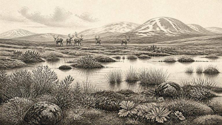
Derryvree’s plant and animal remains indicate open tundra or tundra-like vegetation in a periglacial regime: ground subjected to intense freezing and thawing, but not necessarily covered by glacier ice at that precise time. Mosses, sedges and other low-growing plants mattered more than trees. A fossil seed of bogbean, a wet-ground plant, is a small but powerful indication of shallow freshwater habitat. Insects and pollen complement this picture, pointing to a treeless, exposed environment with wet hollows, silty pools and seasonally harsh ground.

31780–31771 BCE

Crag Cave’s Living Calcite

Crag Cave’s Living Calcite

Ireland was not yet at the Last Glacial Maximum, the later phase when the British–Irish Ice Sheet reached its greatest overall extent, broadly between about 27,000 and 21,000 years ago. Around the horizon represented by 31,776 BCE, however, that ice complex was developing. Reviews of the ice-sheet record place its principal build-up after roughly 35,000–32,000 years ago, while emphasising that individual ice lobes advanced and retreated unevenly. It would be wrong, therefore, to picture either a wholly ice-covered Ireland or an entirely open island at this exact point. Conditions differed sharply between regions and changed over comparatively short geological intervals.

31800–31791 BCE

Trifoliate Seed Beneath a Drumlin

Trifoliate Seed Beneath a Drumlin

The distinction between radiocarbon years and calendar years matters especially here. A determination of 30,500 radiocarbon years before present from organic deposits at Derryvree, near Maguiresbridge in County Fermanagh, has been calibrated in later work to a broad range of about 36,900–31,700 cal BP. “Before present” conventionally means before AD 1950. Thus 31,800 BCE falls near the younger end of the wider calibrated interval, rather than marking a separate archaeological horizon. The Derryvree material is not a diary of 31,800 BCE; it is a deposit accumulated in a cold-stage environment and dated with an uncertainty that must remain visible in any account of the period.

31880–31871 BCE

Crag Cave’s Interstadial Drips

Crag Cave’s Interstadial Drips

At this distance in time, Ireland was not a fixed physical stage. Ice sheets expanded and contracted, sea level changed, river systems altered course, and vegetation responded rapidly to shifts in temperature and moisture. MIS 3 was colder than the present but was not one uninterrupted freeze. Greenland ice-core records, cave mineral deposits and sediments across north-west Europe reveal abrupt alternations between comparatively milder interstadials and harsher stadials. Irish evidence preserves parts of that changing pattern, although rarely with enough resolution to reconstruct a particular decade, let alone a year.

31950–31941 BCE

Before the Deep Freeze

Crag Cave Interstadial

Ireland lay on Europe’s Atlantic north-western fringe during a climatically unstable phase of the last Ice Age. It was not yet the fully ice-covered landmass of the Last Glacial Maximum, generally placed at about 26,000–19,000 cal BP, but the conditions that would produce that maximum were gathering strength. Research on the British–Irish Ice Sheet indicates that ice expansion was already under way in parts of the wider archipelago by about 31,000 years ago. Its precise limits earlier in the sequence are uncertain, and Ireland’s conditions were not uniform. Uplands, northern districts, Atlantic margins and lower southern landscapes could have had sharply different local histories.

31970–31961 BCE

Before the Ice Sheet

Crag Cave Calcite Growth

The distinction between calendar years, radiocarbon years and calibrated ages matters especially here. Radiocarbon measurements are not themselves calendar dates: their conversion into calibrated ranges depends on changing atmospheric carbon levels and carries margins of uncertainty. Nor do the available Irish deposits allow scholars to identify conditions in one numbered year. It is safer to speak of the interval around 34,000 calibrated years ago, and to test broad reconstructions against several independent forms of evidence.