
Derryvree’s Fossil Plant Census31069 BCE
Thirty-one thousand and sixty-nine BCE cannot be resolved as a distinct Irish historical year, but evidence overlapping it illuminates MIS 3 conditions. At Derryvree, County Fermanagh, an organic freshwater bed between glacial tills preserves mosses, sedges and plant macrofossils, indicating cold, open, tundra-like wetland during an ice-free interval. Castlepook Cave, County Cork, contains remains of varied Late Pleistocene mammals, accumulated across separate episodes, showing changing ecological connections with north-west Europe. A cut-marked reindeer femur may indicate brief human activity, although not settlement. Subsequent glaciation erased and buried much evidence, leaving a fragmented record of dynamic climates, habitats and Irish fauna.
Dateline
31,069 BCE is a modern chronological label, not a year that can be recovered from Ireland’s prehistoric record. It falls about 33,018 years before AD 1950, the conventional reference point for “before present” dating, within Marine Isotope Stage 3 of the last Ice Age. No Irish calendar, settlement sequence, named individual or securely dated event allows historians to describe this particular year. The responsible approach is therefore to examine the archaeological and environmental evidence whose broad ranges overlap it, and to keep demonstration separate from interpretation.
The closest unusually informative Irish archive is not a human site but a buried freshwater deposit at Derryvree, near Maguiresbridge in County Fermanagh. Excavations exposed it in 1969 when roadworks cut through a drumlin. Fine sands, silts and organic material lay between two thick sheets of till, the unsorted debris deposited by glacier ice. That sequence provides a firm relative order: ice had occupied or influenced the place; a freshwater landscape then existed there; later glaciation buried it. It does not offer an annual diary.
A Date Within a Long Interval
Organic material from Derryvree produced a conventional radiocarbon determination of 30,500 +1,170/−1,030 radiocarbon years BP. Radiocarbon years are not identical to calendar years, especially at this depth of time. Calibration with modern northern-hemisphere curves yields a wide probability range, often expressed broadly as c. 36,900–31,700 calibrated years BP, or approximately 34,950–29,750 BCE. The requested year falls inside that span, but this overlap must not be overstated: it cannot identify a particular season, layer, pond or generation at Derryvree.
The site belongs to the Middle Midlandian, the Irish regional terminology for part of the last glacial cycle, and broadly to MIS 3. Across the North Atlantic, climate during MIS 3 changed abruptly between colder stadials and relatively milder interstadials over centuries and millennia. Ireland was therefore not a landscape in a single, unchanging condition. The Derryvree deposit demonstrates that this part of Fermanagh was at one stage free of overriding ice and capable of sustaining freshwater life. It does not demonstrate that every district of Ireland was simultaneously ice-free, nor that present coastlines, rivers and hills had their modern appearance.
Water Between the Tills
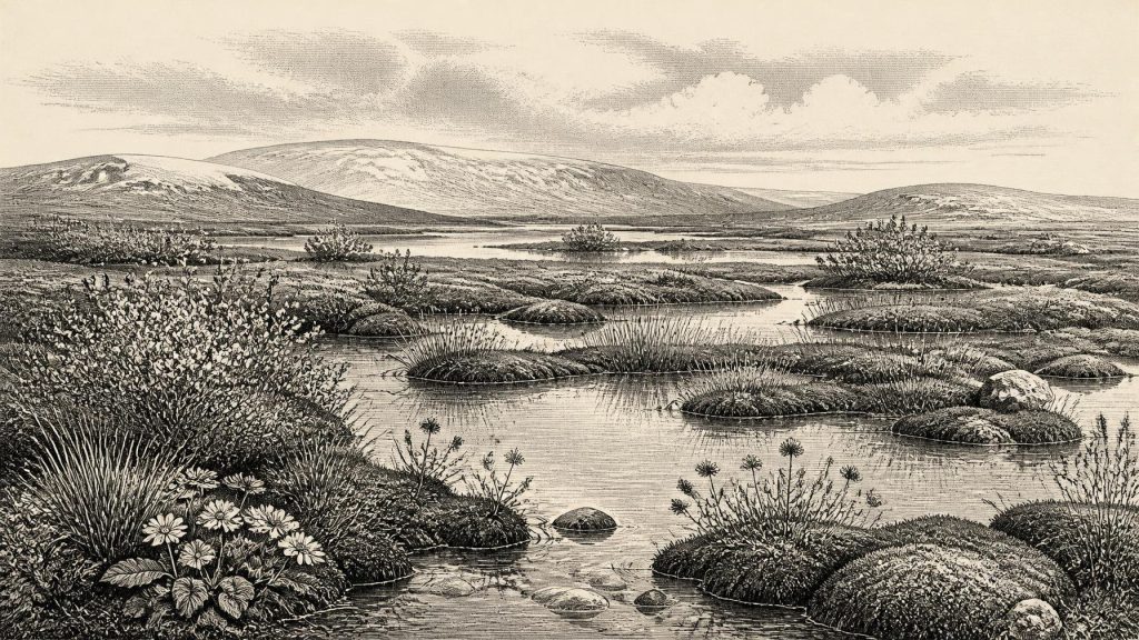
Derryvree’s evidence is powerful because several kinds of fossil survive together. Pollen was poorly preserved, but plant macrofossils, mosses and insect remains indicate an open, cold environment. Freshwater mosses and sedges, together with bogbean, alternate water-milfoil, dwarf willow and mountain-avens, point to wet ground and shallow water within a largely treeless tundra or tundra-like mosaic. The vegetation was not an empty wilderness. It was low, seasonal and resilient: mossy margins, sedge-rich patches, herbs and dwarf shrubs made use of a short growing season.
Such evidence supports a picture of a periglacial wetland, shaped by frost, snowmelt and fluctuating water levels. In places it may have resembled muskeg: waterlogged ground with vegetation growing among pools and muddy channels. Yet it would be misleading to turn this reconstruction into a painted panorama of all Ireland. Fossils establish that these species or closely comparable communities occurred near this particular water body. Their abundance in samples does not directly measure a whole island’s tree cover, summer temperature, animal numbers or the ease with which people could travel through it.
The location is also archaeologically instructive. Later ice advance sealed the organic bed beneath till, preserving a fragment of environmental history while destroying or obscuring much else. Ireland’s older Pleistocene record is patchy partly for this reason. Glaciers eroded surfaces, redeposited sediment and changed drainage routes. Absence of a campsite, hearth or stone-tool scatter from the exposed Derryvree beds is therefore not proof that nobody ever travelled through the broader region; equally, it is no basis for assuming occupation.
Animals in a Changing Ireland
For a wider animal context, Castlepook Cave near Doneraile in north County Cork is indispensable. The cave has yielded Ireland’s richest known assemblage of Late Pleistocene vertebrate remains. Its collections include reindeer, giant deer, brown bear, wolf, fox, hare, lemmings, mammoth and spotted hyena, with radiocarbon determinations showing that different animals belonged to different episodes rather than one simultaneous community. Reindeer and giant deer dates in the broader pre-maximum interval are especially relevant to a landscape around 33,000 calendar years ago.
These bones show that Ireland could support, or at least receive, sizeable cold-stage mammals at various times. They also indicate ecological connections beyond the island: animal populations could not have appeared from nowhere. Lower sea levels altered coastlines and exposed parts of the continental shelf, while ice, rivers, marshes and sea channels created shifting barriers and corridors. Precisely how readily any given route could be crossed at 31,069 BCE remains uncertain. It is safer to say that Ireland formed part of a changing north-west European ecological zone than to assert a simple, permanent land bridge.
Castlepook must nevertheless be read carefully. Many of its bones were recovered during early excavations, and cave deposits can be disturbed by animal activity, water, collapse and later digging. A list of species is not a census from a single year or proof that mammoths, hyenas, reindeer and people stood together outside the cave. Some remains were accumulated by carnivores; caves are often traps, dens, hibernation sites or repositories for material moved from elsewhere. The faunal record is compelling evidence for a changing Ice Age animal world, not a complete food web.
The Reindeer Femur Question
A reindeer femur from Castlepook has brought a possible human dimension to this period. Re-examination identified a deep mark interpreted as having been made on fresh bone by a sharp stone implement during carcass processing. The animal has been presented as about 33,000 years old. If that interpretation and association are upheld, it would be evidence that Upper Palaeolithic people handled a reindeer in Ireland far earlier than the island’s securely documented post-glacial settlement record.
It would not, however, establish a permanent colony, a village or an Irish hunting society. The specimen comes from an old cave collection rather than a modern excavation of an intact living surface containing tools, hearths and repeated occupation layers. A bone date chiefly dates the animal’s death; the assessment of a mark as human-made is a separate zooarchaeological judgement. The most cautious conclusion is that Castlepook offers a serious but limited indication of possible human presence or visitation during the broader period. It does not permit named groups, population estimates or a narrative of sustained settlement.
No Polities, No Diplomacy
There is no evidence from Ireland around this date for political institutions, territorial rulers, warfare, diplomacy, law or collective identities that can responsibly be named. There is likewise no direct Irish evidence for houses, clothing, ritual places, graves, art, spoken languages, teaching or exchange networks. The wider European Upper Palaeolithic demonstrates that humans elsewhere could make sophisticated stone tools, ornaments and images, but contemporaneity elsewhere cannot be transferred automatically to Ireland.
Should the Castlepook interpretation prove sound, the likely human activity implied is practical and brief: the processing of an animal. That would suggest knowledge of cutting tools and the value of meat, marrow, hide or sinew, but none of those uses is preserved on the bone with enough certainty to reconstruct a meal, camp or economy. Trade is wholly unproven. A visitor or small party could have moved through a landscape used by animals without leaving a durable settlement trace; that is a possibility, not a demonstrated social history.
Approaching the Great Ice Expansion
The interval around 31,069 BCE preceded the main maximum growth of the last British–Irish Ice Sheet. BRITICE-CHRONO research places the ice sheet’s greatest overall volume later, around 23,000 years ago, while regional advances varied substantially. Derryvree’s position between tills is a reminder that glaciation was episodic and geographically uneven. By the later Last Glacial Maximum, extensive ice profoundly remodelled the island, helping to explain why the evidence for earlier landscapes and people is so fragmentary.
The enduring significance of this date is therefore environmental rather than eventful. Derryvree records living freshwater vegetation in cold Fermanagh between phases of ice; Castlepook records animals adapted to, or passing through, changing Ice Age conditions in Cork; one marked reindeer bone raises a carefully bounded question about people. Together they replace an outdated image of a uniformly frozen, lifeless Ireland with a more precise one: a region of local habitats, mobile fauna, unstable climate and incomplete evidence. The year itself remains beyond historical resolution, but the deposits around it reveal an Ireland whose future archaeological record was already being buried beneath advancing ice.
Primary Sources
- A Middle Midlandian Freshwater Series at Derryvree, Maguiresbridge, County Fermanagh, Northern Ireland
- Early Midlandian–Middle Midlandian, Pleistocene, Northern Ireland
- Palaeoecology: An Excursion Guide to Fermanagh
- The Irish Quaternary Fauna Project
- Castlepook Cave: County Geological Site Report
- Occurrence of Mammalia Relicts at Site Castlepook Cave
- Excavations at Castlepook Cave, County Cork, 2022
- Heritage Artefacts of County Cork 2021
- Growth and Retreat of the Last British–Irish Ice Sheet, 31,000 to 15,000 Years Ago: the BRITICE-CHRONO Reconstruction
- Growth and Retreat of the Last British-Irish Ice Sheet, 31,000 to 15,000 Years Ago: the BRITICE-CHRONO Reconstruction
- Maximum Extent and Dynamic Behaviour of the Last British–Irish Ice Sheet West of Ireland
- Trimlines, Blockfields and the Vertical Extent of the Last Ice Sheet in Southern Ireland
- The IntCal20 Northern Hemisphere Radiocarbon Age Calibration Curve (0–55 cal kBP)
- The IntCal20 Approach to Radiocarbon Calibration Curve Construction: A New Methodology Using Bayesian Splines and Errors-in-Variables
- Fast and Slow Components of Interstadial Warming in the North Atlantic During the Last Glacial
- The Nature of MIS 3 Stadial–Interstadial Transitions in Europe: New Insights from Model–Data Comparisons
- Sea-Level Change and Inner Shelf Stratigraphy Off Northern Ireland
- Ireland: Submerged Prehistoric Sites and Landscapes
- Menyanthes trifoliata
- Dryas octopetala
- Myriophyllum alterniflorum
- Salix herbacea
