Derryvree’s Intertill Garden31001 BCE
Labelled 31,001 BCE only conventionally, this period cannot be reconstructed to a single calendar year. Derryvree, County Fermanagh, preserves freshwater silts between glacial tills, documenting a cold, largely treeless periglacial mosaic of wetlands, aquatic plants, sedges, mosses and sparse open vegetation during an interval between ice advances. Lower sea levels altered surrounding landscapes, while growing ice sheets created variable barriers. Cave fauna, especially at Castlepook, indicates reindeer, mammoth, giant deer and predators in broader cold-stage Ireland. A possibly cut-marked reindeer bone suggests fleeting human presence, but proves neither settlement nor culture. Evidence reveals a changing landscape vulnerable to renewed glaciation.
Dateline
“31,001 BCE” is a useful modern label, not a date that can be recovered from Ireland’s archaeological record with calendar-year precision. No event, journey, birth or settlement can responsibly be assigned to that year. The evidence instead belongs to a broad Late Pleistocene interval, within Marine Isotope Stage 3, when climate repeatedly shifted between relatively milder interstadial episodes and severe cold. The best Irish record relevant to this notional date is an ancient freshwater deposit at Derryvree, near Maguiresbridge in County Fermanagh. Its radiocarbon result of 30,500 ± c.1,100 radiocarbon years before present calibrates broadly to about 36,900–31,700 calibrated years before present. Thus 31,001 BCE falls within the possible span of this environmental archive, but not at a detectable point within it.
A Landscape Between Ice Advances
Derryvree was exposed during roadworks in 1969, when a cutting through a drumlin revealed an unusual sequence. Glacial till lay below, freshwater silts and fine sands in the middle, and another till above. Till is the unsorted sediment left by glacier ice. The sequence therefore records a local history in three parts: ice had previously crossed the ground; a period followed in which open water and wetland sediment could accumulate; then ice returned or expanded over the locality. It is one of Ireland’s rare surviving records of an ice-free or less heavily glaciated interval during the later Ice Age.
This is crucial context for 31,001 BCE. Ireland was not a stable island with familiar coastlines, woodland and settled communities. Sea level was much lower than today because enormous quantities of water were held in northern ice sheets. The modern Irish Sea basin and surrounding shelves were different landscapes, while the degree and timing of land connections between Ireland, Britain and continental Europe varied through the glacial cycle. Yet lower sea level did not automatically make every route easy: cold seas, shifting ice margins, exposed plains, rivers and periglacial ground formed formidable barriers as well as potential corridors.
At the scale of the British–Irish Ice Sheet, recent reconstructions place this period at the beginning of major ice-sheet growth, from about 31,000 years ago. They reconstruct ice accumulation in the north-west of Ireland, particularly around the Derryveagh and Sperrin uplands, alongside mountain glaciers and icefields elsewhere. This is a model-based regional picture, constrained by landforms, sediments and dates; it should not be converted into a claim that every Irish valley or county was ice-covered in a particular year. Derryvree itself shows why local sequences matter. Its buried wetland demonstrates that conditions could differ markedly through time and place before the ice sheet reached its later maximum extent.
What Grew Around the Water
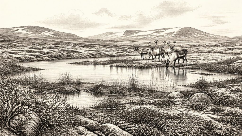
The Derryvree silts preserve pollen, plant macrofossils, mosses and insect remains. Their combined evidence points to a cold, open, periglacial landscape rather than forest. Herbaceous plants dominate the pollen record. Mosses and the remains of plants associated with tundra, sedge-rich ground and shallow freshwater indicate damp hollows, pools and marshy margins. Among the notable finds is bogbean, a three-leaved wetland plant, alongside water-milfoil and other aquatic or waterside species. Mountain avens, dwarf willow, clubmosses and sedges help to evoke exposed ground where vegetation could survive a rigorous climate.
This was not necessarily a uniform blanket of “tundra”. Plant communities respond to drainage, snow cover, soil disturbance, slope and exposure. A shallow pool could support aquatic plants while nearby ridges carried sparse herbs and mosses; wetter ground might have held sedges and dwarf shrubs. The few grains of tree pollen in the record do not demonstrate local woodland. They may have travelled long distances, been redeposited, or represent only very scattered trees beyond the immediate basin. The sound conclusion is a largely treeless, cold mosaic of wetland and open ground, not a precise reconstruction of every hillside.
Seasonality would have organised life in this environment. Short growing seasons, frost action and prolonged winter darkness limited plant productivity. In summer, however, wetlands could have produced a concentrated flush of vegetation and attracted grazing animals. Meltwater and standing water also shaped the ground, while repeated freezing and thawing moved soils, cracked surfaces and altered drainage. The landscape that Derryvree records was alive, but it was not benign or predictable.
Animals in an Open Country
Irish cave deposits provide a complementary, though imperfect, glimpse of the larger animal world. Castlepook Cave near Doneraile, County Cork, has yielded remains attributed to reindeer, woolly mammoth, giant deer, brown bear, wolf, fox, Arctic fox, lemmings and spotted hyaena. Not all of those animals need have been present together, and cave sediments were disturbed by earlier excavations and natural processes. Nevertheless, the fauna shows that parts of Ireland supported a varied cold-stage mammal community during the wider period between roughly 45,000 and 20,000 years ago.
Reindeer are especially informative. They are adapted to cold, open terrain and their presence accords with the treeless vegetation inferred at Derryvree. Mammoth and giant deer likewise suggest that, at least in some phases and places, there was sufficient forage and accessible terrain for large herbivores. Predators and scavengers complicate any simple picture of a peaceful grazing landscape. Wolves and hyaenas could exploit carcasses and hunt vulnerable animals; caves may have served as dens, shelters or traps rather than human homes. Animal bones in caves therefore record mortality, scavenging, transport and geological disturbance as much as they record a living community.
The most arresting find from Castlepook is a reindeer femur reported to carry a deep mark interpreted as a stone-tool cut or chop mark. Modern radiocarbon work has placed the bone broadly around 33,000 years ago, making it potentially relevant to the era represented by 31,001 BCE. If the mark was made during carcass processing by people, it would be extraordinarily early evidence of human activity in Ireland. But the distinction matters: the dated bone proves that a reindeer lived and died in the relevant broad period; the identification of the mark as human-made is a separate taphonomic interpretation. No associated hearth, stone-tool assemblage, dwelling, burial or repeated occupation surface has yet been securely demonstrated at this age.
People: A Possibility, Not a Population
Accordingly, Ireland around this date cannot be described as a settled human country. There is no evidence for villages, cultivated fields, domestic animals, pottery, metalworking, monuments, writing, named groups, leaders or institutions. There can be no responsible account of Irish political affairs, diplomacy, formal warfare or religion for this year. Such categories depend on evidence that does not exist here.
The Castlepook bone permits a narrower possibility: small groups of Upper Palaeolithic hunter-gatherers may have reached, crossed or briefly visited parts of Ireland during a relatively accessible climatic window. If so, their movements would have been shaped by animal migrations, shelter, fresh water, raw materials and weather rather than by borders. They may have travelled seasonally and left little trace. A single processed carcass would not establish permanent residence, population size, language, social identity or a durable community. Equally, the scarcity of evidence is not proof that no person ever entered Ireland; glaciation, erosion, rising seas and antiquarian excavation have removed or obscured many possible sites.
The more secure evidence for humans in Ireland comes much later, after the Last Glacial Maximum, with Late Upper Palaeolithic traces in County Clare and then Early Mesolithic settlement. That chronological gap is historically important. Any people represented by a possible Castlepook butchery episode cannot presently be connected genealogically, culturally or politically to Ireland’s later Mesolithic inhabitants, much less to later Irish populations. Around 31,001 BCE, the human story is a hypothesis at the extreme edge of the evidence, while the environmental story is much stronger.
Economy, Culture and Knowledge
There is no direct evidence for an Irish economy in the usual historical sense. The Derryvree plants and Castlepook fauna indicate ecological resources, not markets or trade. For any transient foragers, meat, hides, sinew, bone, antler and fat would have been valuable resources, as they were among Upper Palaeolithic communities elsewhere in Europe. But it would be an inference, not Irish evidence, to claim that these resources were certainly used at Derryvree or Castlepook. No securely contemporary tools, ornaments, pigments, art or structures allow a local cultural reconstruction.
Nor is there evidence for formal learning or religious practice. People capable of reaching Ireland, if they did, would have possessed skills transmitted through social learning: knowledge of animals, stone, weather, routes and survival in cold conditions. That general proposition cannot identify their beliefs or customs. It is better to recognise the limits of the archive than to fill the silence with later Celtic, medieval or modern ideas of Irishness.
An Environmental History Before History
The significance of 31,001 BCE lies in this tension between possibility and proof. Derryvree reveals a cold freshwater world briefly preserved between glacial advances: mossy margins, sedges, aquatic plants and sparse open vegetation in south Fermanagh. Castlepook preserves a fragmentary faunal archive from a broader cold-stage Ireland, including reindeer and formidable carnivores. Together, they show that the island was neither timelessly frozen nor recognisably habitable in the modern sense. It was changing rapidly, with ecological opportunities appearing and disappearing as climate and ice altered the land.
For this date, then, Ireland has no annals and no calendar. It has silts under a drumlin, bones from caves, radiocarbon ranges, pollen grains, plant remains and competing scientific interpretations. These are enough to recover an ancient landscape in outline: open, wet in places, cold, biologically active and increasingly vulnerable to renewed ice-sheet growth. They are not enough to narrate one year. That restraint is not a failure of history; it is the essential discipline required by deep time.
Primary Sources
- Growth and Retreat of the Last British–Irish Ice Sheet, 31,000 to 15,000 Years Ago: The BRITICE-CHRONO Reconstruction
- Growth and Retreat of the Last British–Irish Ice Sheet, 31,000 to 15,000 Years Ago: The BRITICE-CHRONO Reconstruction (Maynooth University Research Archive)
- BRITICE-CHRONO Maps and GIS Data of the Last British-Irish Ice Sheet 31 to 15 ka
- Stratigraphic and Palaeo-Geomorphological Evidence for the Glacial-Deglacial History of the Last British-Irish Ice Sheet in the North-Western Irish Sea
- Character of Advance and Retreat of the Southwest Sector of the British-Irish Ice Sheet During the Last Glaciation
- British–Irish Ice Sheet and Polar Front History of the Goban Spur, Offshore Southwest Ireland Over the Last 250,000 Years
- The Timing and Magnitude of the British–Irish Ice Sheet Between Marine Isotope Stages 5d and 2
- The Irish Quaternary Fauna Project
- Palaeoecology: A Field Guide to Selected Sites in County Fermanagh
- Heritage Artefacts of County Cork
- New Insights on the Fauna of Ireland’s Younger Dryas and Early Holocene from Alice & Gwendoline Cave
- New Insights on the Fauna of Ireland’s Younger Dryas and Early Holocene from Alice & Gwendoline Cave (open PDF)
- First Evidence of a Late Upper Palaeolithic Human Presence in Ireland
- The Colonization of Ireland: A Human Ecology Perspective
- The Mesolithic in Ireland: When Was It?
- Pleistocene Vertebrates in the British Isles
- A Critical Review and Re-Investigation of the Pleistocene Deposits Between Cranfield Point and Kilkeel, Northern Ireland
- The Irish Quaternary Fauna Project (full-text copy)
- The Castlepook Cave Project: County Cork Heritage Grant Record
- Marine Isotope Stage 4 (71–57 ka) on the Western European Margin: Insights to the Drainage and Dynamics of the Western European Ice Sheet
