Castlepook’s Uncertain Cut31000 BCE
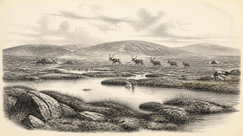
Around 31,000 BCE, Ireland lacked written records, and archaeological dates remain broad rather than annual. During Marine Isotope Stage 3, the island was entering expansion of the British-Irish Ice Sheet, though conditions varied regionally. Derryvree, County Fermanagh, preserves freshwater silts indicating cold, periglacial tundra wetlands with sedges, mosses and sparse vegetation, but no human occupation. Castlepook Cave, County Cork, contains diverse Pleistocene fauna, including reindeer, mammoth and hyena. A marked reindeer femur may indicate stone-tool butchery, yet its disturbed cave context cannot prove settlement. Evidence supports changing habitats and possible human presence, while leaving population, culture, routes and society unknown.
Dateline
“31,000 BCE” is a useful modern label, not a date at which an Irish event can be placed. No contemporary calendar, writing or year-by-year record existed, and archaeological dating at this depth works in ranges rather than anniversaries. In the convention of years before AD 1950, the label falls roughly 33,000 years before present. It belongs broadly to the later part of Marine Isotope Stage 3, during the long approach to the Last Glacial Maximum. The closest Irish evidence is uneven: a buried freshwater deposit at Derryvree near Maguiresbridge in County Fermanagh, and an exceptionally important but complicated cave-fossil archive at Castlepook, near Doneraile in north County Cork. Neither permits a narrative of a particular day, season or individual.
Dating a Changing Ireland
The distinction between radiocarbon years and calendar years matters especially here. A radiocarbon result measures the remaining carbon-14 in a sample and must be calibrated against changing atmospheric carbon levels before it can be expressed as a calendar range. Beyond about 30,000 years ago, the resulting ranges are often broad and are regularly refined as methods and calibration curves improve. A numbered BCE year should therefore not be treated as a point on which a cave bone, pollen grain or ice advance can be pinned.
The Derryvree freshwater silts and fine sands produced a radiocarbon determination of 30,500 BP, with an uncertainty of more than a millennium. The deposit lies between two thick tills within a drumlin, showing that it represents an interval between episodes of glaciation rather than a familiar, stable landscape. It has conventionally been assigned to the Middle Midlandian, within the wider cold-stage sequence preceding the full Last Glacial Maximum. Its age is close enough to illuminate the world denoted by 31,000 BCE, but it is not evidence for a precisely dated ‘year 31,000 BCE’ in Fermanagh.
At the scale of the island, the strongest modern reconstructions describe the British–Irish Ice Sheet as building from about 31,000 years ago, expanding markedly across the following millennia and reaching its greatest overall volume much later, around 23,000 years ago. That does not mean every part of Ireland was already buried beneath a uniform blanket of ice in 31,000 BCE. Ice margins, uplands, lowlands and coasts changed at different rates. The responsible picture is one of a cold, unstable northern landscape in which habitable ground, ice and meltwater environments shifted over time.
Derryvree’s Open Wetland
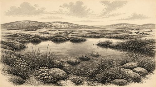
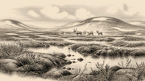
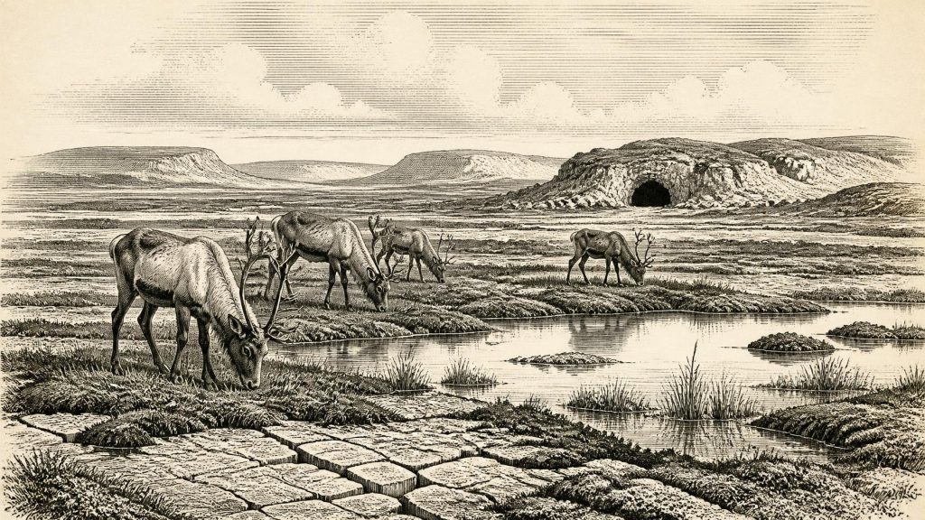
Derryvree provides the clearest local environmental evidence. Its plant remains, pollen and small animal evidence point to an open tundra or steppe-tundra setting under periglacial conditions: ground strongly affected by freezing and thawing, rather than a forested Ireland. The assemblage included mosses and sedges, along with fossil evidence for bogbean, alternate water-milfoil and mountain avens. These are not merely botanical curiosities. Together they indicate freshwater, wet ground and low vegetation adapted to a short growing season and cold climate.
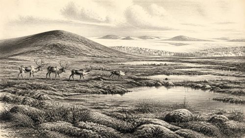
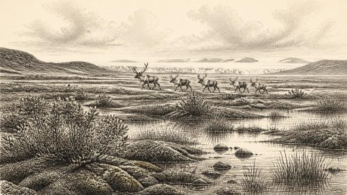
The site should not be imagined as a continuous carpet of snow or lifeless gravel. Freshwater silts preserve a more varied scene: shallow water and muddy margins, moss-rich wetland, sedge beds and patches of herbaceous tundra. Some ground may have been sparsely vegetated, while sheltered or waterlogged places retained plants. Yet the same record rules out projecting later Irish scenery backwards. There were no oak woods, hazel scrub, enclosed fields or peatlands of the modern sort. The productive months would have been brief, and winter conditions severe.
This is environmental evidence, not evidence of a settlement at Maguiresbridge. No dwelling, hearth, tool scatter, grave or food-processing site of this age has been recovered there. The Derryvree deposit can demonstrate that northern Ireland contained freshwater habitats and cold-adapted plant communities during this part of the glacial cycle. It cannot demonstrate who visited them, how many people lived in Ireland, or whether people were present at all.
Castlepook and the Reindeer Question
Castlepook Cave, sometimes called Mammoth Cave, is the other indispensable Irish archive. Antiquarian excavation there produced a remarkable mixture of Late Pleistocene animal remains. Reindeer, giant deer, mammoth, wolf, brown bear, Arctic fox, hares, lemmings and spotted hyena are among the species recorded from the cave complex. These animals did not all necessarily live together at one moment; deposits accumulated, were disturbed by carnivores and water, and were excavated long before modern field standards. New radiocarbon work has also shown that some older determinations from Irish caves were substantially too young, underlining why individual dates require reassessment.
Nevertheless, the Castlepook fauna is compelling evidence that southern Ireland supported, or was reached by, large mammals and their predators during portions of the pre-maximum glacial period. Reindeer are particularly informative. They are animals of open northern environments, and their presence accords with the cold, treeless settings indicated at Derryvree. Mammoth, giant deer and hyena add to the sense of a more diverse Pleistocene fauna than survived into later Irish history. A cave assemblage, however, records animals carried into, dying near or entering a cave; it cannot map their exact ranges or calculate their population sizes.
A reindeer femur from Castlepook has been publicised as bearing a deep mark interpreted as a fresh-bone cut or chop made by a sharp stone tool, and has been associated broadly with about 31,000 BCE. If the interpretation is upheld through further microscopic study, secure dating and contextual investigation, it could indicate that a person processed a reindeer in Ireland far earlier than the better-attested terminal-Pleistocene evidence. It would be an extraordinary find.
But the conclusion must remain deliberately narrow. The bone comes from an old cave collection rather than a newly excavated occupation surface with associated tools, hearths and food refuse. A date on a bone dates the animal’s death within a range; it does not automatically date a surface mark or establish the identity of its maker. No securely associated stone toolkit, habitation floor, human remains or repeated hunting camp of comparable age has yet been found at Castlepook. The femur is therefore proposed evidence for a brief human encounter with an animal, not proof of permanent settlement, continuous occupation or an Irish population in 31,000 BCE.
People Beyond the Evidence
Should people have reached Ireland during this period, they would have belonged to Upper Palaeolithic hunter-gatherer worlds known elsewhere in north-west Europe. Their lives would have depended on mobility, intimate ecological knowledge, stone tools, clothing and shelter suited to cold conditions, and decisions shaped by animal movements and seasonal resources. Yet these general comparisons cannot be converted into facts about an Irish band, family or camp. There is no basis for assigning language, ethnicity, population numbers, kinship system or migration route to Ireland at this date.
Low global sea levels exposed much more of the continental shelf than exists today. Ireland was not necessarily separated from Britain by the sea barrier familiar in the modern map; later evidence suggests insular separation was established only much later in the glacial cycle. But exposed ground was not automatically an easy corridor. Ice, meltwater, marshes, river systems, bare terrain and severe weather could all obstruct movement. Whether an early visitor crossed connected land, coastal waters, seasonal ice or a mixture of routes remains unknown.
There is similarly no evidence for political affairs, diplomacy or organised warfare in Ireland at this time. No chiefs, territories, alliances or named communities can responsibly be inferred. A possible hunting episode need not imply conflict, trade or control of a region. Trade in the later prehistoric sense is untraceable: there are no demonstrated Irish exchange networks, imported artefacts or quarries linked to people of this age. Nor is there evidence for farming, livestock, ceramics, metalworking, monuments or permanent villages. Those belong to much later chapters of Irish prehistory.
Culture Without Written Memory
Religion, art and learning are also beyond direct recovery in Ireland around this date. Upper Palaeolithic communities elsewhere in Europe created sophisticated tools, ornaments and images, and may have held complex beliefs. Ireland has not yielded securely dated material of that sort for this period. It would be misleading to transfer continental cave art, ritual or social institutions to Castlepook merely because the island lay at the far western edge of the same broad climatic world.
The culture that can be described with confidence is the culture of evidence itself: cave bones studied in museum collections; collagen extracted for accelerator radiocarbon dating; marks assessed through zooarchaeology; pollen, seeds and mosses read from sediments; and glacial landforms reconstructed through mapping and exposure dating. These methods have replaced an older image of Ireland as an empty, simple Ice Age margin with a more nuanced one. The island’s environments could be locally varied, rich in animals and repeatedly transformed by climate. Whether people made use of those openings remains one of the most important unanswered questions in Irish archaeology.
An Iceward Threshold
The principal development around 31,000 BCE was thus environmental rather than political: Ireland was moving towards the most extensive glaciation of the last ice age. Derryvree preserves a cold freshwater tundra landscape before later ice sealed it beneath till. Castlepook preserves animals that inhabited or passed through southern Ireland during changing pre-maximum conditions. The marked reindeer femur offers a tantalising possibility of human action, but not a settled history.
For Ireland at this depth in time, restraint is not a failure of imagination. It is the historical achievement. We can responsibly see wet tundra, frost-affected ground, freshwater plants, grazing animals and carnivores, with ice expanding in the wider landscape. We can recognise a possible human trace at Castlepook. We cannot yet name a people, reconstruct a society or narrate an event for this particular calendar year. The evidence preserves a threshold: a landscape on the edge of a great ice advance, and perhaps on the edge of the human story of Ireland.
Primary Sources
- A Middle Midlandian Freshwater Series at Derryvree, Maguiresbridge, County Fermanagh, Northern Ireland
- A reconsideration of the radiocarbon dating of the Marine Isotope Stage 3 fauna from southern Ireland
- The Irish Quaternary Fauna Project
- First evidence of a Late Upper Palaeolithic human presence in Ireland
- New insights on the fauna of Ireland's Younger Dryas and Early Holocene from Alice & Gwendoline Cave
- Growth and retreat of the last British–Irish Ice Sheet, 31,000 to 15,000 years ago: the BRITICE-CHRONO reconstruction
- Trimlines, blockfields and the vertical extent of the last ice sheet in southern Ireland
- The deglaciation of the western sector of the Irish Ice Sheet from the inner continental shelf to its terrestrial margin
- The last Eurasian ice sheets – a chronological database and time-slice reconstruction, DATED-1
- The IntCal20 Northern Hemisphere Radiocarbon Age Calibration Curve (0–55 cal kBP)
- IntCal Publications
- Palaeoecology
- Prehistoric Details
- Heritage Artefacts of County Cork
- Menyanthes trifoliata
- Dryas octopetala
- Myriophyllum alterniflorum
- Modes of Global Climate Variability during Marine Isotope Stage 3 (60–26 ka)
- Equilibrium simulations of Marine Isotope Stage 3 climate
- Maximum extent and dynamic behaviour of the last British–Irish Ice Sheet west of Ireland