Maguirebridge’s Intertill Basin30818 BCE
30,818 BCE is a modern label within late Marine Isotope Stage 3, not a recoverable Irish historical year. At Derryvree near Maguiresbridge, County Fermanagh, a road cutting exposed freshwater and organic deposits between glacial tills, indicating a temporary ice-free, cold wetland with pools, mosses, sedges and aquatic plants before renewed glaciation. Radiocarbon evidence provides only a broad calibrated range, not annual conditions. Cave deposits at Castlepook, County Cork, indicate cold-stage fauna, including reindeer and hyena, but are chronologically complex. A marked reindeer femur may suggest human butchery, yet proves neither settlement nor population. Climate, ice and animals shaped Ireland’s record.
Dateline
30,818 BCE is a modern calendar label, not a year that can be recovered from Ireland’s Ice Age past. No written calendar, named community, ruler, battle or settlement can be attached to it. In archaeological terms, it falls about 32,768 years before the 1950 reference point used for ‘before present’ dating, during the Late Pleistocene and Marine Isotope Stage 3 (MIS 3). Modern calendar-year precision is not available. The responsible evidence consists instead of radiocarbon ranges, strata, fossil plants, insects, animal bones and cave sediments. These illuminate long intervals and local environments, not a particular Irish day or season.
The most useful Irish evidence close to this notional date comes from Derryvree, near Maguiresbridge in County Fermanagh. There, roadworks in 1969 cut through a drumlin and exposed an exceptional sequence: glacial till below, freshwater and organic deposits in the middle, and further glacial sediment above. This was a landscape that had been occupied by ice, then locally became ice-free long enough for water, plants and organic mud to accumulate, before a later advance buried it again. The deposit is therefore a rare survival from a changing, cold Ireland rather than a record of permanent conditions across the entire island.
A Date Within a Range
Organic material from Derryvree produced the radiocarbon determination BIRM-166, conventionally dated to about 30,500 radiocarbon years before present, with a substantial uncertainty. Radiocarbon years cannot simply be converted into calendar years: atmospheric carbon levels have varied over time, so results need calibration against independently constructed curves. Published calibrations place the Derryvree material broadly between about 36,900 and 31,700 calibrated years before present, approximately 34,950–29,750 BCE. The year considered here lies inside that wide range, but this does not mean that BIRM-166 identifies conditions in 30,818 BCE exactly.
That limitation is not a minor technicality. A sample may date the death of a plant, the formation of peat, or organic matter washed into a pool; a sediment bed may itself have built up over generations or far longer. Calibration supplies probabilities, not an annual chronicle. Derryvree can responsibly show that north-central Ireland contained an ice-free freshwater environment during part of late MIS 3. It cannot tell us the temperature on this particular date, prove that every Irish region was simultaneously free of ice, or identify a human group living nearby.
Water Between the Tills
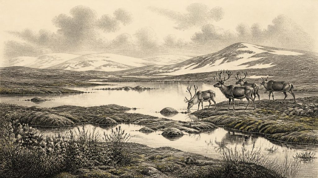
The middle deposits at Derryvree have often been described as a cold, open, muskeg-like wetland: waterlogged ground with pools, sedge margins, mosses, silts and accumulating organic material. Plant macrofossils and pollen are imperfect witnesses, especially where preservation is poor or material may have travelled, but the assemblage points decisively away from a closed forest. Mosses, grasses and sedges belonged to wet ground. Finds including bogbean (Menyanthes trifoliata) and water-milfoil indicate standing or slow-moving freshwater. Mountain-avens and lesser clubmoss are compatible with exposed, cold conditions.
This was no featureless ice desert. Even in a harsh climate, shallow water supported aquatic plants; wet margins held mosses and sedges; insects occupied specialised niches; and fine sediment trapped evidence of life. Yet it was not the familiar green Ireland of historic times. There is no basis for hedged fields, oak woodland, pasture, villages or managed landscapes. Frost action, seasonal freezing, wind, short growing seasons and saturated soils would have shaped the basin and the vegetation around it. Such environments could be productive in patches, but they were fragile and exposed.
The Derryvree sequence also records environmental instability. Its lower till establishes that glacier ice had previously affected the locality. Its upper till shows that the wetland was eventually overridden or sealed by renewed ice-related deposition. The key historical process was therefore not politics but repeated climatic reorganisation: ice, meltwater, freshwater pools, vegetation and animals occupied the same ground at different times. Later glaciers eroded, moved and buried much of Ireland’s earlier record. That destruction helps explain why the evidence for this phase is so sparse and why one well-stratified road cutting carries such importance.
Animals at the Atlantic Edge
Cave deposits in southern Ireland provide the broader faunal setting, although they must not be treated as a single, neatly dated snapshot. Castlepook Cave, also called Mammoth Cave, near Doneraile in County Cork, is Ireland’s most important cave assemblage for mammals of the last cold stage. Excavations in the early twentieth century recovered remains of spotted hyena and a varied Pleistocene fauna. Later research has shown both the value and difficulty of these old collections: bones were accumulated through carnivore activity, natural deaths, water movement and excavation methods that did not meet modern standards, while some earlier radiocarbon dates require reassessment.
Reindeer, mammoth, giant deer, brown bear, wolf, Arctic fox, lemmings and other cold-stage animals are known from Irish Pleistocene evidence, though not all need have lived together at Castlepook or across Ireland at one moment. The cautious conclusion is that, during overlapping parts of MIS 3, Ireland could support or receive a diverse cold-climate fauna. Reindeer suggest open country rather than woodland; spotted hyena demonstrates that large carnivores also used the landscape. Cave assemblages show routes of animal movement and the survival of bone, not the boundaries of a stable ecosystem or a census of every species living on the island in 30,818 BCE.
Sea level was lower during glacial phases, and the geography of the surrounding shelf differed greatly from today. Nevertheless, it is unsafe to turn lower seas into a simple land-bridge narrative. Ice margins, water channels, exposed land, coastlines and animal routes altered through time. The available evidence does not establish a single dry, easily passable route into Ireland at this date, nor does it reconstruct the journeys by which particular mammals arrived. Ireland was an Atlantic-edge landscape whose accessibility varied, rather than an isolated island in the modern sense or an assured extension of continental Europe.
The Reindeer Femur Question
One Castlepook object has particular importance for human history: a reindeer femur bearing a deep mark interpreted by palaeozoologist Ruth Carden as the result of a sharp stone tool used in butchery. County Cork heritage material assigns the bone broadly to around 31,000 BCE. If the mark is indeed human-made and contemporary with the bone, it would be evidence that one or more Upper Palaeolithic people handled a reindeer in Ireland during this general period. It is a striking possibility, and a strong reason to re-examine Ireland’s deep past.
It is not, however, proof of a settlement at Castlepook or elsewhere. The cave has not produced a securely associated hearth, stone-tool assemblage, dwelling surface, human burial, food store or repeated concentration of butchered remains of equivalent age. Nor can one marked bone reveal whether people killed the animal, scavenged it, processed it in the open, stayed briefly in the area, or returned. The old excavation context makes caution still more necessary. The femur may represent a fleeting human encounter at the north-western edge of Upper Palaeolithic Europe; it cannot support a population estimate, a tribal name or a settled community.
No Recoverable Politics
For that reason, political affairs, warfare, diplomacy and institutions cannot responsibly be described for Ireland in 30,818 BCE. There are no known chiefs, territories, meeting places, treaties, shrines or monuments. Equally, there is no Irish evidence for agriculture, metalworking, long-distance trade, writing, formal learning or an organised religious system. It would be misleading to fill these absences with dramatic stories borrowed from later Irish prehistory or from better-documented Upper Palaeolithic societies on the continent.
If people reached Ireland, their survival would necessarily have depended on close knowledge of weather, animal behaviour, fuel, shelter and workable stone. That is a reasonable general inference from hunter-gatherer life, but it remains an inference, not demonstrated Irish evidence. There is no securely identified camp from which to reconstruct meals, clothing, kinship, language, seasonal movement, ritual or exchange. The possible Castlepook trace should enlarge the questions asked of Ireland’s earliest human past, not manufacture answers that the evidence cannot sustain.
An Island in Transformation
The most important development around this point was environmental. Derryvree preserves a local interval in which wetland life occupied ground between phases of glaciation. Castlepook preserves a longer, complex record of animals moving through cold-stage landscapes. Beyond Ireland, reconstructions of the British–Irish Ice Sheet show that ice growth was uneven and asynchronous, with major expansion and a later maximum still part of the wider story. Ireland’s physical geography, drainage, soils and ecological opportunities were being repeatedly remade by ice and meltwater.
Thus 30,818 BCE is best understood not as a lost historical year but as a point within a broad Late Pleistocene interval. At Derryvree, freshwater plants and mosses accumulated in an ice-free basin before later glacial deposition sealed their remains. In Cork, cave deposits preserve the bones of animals adapted to a severe, shifting world, while one reindeer femur raises an unresolved question of human presence. The record is fragmentary, local and difficult to date precisely. It is nevertheless profound: it reveals that Ireland’s oldest recoverable past was shaped first by climate, water, ice and mobile animal life, with the possibility—still unproven—of brief human visits along their margins.
Primary Sources
- Exploring controls of the early and stepped deglaciation on the western margin of the British–Irish Ice Sheet
- A reconsideration of the radiocarbon dating of the Marine Isotope Stage 3 fauna from southern Ireland
- The Irish Quaternary Fauna Project
- New insights on the fauna of Ireland's Younger Dryas and Early Holocene from Alice & Gwendoline Cave
- Growth and retreat of the last British–Irish Ice Sheet, 31,000 to 15,000 years ago: the BRITICE-CHRONO reconstruction
- The timing and magnitude of the British–Irish Ice Sheet between Marine Isotope Stages 5d and 2: implications for glacio-isostatic adjustment, high relative sea levels and ‘giant erratic’ emplacement
- Pattern, style and timing of British–Irish Ice Sheet advance and retreat over the last 45,000 years: evidence from NW Scotland and the adjacent continental shelf
- British–Irish Ice Sheet and polar front history of the Goban Spur, offshore southwest Ireland over the last 250,000 years
- Stratigraphic and palaeo-geomorphological evidence for the glacial-deglacial history of the last British-Irish Ice Sheet in the north-western Irish Sea
- Palaeoecology
- Figure 6.— The subdivision of the Quaternary Period in Ireland
- BSBI: Menyanthes trifoliata
- BSBI: Dryas octopetala
- Spotted Hyena Skull
- Heritage Artefacts of County Cork
- Archaeology Research Excavation Grant 2022
- 32564 — Castlepook Cave, Co. Cork
- The IntCal20 Northern Hemisphere Radiocarbon Age Calibration Curve (0–55 cal kBP)
- A stratigraphic framework for abrupt climatic changes during the Last Glacial period based on three synchronized Greenland ice-core records
- Magnetic signature of European margin sediments: Provenance of ice-rafted debris and the climatic response of the British ice sheet during Marine Isotope Stages 2 and 3
