
BIRM-166’s Moss Ledger30711 BCE
The modern label 30,711 BCE cannot identify an Irish event, as MIS 3 evidence is broadly dated and uncertain. At Derryvree, County Fermanagh, deposits between glacial tills preserve an ice-free periglacial wetland of mosses, sedges, herbs, pools and treeless open ground. Castlepook Cave, County Cork, provides a complex, time-averaged fauna including mammoth, giant deer, reindeer, predators and cold-adapted animals. Lower sea levels altered access to surrounding lands, but routes remain uncertain. A possibly butchered reindeer bone suggests brief human activity, not settlement. Together, these damaged archives reveal fluctuating Ice Age habitats, while precluding claims about inhabitants, events or precise dates.
Dateline
“30,711 BCE” is a modern calendar label, not a date at which an event can be placed in prehistoric Ireland. There are no written records, named communities, political boundaries or securely dated human settlements for this point in time. Indeed, calendar-year precision is unavailable: the evidence comes from deposits and bones dated in broad scientific ranges, often with substantial uncertainties. The label falls within the later part of Marine Isotope Stage 3 (MIS 3), a fluctuating interval of the last Ice Age conventionally dated to roughly 57,000–29,000 years ago. In Ireland, its most informative local evidence is not a chronicle of people but a fragmentary environmental archive: sediments, fossils and glacial landforms.
A Date Within Deep Time
The most relevant Irish chronological clue is BIRM-166, a radiocarbon determination from organic silts and fine sands at Derryvree, near Maguiresbridge in County Fermanagh. The sample returned an age of 30,500 radiocarbon years before present, with a large quoted uncertainty of +1,170/−1,030 years. “Present” in radiocarbon terminology means AD 1950, not the present day. Such an age is not interchangeable with a calendar date: atmospheric radiocarbon levels changed through time, so results must be calibrated against international calibration curves. At this depth of time the calibrated result is a range rather than a single year, and it can be affected by the condition and history of the material sampled.
The requested calendar label therefore cannot be said to mark the formation of the Derryvree bed, the death of an animal, or a human visit. It is best understood as an approximate waypoint in an era illuminated by evidence broadly of this antiquity. The Derryvree deposit is particularly valuable because it lay between two sheets of glacial till. It records an ice-free, freshwater and periglacial episode between glacial advances, rather than a permanently temperate Ireland. Its preservation beneath later ice also explains why it survives at all: much of Ireland’s older surface archaeology and ecology was removed, disturbed or buried by succeeding glaciers.
Derryvree Between the Ice Sheets
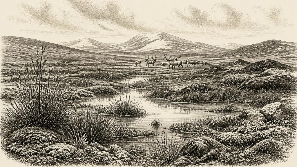
Road works in 1969 cut through a drumlin at Derryvree and exposed the unexpected sequence. Beneath the upper till and above an older one lay freshwater silts, fine sands and organic material. Researchers identified pollen, plant macrofossils, mosses and small animal remains. These are direct observations. Their wider meaning—that the locality supported open tundra or muskeg, with shallow pools and wet ground amid a harsh periglacial climate—is an interpretation built from the ecological preferences of the species and the sediments in which they occurred.
The vegetation was markedly unlike the familiar Irish landscape of oak woodland, pasture, hedgerow and blanket bog. Grasses and sedges were important, while herbs, dwarf shrubs and cold-adapted plants occupied exposed ground. Mosses were especially significant in the waterlogged setting. Finds including mountain-avens, dwarf willow, juniper, bogbean, water-milfoil and clubmosses point to a varied but treeless mosaic: wet hollows, pool margins, sedge-rich ground and sparsely vegetated drier patches. Pollen preservation was poor, so individual pollen grains must not be made to carry too much weight. Yet the convergence of pollen, seeds, mosses, insects and sedimentary context strongly supports a low, open landscape rather than forest.
This was not necessarily a uniform snowbound desert. Periglacial means a landscape shaped by severe cold and frost processes near ice, not one continuously sealed under a glacier. Short summers could create standing water, permit vigorous plant growth in sheltered wet places and support insects. Winters were much colder than those of modern Ireland; frozen ground, seasonal snow and repeated freeze–thaw would have governed drainage and soil formation. The area near today’s Maguiresbridge was therefore capable of supporting life, but it was an unstable habitat on an Atlantic margin exposed to abrupt North Atlantic climatic shifts.
An Island, But Not Today’s Shoreline
Ireland’s physical setting also differed greatly from the modern island. Global sea level was lower during MIS 3 because more water was stored in continental ice sheets, although it varied through the stage and was not as low as at the later Last Glacial Maximum. The Irish Sea basin and surrounding shelves were accordingly more extensive land or shallow-water landscapes than they are today. Exact coastlines, crossings and local sea levels remain difficult to reconstruct because global sea-level fall interacted with the sinking and later rebound of the Earth’s crust under ice loads.
It is responsible to say that Ireland was connected to a changing north-west European landscape through exposed shelves and narrowed water gaps at some times. It is not responsible to draw a single confident land bridge for 30,711 BCE, or to assume that people and animals could always walk to Ireland. Access depended on sea level, ice margins, rivers, weather, terrain and the timing of individual cold phases. The later expansion of the British–Irish Ice Sheet would profoundly remodel these routes and erase evidence of earlier movements.
Castlepook’s Animal Archive
For the larger animals of this broad period, the principal Irish archive is Castlepook Cave near Doneraile, County Cork, sometimes called Mammoth Cave. Its early excavators recovered more than 2,000 bones from complex cave deposits, and subsequent work has re-examined surviving museum collections. The assemblage contains remains attributed to woolly mammoth, giant deer, reindeer, brown bear, wolf, Arctic fox, mountain hare, lemmings and spotted hyaena. This is compelling evidence that these animals reached Ireland during parts of the Late Pleistocene. It does not prove that every species lived together at the same moment, nor that the cave was a single intact ecological snapshot.
That caution is essential. Castlepook’s deposits accumulated over a long period; carnivores carried remains into caves, water moved sediments, and antiquarian excavation did not record contexts to modern standards. Some bones were later directly radiocarbon dated, while advances in collagen purification have shown that several older determinations understated their true age by thousands of radiocarbon years. Re-dating has strengthened the case for a significant MIS 3 fauna in southern Ireland and suggests that spotted hyaena and giant deer may have disappeared locally before the Last Glacial Maximum, around 40,000 calibrated years before present. But it cannot turn the entire cave collection into a neatly dated herd list for one calendar year.
The fauna nevertheless gives scale to the Derryvree picture. Reindeer and lemmings suit cold, open environments; Arctic fox and mountain hare likewise point towards northern or tundra-like conditions. Mammoths and giant deer indicate that enough vegetation and open terrain existed, intermittently at least, to support large herbivores. Wolves and spotted hyaenas reveal a predator and scavenger guild far richer than historic Ireland’s. A mammoth bone from Castlepook bearing tooth impressions consistent with hyaena feeding offers a tangible reminder that caves could be carnivore places, not merely traps in which animals died.
People: Possibility, Not Population
Political affairs, diplomacy, institutions and warfare cannot be reconstructed for Ireland at this date. There are no settlements, graves, monuments, hearths, tool assemblages or written traditions from which to infer a resident society. Nor is there evidence for farming, herding, pottery, metalworking, trade networks or formal religious practice. To invent tribal names, chiefs or seasonal camps would mistake a thin palaeoenvironmental record for history.
One intriguing object does require careful mention. A reindeer femur from Castlepook has been reported as bearing a deep mark interpreted by its researcher as damage from a sharp stone tool used in butchery; County Cork heritage material places it broadly around 31,000 BC. If that interpretation and age are sustained, the bone may represent an exceptionally early episode of human activity in Ireland, perhaps the processing of a reindeer carcass by Upper Palaeolithic hunter-gatherers. It would be evidence of an action, not of permanent settlement. The bone derives from an old cave collection rather than a modernly excavated occupation floor, and no securely associated hearth, lithic assemblage, dwelling or human remains has yet demonstrated an established population.
The most that can safely be envisaged is a possibility of brief, mobile visits by small groups familiar with the wider north-west European Upper Palaeolithic world. If people were present, their economy would have depended on knowledge of animal movements, weather, shelter and fuel; their social lives, languages, beliefs and routes remain unknown. Even the evidence for a human visit should be distinguished from the certain evidence that animals and plants occupied suitable Irish habitats during portions of MIS 3.
A Landscape of Intervals
What matters most around this notional year is environmental change. Ireland was neither an empty, eternally ice-covered land nor a stable homeland continuously occupied by Ice Age people. It was a place of intervals: ice advance and retreat, tundra wetland and exposed ground, faunal arrivals and local disappearance. Derryvree preserves the small-scale world of mosses, sedges and pools; Castlepook preserves the larger drama of mammoths, reindeer and carnivores. Together they show that life repeatedly found footholds on the island during a volatile cold stage.
That evidence also defines the limits of the story. We can responsibly describe an Irish periglacial environment and a diverse Pleistocene fauna in broad dated ranges. We cannot assign either to the precise modern year 30,711 BCE, identify its inhabitants, or narrate a battle, ritual or migration on that date. The historical achievement is therefore not a year-specific event but the recovery of a damaged archive: organic mud under a Fermanagh drumlin, cave bones in north Cork, and scientific methods that continue to revise what Ireland’s deep past can tell us.
Primary Sources
- A Middle Midlandian Freshwater Series at Derryvree, Maguiresbridge, County Fermanagh, Northern Ireland
- Irish Pleistocene Biostratigraphy
- Palaeoecology
- The Irish Quaternary Fauna Project
- A Reconsideration of the Radiocarbon Dating of the Marine Isotope Stage 3 Fauna from Southern Ireland
- Castlepook Cave: County Geological Site Report
- Heritage Artefacts of County Cork
- 2022:564 – Castlepook Cave, Castlepook South, Cork
- 18) Castlepook Caves
- Ice Age Ireland: Cool Fossils!
- Guide to the National Museum of Ireland: Natural History
- Pleistocene Vertebrates in the British Isles
- New Insights on the Fauna of Ireland’s Younger Dryas and Early Holocene from Alice & Gwendoline Cave
- Landscapes and Environments of the Last Glacial-Interglacial Transition: A Time of Amazingly Rapid Change in Ireland
- Late Pleistocene Chronostratigraphy and Ice Sheet Limits, Southern Ireland
- The Timing and Magnitude of the British–Irish Ice Sheet Between Marine Isotope Stages 5d and 2
- Ireland: Submerged Prehistoric Sites and Landscapes
- The IntCal20 Northern Hemisphere Radiocarbon Age Calibration Curve (0–55 cal kBP)
- Dansgaard–Oeschger Events in Climate Models: Review and Baseline Marine Isotope Stage 3 Protocol
- The Marine δ18O Record Overestimates Continental Ice Volume During Marine Isotope Stage 3
- First Evidence of a Late Upper Palaeolithic Human Presence in Ireland
- Reindeer Bone Found in Cork Cave Shows Human Activity in Ireland 33,000 Years Ago
