
Castlepook and the Thaw Pools30676 BCE
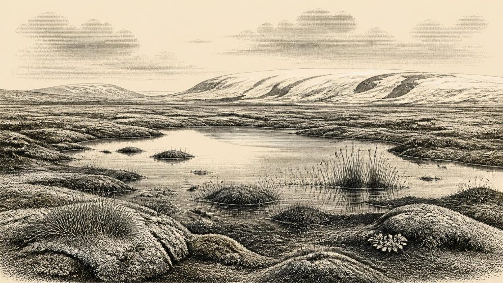
About 30,676 BCE, Ireland lay within the climatically unstable Middle Midlandian or Marine Isotope Stage 3, not a precisely dateable historical moment. At Derryvree, County Fermanagh, organic sediments between glacial tills preserve evidence of an ice-free interval: shallow freshwater pools, tundra vegetation, insects and seasonal thaw within a largely treeless periglacial landscape. Elsewhere, ice conditions varied regionally. Castlepook Cave, County Cork, records diverse Pleistocene fauna, including reindeer, mammoth, bear, wolf and hyaena, accumulated over millennia. A cut-marked reindeer femur may indicate brief human activity, but no secure settlement evidence exists. Political, cultural and religious life remain unknown for this period.
Dateline
“30,676 BCE” is a modern calendar label, not a date that can be matched to an event in prehistoric Ireland. No written record, settlement sequence or annually resolved archaeological layer permits that degree of precision. In calendar terms it falls about 32,625 years before AD 1950, within the later part of the Last Glacial period, conventionally Marine Isotope Stage 3 (MIS 3). The responsible approach is therefore to consider the evidence whose calibrated ranges encompass, precede or closely frame this horizon, rather than inventing a happening for a particular year.
The most valuable evidence is environmental and faunal. It illuminates an Ireland of repeated climatic shifts, local water, treeless vegetation, large mammals and expanding or changing ice. It does not reveal an Irish people, tribe, ruler, polity or religion. At most, a controversial but important bone from County Cork raises the possibility of a brief human encounter with a reindeer during this broad period. That distinction—between what deposits directly demonstrate and what historians may cautiously infer—is central to understanding Ireland at this remote date.
Dating a Cold Interval
Radiocarbon ages are not calendar dates. They measure residual radioactive carbon and must be calibrated against changing atmospheric carbon levels. For deep time, the uncertainty is substantial. The key Derryvree organic deposit in County Fermanagh produced a conventional radiocarbon age of 30,500 +1,170/−1,030 years BP. Using modern calibration, this is commonly expressed as approximately 31,700–36,900 calibrated years BP: a broad span which includes the modern calendar position represented by 30,676 BCE. It is not evidence that a pool existed on that exact year, but it makes Derryvree the closest securely dated Irish environmental archive for the article’s horizon.
The period is known in Irish Quaternary scholarship as part of the Middle Midlandian, while the wider international framework calls it MIS 3. Neither label describes a single uniform climate. Greenland ice-core records, cave formations and marine sediments show abrupt warming and cooling episodes on millennial scales. Ireland lay at the Atlantic edge of north-west Europe, where temperature, snowfall, sea ice, rainfall and glacier margins could alter markedly over periods far shorter than the long archaeological ranges normally available. A fixed annual narrative is impossible; an account of a volatile landscape is not.
Derryvree’s Freshwater World
Derryvree townland lies near Maguiresbridge in County Fermanagh. Road works in 1969 cut through a drumlin and exposed an unusual sequence: freshwater silts and fine sands, including organic material, trapped between two thick sheets of till. Till is debris laid down by glacier ice. The sequence therefore records three broad facts directly: ice had covered or influenced the locality; during an intervening phase a freshwater environment developed; and later glacial action buried and preserved it.
The organic layer contained plant and animal remains that point to open tundra vegetation and a periglacial regime. Periglacial does not mean an unbroken desert of snow. It describes ground profoundly shaped by severe cold, frost and seasonal thaw near ice margins. Mosses, sedges, herb pollen, insect remains and aquatic plants indicate a wet, locally productive setting: shallow pools and saturated ground amid exposed mineral surfaces. The presence of water-milfoil and other wetland indicators is particularly revealing. In summer, meltwater and thaw could support aquatic life even where winters were hard and prolonged.
The reconstruction must remain local. Derryvree was a basin within a changing glacial landscape, not a complete map of the island. Poorly preserved pollen gives an incomplete signal, and isolated tree pollen grains need not prove nearby woodland; they may have travelled far on the wind or derived from older sediments. The stronger evidence is for a largely treeless, open mosaic of wet hollows, mossy ground, herbs and sparse vegetation. It offers a sharper image of Ireland around this chronological horizon than any imagined Palaeolithic village could do.
Ice, Water and Regional Change
The British–Irish Ice Sheet had not yet reached the major late-glacial maximum for which the clearest evidence falls later, roughly after 27,000 years ago. Yet Ireland was not simply ice-free before that point. Its glaciers expanded and contracted in separate sectors, while older and later ice deposits obscure much of the record. Derryvree’s buried freshwater bed demonstrates that its part of Fermanagh was ice-free long enough for sediment, plants and insects to accumulate. It does not prove that every region of Ireland was free of ice at the same moment.
This was a landscape in transition rather than a stable “Ice Age Ireland”. At one locality, cold wetlands could form; elsewhere, ice masses, snowfields or barren terrain may have dominated. In south-west Ireland, dated cave calcite deposits similarly suggest intervals in MIS 3 when liquid water could circulate through shallow cave systems, an indirect sign of climatic amelioration. Such evidence matters because it counters two misleading extremes: Ireland was neither continuously entombed beneath a single unchanging ice sheet nor a hospitable woodland island resembling the later Holocene.
Glacial conditions also altered drainage, coastlines and the practical geography of movement. Global sea levels were lower than today, but lower water alone does not demonstrate a walkable or easy route from Britain or continental Europe. Ice, tidal channels, changing shorelines and the timing of marine passages all mattered. The evidence does support a changing north-west European corridor for animals; it does not identify the route, season or technology by which any people may have reached Ireland.
Castlepook’s Animal Archive
Far to the south, Castlepook Cave near Doneraile, County Cork—historically called Mammoth Cave—provides the major Irish archive of pre-Last Glacial Maximum animal remains. Antiquarian excavations early in the twentieth century recovered a remarkable collection, and later radiocarbon programmes demonstrated that Irish cave deposits contain fauna dating across a long interval. Improved dating has pushed several Castlepook specimens thousands of radiocarbon years older than earlier results suggested. The cave is consequently crucial for showing that a richer cold-stage fauna reached Ireland between at least about 45,000 and 20,000 years ago.
Its assemblage includes evidence for reindeer, giant deer, brown bear, wolf, Arctic fox, hare, lemmings, woolly mammoth and spotted hyaena. These animals should not be assembled into one illustrated herd outside the cave in 30,676 BCE. Cave deposits accumulated over long spans through carnivore activity, natural deaths, water movement, disturbance and early excavation. A mammoth bone proves that mammoths reached the wider Irish landscape during part of this broad interval; it does not prove that mammoths, hyaenas, reindeer and giant deer all grazed together on the same day.
Even so, the fauna conveys the scale of environmental change. Reindeer and Arctic-associated small mammals fit the evidence for cold, open country. Spotted hyaena, a formidable scavenger and predator, signals ecological links with the wider Pleistocene world of Britain and mainland Europe. Large herbivores required vegetation and space, while carnivores depended upon prey and carcasses. Ireland was therefore ecologically connected to wider animal movements, even if the precise pathways and duration of each population’s presence remain unresolved.
The Reindeer Femur Question
Castlepook has also produced the most provocative possible human trace for this era: a reindeer femur bearing a deep linear mark interpreted by zooarchaeologist Ruth Carden as damage from a sharp stone tool used during fresh-bone butchery. Public heritage accounts have associated the object with roughly 31,000 BCE, close to the modern date used here. If the interpretation is sustained, it would indicate that a person handled a reindeer in Ireland during the Upper Palaeolithic, vastly earlier than the long-established evidence for terminal-Pleistocene human activity.
The finding must not be inflated into proof of a settled population. The age is that of the animal bone, not a calendar date for the incision. The specimen comes from an old, complex cave collection rather than a sealed excavated occupation floor. Ireland has yielded no securely associated hearth, stone-tool assemblage, dwelling, burial, human remains or food-processing area of comparable age. Current fieldwork at Castlepook seeks precisely the contextual evidence—stratified deposits, lithics, charcoal and further modified bone—that could test the claim properly.
Accordingly, society and everyday life cannot responsibly be reconstructed for Ireland in this year. If people did visit, they may have been mobile foragers exploiting a carcass or moving through a favourable environmental window. That is an interpretation from the bone mark and wider European comparison, not a demonstrated Irish settlement pattern. Their language, kinship, clothing, beliefs and numbers are unknown.
No Polities, Trade or Sacred Landscape
There is no evidence for political affairs, diplomacy, warfare, institutions, territorial rule or organised conflict in Ireland at this time. Nor is there evidence for farming, trade, exchange networks, pottery, monuments, formal burial or religious practice. These are not gaps awaiting colourful reconstruction; they are categories for which the Irish record currently supplies no reliable data. A reindeer bone with a possible cut mark cannot support claims about clans, chieftains, ritual hunters or contacts with a named continental culture.
Culture and learning are similarly beyond recovery here. Stone technology may once have existed if people entered the island, but no unequivocal Irish tool assemblage of this age has been identified. The durable record is instead ecological: sediment, pollen, plant macrofossils, insects, animal bone, cave strata and the imprint of glacial movement. These are not lesser forms of history. They explain the environmental conditions within which later human history became possible, and they show why early traces are rare, vulnerable and often difficult to interpret.
A Landscape Before Settlement
Ireland around the modern calendar label 30,676 BCE was a cold, unevenly known and rapidly changing place. The Derryvree deposit, calibrated broadly to 31,700–36,900 years BP, provides direct evidence for an open freshwater tundra environment during an ice-free interval in Fermanagh. Castlepook reveals that varied Pleistocene mammals reached southern Ireland across a much longer span, and a single marked reindeer femur offers a tantalising but unconfirmed indication of human action.
The year therefore belongs not to kings, communities or events, but to a buried wetland, a changing ice-sheet margin and an animal world far richer than modern Ireland’s. Its history is necessarily cautious: evidence first, interpretation second, and silence where the ground has not yet spoken.
Primary Sources
- A Middle Midlandian Freshwater Series at Derryvree, Maguiresbridge, County Fermanagh, Northern Ireland
- A Middle Midlandian Freshwater Series at Derryvree, Maguiresbridge, County Fermanagh, Northern Ireland
- The IntCal20 Northern Hemisphere Radiocarbon Age Calibration Curve (0–55 cal kBP)
- IntCal Publications
- The Irish Quaternary Fauna Project
- A Reconsideration of the Radiocarbon Dating of the Marine Isotope Stage 3 Fauna from Southern Ireland
- Episodic Speleothem Deposition Tracks the Terrestrial Impact of Millennial-Scale Last Glacial Climate Variability in SW Ireland
- Growth and Retreat of the Last British–Irish Ice Sheet, 31,000 to 15,000 Years Ago: the BRITICE-CHRONO Reconstruction
- Exploring Controls of the Early and Stepped Deglaciation on the Western Margin of the British-Irish Ice Sheet
- The Timing and Magnitude of the British–Irish Ice Sheet Between Marine Isotope Stages 5d and 2
- Maximum Extent and Dynamic Behaviour of the Last British–Irish Ice Sheet West of Ireland
- Archaeology Research Excavation Grant 2022: Castlepook Cave Project Report
- 2022:564 – Castlepook Cave, Castlepook South, Cork
- The Exploration of Castlepook Cave, County Cork
- The Archaeological Heritage of County Cork
- County Cork Geological Heritage Audit Report
- Palaeoecology: Field Guide 16
- The Subdivision of the Quaternary Period in Ireland
- Myriophyllum alterniflorum in Fermanagh
- New Insights on the Fauna of Ireland’s Younger Dryas and Early Holocene from Alice & Gwendoline Cave
