
BIRM-166’s Fermanagh Silts30610 BCE
At Derryvree, County Fermanagh, freshwater silts sealed between glacial tills record a locally ice-free episode during Marine Isotope Stage 3. Radiocarbon dating of organic material, though incapable of fixing events to 30,610 BCE, places the deposit broadly within 36,900–31,700 calibrated years before present. Its wetland flora, insects and sediments reveal treeless tundra, cold shallow water and short growing seasons. Castlepook Cave, County Cork, preserves fauna including mammoth, reindeer, hyaena and Arctic fox, indicating cold open habitats. A possibly cut-marked reindeer bone suggests, but does not prove, fleeting human activity. Evidence supports an intermittently habitable, environmentally unstable Ireland, without settled communities.
Dateline
Modern calendar-year precision is not available for Ireland in 30,610 BCE. No one in Ireland recorded a year, and no excavated layer can be responsibly tied to one twelve-month interval at this depth in time. The label is a modern chronological point, roughly 32,559 years before the radiocarbon convention’s reference year of AD 1950. What archaeology can illuminate is a wider part of the Late Pleistocene, within Marine Isotope Stage 3: a cold, unstable world before the fullest expansion of the last British–Irish Ice Sheet. The most useful evidence is a buried wetland deposit at Derryvree near Maguiresbridge, County Fermanagh, supplemented cautiously by cave fauna from County Cork.
Dating a Buried Wetland
Derryvree was exposed during roadworks in February and March 1969, when a cutting passed through a drumlin about two kilometres north-east of Maguiresbridge. The sequence was remarkable. Two thick sheets of till – unsorted sediment laid down by glacier ice – enclosed freshwater silts, fine sands and organic mud. The basic history is secure even if its dates are broad: ice deposited the lower till; a period of standing or slowly moving freshwater followed, allowing sediment, plants and animals to accumulate; then a later advance of ice sealed the deposit beneath the upper till.
A sample from the organic layer, BIRM-166, returned a conventional radiocarbon age of 30,500 years before present, with a sizeable uncertainty of +1,170 and −1,030 years. A radiocarbon result is not identical to a calendar date. Atmospheric carbon-14 has varied over time, and dates of this antiquity must be calibrated against independently constructed curves. Published calibrations place the Derryvree evidence broadly within about 36,900–31,700 calibrated years before present, or roughly 34,950–29,750 BCE; later ice-sheet modelling centres its significance near 33,500 ± 1,200 calibrated years before present. The nominal year 30,610 BCE lies within the wider relevant range, but it cannot identify a particular season, pool, plant or occurrence in the deposit.
This distinction matters. Derryvree is not a lost diary entry for an Irish year. It is an environmental archive accumulated over an extended interval and preserved by later glaciation. Its value is precisely that it records an episode when part of Fermanagh was locally ice-free, despite the generally severe conditions of the last Ice Age.
Open Ground and Cold Water
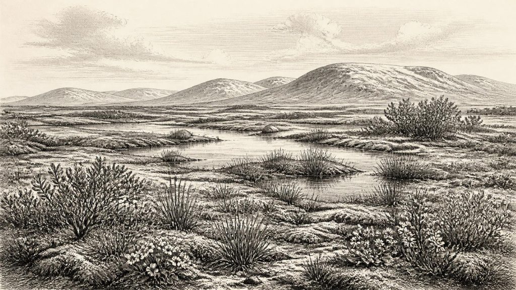
The plant and animal remains in the Derryvree silts indicate open tundra vegetation and a periglacial climate. The locality was treeless or nearly so. Fossil pollen, plant macrofossils, mosses and insects point to wet, exposed ground, with freshwater pools and saturated margins among low-growing vegetation. Sedges, grasses, mosses and small herbs were important elements. Finds attributed to bogbean, dwarf willow, mountain avens, lesser clubmoss and rosy saxifrage help to establish a flora suited to cold ground, short growing seasons and plentiful surface water.
Older descriptions compare the landscape to muskeg, meaning a waterlogged, mossy, organic-rich wetland. That comparison is useful only as a reconstruction. It does not mean that a modern northern bog was reproduced unchanged in Fermanagh, nor that every Irish valley had the same character. The evidence belongs to one basin and its immediate catchment. Yet the combination of freshwater sediments, wetland plants and cold-adapted insects makes clear that this was not a sterile ice desert. Liquid water persisted; plants colonised mud, margins and shallow water; insects occupied the resulting mosaic of pool, moss and sedge.
Everyday conditions would nevertheless have been demanding. Frost action affected exposed soils, winters were severe and the productive season was brief. The people who would later farm, build monuments and cultivate dense woodland had no place in this scene. There is no evidence for forest clearance, crops, domestic stock, pottery or fixed fields. The familiar green, wooded Ireland of later prehistory was still far in the future.
An Island in Transition
Derryvree demonstrates local ice-free conditions, not an all-Ireland weather report. During Marine Isotope Stage 3, climate shifted sharply on northern-hemisphere scales, and ice margins responded unevenly. Other parts of Ireland may have held snowfields, valley glaciers or exposed cold-steppe terrain at different times. The island’s coastlines and neighbouring seas also differed greatly from the modern map because global sea level was lower, exposing parts of the continental shelf now submerged.
It would be irresponsible, however, to turn lower sea level into a mapped route for migrants. The Derryvree deposit cannot show whether a crossing to Britain was dry, coastal, seasonal or impossible at a particular moment; nor does it identify a route from continental Europe. What it does show is that Ireland was part of a changing north-west European environmental zone, not a permanently isolated and uniformly ice-covered landmass. In the millennia after the interval represented at Derryvree, ice expanded much more extensively. The Last Glacial Maximum, generally placed later, around 26,000–20,000 years ago, would radically reshape Irish terrain and conceal or destroy many older deposits.
Cork’s Cave Fauna
Castlepook Cave, also known as Mammoth Cave, near Doneraile in north County Cork, provides a second, very different window on this broad period. Excavated principally in the early twentieth century, it produced a striking collection of Ice Age animal remains. These include woolly mammoth, reindeer, giant deer, brown bear, wolf, fox, Arctic fox, spotted hyaena, hare and lemming. Re-dating has made clear that the cave’s older fauna is more ancient than some earlier results suggested, and that specimens need not all belong to one moment or one community.
The cave therefore does not permit a single dramatic tableau of mammoths, hyaenas and reindeer gathered together in 30,610 BCE. Bone deposits can be assembled through carnivore activity, natural death, water movement, collapse and the long history of cave use. Antiquarian excavation also removed much of the original context. Still, the fauna establishes an important wider point: during parts of MIS 3, Ireland supported or was visited by animals associated with open, cold environments and functioning predator–scavenger food webs. Reindeer and mammoth imply grazing habitat; Arctic fox and lemmings reinforce the evidence for cold conditions; hyaena and wolf show that large carcasses were part of a wider ecological system.
The Limits of Human Evidence
A reindeer femur from Castlepook has a deep surface incision interpreted by some specialists as a cut made with a sharp stone tool while processing a fresh carcass. If that identification and its broad dating are sustained, it may represent a very early human action in Ireland, vastly earlier than the well-established post-glacial archaeological record. It is an important possibility, but it is not proof of a permanent population, a settlement, a named culture or a continuous occupation of the island.
The distinction is essential. A single marked bone cannot tell us whether people hunted the animal, found and butchered a carcass, camped nearby or made only a brief visit. Nor can it establish their language, ancestry, clothing, tools beyond the possible cutting edge, or the route by which they arrived. Recent work at Castlepook has sought surviving Pleistocene deposits and improved chronological control, because secure context is crucial when evaluating a claim of such importance. The careful conclusion for this period is that human presence is possible and under investigation; it is not an established annual narrative of settlement.
Comparison with Upper Palaeolithic groups elsewhere in north-west Europe can indicate what mobile foragers were capable of: close knowledge of seasonality, animal movement, shelter, fuel and the practical uses of meat, marrow, hide, sinew and bone. But these are comparative possibilities, not demonstrated details of life in Ireland. No Irish artefact assemblage of this date establishes an economy, trade network or cultural tradition. There is no direct evidence for boats, exchange, art, burial, shrines or formal learning.
No Polities, No Chronicle
Political affairs, diplomacy and warfare cannot be recovered for Ireland at this point. There are no known rulers, tribes, territorial institutions, laws or alliances, and no basis for assigning later ethnic or national identities to the people who may – or may not – have entered the island. Likewise, there is no material evidence for religion in the form of ritual structures, graves, images or offerings. Silence here is not proof that people lacked belief or social bonds; it is a limit imposed by the surviving record.
The strongest history of 30,610 BCE is consequently environmental. Derryvree records cold freshwater, tundra vegetation and exposed ground between two episodes of glaciation. Castlepook preserves evidence of an Ice Age fauna in the south, together with a provocative but still limited possible trace of human carcass processing. These sites do not offer a year of kings, conflicts or communities. They reveal something older and more fragile: an intermittently habitable Irish landscape of wetland, frost, large mammals and gathering ice.
Primary Sources
- A Middle Midlandian Freshwater Series at Derryvree, Maguiresbridge, County Fermanagh, Northern Ireland
- A reconsideration of the radiocarbon dating of the Marine Isotope Stage 3 fauna from southern Ireland
- The Irish Quaternary Fauna Project
- Exploring controls of the early and stepped deglaciation on the western margin of the British-Irish Ice Sheet
- Growth and retreat of the last British-Irish Ice Sheet, 31,000 to 15,000 years ago
- Last Glacial Maximum cirque glaciation in Ireland and implications for reconstructions of the Irish Ice Sheet
- The IntCal20 Northern Hemisphere Radiocarbon Age Calibration Curve (0–55 cal kBP)
- The Exploration of Castlepook Cave, County Cork, Being the Third Report from the Committee Appointed to Explore Irish Caves
- The Exploration of Castlepook Cave, Co. Cork. With 3 plates
- 2022:564 – Castlepook Cave, Castlepook South, Cork
- Heritage Artefacts of County Cork
- Archaeological Heritage of County Cork
- The subdivision of the Quaternary Period in Ireland
- Irish Quaternary Stratigraphy: A Review
- Mammoth Cave (Castlepook Cave)
- New Insights on the Fauna of Ireland’s Younger Dryas and Early Holocene from Alice & Gwendoline Cave
- New Insights on the Fauna of Ireland’s Younger Dryas and Early Holocene from Alice & Gwendoline Cave
- The Irish Quaternary Fauna Project
- A Middle Midlandian Freshwater Series at Derryvree, Maguiresbridge, County Fermanagh, Northern Ireland
- Timing, Pace and Controls on Ice Sheet Retreat: An Introduction to the BRITICE-CHRONO Transect Reconstructions of the British–Irish Ice Sheet
