Maguirebridge’s Treeless Muskeg30609 BCE
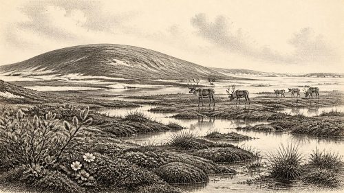
30,609 BCE is not a recoverable Irish historical year but falls within a broad calibrated range for Derryvree, County Fermanagh. Sediments between two till sheets show an ice-free interval during Marine Isotope Stage 3, when treeless, waterlogged tundra supported pools, mosses, insects and seasonal wildlife. Crag Cave records intermittent milder conditions, while Castlepook Cave preserves diverse cold-adapted fauna, including mammoth, reindeer and hyaena. A possibly cut-marked reindeer bone may indicate human carcass processing, but proves neither settlement nor culture. Lower sea levels altered routes as ice expanded. These fragmentary archives describe climatic change, not directly an ancient Irish society there.
Dateline
“30,609 BCE” is a modern chronological label, not a recoverable year in Ireland’s past. No Irish calendar, named person, settlement, political event or human lifetime can be tied to that twelve-month span. At this depth in time, archaeologists and Quaternary scientists work with stratigraphy, fossil assemblages and probability ranges from scientific dating. The most responsible picture is therefore regional and approximate: Ireland lay within the Late Pleistocene, in Marine Isotope Stage 3, during the long, unstable cold phase that preceded the Last Glacial Maximum.
The nearest important Irish environmental archive is Derryvree, in County Fermanagh, about two kilometres north-east of Maguiresbridge. Organic sediments there produced radiocarbon determination BIRM-166, 30,500 radiocarbon years before present, with a substantial laboratory uncertainty of +1,170 and −1,030 years. “Present” in radiocarbon terminology is AD 1950. Calibration converts that laboratory age into a broad calendar range, published as roughly 36,900–31,700 calibrated years before present. The nominal date 30,609 BCE, about 32,558 years before AD 1950, falls within that wide range. It does not date a particular season, pool, animal or event at Derryvree.
A Wetland Between Ice Sheets
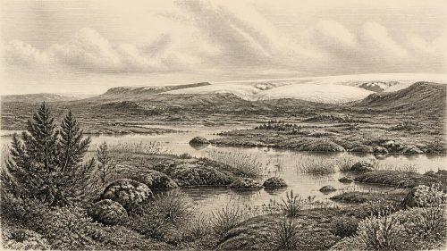
Derryvree was revealed by roadworks in 1969, which cut through a drumlin: a streamlined hill made largely of till, the unsorted mixture of clay, stones and debris left by glacier ice. The exposure showed two thick and distinct till sheets. Between them lay fine sands, freshwater silts and organic deposits. The basic sequence is unusually eloquent. Ice had occupied the locality and deposited the lower till. Later, the site held fresh water and wet ground long enough for sediment, plants and small animals to accumulate. A renewed advance of ice, or at least ice depositing glacial debris, then buried and protected that interval beneath the upper till.
This is direct evidence for an ice-free episode at that particular Fermanagh locality, not proof that every part of Ireland was ice-free simultaneously. Glaciers advance and retreat unevenly, and a record preserved in one hollow cannot be made into a map of an entire island. Yet Derryvree matters because it establishes that the Irish landscape was not simply locked beneath uninterrupted ice throughout the later part of the last glacial cycle. In places and at times, exposed ground, standing water and tundra-like wetland persisted between phases of glaciation.
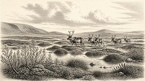
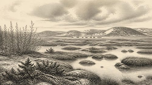
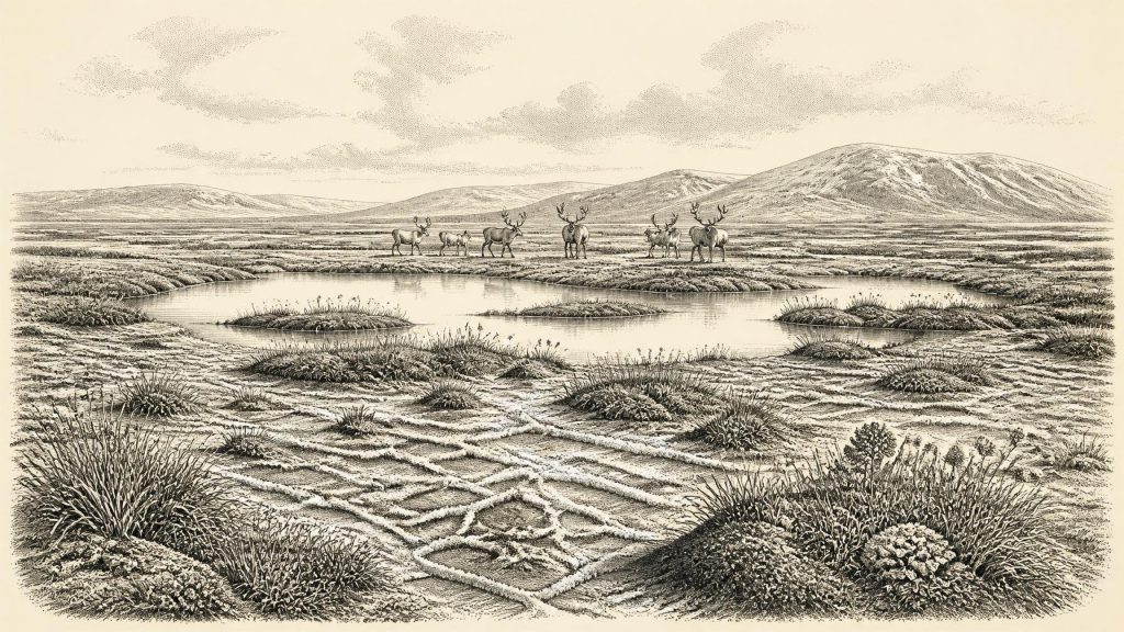
The fossil content indicates a severe, open environment. The original investigators described a full-glacial flora and fauna, while later syntheses characterise the setting as treeless tundra or muskeg: waterlogged ground with open pools, abundant plant matter and mossy margins. Insect evidence was especially valuable because many beetles have exacting habitat requirements. Together with plant remains, it points to cold conditions, long winters and a landscape without woodland. The productive pockets were low, wet places rather than forests, farms or settled valleys.
Plants, Pools and Seasons
For people accustomed to modern Fermanagh’s enclosed fields, hedgerows and woods, the contrast is immense. Around the broad period represented by BIRM-166, the local scene may have included shallow pools, silty water, sedges, mosses and scattered Arctic-alpine plants on damp and exposed ground. Such vegetation could survive a short growing season, but it would not have concealed the land beneath a continuous canopy of trees. Wind, frost, snow cover and waterlogging shaped movement across the ground far more than roads or boundaries ever could.
This was not necessarily a lifeless wasteland. Wetlands concentrate water, edible and sheltering plants, insects and grazing opportunities, even in a cold climate. But productivity was seasonal and precarious. A pool could support aquatic life and preserve organic remains; nearby frozen or windswept ground could be difficult terrain for large mammals. The Derryvree deposit consequently records an ecological mosaic rather than a single uniform “Ice Age landscape”. Its scientific importance lies precisely in the coexistence of cold-climate signals, fresh water and living communities between glacial deposits.
Irish evidence from Crag Cave in County Kerry adds a wider climatic context. U-series dating of cave calcite indicates that dripstone formed episodically during relatively milder Greenland Interstadials of the last glacial period. Because shallow-cave speleothem needs liquid water, those episodes show that climatic improvement could reach Ireland’s Atlantic margin. Correlating Derryvree directly with one named Greenland event remains an interpretation, not an observation from the site itself. Nonetheless, the Fermanagh wetland and the Kerry cave record both fit a world in which temperature and moisture changed sharply over millennia, sometimes far more rapidly than a conventional historical narrative suggests.
Animals at Ireland’s Edge
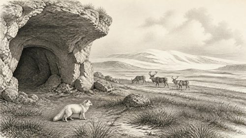
Animal bones from southern Irish caves provide another, differently dated window onto this period. Castlepook Cave near Doneraile, County Cork—also known as Mammoth Cave—has yielded Ireland’s richest known pre-Last Glacial Maximum vertebrate assemblage. Its deposits contain remains of woolly mammoth, giant deer, reindeer, brown bear, spotted hyaena, wolf, Arctic fox, lemmings and mountain hare. Individual bones span a very long interval, rather than representing one moment or one coherent animal community. Still, the assemblage demonstrates that Ireland could support, or at least receive, a striking cold-stage fauna during Marine Isotope Stage 3.
That evidence must be handled carefully. Caves are repositories, not simple snapshots. Carnivores carried prey and carrion into them; animals died in or near fissures; water could move bones; and antiquarian excavations removed much context now expected in modern fieldwork. Re-dating with improved collagen pretreatment has shown that several older Irish cave radiocarbon results were too young, and that Castlepook fauna includes animals substantially older than earlier estimates suggested. The lesson is methodological as well as chronological: a bone’s species, date and findspot do not automatically reveal the date of its deposition, the cause of death or the nature of its relationship with people.
Reindeer and mammoth are particularly evocative, but neither authorises a detailed reconstruction of migration routes through Ireland in 30,609 BCE. Their presence indicates habitats capable of supporting large herbivores at some points in the wider period. Spotted hyaena, known in Ireland most securely from Castlepook, indicates powerful carnivores in the ecosystem. Predation, scavenging and seasonal animal movement were real forces in this landscape. Whether the animals ranged continuously across the island, arrived in separated pulses, or survived only in favourable localities cannot be settled from the surviving record.
The Human Question
The most arresting possible evidence for people is also from Castlepook: a reindeer femur reported to bear a mark made by a sharp stone tool while fresh bone was processed. County Cork heritage interpretation dates the object broadly to about 31,000 BC and presents it as Palaeolithic. If the mark is correctly identified as a human butchery cut and belongs to the bone’s Pleistocene history, it may be evidence that a person handled a reindeer in Ireland tens of millennia before the well-established post-glacial settlement record.
That is a consequential but narrow claim. No securely associated stone-tool assemblage, hearth, dwelling floor, burial, repeated kill site or camp has been recovered from Ireland for this horizon. The femur would not establish a permanent population, a named culture, a route of colonisation or a settled hunting territory. Nor does it permit a confident account of language, kinship, religious practice or artistic tradition. The most that can responsibly be said is that a possible episode of carcass processing may have occurred somewhere in the wider Castlepook landscape, with the bone subsequently entering a cave system affected by carnivores and other natural processes.
Accordingly, there are no identifiable political affairs, diplomacy, leaders, warfare or institutions to report for Ireland at this date. There is no evidence for farming, livestock, metalworking, pottery, long-distance trade or permanent villages. If people were present, they would have been mobile foragers operating at the north-western margin of Upper Palaeolithic Europe, dependent on skills and social connections that are not preserved in the Irish record. This is a reasonable comparative possibility, not a demonstration from Irish artefacts.
Coastlines and Approaching Glaciation
Ireland’s physical geography was also different. Global sea level was much lower than today because immense volumes of water were stored in northern ice sheets. Ireland was not yet an island in the modern sense: the Irish Sea basin and surrounding shelves exposed or shallowed at various times, altering distances and possible animal or human routes. Yet lower sea level did not mean easy travel. Cold seas, shifting coastlines, ice margins, rivers and treacherous wet ground made the region a changing frontier rather than an open plain.
The main expansion of the last British–Irish Ice Sheet was still gathering force. Modern reconstructions indicate steady overall growth from about 31,000 to 26,000 years before present, followed by maximum volumes and highly variable regional behaviour later. Derryvree’s organic interval belongs before the final burial of its wetland by the later glacial advance. In that sense, its delicate mosses, insects and freshwater sediments preserve a world that would eventually be overridden, reshaped and concealed beneath ice-derived deposits.
The year 30,609 BCE therefore stands not for a historical episode but for a fragile environmental archive. At Derryvree, water and vegetation briefly occupied a hollow between glacial phases; at Castlepook, bones record a diverse, cold-adapted fauna and perhaps a fleeting human act. These sites do not yield an ancient Irish society. They reveal the environmental preconditions from which much later Irish human history would emerge: a northern Atlantic land repeatedly transformed by climate, ice, animals and, possibly, rare visits by people.
Primary Sources
- A Middle Midlandian Freshwater Series at Derryvree, Maguiresbridge, County Fermanagh, Northern Ireland
- The Irish Quaternary Fauna Project
- A Reconsideration of the Radiocarbon Dating of the Marine Isotope Stage 3 Fauna from Southern Ireland
- The IntCal20 Northern Hemisphere Radiocarbon Age Calibration Curve (0–55 cal kBP)
- Episodic Speleothem Deposition Tracks the Terrestrial Impact of Millennial-Scale Last Glacial Climate Variability in SW Ireland
- Growth and Retreat of the Last British–Irish Ice Sheet, 31,000 to 15,000 Years Ago: the BRITICE-CHRONO Reconstruction
- Exploring Controls of the Early and Stepped Deglaciation on the Western Margin of the British Irish Ice Sheet
- Castlepook Cave: Cork County Geological Site Report
- The Archaeological Heritage of County Cork
- Heritage Artefacts of County Cork
- Maximum Extent and Readvance Dynamics of the Irish Sea Ice Stream and Irish Sea Glacier Since the Last Glacial Maximum
- Advance and Retreat of the Marine-Terminating Irish Sea Ice Stream into the Celtic Sea During the Last Glacial: Timing and Maximum Extent
- Stratigraphic and Palaeo-Geomorphological Evidence for the Glacial-Deglacial History of the Last British-Irish Ice Sheet in the North-Western Irish Sea
- Radiocarbon Constraints on the Age of the Maximum Advance of the British-Irish Ice Sheet in the Celtic Sea
- Dimensions and Chronology of the Last Ice Sheet in Western Ireland
- Trimlines, Blockfields and the Vertical Extent of the Last Ice Sheet in Southern Ireland
- The Deglaciation of the Western Sector of the Irish Ice Sheet from the Inner Continental Shelf to its Terrestrial Margin
- Oscillating Retreat of the Last British-Irish Ice Sheet on the Continental Shelf Offshore Galway Bay, Western Ireland
- A 10Be-Dated Record of Glacial Retreat in Connemara, Ireland, Following the Last Glacial Maximum and Implications for Regional Climate
- New Insights on the Fauna of Ireland’s Younger Dryas and Early Holocene from Alice & Gwendoline Cave