Doneraile’s Marked Reindeer Femur30611 BCE
About 30,611 BCE, Ireland lay within the unstable, cold conditions of Marine Isotope Stage 3, before maximum expansion of the British–Irish Ice Sheet. Derryvree, County Fermanagh, preserves freshwater silts between tills, indicating an ice-free periglacial interval with treeless tundra wetlands, pools, sedges, mosses, herbs and insects. Castlepook Cave, County Cork, produced reindeer, mammoth and hyaena remains, reflecting open grazing country. A cut-marked reindeer femur may indicate Upper Palaeolithic butchery, but cannot prove settlement or continuous occupation. No securely contemporary human sites exist; Ireland’s evidence chiefly records changing climate, habitats, fauna and returning ice across chronological ranges rather than exact dates.

Dateline
30,611 BCE is a modern label imposed on a time far beyond any written calendar. No person in Ireland could have named this year, and archaeology cannot identify an event, ruler, journey or season belonging precisely to it. The responsible approach is therefore to place it within wider, calibrated ranges. It falls in the later part of the Late Pleistocene, during Marine Isotope Stage 3, an unstable interval of the last Ice Age. Ireland’s most relevant evidence comes from two very different archives: freshwater sediments preserved beneath later glacial deposits at Derryvree near Maguiresbridge, County Fermanagh, and the rich but complicated animal-bone assemblage from Castlepook Cave near Doneraile, County Cork.
The date lies within the broad chronological territory of the Derryvree evidence, not at a securely distinguishable point within it. Organic silts between two sheets of glacier-laid till produced a conventional radiocarbon age of 30,500 +1,170/−1,030 radiocarbon years BP. Because radiocarbon years are not calendar years, the result must be calibrated and treated as a range rather than converted mechanically. Recent treatments place the Derryvree freshwater interval broadly around 36,900–31,700 calibrated years BP, approximately 34,950–29,750 BCE. Thus 30,611 BCE can be used to discuss the kind of Irish environment preserved by the deposit, but not to claim that the deposits record conditions in that exact calendar year.
An Ice-Age Interval
This was part of the Midlandian cold stage, Ireland’s name for the last major glacial phase, and before the fullest expansion of the British–Irish Ice Sheet. The word “before” needs care. Ice did not arrive everywhere at once, nor did it behave as a single fixed blanket. Glaciers and ice sheets advanced, stagnated, thinned and redirected their flow in response to changing snowfall, temperature, sea level and terrain. Later ice also scoured away or buried large stretches of the older landscape. That destruction helps explain why Ireland has so few surviving deposits from this deep past and why one road-cut exposure in Fermanagh has exceptional importance.
At Derryvree, excavations revealed fine sands and freshwater silts lying between distinct tills. A till is unsorted material deposited directly by ice; the intervening sediments consequently show that this locality experienced an ice-free episode between glacial advances. The deposits do not prove that every part of Ireland was ice-free simultaneously. They do, however, demonstrate that a freshwater basin and its surrounding vegetation existed in Fermanagh during a cold, periglacial interval. The later advance sealed this brief archive beneath the sediments that now form part of a drumlin landscape.
Modern reconstructions of the British–Irish Ice Sheet describe major growth and changing configurations from about 31,000 years ago onward, with the maximum extent later, principally during the Last Glacial Maximum. At 30,611 BCE, then, Ireland was part of a rapidly changing north-west European cold-world rather than a settled, stable island landscape. The exact local position of ice margins remains a research problem, but the evidence points to severe conditions, short productive seasons and considerable environmental instability.
Derryvree’s Treeless Wetland
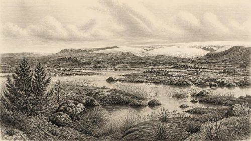
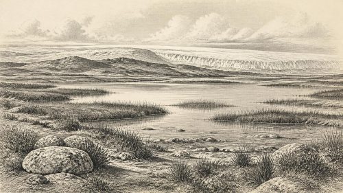
The Derryvree fossils make this distant setting unusually tangible. Pollen, plant macrofossils, mosses and insect remains indicate open, treeless tundra or muskeg: wet, peaty ground, with pools and waterlogged patches rather than forest. Grasses and sedges formed important parts of the vegetation. Juniper and a variety of cold-tolerant herbs occurred, while mosses flourished in damp ground. Finds including bogbean and water-milfoil show that open water and shallow margins existed locally. This was not a lush modern bog or a uniform white wilderness. It was a patchwork of sedge-rich wetland, exposed mineral ground, mossy surfaces and freshwater pools within a broader cold landscape.
The insects add ecological detail. Their assemblage supports the picture of wet ground rich in plant matter, open pools and a harsh climate. Such evidence permits cautious inferences about everyday ecological processes: summer thaw replenished shallow water; plants grew rapidly when light and temperature allowed; frost, snow cover and frozen ground constrained much of the rest of the year. Yet it cannot give exact temperatures for 30,611 BCE itself. Nor can it reconstruct a particular herd moving through Fermanagh. The strength of the evidence lies in its accumulated environmental signal, not in a cinematic single-day scene.
There was no agriculture, woodland clearance, village-building or managed landscape. No cereal pollen, field system, domestic animal bone or manufactured object belongs to this evidence. The economy of later prehistoric Ireland has no place here. If people reached the island, their survival would have depended on highly mobile hunting, gathering and the use of animal and plant resources available in a demanding seasonal environment. But this is an inference drawn from better-known Upper Palaeolithic societies elsewhere in Europe, not a demonstrated Irish way of life at Derryvree.
Castlepook and the Animal World
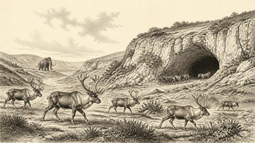
Castlepook Cave, also called Mammoth Cave, offers the other major window on this period. Its galleries yielded one of Ireland’s most important Pleistocene mammal collections. The fauna includes animals associated with cold, open environments, notably reindeer and woolly mammoth, alongside carnivores such as spotted hyaena. Radiocarbon determinations on bones have placed elements of the assemblage broadly in the mid-30,000s radiocarbon years BP, again indicating a world earlier than the Last Glacial Maximum. The cave records an animal landscape capable of supporting large grazing mammals and their scavengers or predators.
That conclusion must not become a claim that mammoths and reindeer were certainly together at Doneraile in 30,611 BCE. Cave assemblages commonly accumulated over long periods. Bones may have been brought in by carnivores, moved by water, disturbed by burrowing animals or displaced during early excavation. Castlepook is especially valuable because of the number and variety of bones it preserves; it is difficult precisely because the original relationship between individual bones and events has often been lost. It reveals a regional faunal mosaic, not an intact hunting camp or a census of a single moment.
Reindeer are particularly important because a femur from Castlepook bears a deep incision that palaeozoologist Ruth Carden has interpreted as a mark made by a sharp stone tool during butchery. County Cork heritage material dates the bone to about 31,000 BCE, making it strikingly close to the modern year-label considered here. If the interpretation is sustained, it would be evidence that people processed a reindeer carcass in Ireland during the Upper Palaeolithic. It would not, by itself, establish a settlement, continuous occupation, a named people, a hunting party’s size or the place where the animal was killed. The bone may even have been carried to the cave later by scavengers.
The Limits of Human History
This single modified bone is a significant but unresolved clue. There is no securely dated house, hearth, stone-tool assemblage, workshop, burial, human skeleton or stratified camp floor in Ireland that can be assigned to around 30,611 BCE. The first securely published evidence for human presence in Ireland is much later: cut marks on a brown-bear patella from Alice and Gwendoline Cave, County Clare, dated to roughly 12,800–12,600 calibrated years BP. That later evidence demonstrates human activity, but it cannot retrospectively fill the enormous chronological gap between itself and Castlepook.
Accordingly, political affairs, conflict and diplomacy cannot responsibly be narrated for Ireland at this date. There are no communities whose territories, alliances, languages, leaders or beliefs can be identified. Nor is there evidence for trade in the ordinary archaeological sense: no imported toolstone, ornaments, exchange goods or transport network has been recovered from a securely contemporary Irish context. Lower sea levels altered coastlines and the geography of the Irish Sea region, but the practical routes available at any particular time remain uncertain. It is possible that animals, and perhaps occasional people, moved through changing north-west European landscapes; possibility is not proof of a regular Irish connection.
Religion, art and formal learning are likewise beyond recovery. Upper Palaeolithic communities elsewhere in Europe produced sophisticated stone tools, bodily ornaments, images and ceremonial practices, but none has been demonstrated in Ireland for this interval. It would be misleading to attach a continental archaeological culture to the island merely because its members lived at broadly the same time. The absence of evidence is partly a product of later glaciation and submerged or eroded landscapes, yet it remains absence: archaeology must distinguish what might once have existed from what the surviving record can show.
A Landscape Before Later Ireland
The principal historical development around 30,611 BCE was environmental, not political. Derryvree records an ice-free freshwater refuge within a cold-stage world; Castlepook records that sizeable Ice-Age mammals reached the Irish region; the marked reindeer femur raises the possibility of a human encounter. Together they show that Ireland was neither a blank void nor a knowable human homeland. It was a dynamically changing northern landscape of tundra wetlands, pools, grazing animals, carnivores and encroaching ice.
That distinction matters. The familiar Ireland of farms, towns, languages, monuments and recorded communities lay tens of millennia in the future. Around this date, the island’s history survives chiefly in pollen grains, insect fragments, mosses, silts, cave bones and the stratigraphic fact that ice returned. These traces offer a precise lesson in historical method: they can illuminate climate, habitats and animal life across broad spans of time, and they can preserve a tantalising indication of human action. They cannot supply the exact calendar-year story that later history makes possible.
Primary Sources
- A Middle Midlandian Freshwater Series at Derryvree, Maguiresbridge, County Fermanagh, Northern Ireland
- A Middle Midlandian Freshwater Series at Derryvree, Maguiresbridge, County Fermanagh, Northern Ireland
- Figure 6: The Subdivision of the Quaternary Period in Ireland
- Irish Pleistocene Biostratigraphy
- The Irish Quaternary Fauna Project
- Heritage Artefacts of County Cork
- First Evidence of a Late Upper Palaeolithic Human Presence in Ireland
- First Evidence of a Late Upper Palaeolithic Human Presence in Ireland
- New Insights on the Fauna of Ireland's Younger Dryas and Early Holocene from Alice & Gwendoline Cave
- The Colonization of Ireland: A Human Ecology Perspective
- Growth and Retreat of the Last British–Irish Ice Sheet, 31,000 to 15,000 Years Ago: the BRITICE-CHRONO Reconstruction
- Project Findings Provide Essential Insight into the Last British–Irish Ice Sheet
- BRITICE-CHRONO: Project Introduction
- BRITICE-CHRONO: Constraining Rates and Style of Marine-Influenced Ice Sheet Decay
- The Timing and Magnitude of the British–Irish Ice Sheet Between Marine Isotope Stages 5d and 2
- A Critical Review and Re-Investigation of the Pleistocene Deposits
- Irish Quaternary Association: Outreach and Education Resources
- Irish Quaternary Association: Field Guides
- Irish Quaternary Association: Publications
- A Field Guide to Some Aspects of the Quaternary History of South Fermanagh
- The Mesolithic in Ireland: When Was It?
- Proceedings: Postglacial Colonisation Conference