Bogbean Ecology30585 BCE
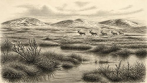
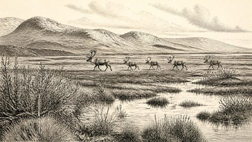
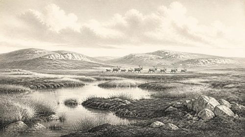
At the notional date of 30,585 BCE, Ireland was a climatically unstable Late Pleistocene landscape, not a documented historical society. Derryvree, County Fermanagh, preserves freshwater silts between glacial tills, dated broadly to this interval, demonstrating a locally ice-free, treeless tundra wetland with bogbean, sedges, mosses and seasonal freezing. Cave deposits at Castlepook, County Cork, indicate that cold-adapted animals, including reindeer, mammoth and giant deer, occupied parts of Ireland over the wider period. A possibly tool-marked reindeer bone suggests transient human activity, but proves neither settlement nor society. Later ice advances buried deposits and erased much evidence of this ancient world.
Dateline
Modern calendar-year precision is not available for Ireland in 30,585 BCE. The date is a useful point on a modern timeline, but it cannot be matched to a recorded event, a ruler, a battle or even a single season. In archaeological terms it falls within the Late Pleistocene, broadly Marine Isotope Stage 3, long before written history and before any demonstrable permanent human community in Ireland. The most responsible way to approach this moment is through dated deposits, animal remains and the changing behaviour of ice, not through a conventional historical narrative.
The closest important Irish archive is the freshwater deposit exposed at Derryvree, near Maguiresbridge in County Fermanagh. Its conventional radiocarbon determination, Birm-166, was 30,500 radiocarbon years before present, with a substantial uncertainty. When calibrated, that legacy measurement spans roughly 36,900–31,700 calibrated years before present, or approximately 34,950–29,750 BCE. Thus 30,585 BCE lies within the broad calendar range indicated by the deposit, but cannot be isolated as the exact year in which its plants, insects or sediments accumulated. The evidence illuminates an interval, not a date on which one could reconstruct individual lives.
A Freshwater Pause Between Ice Advances
Derryvree became known when road works in 1969 cut through a drumlin: a streamlined hill made largely of glacial sediment. Beneath one sheet of till and above another lay organic silts and fine sands, deposited in and around fresh water. This simple sequence is exceptionally valuable. The lower till shows that ice had previously affected the locality; the organic layer records a subsequent period in which open water, wet ground and living communities existed; the upper till shows that later ice advance buried and protected that evidence.
It would be wrong to turn this into a neat island-wide map. The Derryvree deposit securely describes its basin and immediate surroundings, while the wider extent of ice over Ireland at any particular point in Marine Isotope Stage 3 remains debated. Yet it firmly demonstrates that north-central Ireland was locally ice-free during part of this long cold phase. The later Last Glacial Maximum, when the British–Irish Ice Sheet expanded much more extensively, lay ahead. Around the notional year 30,585 BCE, Ireland should therefore not be imagined either as a wholly ice-covered land or as the green, wooded island familiar today. It was a changing, regionally varied cold-world landscape.
Tundra Water and Frozen Ground
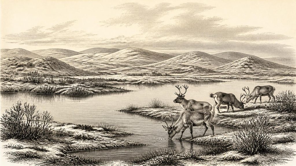
The plants and small animals preserved at Derryvree indicate open tundra or muskeg-like wetland: saturated, peaty ground, shallow pools and sedge-rich margins in a periglacial climate. Periglacial does not mean permanently beneath glacier ice. It describes land shaped by severe seasonal freezing, thawing, snow, frost-heave and poorly drained soils near a cold-climate ice margin. Such terrain could support life, but its productivity would have been sharply seasonal.
Plant remains include mosses, sedges and aquatic or wetland species. A seed of bogbean, Menyanthes trifoliata, is particularly evocative. The species still grows in suitable wet places, but its fossil occurrence at Derryvree should not be read as proof of familiar modern Irish vegetation. It establishes that a hardy freshwater-margin plant grew in, or close to, this ancient basin. Other fossils point towards sparse, low-growing northern and Arctic-alpine vegetation. Together they support a landscape of muddy water edges, mossy ground, scattered herbs and dwarf shrubs, exposed mineral soil and shallow fresh water rather than forest.
That reconstruction has limits. Pollen can travel far on the wind; plant remains normally come from particular microhabitats; and a road-cut gives only a narrow section through a former landscape. The safest conclusion is not that every hill and valley held identical tundra, but that Derryvree contained a cold, treeless wetland mosaic. Brief summers may have brought rapid growth, flowering insects and abundant waterfowl or small animals; winters would have imposed a very different regime of frozen ground, snow cover and scarcity.
Animals in a Wider Cold-Stage Ireland
For larger animals, the major Irish record comes from cave deposits rather than Derryvree itself. Castlepook Cave, also called Mammoth Cave, near Doneraile in north County Cork, has yielded one of Ireland’s richest Pleistocene faunal collections. Its assemblage includes remains attributed to reindeer, giant deer, woolly mammoth, brown bear, wolf, Arctic fox, mountain hare, lemmings and spotted hyaena. These animals demonstrate that Ireland, during portions of the pre-Last Glacial Maximum, was capable of supporting a striking cold-adapted fauna.
There is an essential caution. Castlepook is not a photograph of the island in one year. A cave may gather bone over long periods through carnivore denning, scavenging, natural deaths, water movement and excavation disturbance. Improved radiocarbon methods have also shown that some older Irish cave dates require reassessment. Individual species from the cave need not have stood together in one herd, nor need they all belong precisely to 30,585 BCE. Even so, the fauna makes good ecological sense beside Derryvree’s open, cold wetland: grazers and browsers, their predators and scavengers, and smaller northern mammals inhabited at least some Irish landscapes during this broad climatic era.
Reindeer are especially informative, since they are well adapted to open, seasonal environments and can move over great distances. Their presence does not prove a fixed annual migration route through Ireland, but it suggests the possibility of mobile herds responding to snow, forage and terrain. Mammoth and giant deer remains underline the fact that Late Pleistocene Ireland was not biologically empty. The island’s surviving evidence is sparse because later ice, erosion, rising seas and thousands of years of landscape change destroyed or concealed much of the record, not because the living world was necessarily sparse everywhere.
The Castlepook Human Question
The possibility of people in Ireland at this remote date rests on a far narrower foundation. A reindeer femur from Castlepook has been reported as bearing a deep mark interpreted by zooarchaeologist Ruth Carden as damage from a sharp stone tool during butchery. County Cork heritage material places the find broadly at about 31,000 BCE. If the interpretation and chronological association are sustained, it would indicate that Upper Palaeolithic people processed a reindeer in Ireland during the broad period relevant to this article.
That is an important possibility, but not a licence to invent an Irish population. The bone is not a securely excavated campsite with a hearth, a stone-tool assemblage, shelters, burials or a sequence of domestic refuse. The age of an animal bone and the moment when a surface mark was made are related questions, not automatically identical ones. Nor can one cut mark reveal whether the people concerned killed the animal, found a carcass, visited briefly, travelled from Britain or continental Europe, or returned in later seasons. At most, the evidence raises the prospect of a short-lived human incursion or episode of carcass processing.
Consequently there can be no responsible account of political affairs, diplomacy, named groups or organised conflict in Ireland for 30,585 BCE. There are no states, chiefs, boundaries, treaties or communities recoverable from the evidence. Nor is there proof of settlement, farming, livestock, pottery, metalworking, trade networks or religious monuments. If people were present, they were likely highly mobile hunter-gatherers operating in a harsh landscape, but even that is an interpretation from a single proposed trace and wider European comparison, not an established fact about a resident Irish society.
Economy, Culture and the Limits of Evidence
The only plausible economy suggested by the evidence is the direct use of wild resources: perhaps hunting, scavenging and the processing of animal carcasses. Reindeer would have offered meat, fat, hide, sinew, antler and bone, although none of these uses can be demonstrated from Derryvree. No Irish assemblage securely attributable to this precise interval allows archaeologists to reconstruct toolkits, food-sharing, dwellings, clothing or seasonal camps.
The same restraint applies to culture and belief. Upper Palaeolithic populations elsewhere in Europe made sophisticated stone tools, portable art and cave images, but it would be misleading to transfer those achievements automatically to Ireland. No comparable Irish art, ritual site or learning tradition has yet been securely dated to this period. What can be said is that surviving environmental deposits are themselves a form of evidence-rich archive. Their study depends on palaeobotany, insect analysis, sedimentology, radiocarbon science and glacial geomorphology: disciplines that turn a buried wetland into a cautious account of a vanished world.
Approaching the Great Ice Expansion
Derryvree’s upper till gives the story its final force. Whatever interval of open water and tundra the organic silts represent, it ended when ice returned and sealed the basin. Across the following millennia the British–Irish Ice Sheet grew towards its later maximum, repeatedly remaking the surface of Ireland. Valleys were deepened, sediments reworked and older landforms obscured. The drumlin enclosing the Derryvree sediments is therefore both an archive and a reminder of destruction: it preserves one local ecological interlude precisely because later glacial deposits covered it.
For Ireland in 30,585 BCE, the central development was not political change but environmental instability. A cold freshwater basin near Maguiresbridge supported hardy plants and invertebrates during a locally ice-free interval. Elsewhere, large mammals occupied at least some parts of the island, while one disputed but consequential bone hints that people may have entered this northern Atlantic landscape. Beyond those findings, silence is not an invitation to certainty. It is the defining condition of this very early chapter of Irish history.
Source References
Hover over a number to see the source. Select it to open the source.

- [1] A Middle Midlandian Freshwater Series at Derryvree, Maguiresbridge, County Fermanagh, Northern Ireland
- [2] A reconsideration of the radiocarbon dating of the Marine Isotope Stage 3 fauna from southern Ireland
- [3] New insights on the fauna of Ireland's Younger Dryas and Early Holocene from Alice & Gwendoline Cave
- [4] New insights on the fauna of Ireland's Younger Dryas and Early Holocene from Alice & Gwendoline Cave
- [5] Exploring controls of the early and stepped deglaciation on the western margin of the British Irish Ice Sheet
- [6] Growth and retreat of the last British–Irish Ice Sheet, 31 000 to 15 000 years ago: the BRITICE‐CHRONO reconstruction
- [7] Timing, pace and controls on ice sheet retreat: an introduction to the BRITICE‐CHRONO transect reconstructions of the British–Irish Ice Sheet
- [8] Pattern, style and timing of British–Irish Ice Sheet advance and retreat over the last 45 000 years: evidence from NW Scotland and the adjacent continental shelf
- [9] Exploring controls of the early and stepped deglaciation on the western margin of the British Irish Ice Sheet
- [10] The colonization of Ireland: A human ecology perspective
- [11] Dimensions and chronology of the last ice sheet in Western Ireland
- [12] Trimlines, blockfields and the vertical extent of the last ice sheet in southern Ireland
- [13] The Irish Quaternary Fauna Project
- [14] Ancient DNA reveals regional and temporal variation in red deer populations of Ireland
- [15] Figure 6.— The subdivision of the Quaternary Period in Ireland
- [16] Environmental Sites and Species Records: Summary
- [17] Menyanthes trifoliata
- [18] Heritage Artefacts of County Cork
- [19] Archaeology Research Excavation Grant 2022: Castlepook Cave, Co Cork
- [20] 2022:564 - Castlepook Cave, Castlepook South, Cork
- [21] The IntCal20 Northern Hemisphere Radiocarbon Age Calibration Curve (0–55 cal kBP)
- [22] A stratigraphic framework for abrupt climatic changes during the Last Glacial period based on three synchronized Greenland ice-core records
- [23] A 60 000 year Greenland stratigraphic ice core chronology
Primary Sources
- A Middle Midlandian Freshwater Series at Derryvree, Maguiresbridge, County Fermanagh, Northern Ireland
- A reconsideration of the radiocarbon dating of the Marine Isotope Stage 3 fauna from southern Ireland
- New insights on the fauna of Ireland's Younger Dryas and Early Holocene from Alice & Gwendoline Cave
- New insights on the fauna of Ireland's Younger Dryas and Early Holocene from Alice & Gwendoline Cave
- Exploring controls of the early and stepped deglaciation on the western margin of the British Irish Ice Sheet
- Growth and retreat of the last British–Irish Ice Sheet, 31 000 to 15 000 years ago: the BRITICE‐CHRONO reconstruction
- Timing, pace and controls on ice sheet retreat: an introduction to the BRITICE‐CHRONO transect reconstructions of the British–Irish Ice Sheet
- Pattern, style and timing of British–Irish Ice Sheet advance and retreat over the last 45 000 years: evidence from NW Scotland and the adjacent continental shelf
- Exploring controls of the early and stepped deglaciation on the western margin of the British Irish Ice Sheet
- The colonization of Ireland: A human ecology perspective
- Dimensions and chronology of the last ice sheet in Western Ireland
- Trimlines, blockfields and the vertical extent of the last ice sheet in southern Ireland
- The Irish Quaternary Fauna Project
- Ancient DNA reveals regional and temporal variation in red deer populations of Ireland
- Figure 6.— The subdivision of the Quaternary Period in Ireland
- Environmental Sites and Species Records: Summary
- Menyanthes trifoliata
- Heritage Artefacts of County Cork
- Archaeology Research Excavation Grant 2022: Castlepook Cave, Co Cork
- 2022:564 – Castlepook Cave, Castlepook South, Cork
- The IntCal20 Northern Hemisphere Radiocarbon Age Calibration Curve (0–55 cal kBP)
- A stratigraphic framework for abrupt climatic changes during the Last Glacial period based on three synchronized Greenland ice-core records
- A 60 000 year Greenland stratigraphic ice core chronology