
Derryvree’s Sub-Till Waters30538 BCE
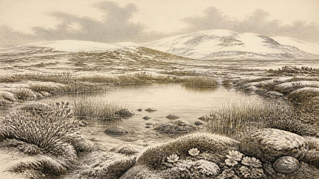
Thirty thousand five hundred and thirty-eight BCE cannot be reconstructed as a discrete Irish year; it falls within a broadly calibrated Late Pleistocene range. Derryvree, County Fermanagh, provides key evidence: freshwater silts and organic layers, sealed between glacial tills, record a locally ice-free interval with tundra, wetlands, mosses, sedges and cold-adapted insects. Plant remains indicate treeless, seasonally severe terrain. Southern cave faunas demonstrate wider Marine Isotope Stage 3 mammal communities, including reindeer, horse and mammoth. Possible butchery evidence is inconclusive, while secure human activity is much later. Fluctuating ice margins preceded maximum glaciation, making environmental change the period’s central story.
Dateline
30,538 BCE is a modern chronological label, not a year that can be recovered from Ireland’s prehistoric record. No written source, settlement sequence or archaeological event can be assigned to that single calendar year. In radiocarbon terms it lies roughly 32,488 years before AD 1950, but radiocarbon ages require calibration and become especially broad at this depth in time. The responsible subject is therefore Ireland during the Late Pleistocene, within Marine Isotope Stage 3, rather than an imagined episode in one year. The most illuminating Irish evidence comes from dated ranges: above all, freshwater sediments sealed between glacial deposits at Derryvree near Maguiresbridge, County Fermanagh. Their conventional radiocarbon determination, Birm-166, was 30,500 radiocarbon years BP, with substantial uncertainty. On modern calibration this is commonly placed broadly around 36,900–31,700 calibrated years BP, approximately 34,950–29,750 BCE. The nominal year falls within that interval, but cannot be tied to a particular season, animal or human action.
A Wetland Between Ice Advances
Derryvree was revealed by roadworks in 1969, which cut through a drumlin about two kilometres north-east of Maguiresbridge. Beneath one thick sheet of glacial till and below another lay fine sands, silts and organic layers deposited in fresh water. The stratigraphy provides the essential historical sequence. First, glacier ice had moved across the area and deposited the lower till. Then came an interval in which the locality was sufficiently free of ice for water, sediment, plants and insects to accumulate. Later ice covered and preserved that small environmental archive beneath the upper till. This is direct evidence for a locally ice-free phase; it is not evidence that the whole island was uniformly hospitable, ice-free or occupied.
The deposit matters because Late Pleistocene Ireland has lost so much of its older landscape to later glacial erosion. At Derryvree, the sediments preserve a fragment of an otherwise almost vanished world. The original investigators identified a freshwater assemblage and concluded that open tundra vegetation and a periglacial climatic regime prevailed. British Geological Survey summaries likewise describe freshwater mosses and sedges, together with insects of cold northern aspect. Such material is more secure evidence than a scenic reconstruction: seeds, spores, pollen, moss remains and insect fragments are physical traces of living communities, while the picture of a wider landscape must remain an interpretation drawn from them.
Open Ground, Shallow Water
The landscape around the Derryvree pool was almost certainly treeless. It was not a primeval Irish woodland, nor a featureless white wilderness. The plant record instead indicates a patchwork of wet ground, shallow water, sedge-rich margins and exposed mineral soil shaped by frost and seasonal thaw. Fossils reported from the deposit include bogbean, alternate water-milfoil, dwarf willow, mountain avens and lesser clubmoss. Together they point towards cold-adapted and Arctic-alpine vegetation, with aquatic life persisting in water and low plants exploiting sheltered or moist places. Mosses and sedges could occupy saturated ground; dwarf willow grew close to the surface rather than forming forest; mountain avens suggests open, well-drained patches.
This was a severe but living environment. A freshwater basin may have offered a more varied microhabitat than surrounding slopes or frost-disturbed ground. Water moderated local conditions, trapped organic matter and supported plants which could not have survived on the driest exposed surfaces. In summer, thaw, standing water and plant growth would have transformed the appearance and usefulness of the basin. In winter, freezing, snow cover and low light would have imposed a radically different regime. Yet the evidence does not allow a precise temperature, an annual rainfall figure or a claim that one particular pool endured without interruption through the entire dated range.
Animals Before the Great Maximum
Southern Irish caves provide a complementary record of Late Pleistocene fauna. Castlepook Cave near Doneraile, County Cork, has yielded bones of animals associated with cold open habitats, including reindeer, mammoth, horse, brown bear, fox, hare, lemming, wolf and spotted hyaena. Redating work has shown that parts of the Castlepook fauna belong to Marine Isotope Stage 3, well before the later Last Glacial Maximum. It also indicates that some animals formerly thought to belong to much later phases were substantially older, a useful warning that older radiocarbon results and antiquarian cave collections require continuing reassessment.
Those cave finds should not be used as a census for 30,538 BCE. Bones accumulated in caves by varied processes: animals died there, carnivores carried material in, water and sediment moved remains, and nineteenth- and early twentieth-century excavation methods did not always preserve the contextual detail expected today. Nevertheless, the fauna demonstrates that Ireland was not biologically empty during at least parts of this broad period. Reindeer and horse imply grazing opportunities on open vegetation; predators and scavengers point to food webs more complex than the small Derryvree wetland alone could show. Mammoth remains speak to connections with the wider north-west European mammoth-steppe world, not to a claim that mammoths stood at Derryvree in the specified year.
The Human Question
There is no securely dated dwelling, hearth, stone-tool scatter, burial or settlement in Ireland that can be assigned to around 30,538 BCE. Consequently, there can be no responsible account of Irish political authority, warfare, diplomacy, religion, language, learning or trade at this date. There were no known states, borders, chiefs or institutions in the historical sense. Nor is there evidence for farming, livestock, fields, pottery, metalworking, monument building or an enduring village economy. Any people who may have reached the island would have been mobile hunter-gatherers, dependent on wild resources and capable of leaving very slight archaeological traces. But that statement describes an appropriate European Upper Palaeolithic comparison, not a demonstrated Irish community.
A reindeer femur from Castlepook has attracted particular attention because a mark on it has been interpreted as a possible stone-tool incision made during butchery. The bone has been associated with an age of about 33,000 years ago. If that interpretation proves correct, it may indicate a very early, fleeting human presence in Ireland before the Last Glacial Maximum. It does not prove permanent settlement, a population size, a route of arrival or a cultural identity. No securely associated tool kit, hearth or campsite has been recovered from the same context. The best-established published evidence for human activity in Ireland remains much later: a butchered brown-bear kneecap from Alice and Gwendoline Cave, County Clare, dated to approximately 12,810–12,590 calibrated years BP. That gap is historically important. It requires restraint rather than a confident tale of Ice Age colonists.
At this time lower global sea levels altered coastlines, and the geography of Ireland, Britain and the continental shelf differed profoundly from that of today. However, changing shorelines did not automatically create an easy overland route into every part of Ireland. The precise configuration of sea, land, ice and viable travel corridors changed through time. A visit by hunters is conceivable in a broad regional sense; regular exchange, seaborne traffic or a settled social network within Ireland is not demonstrated by the current evidence.
Approaching a Colder Ireland
The Derryvree interval preceded the full development of the last British–Irish Ice Sheet. Later growth was neither instantaneous nor uniform: ice-sheet reconstructions show asynchronous advances across different sectors, with Ireland reaching maximum extent around 27,000 years ago and the wider ice sheet achieving its greatest area around 26,000 years ago. Around the date represented here, environmental instability mattered more than any human political narrative. Local wetlands could exist between glacial phases, while ice had already shaped the terrain and further expansion would eventually bury, erode or rearrange much of it.
Regional comparison strengthens that conclusion but also sets limits. Other Fermanagh sites, including Hollymount near Maguiresbridge and Greenagho near Belcoo, preserve organic deposits between tills or evidence for cold, non-glacial conditions. Their dates and deposits cannot be treated as identical episodes, and the Greenagho radiocarbon result is specifically regarded as a minimum age of limited reliability. Taken together, however, they show that northern Ireland’s glacial history involved fluctuating ice margins and ice-free intervals, not a single unbroken blanket of ice.
What Can Be Said Responsibly
For Ireland around 30,538 BCE, the central historical development was environmental rather than political: a cold Late Pleistocene landscape in which local freshwater habitats endured during an interval between ice advances. Derryvree’s silts preserve the strongest direct testimony—open tundra, wetland vegetation and cold-adapted invertebrate life. Cave faunas show that large mammals occupied parts of the island during the wider Marine Isotope Stage 3 world. Possible evidence of human butchery at Castlepook is intriguing but remains too slight to support a narrative of settled occupation.
This is not an empty chapter in Ireland’s past. It is a chapter written in seeds, mosses, insect remains, bones, water-laid sediment and glacial clay. Its lesson is that the island’s deep history was already diverse, dynamic and connected to wider climatic change, while still resisting the familiar categories of nation, society and event. The precise calendar year is beyond recovery; the cold wetland world beneath the Fermanagh drumlin is not.
Primary Sources
- A Middle Midlandian Freshwater Series at Derryvree, Maguiresbridge, County Fermanagh, Northern Ireland
- Early Midlandian–Middle Midlandian, Pleistocene, Northern Ireland
- Middle Midlandian Interstadial Deposits at Greenagho, Near Belcoo, County Fermanagh, Northern Ireland
- An Inter-Till Freshwater Deposit at Hollymount, Maguiresbridge, County Fermanagh
- A Reconsideration of the Radiocarbon Dating of the Marine Isotope Stage 3 Fauna from Southern Ireland
- First Evidence of a Late Upper Palaeolithic Human Presence in Ireland
- New Insights on the Fauna of Ireland’s Younger Dryas Through Analysis of the Historic Alice and Gwendoline Cave Faunal Assemblage
- Phylogeographic, Ancient DNA, Fossil and Morphometric Analyses Reveal Ancient and Modern Introductions of a Large Mammal: the Complex Case of Red Deer (Cervus elaphus) in Ireland
- The Irish Quaternary Fauna Project
- Growth and Retreat of the Last British–Irish Ice Sheet, 31,000 to 15,000 Years Ago: the BRITICE-CHRONO Reconstruction
- Sedimentology and Chronology of the Advance and Retreat of the Last British-Irish Ice Sheet on the Continental Shelf West of Ireland
- Growth, Dynamics and Deglaciation of the Last British-Irish Ice Sheet: the Deep-Sea Ice-Rafted Detritus Record
- The IntCal20 Northern Hemisphere Radiocarbon Age Calibration Curve (0–55 cal kBP)
- IntCal Publications
- IntCal History
- Menyanthes trifoliata
- Salix herbacea
- Dryas octopetala
- Selaginella selaginoides
- Myriophyllum alterniflorum
- Figure 6.—The Subdivision of the Quaternary Period in Ireland
- The Archaeological Heritage of County Cork
