
Maguirebridge’s Brief Wetland30533 BCE
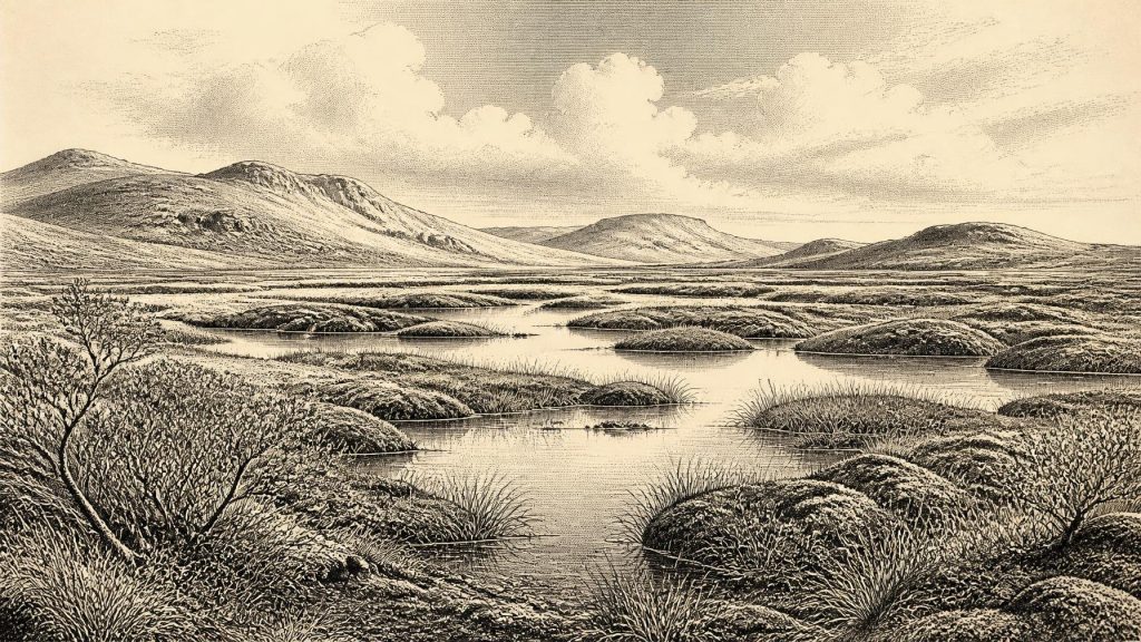
The modern label 30,533 BCE cannot identify a recoverable Irish year, but falls within a broad Late Pleistocene range. At Derryvree, near Maguiresbridge, Fermanagh, organic silts between glacial tills record a temporary freshwater wetland before renewed ice advance. Plant and insect remains indicate treeless, cold periglacial conditions, with pools, sedges, mosses and sparse vegetation. Sea levels were lower and climate fluctuated, though routes into Ireland remain unknown. Castlepook Cave preserves time-averaged Ice Age fauna, including mammoth and reindeer, plus a possible tool-marked bone. Evidence suggests occasional habitability, not permanent human occupation, culture, or year-specific events can be established with confidence.
Dateline
30,533 BCE is a modern numerical label, not a recoverable year in Irish history. No calendar used by people in north-west Europe can be aligned with it; no written record, settlement floor or dated event permits an account of a particular season. In radiocarbon terms, the point lies about 32,482 years before AD 1950, within the later part of the Late Pleistocene and Marine Isotope Stage 3. The responsible approach is therefore to use broad, calibrated ranges and to distinguish what the deposits demonstrate from what they merely suggest.
The most relevant Irish archive is not a monument or village, but a buried wetland at Derryvree near Maguiresbridge in County Fermanagh. Road works in 1969 cut through a drumlin and exposed a remarkable sequence: glacial till below, freshwater sands and organic silts in the middle, and another body of till above. Till is the unsorted debris laid down directly by glacier ice. The sequence securely establishes an order of changing local environments: ice affected the site; a non-glacial interval allowed water, plants and small animals to leave remains; later ice overrode and sealed the deposit.
Organic material from this middle layer produced radiocarbon determination BIRM-166, conventionally reported as 30,500 radiocarbon years BP, with a large uncertainty of +1,170/−1,030 years. A radiocarbon age is not a calendar age. Because atmospheric carbon-14 has varied through time, calibration turns such a measurement into a probability range rather than a date precise to a year. Published calibrations and later chronological discussions place the Derryvree episode broadly within the mid-to-late 30,000s calibrated years BP; one commonly cited range is roughly 36,900–31,700 cal BP. The notional year 30,533 BCE sits within that broad window, but cannot be assigned to the formation of a particular pool, the fall of a seed, or the life of any individual animal.
Fresh Water Between Ice Advances
Derryvree is important precisely because it prevents an over-simple image of an Ireland permanently entombed beneath ice. At the locality represented by its organic silts, freshwater existed long enough for a distinctive wetland community to develop. Yet it would be equally misleading to turn this into a picture of a mild or wooded island. The evidence points to treeless, cold and seasonally severe ground: an open periglacial landscape shaped by frost, thaw, saturated soil and short growing seasons. “Periglacial” does not mean that a glacier stood on the spot; it means a landscape strongly affected by cold-climate processes at or beyond the margin of ice.
Plant macrofossils, mosses, pollen and insect remains offer the closest thing to everyday testimony from this time. Sedges and mosses grew around shallow water. Water-milfoil indicates freshwater habitat. A fossil seed of bogbean, Menyanthes trifoliata, is especially memorable: it is a wetland plant still found in suitable Irish places today, though its Pleistocene occurrence does not make the ancient scene familiar or temperate. Other remains associated with the assemblage include dwarf willow, mountain-avens and lesser clubmoss, plants well suited to cold, open and often waterlogged settings. Poor pollen preservation and the possibility of long-distance pollen transport mean that the evidence cannot supply a detailed vegetation map. It does, however, strongly support a local mosaic of pools, mossy margins, sedgy ground and sparse low vegetation rather than forest.
The insect evidence reinforces this interpretation. Cold-adapted beetles and other invertebrate remains indicate northern, tundra-like conditions. Such creatures are useful environmental witnesses because many have narrow climatic tolerances, but their presence still describes a locality and an interval, not the whole island on one day. Derryvree’s basin may have been sheltered or unusually wet; exposed uplands, river valleys and coastal plains need not have looked identical. Ireland at this time was environmentally varied and unstable, with climatic shifts capable of changing the distribution of snow, ice, open water and vegetation within centuries or less.
Ice, Coasts and a Changing Island
At 30,533 BCE, Ireland had not reached the global Last Glacial Maximum, generally dated to about 26,500–19,000 years ago. The great later expansion of the Irish Ice Sheet, which covered much of the island and extended onto surrounding shelves, still lay ahead. Nonetheless, this was no settled prelude to a stable world. Evidence from Ireland, Britain, North Atlantic marine cores and Greenland ice records shows repeated abrupt shifts between comparatively milder interstadials and severe stadials during Marine Isotope Stage 3. Irish cave speleothems, whose growth requires liquid water, record episodic amelioration in south-west Ireland; their interruptions show how readily colder conditions returned.
Glaciological reconstructions agree that the growth of the British–Irish Ice Sheet was not a simple, island-wide advance. At around 31,000 years ago, the evidence is sparse and uncertainties remain substantial, but models and dated deposits indicate accumulating ice on high ground, including northern Irish centres, followed by more extensive growth during the prolonged cold phase after about 32,000 years ago. The upper till at Derryvree records a later local reoccupation by ice, though it cannot by itself date that readvance precisely. Its real value is to prove that the freshwater interval was temporary and vulnerable to renewed glaciation.
Sea level was much lower than today because vast quantities of water were stored in global ice sheets. The outlines of Ireland’s coast and its surrounding channels were consequently very different, and the continental shelves exposed far more land than they do now. That fact must not be exaggerated into a known migration route. The surviving evidence does not demonstrate whether Ireland was connected to Britain at this precise moment, where any crossing might have been easiest, or whether people travelled across it. Changing coasts were a major regional condition, not proof of a particular journey.
Animals in the Cave Record
Castlepook Cave, also called Mammoth Cave, near Doneraile in north County Cork, gives the period its richest faunal counterpoint. More than 2,000 bones recovered from its galleries represent a long span of Ice Age time, not one simultaneous animal community. Direct dates from the cave extend broadly from about 45,700 to 19,950 years BP. Its assemblage includes woolly mammoth, giant deer, reindeer, brown bear and spotted hyaena, with Arctic fox, wolf and lemmings also recorded in later parts of the sequence. These remains show that Ireland could support, or at least receive, a striking cold-stage fauna during portions of the Late Pleistocene.
The cave must be read carefully. Water movement, carnivore activity, old excavations and disturbed sediments have mixed or obscured contexts. A list of animals is not a census of a single landscape, let alone a herd seen in 30,533 BCE. Spotted hyaenas may themselves have brought bones into the cave; some remains could have been moved after death. The most defensible conclusion is that large herbivores and predators occupied parts of Ireland across the wider period, while Castlepook preserves an unusually deep but time-averaged archive of that fact.
A reindeer femur from Castlepook has particular importance because a deep mark on the bone has been interpreted as the result of a sharp stone tool used on a fresh carcass. The bone has been publicised as dating to about 33,000 years ago. If the mark is securely anthropogenic, it may represent an exceptionally early trace of human handling of an animal in Ireland. But it is not proof of a permanent population, a named people, a camp, a hunt or continuous occupation. No securely associated hearth, stone-tool assemblage, dwelling, burial or occupation surface of this age has yet been identified there. Recent excavation has sought undisturbed Pleistocene deposits and has found no cultural artefacts in the reported 2022 work.
What Cannot Be Recovered
There is no evidence from Ireland around this point for political institutions, rulers, diplomacy, warfare, tribal names, laws or territorial boundaries. Nor can religion, language, art, kinship rules or systems of learning be responsibly reconstructed. It would be tempting to import the practices of Upper Palaeolithic groups elsewhere in Europe, where people made sophisticated tools, art and ornaments, but resemblance in climate does not establish that those traditions were present in Ireland. The Castlepook femur, even if its modification is confirmed, concerns a single act of carcass processing rather than a recoverable culture.
For the same reason, there is no demonstrable Irish economy in the later historical sense: no agriculture, livestock keeping, fields, stores, market exchange or trade network can be assigned to this date. Derryvree records ecological productivity, not cultivation. If people briefly reached the island, they would have depended on mobile knowledge, animal resources and careful movement through a cold landscape, but that is an inference from the possible human trace and broader European comparisons, not direct evidence for a community at Maguiresbridge or Doneraile.
The chief development illuminated by this notional year is environmental rather than political: a short-lived Fermanagh wetland existed between episodes of glaciation. Its silts preserve cold-water plants, insects and the physical reality of open fresh water in a harsh, mostly treeless world. Nearby in historical geography but not necessarily in the same generation, Castlepook preserves the remains of Ice Age mammals and a tantalising possible human intervention. Together, these sources make Ireland around 30,533 BCE intelligible as a changing northern landscape—habitable in places and at times, but climatically precarious, archaeologically fragmentary and far beyond the precision of year-by-year history.
Primary Sources
- A Middle Midlandian Freshwater Series at Derryvree, Maguiresbridge, County Fermanagh, Northern Ireland
- Quaternary Deposits and Glacial Stratigraphy in Ireland
- The Irish Quaternary Fauna Project
- A Reconsideration of the Radiocarbon Dating of the Marine Isotope Stage 3 Fauna from Southern Ireland
- New Insights on the Fauna of Ireland's Younger Dryas and Early Holocene from Alice & Gwendoline Cave
- Castlepook Cave: Cork County Geological Site Report
- 2022:564 – Castlepook Cave, Castlepook South, Cork
- Growth and Retreat of the Last British–Irish Ice Sheet, 31,000 to 15,000 Years Ago: the BRITICE-CHRONO Reconstruction
- Dynamic Cycles, Ice Streams and Their Impact on the Extent, Chronology and Deglaciation of the British-Irish Ice Sheet
- Episodic Speleothem Deposition Tracks the Terrestrial Impact of Millennial-Scale Last Glacial Climate Variability in SW Ireland
- Trimlines, Blockfields and the Vertical Extent of the Last Ice Sheet in Southern Ireland
- Maximum Extent and Readvance Dynamics of the Irish Sea Ice Stream and Irish Sea Glacier Since the Last Glacial Maximum
- Timing and Pace of Ice-Sheet Withdrawal Across the Marine–Terrestrial Transition West of Ireland During the Last Glaciation
- Exploring Controls of the Early and Stepped Deglaciation on the Western Margin of the British-Irish Ice Sheet
- The Colonization of Ireland: A Human Ecology Perspective
- Our Ancient Landscapes: Hunter-Gatherers in Ireland
- Ireland's Palaeolithic Archaeology – Fleeting Footprints in a Frozen Land
- Menyanthes trifoliata L.
- Figure 6.— The Subdivision of the Quaternary Period in Ireland
- Heritage Artefacts of County Cork
