
Courtmacsherry’s Raised Shore30523 BCE
Around 30,523 BCE, Ireland was an unstable Late Pleistocene landscape rather than a historical society. Greenland records suggest abrupt climatic shifts, while Ireland experienced cold, open, periglacial conditions, with fluctuating ice, sea levels and wetlands. Courtmacsherry’s raised shore indicates complex coastal change and possible early growth of British–Irish ice, although precise ice limits remain uncertain. Derryvree preserves a freshwater, tundra-like interval later buried beneath till. Castlepook Cave bones show diverse cold-stage fauna, but not simultaneous species or settlement. Possible human activity remains unproven: no secure contemporary hearths, tools or population evidence exist. These archives document environmental change, not calendar-precise events.
Dateline
“30,523 BCE” is a modern calendar label, not a year that can be observed in Ireland’s archaeological record. No written dates, settlements or historical actors can be assigned to it. In conventional archaeological terms it falls roughly 32,500 years before AD 1950, within the Late Pleistocene and Marine Isotope Stage 3, a climatically unstable portion of the last Ice Age. Even that conversion must not imply false precision: radiocarbon ages require calibration, deposits form over intervals rather than instants, and the surviving Irish record is fragmentary. The responsible task is therefore to describe conditions broadly around this point, distinguishing direct evidence from interpretation.
A North Atlantic Threshold
At approximately 32,500 calibrated years before present, the North Atlantic climate was capable of changing sharply over periods far shorter than the archaeological timescales available in Ireland. Greenland ice-core chronologies place this horizon close to the transition from Greenland Stadial 6 into Greenland Interstadial 5.2, one of the abrupt cold-to-milder shifts characteristic of the last glacial period. That is valuable regional context, but it is not an Irish weather record. A change registered in Greenland did not translate mechanically into a particular temperature, snowfall total or season in Cork, Fermanagh or Donegal.
Ireland lay on the ocean-facing north-western edge of Europe, where ice, sea and atmosphere interacted strongly. It was not the later, wooded island familiar from Mesolithic and modern landscapes. The evidence points instead to a cold, open and environmentally variable country, with local wetlands, sparse vegetation and landscapes repeatedly altered by frost, flowing water, ice advance and ice retreat. Yet the extent of ice over Ireland at this exact horizon remains debated. The well-dated maximum of the last British–Irish Ice Sheet came later: broadly about 27,000–23,000 calibrated years before present in many reconstructions, with regional variation. It would be misleading to project that later, extensive ice cover unchanged back onto 30,523 BCE.
The Raised Shore at Courtmacsherry
One of the most important clues comes from the south coast. At Courtmacsherry in County Cork, and at related localities, a raised beach and shallow-marine deposits have been dated by optically stimulated luminescence to Marine Isotope Stages 4 and 3. The dated results span wide ranges, rather than identifying a single moment; one sequence includes ages extending to about 36,000 years ago with substantial uncertainty. They demonstrate that parts of southern Ireland’s coastal record formed during the last glacial cycle, well before the later maximum advance of the Irish ice sheet.
The raised shore matters because it complicates any simple picture of an island either wholly frozen or wholly ice-free. Its interpretation has implications for relative sea level and ice loading. If a shoreline formed at an unexpectedly high local relative sea level while global sea level was lower than today, the land may have been depressed by the weight of nearby ice. Recent synthesis has used such evidence, alongside ice-rafted debris and other indicators, to argue that substantial British–Irish ice masses may have grown and fluctuated before the classic Last Glacial Maximum. This remains a working hypothesis rather than a map of Ireland in a single year: direct, securely dated till deposits for this earlier phase are scarce.
For communities of animals, and for any people who may have reached the island, this changing coastal geography would have mattered greatly. It affected the availability of lowland ground, river mouths, sheltered coves and crossing routes. But the exact outline of the coast around 30,523 BCE cannot be recovered. Global sea level, local land depression beneath ice, sediment accumulation and erosion all complicate reconstruction. There is no basis for describing a fixed land bridge, a known harbour or a particular route into Ireland at this date.
Derryvree’s Cold Wetland
The clearest Irish environmental archive relevant to this earlier phase is inland, at Derryvree near Maguiresbridge in County Fermanagh. Road works exposed freshwater silts and fine sands sealed between two thick till sheets within a drumlin. The deposit yielded a conventional radiocarbon determination of 30,500 +1,170/−1,030 radiocarbon years before present. That is not equivalent to 30,523 BCE, and its calibrated age range is broad; nor can every seed, moss fragment or insect from the deposit be made contemporaneous. Nevertheless, it offers an exceptionally important window on an ice-free interval before a later glacier overran the locality.
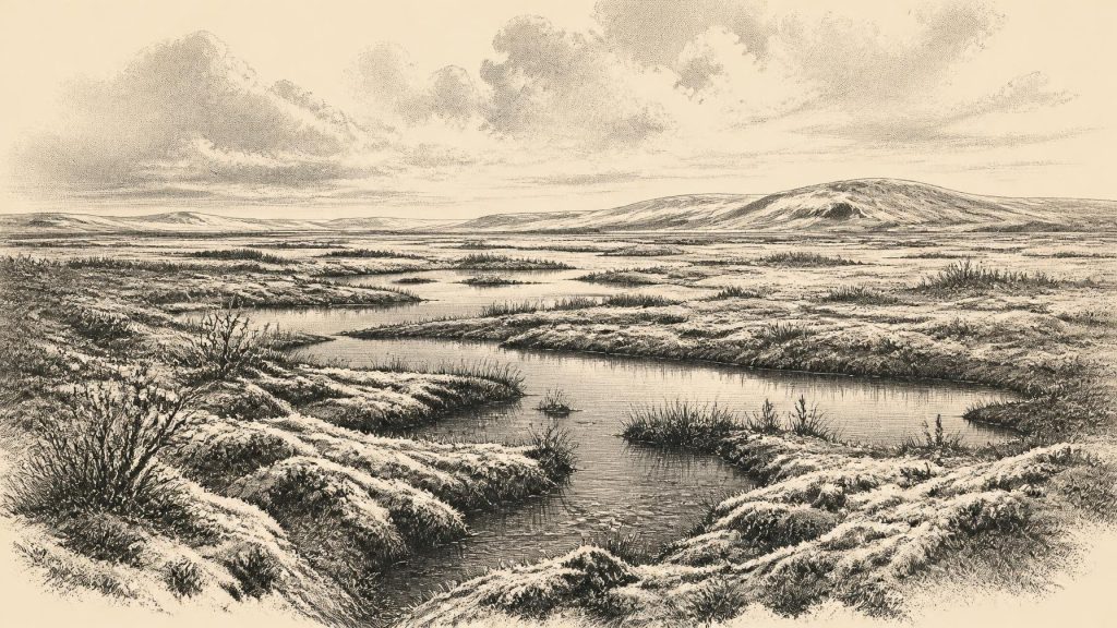
The Derryvree assemblage directly supports the presence of cold, open, periglacial conditions. Plant remains include mosses and herbaceous taxa associated with tundra-like vegetation; aquatic and wetland species show that freshwater persisted locally. The landscape was not a featureless ice desert. It contained shallow water, saturated ground and patches of vegetation capable of supporting specialised plants and invertebrates. Sparse pollen of trees such as pine and hazel is not sound evidence for nearby woodland: wind can carry pollen over long distances, and the broader plant record indicates exposed ground rather than forest.
Interpretation must stop where the evidence stops. Derryvree does not reveal an enduring village beside a lake, a season-by-season climate diary or an unbroken habitat across Ireland. It documents a local freshwater environment during a broader cold phase. Still, the fact that later glacial deposits buried it vividly illustrates regional change: landscapes hospitable to wetland life could be overridden, reshaped and concealed as ice conditions altered.
Animals, Caves and Caution
Limestone caves, particularly Castlepook or Mammoth Cave near Doneraile in north County Cork, preserve another kind of evidence: animal bone. The wider Pleistocene assemblage includes reindeer, woolly mammoth, giant deer, brown bear, wolf, Arctic fox, lemming and spotted hyaena. Direct dates from individual specimens show that the cave’s deposits accumulated across a long span, not in one episode. Reindeer and giant-deer remains, for example, demonstrate that cold-stage herbivores reached Ireland during the wider pre-maximum glacial world, while carnivore bones and gnawed material show that caves could be dens, scavenging places and traps for transported remains.
These finds support an image of mobile animal populations using open country where grazing and browse were sufficient, with predators competing for carcasses and shelter. They do not prove that every species coexisted at Castlepook in 30,523 BCE, that mammoth herds were permanent residents, or that a bone lay where the animal died. Early excavations disturbed deposits, and carnivores, water and collapse could all move bones. The Irish Quaternary Fauna Project and later re-dating programmes have shown why each specimen requires its own chronology and taphonomic assessment.
A reindeer femur from Castlepook has been reported as carrying a mark interpreted as a stone-tool cut made during butchery, and has been publicised as very early evidence of human activity. It is an important research question, not a secure foundation for a history of settlement. The dated animal bone cannot identify the precise date of the incision, and there is no securely associated Upper Palaeolithic hearth, lithic assemblage, dwelling floor, burial, artwork or human skeleton from Ireland around this time. Modern work at the cave has renewed investigation, but it has not supplied evidence for a resident population in the thirty-first millennium BCE.
No Politics, No Proven Society
Accordingly, political affairs, diplomacy and organised conflict cannot responsibly be reconstructed. There were no known Irish kingdoms, named peoples, frontiers, leaders or institutions. Nor is there evidence for farming, herding, fields, pottery, metalworking, monuments, formal trade networks or religious practice. It would be equally unsafe to import the cave art, costumes, languages or social structures of contemporary groups in France, Iberia or central Europe into Ireland simply because modern humans lived elsewhere on the continent.
The possible presence of people remains a question of episodic movement, not of a demonstrable society. Had small groups entered Ireland, their practical economy would necessarily have depended on immediate resources: animal carcasses, fuel, stone, freshwater and sheltered terrain. That is an inference from the conditions, not direct evidence of an Irish camp. The archaeological record cannot establish whether visitors crossed once, returned repeatedly, hunted locally or merely passed through a changing coastal world.
An Island Before History
The principal development around 30,523 BCE was environmental, not political. Ireland was part of a north-west European Ice Age zone in which glaciers were growing or fluctuating, relative sea levels responded to changing ice loads, and open periglacial habitats supported a shifting fauna. Courtmacsherry preserves a coastal clue to this complex glacial history; Derryvree preserves a freshwater tundra-like interval later sealed below ice-derived sediment; Castlepook preserves bones that testify to a richer, colder mammal world than later Ireland would know.
Those archives are not fragments of a lost annual chronicle. They are evidence accumulated over centuries and millennia, read through dating, sedimentology, palaeobotany, faunal analysis and comparison with regional climate records. Their proper lesson is both vivid and restrained: around this notional year, Ireland was a dynamic Ice Age landscape, potentially accessible to animals and perhaps briefly to people, but still far beyond the reach of calendar-precise history.
Primary Sources
- A Middle Midlandian Freshwater Series at Derryvree, Maguiresbridge, County Fermanagh, Northern Ireland
- Palaeoecology
- A Stratigraphic Framework for Abrupt Climatic Changes During the Last Glacial Period Based on Three Synchronized Greenland Ice-Core Records: Refining and Extending the INTIMATE Event Stratigraphy
- Consistently Dated Atlantic Sediment Cores Over the Last 40 Thousand Years
- The Timing and Magnitude of the British–Irish Ice Sheet Between Marine Isotope Stages 5d and 2: Implications for Glacio-Isostatic Adjustment, High Relative Sea Levels and ‘Giant Erratic’ Emplacement
- Extent and Timing of the Last Glacial Maximum (LGM) in Britain and Ireland: A Review
- Growth and Retreat of the Last British–Irish Ice Sheet, 31,000 to 15,000 Years Ago: The BRITICE-CHRONO Reconstruction
- Pattern and Timing of Retreat of the Last British-Irish Ice Sheet
- Late Pleistocene Chronostratigraphy and Ice Sheet Limits, Southern Ireland
- Early Deglaciation of the British-Irish Ice Sheet on the Atlantic Shelf Northwest of Ireland Driven by Glacioisostatic Depression and High Relative Sea Level
- Stratigraphic and Palaeo-Geomorphological Evidence for the Glacial-Deglacial History of the Last British-Irish Ice Sheet in the North-Western Irish Sea
- Last Glacial Maximum Cirque Glaciation in Ireland and Implications for Reconstructions of the Irish Ice Sheet
- Trimlines, Blockfields and the Vertical Extent of the Last Ice Sheet in Southern Ireland
- Ireland: Submerged Prehistoric Sites and Landscapes
- The Irish Quaternary Fauna Project
- New Insights on the Fauna of Ireland’s Younger Dryas and Early Holocene from Alice & Gwendoline Cave
- The IntCal20 Northern Hemisphere Radiocarbon Age Calibration Curve (0–55 cal kBP)
- Prehistoric Details
- Who Lived in Ireland Before Neolithic Times?
- 2022:564 – Castlepook Cave, Castlepook South, Cork
- The Archaeological Heritage of County Cork
- The Exploration of Castlepook Cave, County Cork
