Fermanagh’s Fringed Sandwort30524 BCE
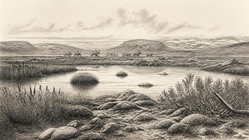
About 30,524 BCE, Ireland lay within the volatile Late Pleistocene, not a datable historical year. At Derryvree, County Fermanagh, sediments between glacial tills preserve evidence of an ice-free freshwater wetland sometime between roughly 36,900 and 31,700 cal BP. Fossils indicate tundra vegetation, including fringed sandwort, mosses, sedges and aquatic plants, with insects inhabiting pools and saturated ground. Southern cave collections show that diverse cold-stage mammals, including reindeer, mammoth and predators, reached or inhabited Ireland at varying times. Human presence remains unproven: a possibly butchered reindeer bone is inconclusive. Subsequent ice-sheet expansion buried and preserved this fragile environmental archive for posterity.
Dateline
The label 30,524 BCE is a modern point on a calendar, not a year that can be isolated in Ireland’s prehistoric record. No community in Ireland then used a calendar that can be correlated with ours; there are no written records, named individuals, settlements or datable events. In archaeological terms, the date falls about 32,473 years before AD 1950, conventionally expressed as c. 32.5 thousand calibrated years before present (cal BP). At this depth in time, even good radiocarbon dates produce ranges rather than annual precision. The responsible subject is therefore Ireland during a broad Late Pleistocene interval, within Marine Isotope Stage 3, rather than a supposed event in one particular year.
That interval was a volatile part of the last Ice Age. Ireland was approaching, but had not yet reached, the much later island-wide maximum of the last Irish Ice Sheet, generally placed around 27,000–23,000 cal BP. Ice margins, sea level, plant cover and animal routes changed substantially across regions and over millennia. The evidence is fragmentary because later glaciers scoured, transported and buried older deposits. Yet a remarkable exposure at Derryvree near Maguiresbridge, County Fermanagh, and cave-bone collections from southern Ireland show that this was neither a timeless frozen void nor a documented human society. It was a changing, cold environment in which water, mosses, insects and large mammals left intermittent traces.
A Date Within a Broad Window
The most informative Irish environmental record close to this notional date is the Middle Midlandian freshwater sequence at Derryvree. Road works in 1969 cut through a drumlin about two kilometres north-east of Maguiresbridge and exposed silts, fine sands and organic material enclosed between two distinct tills: sediments deposited directly by glacial ice. The sequence gives an unusually clear order of events. Ice had affected the locality; a freshwater and wet-ground environment subsequently existed long enough for sediment and biological remains to accumulate; then later glaciation covered and preserved the deposit beneath another till.
An organic sample from Derryvree, Birm-166, produced a conventional radiocarbon determination of 30,500 years BP, with a large uncertainty of +1,170/−1,030 years. Calibration is essential: radiocarbon years are not calendar years, because atmospheric carbon-14 concentrations have varied through time. Later discussion using modern calibration places the Derryvree evidence broadly between about 36,900 and 31,700 cal BP. The modern label 30,524 BCE, equivalent to roughly 32,473 cal BP, falls within that wide interval. It cannot be assigned to a single layer, a particular pool, or a single generation of plants and animals at Derryvree.
This distinction between evidence and interpretation matters. The two tills securely demonstrate repeated glacial episodes at one Fermanagh locality. The intervening sediments securely demonstrate an ice-free freshwater setting there during part of late MIS 3. They do not prove that every district of Ireland was ice-free at the same time, nor do they yield a precise national climate map for 30,524 BCE. The island’s uplands, exposed coasts and areas near expanding ice centres may have differed markedly from this sheltered basin.
A Wetland Between Glaciers
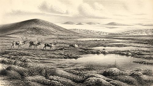
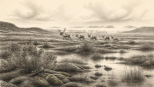
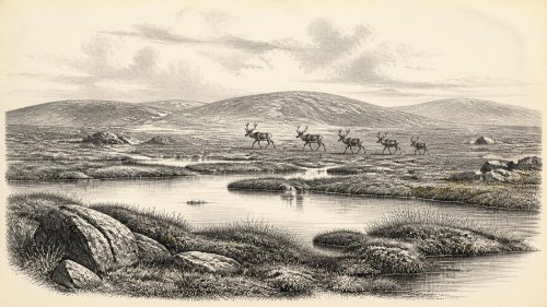
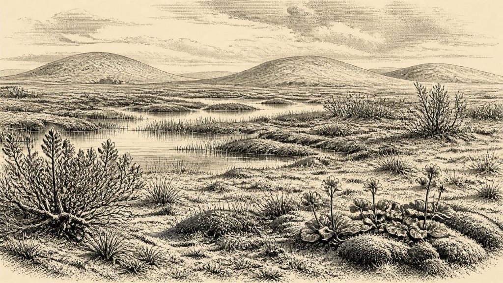
Derryvree’s fossil record permits a vivid but carefully bounded reconstruction. Plant remains, pollen and insects indicate open tundra-like vegetation and a periglacial regime: a landscape strongly shaped by severe cold and repeated freezing and thawing, though not necessarily permanently frozen everywhere. The deposits include aquatic and wet-ground plants such as alternate water-milfoil and bogbean, alongside mosses, sedges, grasses, dwarf willow, mountain avens and fringed sandwort (Arenaria ciliata). These were not the components of a forest. They indicate shallow freshwater, saturated margins and low vegetation adapted to short growing seasons and cold soils.
Fringed sandwort gives the article its title because it is especially revealing. Today it is associated with Arctic and alpine settings. Its fossil occurrence at Derryvree does not show that modern Irish plants have survived unchanged for thirty-two millennia, nor does it turn the whole island into a replica of any one modern Arctic region. It does show that cold-adapted plants occupied this Fermanagh habitat. The insect evidence likewise suggests pools rich in plant material and mossy wet ground. In a landscape often imagined simply as ice and snow, these small fossils record biological variety: water, organic mud, plants, invertebrates and exposed mineral ground existed together.
Everyday life can therefore be described only in ecological terms. Around pools and sedgy margins, plants would have exploited the short summer growing season; insects inhabited water, moss and decaying vegetation; seasonal frost disturbed exposed soils. There is no basis for projecting the later green, wooded and pasture-rich Ireland backwards into this age. Nor should tundra be mistaken for barren land. It was a difficult habitat, but one capable of supporting specialised life in a mosaic of wet and dry micro-environments.
The Southern Cave Fauna
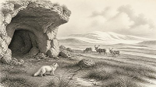
Southern Irish caves provide a second, differently dated line of evidence. Castlepook Cave near Doneraile, County Cork, is among the most important. Its old collections include remains attributed to mammoth, reindeer, giant deer, brown bear, wolf, Arctic fox and spotted hyaena. Modern redating has shown that some earlier determinations from Castlepook were substantially too young; the revised work supports the broad conclusion that a varied cold-stage fauna used or reached southern Ireland during MIS 3, with some species disappearing locally before the Last Glacial Maximum.
These animals must not be made into a single, simultaneous herd crossing Ireland in 30,524 BCE. Cave assemblages accumulate over long periods and are shaped by carnivore activity, scavenging, water movement, bone transport and the methods of early excavation. Spotted hyaenas, for example, may themselves have accumulated some material in caves. The responsible inference is more modest: at different points before the later ice maximum, Ireland was ecologically connected to wider north-west European cold-stage animal movements and could support, or be visited by, large herbivores and their predators.
That connection had geographical implications. Lower global sea levels exposed more of the continental shelf than exists today, but changing sea level and ice cover did not automatically create a simple, reliable walking route to Ireland. The shape of coasts and passages, local ice barriers, rivers, marine waters and seasonal conditions all mattered. It is safest to say that Ireland’s ecological boundaries were different and often more permeable than those of the modern island, while the exact routes and timing of animal dispersal remain uncertain.
The Human Question
There is no securely established settlement, dwelling, hearth, burial, stone-tool assemblage or human skeleton in Ireland that can be assigned to this date. Consequently there can be no factual narrative of named peoples, political authority, warfare, diplomacy, religion, literacy, formal learning or organised trade. Those categories belong to later kinds of evidence and cannot responsibly be inferred from pollen, glacial sediment or animal bones.
A reindeer femur from Castlepook has been reported as bearing a deep mark interpreted as damage from a stone tool during butchery, and public accounts have associated it with human activity around 33,000 years ago. If confirmed, this would be profoundly important: it could indicate that people processed a reindeer in Ireland during the Upper Palaeolithic. But the find comes from an old cave collection rather than a modern, sealed occupation surface. Recent excavation at Castlepook found no cultural artefacts. There is as yet no associated hearth, tool set, shelter, burial or repeated food-waste deposit of comparable age.
The marked bone is therefore a question to investigate, not proof of permanent colonisation. It cannot establish who the possible visitors were, how many there were, whether they hunted or merely processed a carcass, how long they remained, or whether they had descendants in later Ireland. The National Museum of Ireland’s broader caution about clear Palaeolithic occupation remains important. In contrast, sustained and readily recognisable settlement evidence belongs much later, in the Mesolithic after the final retreat of the ice.
An Approaching Transformation
The date belongs to a period of instability rather than to a settled environmental order. Greenland ice-core records and Irish cave calcite show that the last glacial period contained abrupt colder and relatively milder phases. Speleothems in Crag Cave, County Kerry, formed only episodically, indicating intervals when water could infiltrate soils and caves under less severe conditions. Such records cannot be matched confidently to every Derryvree layer, but they reinforce the larger conclusion: Atlantic-margin Ireland responded to rapid climate shifts, not to one unchanging Ice Age climate.
Later, the last British–Irish Ice Sheet expanded dramatically. Modern reconstruction projects identify major growth and shifting margins from about 31,000 years ago onwards, with maximum extent reached later and asynchronously in different sectors. By the peak, ice covered Ireland and extended across much of its continental shelf. The Derryvree sequence is powerful precisely because it preserves a local interval before renewed ice buried it. The glacier that later reshaped the drumlin also protected the wetland archive beneath it.
Thus the most historically meaningful development around 30,524 BCE was not a kingdom, battle or invention, but the precarious persistence of a cold-climate landscape. Freshwater lay between glacial episodes in Fermanagh; Arctic-alpine plants grew beside wet ground; animals moved through an Ireland whose coastlines and habitats differed profoundly from today’s. Whether people briefly entered that world remains an open archaeological problem. What survives securely is the environmental record: a small, extraordinarily valuable archive of life in Ireland as the Ice Age intensified.
Primary Sources
- A Middle Midlandian Freshwater Series at Derryvree, Maguiresbridge, County Fermanagh, Northern Ireland
- A reconsideration of the radiocarbon dating of the Marine Isotope Stage 3 fauna from southern Ireland
- The Irish Quaternary Fauna Project
- Growth and retreat of the last British–Irish Ice Sheet, 31,000 to 15,000 years ago: the BRITICE-CHRONO reconstruction
- Extent and timing of the Last Glacial Maximum (LGM) in Britain and Ireland: a review
- Reconstructing the last Irish Ice Sheet 2: a geomorphologically-driven model of ice sheet growth, retreat and dynamics
- Last Glacial Maximum cirque glaciation in Ireland and implications for reconstructions of the Irish Ice Sheet
- The timing and magnitude of the British–Irish Ice Sheet between Marine Isotope Stages 5d and 2: implications for glacio-isostatic adjustment, high relative sea levels and ‘giant erratic’ emplacement
- Episodic speleothem deposition tracks the terrestrial impact of millennial-scale last glacial climate variability in SW Ireland
- The IntCal20 Northern Hemisphere Radiocarbon Age Calibration Curve (0–55 cal kBP)
- OxCal: Online Radiocarbon Calibration
- Ireland: Submerged Prehistoric Sites and Landscapes
- Figure 6: The subdivision of the Quaternary Period in Ireland
- The Geological Heritage of County Leitrim
- Prehistoric Details: Stone Age
- 2022:564 — Castlepook Cave, Castlepook South, Cork
- Archaeological Heritage of County Cork
- The Mesolithic in Ireland: When Was It?
- Deglaciation chronology of the Donegal Ice Centre, north-west Ireland
- Dimensions and chronology of the last ice sheet in western Ireland
- Late Pleistocene mountain glacier response to North Atlantic climate change in South West Ireland
- New data for the Last Glacial Maximum in Great Britain and Ireland
- Proceedings of the Postglacial Colonization Conference