
Buckbean Under Drumlin Clay30369 BCE
About 30,369 BCE is only a modern label within broad dating ranges for late Marine Isotope Stage 3. At Derryvree, County Fermanagh, organic freshwater sediments between glacial tills record an ice-free interval before renewed ice sealed the wetland. Plants, pollen, mosses and insects indicate shallow water, sedges, herbs and cold-adapted, largely treeless periglacial vegetation. Castlepook Cave, County Cork, preserves diverse Ice Age fauna, although remains span uncertain periods and were often modified by carnivores. A possibly cut-marked reindeer bone suggests fleeting Upper Palaeolithic human activity, but proves neither settlement nor population. Together they reveal intermittent habitats, recolonisation, instability, not society.
Dateline
Modern calendar-year precision is not available for Ireland at this depth in time. “30,369 BCE” is a useful modern label, but it cannot identify an event, season, community or individual. In the conventional archaeological reckoning, it sits about 32,318 years before AD 1950; the evidence closest to it is dated in broad radiocarbon and calibrated ranges, not to a single year. The most revealing Irish archive is a freshwater deposit at Derryvree, near Maguiresbridge in County Fermanagh. Its organic material produced the radiocarbon determination BIRM-166: 30,500 years BP, with an uncertainty of roughly a millennium. Calibration places the deposit broadly within the later part of Marine Isotope Stage 3, approximately 36,900–31,700 calibrated years BP. The nominated year lies within that wide span, but cannot be isolated within it.
A Wetland Sealed by Ice
The Derryvree evidence was exposed by roadworks in 1969, when a cutting passed through a drumlin: one of the streamlined hills characteristic of Fermanagh’s glacial landscape. The section revealed two thick beds of till, unsorted debris deposited by glacier ice. Between them lay fine sands, silts and organic layers formed in freshwater and wet ground. The sequence supplies a secure relative history even where its absolute dating remains broad. Ice had crossed the site and deposited the lower till; later, water accumulated and living communities occupied the basin; eventually, ice returned or expanded across the locality, laying down the upper till and sealing the older landscape beneath it.
That is the central fact for Ireland around this notional date. It does not demonstrate that the entire island was ice-free, nor that conditions in Fermanagh applied unchanged in Cork, the western seaboard or the Irish Sea basin. Glaciers and climates varied between regions. Yet Derryvree firmly shows that an ice-free freshwater environment existed in part of northern Ireland during a cold and unstable phase of the last Ice Age. The later ice advance destroyed or buried much comparable evidence; paradoxically, at this one place it also preserved a rare sample of the world it overran.
Open Water, Moss and Frost
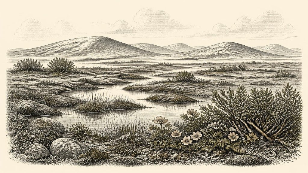
The Derryvree layers contain pollen, plant macrofossils, mosses and insect remains. Taken together, they indicate an open, treeless or nearly treeless landscape rather than woodland. Grasses, sedges, herbs and mosses belonged to wet margins and exposed ground. Fossils of bogbean, the three-leaved wetland plant Menyanthes trifoliata, and water-milfoil point to shallow fresh water or saturated ground. Mountain avens, dwarf willow and other cold-tolerant plants show that aquatic and terrestrial niches lay close together. The evidence is therefore for a mosaic: pools or slow water, mossy and sedgy edges, damp hollows and sparsely vegetated surfaces affected by frost.
Researchers have described this setting as tundra, periglacial terrain and muskeg-like wetland. Each term is shorthand rather than an exact match for a modern habitat. What the fossils demonstrate is more modest and more valuable: harsh winters, short productive seasons, open vegetation, wet ground and fresh water capable of supporting specialised plants and insects. Pollen of trees, where it occurs in such deposits, cannot by itself prove local forest; small quantities may have travelled long distances. The strongest interpretation remains one of low, herb-rich vegetation and cold wetland, not a hidden wooded Ireland.
At the scale of the island, this was part of a changing glacial world. The British–Irish Ice Sheet was building towards its later maximum extent. Recent reconstructions place its greatest Late Pleistocene expansion later, principally around 27,000–21,000 years ago, although ice growth was neither uniform nor simultaneous in every Irish sector. Thus the Derryvree wetland belongs to an interval before the fullest documented expansion, while already lying within a long cold-stage history of advancing and retreating ice. Its upper till records the important local outcome: the window of freshwater conditions closed as glacier ice once again occupied the ground.
Animals in a Changing Country
County Cork’s limestone caves provide a different, complementary archive. Castlepook Cave near Doneraile, long known as Mammoth Cave, has yielded remains of woolly mammoth, reindeer, giant deer, brown bear, wolf, Arctic fox, mountain hare, lemmings and spotted hyaena. Improved radiocarbon methods have substantially revised the ages of some Irish cave specimens, confirming that several animals lived in Ireland during Marine Isotope Stage 3, well before the Last Glacial Maximum. The list should not be turned into a single painted scene: cave collections may combine material accumulated over many thousands of years, and animals represented in one cave were not necessarily contemporaries.
Still, the fauna establishes an ecological possibility that the Fermanagh plant record alone cannot show. Ireland supported, at different times within this broad cold-stage interval, substantial grazing and browsing animals as well as predators and scavengers. Reindeer are especially relevant to open, cold environments; mammoth and giant deer likewise testify to landscapes with enough food and space for large herbivores. Hyaenas and wolves remind us that caves were not neutral containers of bone. Carnivores could carry carcass parts into dens, gnaw bones and mix remains from different episodes. A cave bone is therefore evidence first for an animal and a depositional history, not automatically for a hunt, a campsite or a local herd.
The Human Question
The possibility of people in Ireland during this period deserves careful attention precisely because the evidence is so slight. A reindeer femur from Castlepook has been reported as bearing a deep mark consistent with cutting or chopping by a sharp stone tool. It has been presented as potential evidence that Upper Palaeolithic people processed a reindeer in Ireland about 33,000 years ago. If that interpretation is sustained, it would transform the older history of human activity on the island: it would indicate an episode of carcass processing tens of millennia before the well-established Mesolithic settlement record.
But the limits are decisive. The femur comes from an old cave collection, not a modern excavation of a sealed camp surface. No securely associated stone-tool assemblage, hearth, built shelter, burial, human bone or repeatedly used habitation area of comparable age has yet been recovered from Ireland. Nor does one modified bone establish whether people killed the animal, scavenged it, butchered it outside the cave, visited for a day, travelled in a family group or returned in later seasons. The cautious conclusion is not that Ireland possessed a known resident population in 30,369 BCE, but that a possible, highly significant trace of human action belongs to the wider period.
This restraint also governs discussion of society and everyday life. There is no evidence from Ireland at this date for named communities, leaders, political institutions, territorial boundaries, diplomacy or warfare. There is no basis for reconstructing kinship, language, ritual, artistic traditions, formal learning, clothing or dwelling design. Upper Palaeolithic peoples elsewhere in Europe made sophisticated tools, ornaments and art, but importing those achievements into Ireland would be analogy, not Irish evidence. The same applies to trade: no Irish exchange network can be identified from the Derryvree sediments or the Castlepook bones.
Mobility Without a Map
Nevertheless, the environmental record makes movement an important question. Lower global sea levels during the Ice Age exposed wider continental shelves than exist today, and coastlines, river systems and crossings differed greatly from the modern map. Animals reached Ireland in some fashion, while any people responsible for the Castlepook mark would also have travelled through a changing north-west European landscape. Yet the evidence does not establish a particular route, bridge, boat journey or migration corridor. It would be misleading to describe a direct land connection, a trading passage or a regular reindeer-hunting circuit without archaeological proof.
What can responsibly be said is that Ireland was not environmentally uniform or permanently lifeless throughout the last glaciation. Freshwater plants and insects at Derryvree, alongside the broad Ice Age fauna recorded in southern caves, reveal a country repeatedly reshaped by climate, ice and ecological recolonisation. A cold wetland near Maguiresbridge and bone accumulations in Cork are separated by geography, depositional processes and uncertain spans of time; they should not be treated as one day’s landscape. Together, however, they replace an older picture of an entirely blank Ice Age island with one of intermittent habitable ground, specialised life and, perhaps, fleeting human contact.
What This Date Can Mean
The historical importance of 30,369 BCE is therefore geological and archaeological rather than biographical. No ruler acted, no battle can be named, and no Irish polity can be located in this year. The durable witnesses are a radiocarbon-dated organic bed, fossil seeds and mosses, insect remains, glacial sediments and cave bones. Their testimony has unequal strength. The stratigraphy at Derryvree securely records freshwater conditions between episodes of glaciation; the flora and insects strongly support an open periglacial wetland; the cave fauna proves the former presence of particular animals over broad intervals; and the interpretation of the Castlepook cut mark remains consequential but necessarily cautious.
Seen through those distinctions, Ireland around this point in the late Pleistocene was a place of shallow water beneath severe skies, sedges and mosses along pool margins, sparse cold-adapted vegetation and a future landscape vulnerable to renewed ice. It was not yet a historical Ireland of settlements or states. Its deepest recoverable past is instead held in the quiet survival of organic mud beneath drumlin clay.
Primary Sources
- A Middle Midlandian Freshwater Series at Derryvree, Maguiresbridge, County Fermanagh, Northern Ireland
- The IntCal20 Northern Hemisphere Radiocarbon Age Calibration Curve (0–55 cal kBP)
- A Reconsideration of the Radiocarbon Dating of the Marine Isotope Stage 3 Fauna from Southern Ireland
- New Insights on the Fauna of Ireland's Younger Dryas and Early Holocene from Alice & Gwendoline Cave
- Phylogeographic, Ancient DNA, Fossil and Morphometric Analyses Reveal Ancient and Modern Introductions of a Large Mammal: the Complex Case of Red Deer (Cervus elaphus) in Ireland
- The Irish Quaternary Fauna Project
- Extent and Timing of the Last Glacial Maximum (LGM) in Britain and Ireland: a Review
- Growth and Retreat of the Last British–Irish Ice Sheet, 31,000 to 15,000 Years Ago: the BRITICE-CHRONO Reconstruction
- Deglaciation Chronology of the Donegal Ice Centre, North-West Ireland
- The Timing and Magnitude of the British–Irish Ice Sheet Between Marine Isotope Stages 5d and 2
- Maximum Extent and Dynamic Behaviour of the Last British–Irish Ice Sheet West of Ireland
- Early Deglaciation of the British–Irish Ice Sheet on the Atlantic Shelf West of Ireland Driven by Glacimarine Ice Stream Retreat
- Stratigraphic and Palaeo-Geomorphological Evidence for the Glacial-Deglacial History of the Last British-Irish Ice Sheet in the North-Western Irish Sea
- The Colonization of Ireland: A Human Ecology Perspective
- Exploring Controls of the Early and Stepped Deglaciation on the Western Margin of the British-Irish Ice Sheet
- Figure 6.— The Subdivision of the Quaternary Period in Ireland
- Derryree and Maguiresbridge: Interstadial Organic Deposits Trapped Within Drumlins
- Menyanthes trifoliata L.
- Dryas octopetala L.
- Heritage Artefacts of County Cork
- Archaeological Heritage of County Cork
- Our Ancient Landscapes: Hunter-Gatherers in Ireland
