Derryvree’s Intertill Muskeg30368 BCE
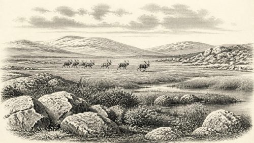
Around 30,368 BCE, Ireland’s environment is best understood through Derryvree, a freshwater organic deposit beneath glacial tills near Maguiresbridge, County Fermanagh. Radiocarbon dating places it broadly within 36,900–31,700 calibrated years BP, rather than at a single year. Pollen, plants, mosses and insects indicate an ice-free, treeless, cold periglacial wetland during Marine Isotope Stage 3, before maximum British-Irish ice cover. Castlepook Cave fauna shows that cold-adapted mammals reached Ireland during this wider period. A possibly butchered reindeer bone suggests, but cannot confirm, brief human presence. No evidence supports permanent settlement, society or economy. Derryvree preserves an ecological record of pre-glacial Ireland.
Dateline
The label 30,368 BCE is useful only as a modern point of reference. No person in prehistoric Ireland recorded years, and the surviving evidence cannot be assigned to one calendar year. In radiocarbon terms, the date lies roughly 32,300 years before 1950. The closest important Irish environmental record is the freshwater deposit found beneath a drumlin at Derryvree, near Maguiresbridge in County Fermanagh. Its radiocarbon determination, BIRM-166, is 30,500 +1,170/−1,030 radiocarbon years BP; later calibration has placed the deposit broadly at about 36,900–31,700 calibrated years BP. Thus 30,368 BCE falls within the wide chronological horizon that the deposit may illuminate, not at a dated moment within it.
A Wetland Beneath the Tills
Derryvree was exposed in 1969 when road works cut through a north-east to south-west drumlin, about two kilometres north-east of Maguiresbridge. Archaeologists and Quaternary scientists found silts and fine sands, including organic material, trapped between two substantial sheets of till: debris laid down by glacier ice. The lower and upper tills show that ice had crossed the district at different times. The freshwater sediments between them show, just as decisively, that the site was ice-free while they accumulated. Their later burial protected a small but exceptional archive of Irish life during the last cold stage.
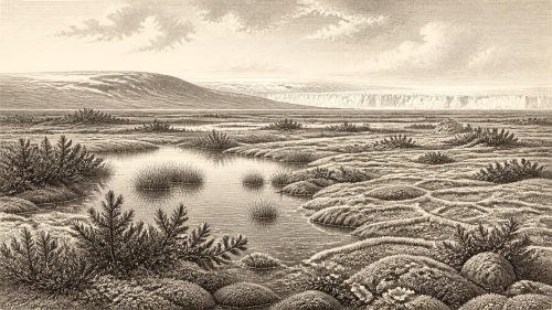
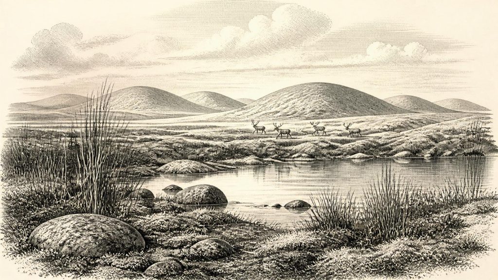
The evidence is palaeoecological rather than historical. Poorly preserved herb pollen, plant macrofossils, mosses and insect remains point to a cold, treeless, periglacial environment. Periglacial does not mean that glacier ice covered the precise spot; it describes a landscape shaped by intense cold, frost, seasonal thaw and proximity to glacial conditions. The original investigators interpreted Derryvree as open tundra with wet, organic-rich ground. Later summaries have used the term muskeg for its mix of mossy saturated ground, sedgy margins, plant detritus and shallow pools.
This was not an Irish landscape of oak woods, pasture and enclosed fields. Trees were absent locally, while low-growing plants could exploit the short summer season and waterlogged hollows. The record includes wetland and cold-adapted elements, while the insect evidence reinforces the picture of open water and mossy vegetation. Such remains cannot produce an annual temperature, rainfall total or a complete map of the island. They do show that freshwater persisted in at least one Fermanagh basin, and that a living plant-and-insect community survived amid harsh conditions. In a country whose older deposits have often been eroded or overridden by later ice, that local evidence matters greatly.
Before the Maximum Ice
The landscape represented by Derryvree belonged to Marine Isotope Stage 3, a long and climatically unstable interval of the Late Pleistocene. It preceded the fullest development of the British-Irish Ice Sheet during Marine Isotope Stage 2. Scholarly reconstructions place the broad build-up of that ice sheet after roughly 35,000–32,000 years ago, with its maximum extent later, approximately 27,000–21,000 years ago. The date under consideration was therefore part of a changing pre-maximum world, not a scene from the eventual all-Ireland ice cover.
That distinction corrects a tempting but misleading image of Ireland as uniformly sealed beneath ice at all points of the Ice Age. Conditions were regionally varied and changed repeatedly. Derryvree demonstrates ice-free ground in north-central Ireland during the interval represented by its sediments. It does not prove that every district was open, nor that its wetland extended across the island. Evidence from the wider Irish Sea region and later glacial landforms instead suggests advancing and fluctuating ice margins, accumulating snowfields and major contrasts between lowlands, uplands and coastal shelves. The approach of a larger ice sheet was the decisive long-term environmental development, but it had not yet erased every freshwater habitat.
Fermanagh’s drumlin country itself preserves the force of later glaciation. Drumlins are streamlined hills shaped beneath moving ice, and the organic layer at Derryvree survived only because it was sealed rather than wholly removed. Its preservation is therefore partly accidental. Much of the terrain on which plants grew, animals travelled and water flowed was later scoured, covered or rearranged. The scarcity of evidence for this period is not evidence that nothing happened; it is a consequence of what ice sheets do to landscapes and deposits.
Animals and Moving Ground
Another Irish source offers a wider, though not precisely contemporary, view of the cold-stage fauna. Castlepook Cave, also known as Mammoth Cave, near Doneraile in County Cork, produced remains of woolly mammoth, reindeer, giant deer, wolf, Arctic fox, brown bear and spotted hyaena, alongside smaller animals. The National Museum of Ireland describes Castlepook as the country’s most important site for mammal remains from the last cold stage. Its spotted-hyaena material indicates that these large carnivores and other mammals reached Ireland from Britain during part of the interval broadly estimated at 45,000–30,000 years ago.
These bones should not be assembled into a single illustrated herd at Derryvree in 30,368 BCE. Castlepook and Derryvree are far apart, their deposits formed differently, and cave collections accumulated over long periods. Castlepook was excavated principally in the early twentieth century, and modern redating has shown that several earlier cave-bone dates were too young. Nevertheless, the cave fauna establishes an important proposition: at different times during Marine Isotope Stage 3, parts of Ireland supported or were reached by large grazing mammals, predators and scavengers adapted to open cold environments.
Lower sea levels altered coastlines and exposed more of the surrounding shelf than exists today. Yet the exact routes by which animals entered Ireland, and whether they crossed exposed land, seasonal ice or a changing succession of water barriers, cannot be recovered from Derryvree alone. The safest conclusion is movement, not a simplistic permanent land bridge. Animal dispersal made the island part of a wider north-west European ecological zone, even as its geography and ice cover changed profoundly.
The Limits of Human History
There is no securely excavated dwelling, hearth, stone-tool assemblage, burial, artwork or human bone from Ireland that can be assigned to this nominal year. Consequently, there is no evidence from which to reconstruct named leaders, political communities, warfare, diplomacy, laws, language or territorial boundaries. Nor is there evidence for an Irish trade system, formal religious practice, schooling or inherited cultural traditions at Derryvree. These absences are central historical facts, not gaps to be filled with fictional clans or ceremonies.
A possible exception makes the question of human presence more interesting, but not settled. A reindeer femur from Castlepook has been reported as carrying a deep cut consistent with a stone-tool butchery action, and has been presented as evidence for human activity in Ireland about 33,000 years ago. If that interpretation and the specimen’s chronological association are sustained, it would indicate an early, probably brief Upper Palaeolithic human visit. It would not establish a permanent population, a camp at Derryvree, continuous settlement or an identifiable people. The object comes from an old cave collection rather than a newly excavated, sealed living surface with tools, hearths and food debris.
For society and everyday life, then, responsible interpretation must remain conditional. Mobile hunter-gatherers elsewhere in north-west Europe possessed detailed practical knowledge of seasonal terrain, stone, animal behaviour and safe travel. If people reached Ireland during this wider period, comparable skills would be a reasonable general inference. It is not direct evidence for what anyone did on Irish ground. The Derryvree deposits record wetland ecology, while the Castlepook bone raises a limited question about human action; neither supplies the material basis for a detailed social history.
An Ecological, Not Political, Economy
No human economy can be demonstrated for Ireland at this point. There is no direct proof of hunting strategy, food sharing, exchange, boat building, storage, clothing production or the management of herds. Yet the natural economy was active and legible. Water collected in pools; sedges, mosses and other low plants occupied wet ground; insects inhabited the freshwater margins; herbivores could exploit suitable open vegetation; and carnivores or scavengers followed opportunities created by prey and carrion. These relationships help explain why Ireland could be entered by cold-stage mammals, and perhaps occasionally by people, without turning possibility into proof.
The most important development around this modernly labelled year was therefore environmental instability. Derryvree preserves a brief-looking but real window of open, freshwater country between episodes of glaciation. It reminds us that Ireland’s deepest recoverable past is not yet a story of kingdoms or communities. It is a story of ice, thaw, water, plants, insects and animal movement, preserved in a thin layer of organic silt beneath a Fermanagh drumlin.
Primary Sources
- A Middle Midlandian Freshwater Series at Derryvree, Maguiresbridge, County Fermanagh, Northern Ireland
- Palaeoecology: Irish Quaternary Association Guide 16
- Figure 6—The Subdivision of the Quaternary Period in Ireland
- Extent and Timing of the Last Glacial Maximum (LGM) in Britain and Ireland: A Review
- Trimlines, Blockfields and the Vertical Extent of the Last Ice Sheet in Southern Ireland
- Deglaciation Chronology of the Donegal Ice Centre, North-west Ireland
- Last Glacial Maximum Cirque Glaciation in Ireland and Implications for Reconstructions of the Irish Ice Sheet
- New Data for the Last Glacial Maximum in Great Britain and Ireland
- Exploring Controls of the Early and Stepped Deglaciation on the Western Margin of the British-Irish Ice Sheet
- Deglacial Rates and Controls for BIIS Western Margin
- A Reconsideration of the Radiocarbon Dating of the Marine Isotope Stage 3 Fauna from Southern Ireland
- The Irish Quaternary Fauna Project
- Occurrence of Mammalia Relicts at Site Castlepook Cave
- Spotted Hyena Skull
- Castlepook Cave, Castlepook South
- Archaeological Heritage of County Cork
- The IntCal20 Northern Hemisphere Radiocarbon Age Calibration Curve (0–55 cal kBP)
- The IntCal20 Northern Hemisphere Radiocarbon Age Calibration Curve (0–55 cal kBP) PDF
- Anthropogenic Changes to the Holocene Nitrogen Cycle in Ireland
- New Insights on the Fauna of Ireland’s Younger Dryas and Early Holocene from Alice & Gwendoline Cave