Derryvree’s Periglacial Fen30143 BCE
Although 30,143 BCE is a modern, imprecise conversion, Derryvree, County Fermanagh, provides Ireland’s strongest evidence for conditions within this later Pleistocene interval. Freshwater sediments, dated broadly to 36,900–31,700 calibrated BP, lay between glacial tills, recording open water, marsh, tundra vegetation and severe periglacial climate before renewed ice advance. Castlepook Cave, County Cork, preserves a mixed fauna including mammoth, reindeer, giant deer, predators and smaller cold-adapted animals, demonstrating ecological links beyond Ireland. No secure human settlement is known. A possibly cut-marked reindeer bone suggests brief human presence, but remains uncertain. Together, sites reveal regionally varied, unstable environments, not fixed political history.
Dateline
The label 30,143 BCE gives a misleading impression of precision. No event, individual life or political episode in Ireland can be assigned to that calendar year. It is a modern conversion imposed upon a far deeper past: roughly 32,090 years before the 1950 reference point used by archaeologists. The responsible subject is therefore not a dated “year in history”, but a broad interval in the later Pleistocene, during Marine Isotope Stage 3 and the Midlandian cold stage in Ireland. For this period, radiocarbon determinations must be calibrated and carry wide uncertainty ranges. The best Irish evidence can illuminate an ecological world, not a diary of events.
A Date Within a Wide Window
The closest major Irish record is from Derryvree, near Maguiresbridge in County Fermanagh. Roadworks in 1969 cut through a drumlin and exposed a remarkable sequence: freshwater silts and fine sands, rich in organic remains, lay between two distinct layers of glacial till. The lower and upper tills were deposited by ice; the intervening sediments show that, for a time, the locality was not beneath overriding glacier ice.
Organic material from the freshwater deposit, catalogue number BIRM-166, returned a conventional radiocarbon determination of 30,500 years BP, with a substantial error range. Later calibration places the deposit broadly at about 36,900–31,700 calibrated years BP. The modern date 30,143 BCE falls within that broad calibrated span, but that overlap must not be overstated. It does not prove that a particular pond existed, or a particular animal walked there, in that numbered year. It makes Derryvree the strongest available witness to the kind of northern Irish environment that may have existed around this point in time.
The period belongs to a fluctuating cold world rather than a single, uniform “Ice Age”. The British–Irish Ice Sheet was growing and changing across its regions, while ice limits, sea levels and local climates did not move in step everywhere. Recent reconstructions show major ice-sheet expansion around the British and Irish uplands from about 31,000 years ago, but they also stress regional asynchrony. Ireland at this time should not be pictured simply as an island entirely buried beneath a static white cap, nor as a wholly open landscape. It was a patchwork whose details remain difficult to recover.
Fresh Water Between Ice Advances
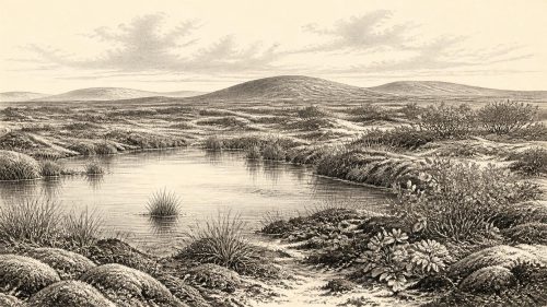
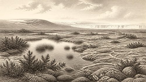
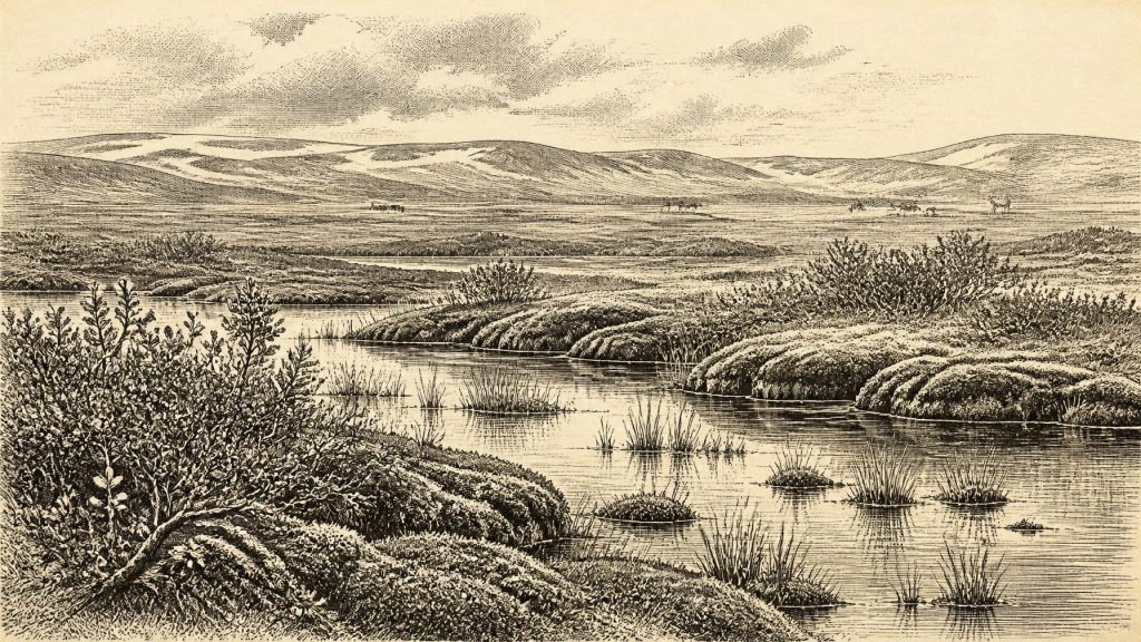
Derryvree offers unusually direct evidence. Its plant macrofossils, pollen, mosses and insect remains point to an open, treeless landscape with a cold, periglacial climate. Aquatic plants included water-milfoil and bogbean; sedges and mosses grew around wet ground. Dwarf willow, mountain avens and lesser clubmoss indicate vegetation able to survive short growing seasons, frost disturbance and exposed conditions. The evidence is especially valuable because later glaciation removed or scrambled so many Irish deposits of comparable age.
This was no lush woodland. Trees need not be imagined standing around the Fermanagh basin. The sparse pollen of pine or hazel found in such deposits may have travelled long distances or have been redeposited, and it cannot securely demonstrate local forest. Rather, the fossils support a mosaic of shallow water, marshy ground, sedge-rich margins, mossy patches and dry, thinly vegetated tundra. Summers could allow a quick burst of plant growth; winters were severe enough for the landscape and soil to be shaped by freezing and thawing.
The word “fen” is useful if used carefully. It conveys a low, waterlogged, plant-rich margin, but Derryvree was not a modern Irish wetland transplanted into deep time. Its freshwater environment existed under a colder climate, in terrain vulnerable to renewed glacial advance. The sediments demonstrate local open water and wet ground. The wider reconstruction of a tundra-like landscape is an interpretation drawn from those fossils, the enclosing tills and comparison with other northern European cold-stage sites.
Animals of the Open Country
County Cork supplies the other great archive. Castlepook Cave, also known as Mammoth Cave or Doneraile Cave, lies in the Awbeg valley near the Ballyhoura Hills. Its deposits have produced Ireland’s richest known assemblage of vertebrate remains from the time leading towards the Last Glacial Maximum. Radiocarbon dates on individual bones cover a long interval, rather than one moment, but several point towards the middle and later parts of the cold stage.
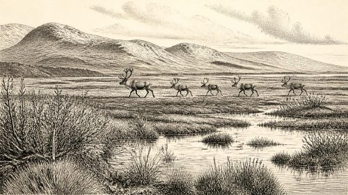
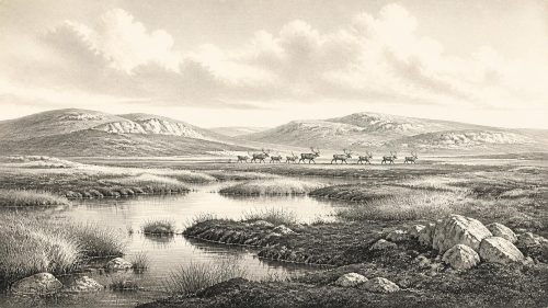
The fauna shows that Ireland, or at least some ice-free and accessible parts of it, could support large mammals and predators. Castlepook has yielded woolly mammoth, reindeer, giant deer, brown bear, wolf, fox, Arctic fox, mountain hare, lemmings and spotted hyaena. These animals did not all necessarily share one landscape at one time; cave deposits accumulate through many episodes, and bones can be brought in by carnivores, water or natural deaths. Nonetheless, the assemblage firmly rejects the idea of an empty island. It evokes open country in which grazing animals, scavengers and hunters could move through a cold, seasonally productive environment.
Food webs were likely precarious. Mammoth and reindeer depended on substantial plant biomass across broad ranges; hyaenas and wolves depended on prey and carrion. Cave denning, scavenging and the reworking of sediments mean that the cave cannot be treated as a census of the living countryside. Yet its bones, alongside Derryvree’s plants and insects, reveal an Ireland with ecological connections to Britain and continental north-west Europe. How, when and where animal populations crossed fluctuating marine and ice-bound barriers remain matters of reconstruction, not simple fact.
The Human Question
There is no securely excavated settlement, hearth, stone-tool assemblage, burial or dwelling that can be assigned to Ireland around 30,143 BCE. Accordingly, there is no responsible basis for describing tribes, leaders, territory, diplomacy, warfare, religious observance, language or artistic traditions in Ireland at this date. There were no states, kingdoms, written records or institutions known to us. Political history is silent here because the evidence is silent.
One object makes that silence less absolute, while also demanding caution. A reindeer femur from the old Castlepook collection has been reported by palaeozoologist Ruth Carden as bearing a deep mark consistent with cutting or chopping fresh bone using a sharp stone tool. The specimen has been presented as dating to roughly 33,000 years ago. If the interpretation and association are confirmed, it would indicate human handling of an animal in Ireland far earlier than the island’s long-established post-glacial archaeological record.
But a single modified bone is not a settlement. The cave was excavated in the early twentieth century, when methods of recording stratigraphy and provenience were much less exact than today. Its deposits have complex histories, and the mark itself requires continuing microscopic, contextual and comparative assessment. The proper conclusion for this period is therefore measured: people may have reached or visited Ireland, perhaps briefly, but enduring human occupation has not been demonstrated. It is equally unsafe to turn a possible butchery episode into evidence for a local community, a migration route or a continuous population.
Life Without a Historical Record
If people were present, their economy would have been founded on immediate knowledge of animals, weather, stone and seasonal movement rather than agriculture. Hunting or scavenging of large herbivores is plausible in the abstract, especially given the reindeer-bone claim, but remains unproven as a regular Irish practice. There is no evidence for cultivation, livestock, houses, pottery, metalworking, exchange networks or monuments. Nor can archaeology presently identify a ritual landscape or a system of teaching particular to Ireland.
That absence partly reflects preservation. Acid soils, later ice movement, erosion, rising seas and the small scale of Palaeolithic research have all narrowed the surviving record. Caves and sealed organic sediments preserve exceptional traces; open-air camps may have been destroyed, submerged or remain undiscovered. Absence of evidence is therefore not absolute proof that no person ever entered Ireland. It is, however, a decisive reason not to manufacture a social history where none can be recovered.
An Island in Formation
The most important development around this date was environmental instability. Ice was advancing in some sectors of the wider British–Irish world, while freshwater and tundra communities survived in others. Conditions in southern Cork and northern Fermanagh need not have been identical. Derryvree records a local interval of wet, open, periglacial terrain before ice again sealed it beneath till. Castlepook records a longer, mixed archive of animal life within a cave system. Together they show regional variation rather than a single all-Ireland scene.
For Ireland, then, 30,143 BCE is best understood as a point inside a long climatic transition. The recoverable history is not one of rulers or battles, but of water gathering beneath a cold sky, hardy plants taking hold at a pond edge, large mammals ranging across open ground, and glaciers capable of erasing much of what came before. Derryvree’s buried freshwater sediments are valuable precisely because they preserve that fragile interval between ice advances. They are a reminder that the earliest Irish past survives not as a chronology of years, but as scattered, contested traces of changing land, climate and life.
Primary Sources
- A Middle Midlandian Freshwater Series at Derryvree, Maguiresbridge, County Fermanagh, Northern Ireland
- Palaeoecology
- Pleistocene glaciations in Ireland
- Irish Pleistocene biostratigraphy
- The IntCal20 Northern Hemisphere Radiocarbon Age Calibration Curve (0–55 cal kBP)
- Growth and Retreat of the Last British–Irish Ice Sheet, 31,000 to 15,000 Years Ago: The BRITICE-CHRONO Reconstruction
- The Timing and Magnitude of the British–Irish Ice Sheet Between Marine Isotope Stages 5d and 2
- Late Pleistocene Chronostratigraphy and Ice Sheet Limits, Southern Ireland
- Radiocarbon Constraints on the Age of the Maximum Advance of the British–Irish Ice Sheet in the Celtic Sea
- Castlepook Cave
- Castlepook Caves
- Mammoth Cave
- The Irish Quaternary Fauna Project
- Pleistocene Vertebrates in the British Isles
- Ireland's Palaeolithic Archaeology – Fleeting Footprints in a Frozen Land
- 32564 – Castlepook, Cork
- Archaeological Heritage of County Cork
- Prehistoric Details: Mell Flint Flake
- Introduction to the Late Quaternary and Holocene of Northern Ireland
- Biogeography of Ireland: Past, Present, and Future
- New Insights on the Fauna of Ireland's Younger Dryas and Early Holocene from Alice and Gwendoline Cave
- Periglacial Wedge-Casts and Patterned Ground in the Midlands of Ireland