Cork’s Vanishing Cave Fauna30127 BCE
Rather than a precise historical year, 30,127 BCE denotes a Late Pleistocene, Marine Isotope Stage 3 interval of climatic instability before the Last Glacial Maximum. Ireland comprised shifting cold environments, with uncertain ice extent. Derryvree, County Fermanagh, preserves a buried freshwater wetland, dated broadly to this period, whose plants indicate treeless periglacial conditions and shallow water. Castlepook Cave, County Cork, contains a long, disturbed accumulation of mammal bones, including mammoth, reindeer and hyaena, demonstrating diverse Ice-Age fauna. A cut-marked reindeer femur may indicate human butchery, but cannot prove settlement. Evidence reveals ecological richness, not a historical chronicle for this island.
Dateline
“30,127 BCE” is a modern chronological label, not a year in which Ireland’s archaeological record can identify an event, ruler, settlement or individual. There is no calendar-year precision for this part of prehistory. Simply converting the label against the conventional radiocarbon reference year of AD 1950 places it about 32,076 years before present, but that arithmetic is not a scientific date for an Irish deposit. The responsible approach is to place it within the Late Pleistocene, broadly Marine Isotope Stage 3 (MIS 3), and to use dated evidence as wide ranges. Ireland at this point is illuminated chiefly by cave bones in the south and a buried freshwater sequence in Fermanagh, not by a historical narrative.
A Landscape Entering Glaciation
This was not yet the classic Last Glacial Maximum, when the British–Irish Ice Sheet reached its greatest known Late Pleistocene extent, broadly between 26,000 and 20,000 years ago. It was, however, part of the unstable build-up towards that maximum. Recent modelling describes roughly 32,000–23,000 years before present as a period of ice-sheet growth that varied greatly from one sector to another. At about 32,000 years ago, small glaciers or ice caps may have existed on high ground, while the exact extent of larger ice in Ireland remains uncertain. By about 31,000 years ago, model runs produce smaller ice caps in north-west Ireland, followed by rapid growth and merger in later millennia.
That uncertainty matters. It would be wrong to picture the entire island beneath a single, fixed mantle of ice in 30,127 BCE, or to assume that every valley was open tundra. Ice margins shifted; snowfall, summer thaw, permafrost, meltwater and vegetation responded at different rates; and later glaciers erased much of the earlier land surface. The very evidence that survives is selective: caves protected bones, while a few basins trapped mud and plant remains before they were overridden or sealed by fresh glacial sediment. Ireland was therefore a changing mosaic of cold environments rather than a stage on which a single island-wide scene can confidently be reconstructed.
Derryvree’s Buried Wetland
The closest Irish environmental archive to the requested point comes from Derryvree near Maguiresbridge, County Fermanagh. Roadworks in 1969 exposed a remarkable sequence within a drumlin: an older till below, freshwater sands, silts and organic material in the middle, and a younger till above. The order establishes a basic history beyond reasonable doubt. Ice had occupied the locality; an ice-free interval followed, long enough for freshwater sediment and vegetation to accumulate; then later glacial activity buried the wetland.
Organic matter from the intervening deposit produced the conventional radiocarbon determination BIRM-166, 30,500 radiocarbon years before present, with a substantial error margin of +1,170 and −1,030 years. Radiocarbon years are not calendar years. After calibration, the result is best treated as a broad window of roughly 36,900–31,700 calibrated years before present, approximately 34,950–29,750 BCE. The modern label 30,127 BCE falls within that wide interval, but it cannot be attached to a particular season, water level or generation of plants at Derryvree.
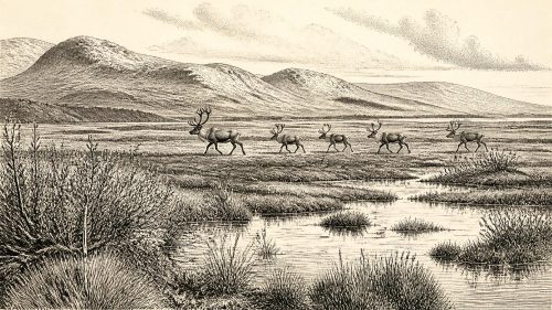
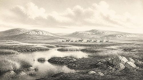
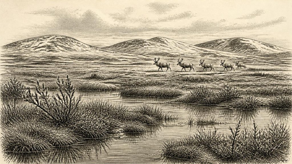
The fossils nevertheless give valuable local evidence. They indicate open, treeless ground and a cold, periglacial wetland or muskeg, with shallow freshwater nearby. Recorded plant remains include sedges and mosses, dwarf willow, mountain avens, bogbean and alternate water-milfoil. This was no featureless polar desert: plants able to exploit wet hollows, margins and short growing seasons formed a patchwork in the basin. Yet Derryvree was one sheltered Fermanagh locality, not a complete map of Ireland. Its flora shows that suitable freshwater habitats existed during part of this broad cold interval; it does not prove that identical habitats covered the island at the same moment.
Castlepook’s Long Bone Archive
County Cork provides a second, very different kind of evidence. Castlepook Cave, near Doneraile, is Ireland’s richest known vertebrate archive from the period leading towards the Last Glacial Maximum. Excavations undertaken between 1904 and 1918 recovered more than 2,000 bones from its passages and chambers, whose evocative old names include Elephant Hall and Hyena Hall. The collection includes woolly mammoth, giant deer, reindeer, brown bear and spotted hyaena, as well as wolf, Arctic fox, mountain or Arctic hare, and both collared and Norwegian lemmings.
These animals evoke open, cold landscapes capable of supporting grazing and browsing herbivores, but the archive must not be read as a census of one particular year. The cave accumulated remains over a long span. Individual radiocarbon determinations cover many millennia; revised dating has shown that some earlier results were substantially too young. Water movement, carnivore activity, collapse, mixing and the limitations of early twentieth-century excavation all complicate associations between bones. Geological Survey Ireland accordingly describes Castlepook as a repository for remains, not a single undisturbed occupation floor. Its fauna establishes that Ice-Age mammals lived in Ireland across the wider period; it does not demonstrate that mammoths, hyenas and every other listed species met in one Cork valley in 30,127 BCE.
Spotted hyaena are especially revealing. Their presence helps explain why a cave contains so many bones: dens and scavenging places can gather, chew, break and transport carcass parts. Mammoth bones and reindeer remains may similarly have reached cave chambers through several natural processes. The cave’s scientific importance lies partly in this complexity. New, carefully recorded excavation has the potential to separate deposits and agents far better than antiquarian collecting could, while the old collection remains indispensable evidence that would otherwise have been lost.
The Reindeer Femur Question
One Castlepook object raises the most consequential question about people. A reindeer femur fragment from the historic collection has been identified by zooarchaeologist Ruth Carden as bearing a deep incision consistent with a sharp stone implement used on fresh bone. County Cork heritage material presents the specimen as possible evidence of butchery by Palaeolithic people around 31,000 BCE. If that interpretation is sustained, it would push evidence for human activity in Ireland far earlier than the long-established post-glacial record.
Its limitations are as important as its promise. A radiocarbon date on the bone indicates when the reindeer died, not necessarily the precise moment, place or agent that made the mark. The specimen was not excavated from a securely stratified camp alongside stone tools, hearths, a dwelling surface, food waste or human remains. Nor can one modified limb bone tell us whether people killed the animal, scavenged a carcass, visited for hours or days, or returned repeatedly. It is best described as a possible trace of human carcass processing, not as proof of a settled population or a named Upper Palaeolithic culture in Ireland.
What Cannot Be Written
There is no evidence for political institutions, leaders, diplomacy, territorial states or organised warfare in Ireland at this date. Nor is there evidence for farms, cultivated crops, livestock, villages, monuments, formal burials, writing, artistic traditions or religious observance. Nothing permits a responsible account of trade routes or regular sea crossings. Lower global sea levels altered coastlines, but the practical routes through, around or across the Irish Sea region for people and animals varied with ice and water, and cannot be inferred from one bone mark.
If humans were present, the most that can be inferred is a potentially mobile and small-scale use of a cold landscape, focused on animal resources. Freshly worked bone could imply meat, marrow, hide, sinew or bone were valuable; it does not establish the techniques, social organisation or beliefs of those involved. Equally, the evidence may ultimately be revised as research continues. The clear record belongs to the environment: cold open ground, freshwater refuges, large herbivores and powerful carnivores, all increasingly exposed to the advance of glacial conditions.
An Island Without a Chronicle
Ireland around 30,127 BCE is thus not a lost chapter of kings, battles or communities waiting to be named. It is a scientific horizon of wide date ranges and uneven survival. Derryvree preserves the quiet evidence of a tundra wetland between glacial advances. Castlepook preserves a long, disturbed archive of animal life before the ice sheet’s later maximum, together with an intriguing but isolated possible human intervention. Their combination makes the period historically important: not because it supplies a precise anniversary, but because it shows that the island’s deepest past was ecologically rich, climatically volatile and still only partly recovered from the ground.
Primary Sources
- A reconsideration of the radiocarbon dating of the Marine Isotope Stage 3 fauna from southern Ireland
- The Irish Quaternary Fauna Project
- Castlepook Cave, County Cork: County Geological Site Report
- 2022:564 – Castlepook Cave, Castlepook South, Cork
- Heritage Artefacts of County Cork
- Archaeological Heritage of County Cork
- Figure 6.— The Subdivision of the Quaternary Period in Ireland
- Irish Pleistocene Biostratigraphy
- A Middle Midlandian freshwater series at Derryvree, Maguiresbridge, County Fermanagh, Northern Ireland
- The timing and magnitude of the British–Irish Ice Sheet between Marine Isotope Stages 5d and 2: implications for glacio-isostatic adjustment, high relative sea levels and ‘giant erratic’ emplacement
- Behavioural tendencies of the last British–Irish Ice Sheet revealed by data–model comparison
- Growth and retreat of the last British–Irish Ice Sheet, 31,000 to 15,000 years ago: the BRITICE-CHRONO reconstruction
- Last Glacial Maximum cirque glaciation in Ireland and implications for reconstructions of the Irish Ice Sheet
- Trimlines, blockfields and the vertical extent of the last ice sheet in southern Ireland
- Stratigraphic and palaeo-geomorphological evidence for the glacial-deglacial history of the last British-Irish Ice Sheet in the north-western Irish Sea
- Dynamic cycles, ice streams and their impact on the extent, chronology and deglaciation of the British–Irish Ice Sheet
- Irish Cave Exploration
- First evidence of a Late Upper Palaeolithic human presence in Ireland
- New insights on the fauna of Ireland's Younger Dryas and Early Holocene from Alice & Gwendoline Cave
- The Mesolithic in Ireland: when was it?
- Pleistocene Vertebrates in the British Isles
- Menyanthes trifoliata: Fossil Record in Fermanagh
- Dryas octopetala: Fossil Record in Fermanagh