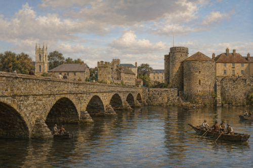
Thomond Bridge and Castle, 1881

This 1881 reconstructed image is based on an engraving and depicts Thomond Bridge and King John’s Castle overlooking the River Shannon in Limerick, County Limerick. The original was published in Élisée Reclus’s geographical work The Earth and Its Inhabitants, the image presents one of the city’s most recognisable historic views. The medieval castle dominates the riverbank, while the bridge connects the city across the Shannon. Boats, buildings, and figures add detail to the busy riverside setting. The engraving reflects both the architectural importance of the castle and the strategic role of the crossing, preserving a valuable nineteenth-century representation of Limerick’s urban landscape and historic waterfront for future generations to appreciate.
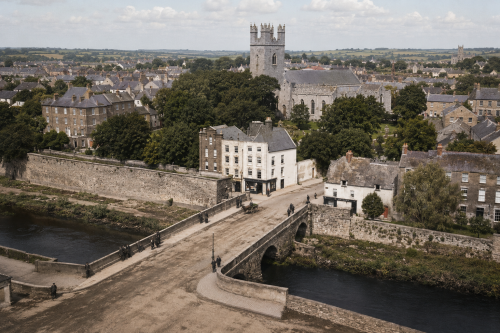
Mathew Bridge, Limerick

Mathew Bridge, completed between 1844 and 1846, forms an important crossing over the Abbey River in Limerick City. Designed by William Henshaw Owen, the triple-span ashlar limestone structure features segmental arches, rounded breakwaters and a broad flat roadway. It linked Rutland Street and Bank Place with Bridge Street and Merchant’s Quay, connecting the Georgian commercial quarter of Newtown Pery with medieval Englishtown. The bridge replaced the inadequate New Bridge of 1762 and accommodated the city’s growing Victorian traffic. Named for Father Theobald Mathew, the celebrated temperance reformer, it remains a notable example of nineteenth-century Irish civic engineering and urban development.

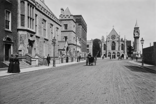
Pery Square

Around 1900, Pery Square presented one of Limerick’s most elegant urban settings, facing the newly opened People’s Park and framed by distinctive Georgian terraces. The celebrated Tontine Buildings, built between 1835 and 1838 as a speculative venture, gave the square a story as unusual as its architecture. Their shares, tied to named lives in the so-called Life and Death Lottery, were still gaining value as horse-drawn traffic, pedestrians, gas lamps, and civic buildings animated the street. The tontine was finally won in 1913 by Sophia Vanderkiste, closing a remarkable chapter in Limerick’s local social and architectural history.

Blossom Gate, Kilmallock

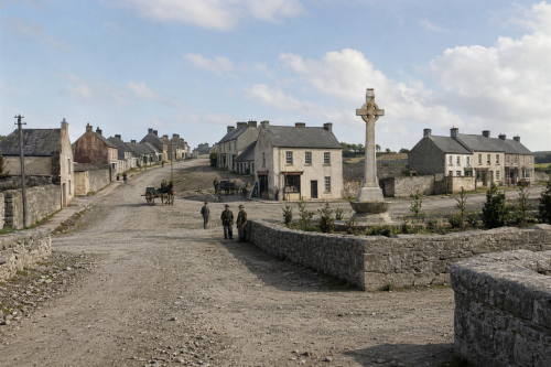
Blossom Gate is the last surviving medieval gateway of Kilmallock, County Limerick, once one of Ireland’s most strongly fortified towns. Originally one of five entrances through the defensive walls, it alone remains; St John’s, Water, Ivy and Friary gates have disappeared. Standing on Emmet Street, the three-storey stone tower spans the roadway above a pointed arched vault, marking where the town walls formerly joined it. The name may derive from “Blae Gate” or from the Irish word blá, meaning flower or blossom, combined with the French porte, meaning gate. Today, it is a prominent reminder of Kilmallock’s medieval importance and heritage.

Council Disqualifications

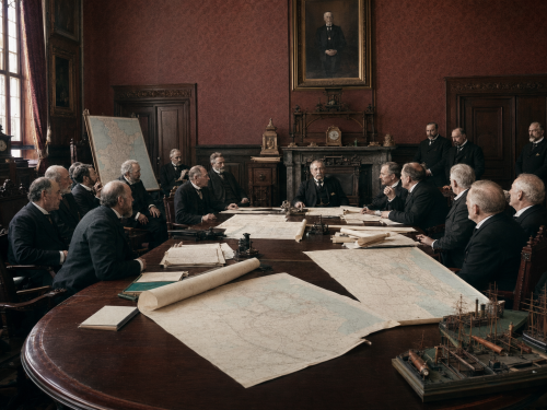
On 1 February 1900, the issue of possible disqualification of members serving on Ireland’s district councils was debated in the British Parliament, a matter that resonated throughout Limerick’s local government circles. The city and county had recently experienced the effects of local-government reform under the 1898 Act, which established new councils and brought a wave of civic participation. The prospect that sitting councillors could be disqualified on various grounds raised concerns among Limerick’s representatives, who were alert to the implications for the stability and credibility of local administration.

Limerick Market Day, 1937

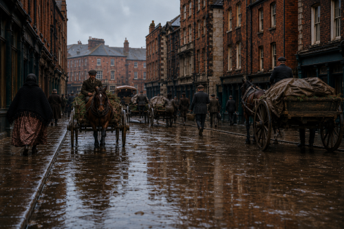
This photograph, dated 1 March 1937, captures a busy market day in Limerick city. Horse-drawn carts, traders, shoppers, and farmers crowd the wet street, creating a vivid picture of everyday commercial life. On the right, a man drives a horse and trap, a form of transport commonly associated with more prosperous Irish farmers. Market goods are displayed on carts and stalls, while pedestrians move between the buildings lining the street. The scene records the importance of markets to Limerick’s economy, bringing rural producers and urban customers together during a period when horses remained central to transport and trade throughout Ireland.

Pery Square

Pery Square stands as the finest surviving expression of Limerick’s Georgian ambition. Built between 1835 and 1838, its elegant western terrace was designed as part of a larger development, but the Great Famine prevented completion. Construction was financed through an unusual tontine scheme, in which ownership depended upon the survival of nominated individuals. The adjoining residents’ garden later became the People’s Park in 1877, opening the landscaped space to the public. Today, the square remains an important cultural and architectural landmark, home to the People’s Museum, Limerick City Gallery of Art and the beautifully restored No. 1 Pery Square Hotel.

Shanagolden Through the Ages

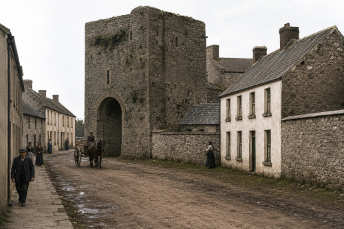
Shanagolden, whose Irish name Seanghualainn means “old shoulder,” possesses a history stretching from early medieval warfare to plantation settlement and modern political struggle. Nearby lands witnessed Mahon’s victory over Norse forces in 968, while Shanid Castle later became a major FitzGerald stronghold. St Katherine’s Abbey reflects the district’s medieval religious heritage. Following the Desmond conflicts, the village was reshaped as an Elizabethan plantation settlement, leaving its broad street, square and central green. During the nineteenth century, policing, trade, farming and creamery production shaped local life. Shanagolden also played a remembered role during Ireland’s War of Independence in the twentieth century.

Civic Compromise

Mayor John Daly was returned unopposed when Limerick Corporation assembled for its quarterly election of civic officers. The council then proceeded to choose three qualified burgesses whose names would be submitted for appointment as City High Sheriff. The principal contest appeared likely to involve the serving sheriff, Thomas H. Cleeve, and John F. Power. Their disagreement arose from the proposed amalgamation of the Waterford, Limerick and Western Railway with the Great Southern and Western Railway, an issue that had united much of the Corporation, harbour administration and commercial community in organised opposition.

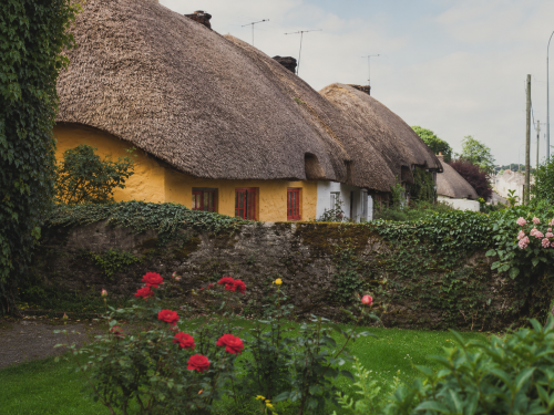
Thatched Cottages of Adare

In July 1981, a row of traditional thatched cottages lends Adare its distinctive old-world character. Whitewashed walls, steep straw roofs and small windows line the roadside, reflecting a style once common throughout rural Ireland. The cottages appear carefully maintained, their simple façades softened by flowers, hedges and mature trees. Passing traffic and summer light place the scene firmly in everyday village life rather than a staged historical setting. The image preserves a familiar view of Adare at a time when its architectural heritage was becoming central to the village’s identity and appeal for visitors to County Limerick and beyond worldwide.

Now Sharing: Articles (166) Images (578) Total Items Archived (744)
Our Mission: 100,000 Items Total Percentage Achieved (0.74%)