

Chandra Deluge
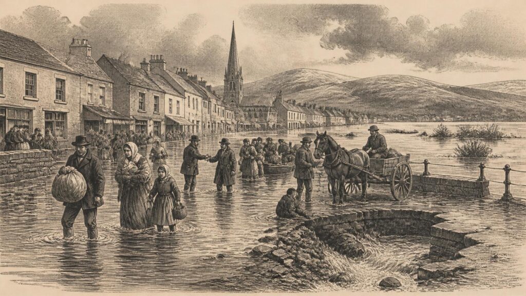
AI generated historical illustration, not a contemporary photograph.
At a Glance
Storm Chandra’s flooding of late January 2026 was a distinctly Irish historical event: not because a single storm suddenly made an otherwise dry country wet, but because rain fell upon an already saturated landscape of full rivers, constrained drains, vulnerable roads and communities carrying memories of earlier inundations. The storm revealed the importance of accumulated weather, local geography and the long development of Irish flood management. It also left a detailed public record, though that record must be read carefully: meteorological measurements, official reports and local testimony illuminate different parts of the same disaster.
Storm Arrival
Storm Chandra affected Ireland principally during the night of Monday 26 January and Tuesday 27 January 2026. It was named by the United Kingdom Met Office under the shared western European storm-naming arrangements, rather than by Met Éireann itself. The name, therefore, should not obscure the meteorological reality: Chandra was a rapidly deepening low-pressure system which approached from the south and tracked northwards over Ireland. Its passage brought strong easterly winds, widespread heavy rain and very difficult coastal and travelling conditions.
Met Éireann’s operational commentary, issued before the worst impacts, identified the essential danger with unusual clarity. The forecast did not describe rain falling on ordinary winter ground. It described rain arriving after an unsettled spell, when soil was already saturated and many rivers were near, or above, bank-full level. The agency warned of localised, river and surface-water flooding, especially in eastern and southern counties. Such wording matters historically. It shows that the basic physical risk was understood before the event, even if the exact place and speed of individual floods remained difficult to predict.
The storm’s wind field was formidable in exposed places. Met Éireann’s later January climate statement recorded a peak gust of 130 kilometres per hour at Malin Head, County Donegal, on 27 January, along with a 10-minute mean wind speed of 104 kilometres per hour. At sea, the low pressure was notably deep: the daily weather record registered 957.7 hectopascals at Buoy M3 off the Cork coast at 08:00 UTC. Yet the most consequential feature for many communities was not wind damage alone. It was water moving through an already overloaded system.
The distinction is important because public memory often labels severe events by the storm that coincided with them. That is understandable. A named storm supplies a beginning, a recognisable cause and a shorthand for a chaotic experience. But the chronology shows that Chandra formed part of a longer wet episode. Repeated frontal rainbands had crossed the country from the south during the second half of January. The storm intensified an existing hydrological crisis; it did not create every condition for flooding from nothing.
Named Weather
Storm naming has changed how Irish weather is remembered. Earlier generations frequently remembered destructive weather through a locality, a month, a damaged bridge, a lost crop or an exceptional tide. Modern named storms create a national label almost immediately. That can assist public communication, because warnings become easier to circulate and recall. It can also compress a complicated sequence of rainfall, river response, drainage failure and tidal interaction into one memorable proper noun.
Chandra consequently belongs to a recent archive of named storms affecting Ireland, but it should not be treated as identical to all of them. In some storms, wind is the dominant threat; in others, coastal surge or wave overtopping commands attention. During Chandra, flood impacts were particularly associated with the cumulative wetness of the preceding days and weeks. This was a compound event, meaning that several environmental factors combined to produce harm greater than any one factor alone would suggest.
Loaded Landscape
By the time Chandra arrived, the ground had become what hydrologists call antecedently wet: it had little remaining capacity to absorb additional water. In plain terms, rain that might otherwise have soaked into fields, gardens and soil began to flow over the surface, into smaller streams, drains and larger rivers. The speed and direction of that water varied sharply from place to place. A modest local depression, a blocked gully, a culverted stream, a steep urban street or a river already close to its banks could transform a difficult day into an emergency.
January 2026 was cool nationally but wet, particularly in the south and east. Met Éireann calculated national rainfall at 123 per cent of the 1991–2020 average for the month. The national figure, however, masks the very uneven geography that made Chandra so destructive. Johnstown Castle in County Wexford recorded 232.7 millimetres during January, equivalent to 230 per cent of its long-term average and its wettest January since 1996. The south-east was therefore not merely experiencing a storm; it was experiencing a storm after a highly abnormal accumulation of rainfall.
The official daily record illustrates why a focus only on the rain falling during Chandra can mislead. Phoenix Park, Dublin, recorded 35.4 millimetres on Tuesday 27 January. That was a serious daily total, amounting to more than half of the site’s normal January rainfall. But a river does not respond solely to the rain of one calendar day. It responds to the moisture already in the ground, the water already moving through tributaries, the condition of drains and channels, and the rainfall still to come. Heavy rain after the storm also prolonged danger and delayed recovery.
The Environmental Protection Agency’s January hydrology bulletin recorded particularly high river flows in eastern and south-eastern catchments. Its account tied those flows to the same persistent rainbands identified by Met Éireann. Such documents are especially valuable because they move attention from dramatic images towards catchment behaviour. Flooding is always local in its consequences, but water is gathered across a wider landscape. Rain falling upslope, outside a town or beyond a county boundary can materially shape what happens in a street or home downstream.
Water Pathways
The floods associated with Chandra involved more than one pathway. Fluvial flooding occurred where rivers and streams overtopped or exceeded the capacity of channels. Pluvial flooding occurred where rainfall could not drain away quickly enough, accumulating on roads, paved areas and low ground. Coastal conditions added another concern in exposed locations, where wind, high tide and wave action could limit drainage or drive water landward. Government statements after the event explicitly described river, coastal, road and surface-water flooding, rather than presenting the emergency as one uniform phenomenon.
This distinction is not technical pedantry. Different types of flooding demand different defences and produce different memories. A river flood may rise more slowly but extend across broad low-lying land. Surface water can appear with alarming speed in urban areas, entering ground-floor rooms, trapping vehicles or cutting roads. Coastal water may coincide with an astronomical tide and arrive with destructive wave energy. A household may simply say that it was flooded; historical analysis needs to ask how water arrived, how long it remained and what systems were meant to contain it.
In January 2026, the overlap of these pathways magnified uncertainty. A local authority might know that a river catchment was full, while individual streets simultaneously faced blocked drainage or runoff from higher ground. The public could receive a wind or rain warning without immediately knowing the precise lane, bridge, estate or small tributary at risk. That gap between broad meteorological warning and intensely local impact later became one of the most important subjects of discussion.
Flooded Places
The east and south-east of Ireland experienced the most widely reported flooding during the early phase of Chandra. Dublin, Wicklow and Wexford were among the counties repeatedly identified in national reporting and official statements. Water affected homes, businesses, roads, rail services and ordinary routines. In south Dublin, floodwater disrupted traffic and required emergency responses in areas including Dodder Park Road, Kilmacud and Rathfarnham. The River Dodder, long familiar in Dublin’s flood history, again became a focus of public concern.
The Dodder’s place in the event demonstrates a recurring truth about urban rivers. They are at once physical waterways, public amenities, transport corridors and historical boundaries. When contained, they can disappear into the background of city life. When they rise, they abruptly expose the relationship between settlement and water. The 2026 flooding was not evidence that every previous investment had failed, nor that flood defences eliminate all danger. Rather, it showed that risk remains where intense rainfall, swollen catchments, local drainage and development patterns meet.
County Wexford supplied some of the most powerful images and accounts. Enniscorthy and Bunclody were repeatedly described as severely affected, with evacuations, flooded premises and emergency assistance. Their location within the Slaney catchment made the wider hydrological setting central to events. Images of people moving through floodwater understandably conveyed urgency, but they do not themselves provide a full chronology. Water levels, local rainfall, tributary response, emergency decisions and subsequent rainfall all formed part of the disaster’s timeline.
In County Wicklow, Arklow featured prominently among the affected towns. Wicklow’s rivers descend relatively quickly from upland areas towards the coast, while settlement, roads and commercial activity are concentrated in valleys and coastal towns. That geography does not make flooding inevitable in any simple sense, but it helps explain why prolonged rain and high water can have acute local consequences. In such places, the meeting of river flow and tidal conditions is especially significant.
Waterford, Kilkenny and Carlow also appeared in the official map of assistance and response. The impact extended beyond a single river basin or urban district. Subsequent rainfall caused continuing concern along waterways and in towns where roads and low ground remained vulnerable. Thomastown in County Kilkenny, for example, was among places affected as the River Barrow rose after the storm. The persistence of the episode matters: the historical event is better understood as a period of flood emergency extending beyond the first named storm day.
Northern Reach
County Monaghan illustrates how the event reached beyond the better-known scenes in Dublin and the south-east. Monaghan County Council’s later account described a prolonged period of severe weather from 26 January to 6 February, marked by persistent rain, strong winds and widespread flooding. At the height of the crisis, the council recorded numerous flooded roads, isolated rural communities and exceptionally high levels on the River Fane. Its minutes stated that the Fane exceeded previously recorded levels, a significant observation that should be understood as relating to the council’s available local records rather than to an absolute statement about all past water levels.
The Monaghan evidence also shows why road disruption was so consequential. Rural roads are not simply transport links: they connect homes, farms, schools, health services, shops and emergency assistance. When floodwater closes several routes at once, a community can be isolated even where houses themselves are not inundated. For farmers, livestock movement and supplies may become urgent concerns. For residents, a detour can become impossible if several minor roads cross streams or low ground.
Local government records therefore complement national reports. National coverage tends to identify the broad zone of greatest impact; council documents preserve the practical texture of response: sandbags, temporary barriers, pumps, debris clearance, road closures and contact with households. They are not neutral in every respect, because they also record an authority explaining its actions. Nevertheless, they are valuable primary evidence of what was done, where staff were deployed and how long emergency conditions lasted.
Compound Waters
The strongest interpretation of Chandra is that it was a compound flood event. That phrase should not be mistaken for a slogan. It describes the interaction of several measurable conditions: prolonged rainfall before the storm, saturated soils, high river levels, further rain during and after the storm, strong winds, and in some areas the timing of tides. The Oireachtas record of February 2026 similarly described a confluence of saturated land, persistent rain and wind, high astronomical tide, river flooding, coastal flooding, road flooding and surface-water flooding.
This approach corrects a tempting but incomplete explanation: that a single extraordinary downpour must have caused every flood. Research reported after the event by scientists associated with Maynooth University’s ICARUS Climate Research Centre and Met Éireann found that seven-day accumulated rainfall, rather than rainfall on Chandra’s principal day alone, was critical. Their rapid analysis concluded that a similar seven-day rainfall total had become more likely in a warmer climate, while emphasising that the storm-day rainfall itself was not the whole explanation.
There is an important methodological lesson here. A rainfall total at one weather station cannot stand for every neighbourhood. Nor can a national monthly total explain a flooded house. But station data, catchment information and observed impacts can be assembled into a more reliable narrative. The evidence supports saying that water had accumulated in the landscape before Chandra; it does not support treating every affected locality as hydrologically identical.
The same caution applies to the popular language of unprecedented weather. Some local river gauges or council records may have reached or exceeded previous observed levels. January totals at particular stations were exceptional in relation to their own records. Yet Ireland has a long history of flood disasters, and historical records vary greatly in length and quality. Claims of absolute novelty require very specific evidence. Chandra was severe, socially disruptive and highly consequential; it need not be falsely described as unparalleled in all places to be recognised as such.
Tidal Pressure
The role of tide was especially important to public understanding because it made the event visibly more complex than inland rainfall. Water draining through a river or urban outlet can be slowed when sea level is high. Strong onshore winds and wave overtopping can add a further hazard on exposed coasts. The National Emergency Co-ordination Group warned after Chandra that saturated ground and high river levels left areas vulnerable to further rain. The Oireachtas discussion added the high astronomical tide to the list of contributing circumstances.
It would be wrong, however, to assign the same tidal role everywhere. Inland communities in Carlow or Monaghan did not experience the event in the same way as low-lying coastal districts in Dublin or Wicklow. The historical value of the compound-event concept is precisely that it allows for difference. One national weather system generated many local emergencies, each shaped by the physical setting and built environment of a particular place.
Emergency Response
The State response began while the storm was still active. The National Emergency Co-ordination Group met to monitor conditions and coordinate central government activity with local authorities, emergency services and relevant agencies. Its public statements recorded serious disruption, especially in the south and east, while also stressing that flood risk would continue after the first day. This was a sensible recognition that the end of a named storm is not necessarily the end of a flood emergency.
Emergency services carried out rescues from floodwater in Dublin. Local authority crews worked with pumps, sandbags, road closures, debris clearance and temporary traffic arrangements. Electricity outages added another layer of difficulty, particularly where access was restricted by standing water or fallen trees. Rail, bus, ferry and aviation disruption brought the event into the daily lives of people far beyond those whose homes were directly damaged. Such disruptions are part of flood history, not incidental detail: they demonstrate how modern communities depend on interconnected networks.
Government activated the Emergency Response Payment for households directly affected in specified counties, including Wexford, Wicklow, Dublin, Carlow, Kilkenny, Waterford, Louth and Monaghan. The scheme was designed to meet immediate hardship and certain essential costs rather than to act as universal compensation. This distinction was important. A flood can destroy possessions, damage fabric, interrupt work and cause emotional distress, but public assistance schemes are bound by eligibility, assessment and exclusions.
Separate support was made available for small businesses and community, voluntary and sports organisations unable to obtain flood insurance. Initially structured with a rapid first payment and a further assessment stage, the business and community flooding scheme was later enhanced in recognition of the scale of reported damage. The existence of such schemes reveals an often overlooked dimension of Irish flood history: the boundary between private loss, insurance, local solidarity and public relief is continually negotiated after each disaster.
Recovery Burden
Flood recovery is seldom captured fully by the first week of news coverage. Water must recede; damaged goods must be removed; buildings require drying and repair; insurance claims and grant applications must be made; roads, drains and public spaces must be restored. Businesses can face lost stock, interrupted trade and delayed reopening. Community organisations may lose equipment or premises at precisely the moment residents need local support most. The aftermath can be prolonged even where the dramatic waterline disappears quickly.
Road damage was one measurable legacy. By March 2026, local authorities in eight particularly affected areas had estimated combined repair costs approaching €59 million for local and regional roads damaged during Chandra and the subsequent wet weather. The figure was an estimate, not a final universal total for all damage in Ireland. Its significance lies in showing how flood impacts accumulate through public infrastructure. A washed-out verge, damaged culvert or undermined carriageway can remain a local problem long after the storm itself is forgotten by national audiences.
Recovery also carried a psychological burden. Official reports can count roads, payments and calls, but they cannot fully quantify anxiety when rain returns or a river rises again. Testimony from affected residents belongs in the historical record, though it should be treated as experience rather than as substitute meteorological evidence. A person may remember rapid water entry, inadequate warning or neighbours helping one another with complete accuracy as to their experience, even when the exact sequence of rainfall requires confirmation from instruments and official logs.
Public Warning
One of the sharpest debates after Chandra concerned warning. Met Éireann had issued wind and rainfall warnings and had communicated a high or elevated flood risk to local authorities in the east. Yet some residents whose streets or homes flooded felt that they had received no warning adequate to the danger. Both propositions can be true. A broad regional warning may be meteorologically sound while failing to reach, persuade or specify the particular people who later face water at their door.
This is a recurring problem in flood management. Weather forecasting works over areas and time periods. Flood impacts can occur at the scale of a small stream, a road dip, a culvert or a few streets. A warning that is too general may not prompt protective action; a warning that is too precise, issued too early or based on uncertain information may be wrong. The issue is not simply whether a warning exists, but how it is produced, distributed, understood and connected to local action.
During the Chandra emergency, public discussion drew attention to the distinction between weather warnings and flood warnings. Rainfall amount is only one variable in flood risk. Ground saturation, river height, drainage condition, topography, tide and local runoff all matter. The need to communicate this complexity without paralysing the public is substantial. A forecast can correctly say that heavy rain is possible, while still being unable to state with certainty which individual property will flood.
Ireland’s warning and planning arrangements did not begin with Chandra. The Office of Public Works had developed flood-risk mapping, planning guidance, water-level information and coordination arrangements over previous decades. It joined the European Flood Awareness System partner network in 2010; the national tide and storm-surge forecasting service began in 2009; and real-time water-level information for main river catchments was made available from 2013. These systems form part of the background against which the shortcomings exposed in January 2026 must be judged.
Warning Limits
The historical lesson is not that prediction is useless. Forecasts plainly assisted agencies in preparing for difficult conditions, and Met Éireann’s pre-storm commentary accurately emphasised saturated ground and full rivers. Rather, Chandra showed the limits of a system in which highly local flood consequences must be inferred from regional weather information and communicated through several institutions. Local authorities, emergency services, national agencies, utilities, transport providers and households all had roles, but responsibility distributed across many bodies can be difficult for the public to interpret during a rapidly developing emergency.
Any account should avoid retrospective certainty. After a flood, it can appear obvious that a particular road or home was at risk. Before the water arrives, decisions are taken amid uncertain rainfall tracks, changing river levels, competing demands and finite staff. Historical scrutiny should ask whether warnings were timely, intelligible and actionable, but it should not pretend that every local consequence could have been forecast exactly.
Historical Context
Chandra entered an Irish history already shaped by repeated flooding. The Comptroller and Auditor General’s review of flood-risk management documented significant events between 2005 and 2015, including severe national flooding in November 2009, major flooding in the greater Dublin area and Wicklow in October 2011, and widespread coastal and inland flooding in early 2014. Such events influenced public expectations, planning policy and investment priorities. They also created local memories that resurfaced when Chandra arrived.
Flood history is not merely a chronology of disasters. It is a history of how Irish society has altered rivers, drainage, land use and settlement. For much of the twentieth century, State policy concentrated on arterial drainage, largely connected with agricultural improvement. The 1945 Arterial Drainage Act was amended in 1995 to permit the Office of Public Works to implement flood-relief schemes for towns and villages. This marked a significant institutional shift towards urban and community protection, though it did not remove the many responsibilities held by local authorities and other agencies.
The modern planning framework similarly emerged from accumulated experience. Flood-risk guidelines published in 2009 sought to prevent inappropriate development in flood-prone places and to integrate flood considerations into planning. The Catchment Flood Risk Assessment and Management programme later examined a large share of national flood risk and proposed measures for vulnerable communities. These efforts demonstrate that Chandra was not a surprise in the sense that Ireland had never considered flooding. Its significance lies in showing how difficult it remains to translate national knowledge into resilience at the scale of every settlement.
There is also a longer environmental context. Rivers, estuaries, bogs, turloughs and floodplains have always changed with season and weather. Not every historical inundation was regarded as a disaster in the modern sense; agricultural land may have flooded where few people lived, while contemporary development has placed more homes, roads and services in vulnerable locations. Conversely, hard engineering, drainage and embankments can protect communities while changing the way water behaves elsewhere. History therefore cautions against easy claims that nature alone, or human action alone, explains every flood.
Remembered Floods
Local memory is an important but uneven source. Residents may recall the height reached by a past river, the year a road was closed, the neighbour who supplied pumps or the flood that changed an insurance decision. These memories can preserve details missing from official files. They can also merge episodes, particularly when several wet winters affect the same community. Historians should record such testimony respectfully while distinguishing it from measured hydrological evidence.
Chandra generated its own immediate folklore: accounts of sudden water, improvised rescues, blocked drains, submerged cars and neighbourhood assistance circulated through conversation, photographs and social media. Such material is historically valuable as evidence of perception and response. It should not be treated uncritically as proof of storm totals, official decisions or the timing of river peaks. The proper distinction is not between true archives and false memories, but between different forms of evidence answering different questions.
For Emerald Archives, that distinction is essential. A council incident record may establish that crews delivered barriers. A meteorological station can establish a measured rainfall total. A resident’s account can explain what it felt like when water rose through a doorway. Together they create a fuller account than any one source can provide. Separately, each has limits.
State Systems
Storm Chandra tested a layered system of Irish flood governance. Met Éireann monitored and forecast the weather. The Office of Public Works held central responsibilities for flood-risk policy, mapping and major flood-relief schemes. Local authorities managed many local roads, drains, emergency actions and community responses. The National Directorate for Fire and Emergency Management coordinated aspects of severe-weather response, while transport agencies, utilities, the Irish Red Cross and social-protection services each had additional roles.
This institutional complexity reflects the complexity of flooding itself. No single agency controls rainfall, river flow, urban drainage, coastal conditions, land use, roads, electricity or household recovery. The danger comes when division of responsibility produces division of understanding. A householder may reasonably want one clear answer to the question, ‘Will my home flood?’ The administrative system may possess fragments of the answer across weather models, river gauges, flood maps, tide forecasts and local knowledge.
After Chandra, the government response concentrated on immediate support and continuing monitoring. It also brought renewed attention to the cost of maintaining roads and the need for stronger local resilience. South Dublin County Council’s later report described a period of alert and response running from 27 January to 6 February, with persistent rain keeping the eastern region under flood advisory after the main storm day. That chronology reinforces the point that emergency management extended well beyond the moment of landfall.
Flood defences occupy a central but sometimes misunderstood place in this system. The Office of Public Works generally designs major schemes to standards based on an annual probability of flooding, where feasible. A ‘one in one hundred year’ river flood standard does not mean an event occurs only once every century. It means a flood of that scale has a one per cent chance of occurring in any year under the assumptions used. Such standards reduce risk; they do not promise invulnerability, particularly when several hazards occur together or conditions change over time.
Built Defences
Defences can include walls, embankments, pumps, storage areas, channel works, bridge alterations and drainage improvements. Non-structural measures include flood mapping, planning control, warnings, emergency plans and public preparedness. The most durable lesson of Chandra is that these should not be posed as alternatives. Engineering without warning can leave residents unprepared for residual risk. Warning without investment can ask households to endure hazards that might partly be reduced. Planning without enforcement may allow vulnerability to grow.
There are also environmental questions. Rivers and floodplains are living systems, and flood-relief projects can affect habitats, landscapes and public access. Ireland’s future response must therefore balance protection with ecological care. That balance is not evidence of indecision; it is a recognition that removing water quickly from one location can alter conditions elsewhere. The historical record of flood management is full of such trade-offs.
Climate Evidence
It is necessary to distinguish three propositions. First, Ireland has always experienced storms and flooding. Second, Chandra’s immediate flooding resulted from identifiable weather and hydrological conditions, especially prolonged rain on saturated ground. Third, climate change alters the background probabilities within which such events occur. These propositions are compatible. A climate explanation does not erase the role of drainage, catchments, tides, planning or emergency response; neither do those local factors erase the influence of a warming climate.
The rapid analysis associated with Maynooth University and Met Éireann concluded that rainfall accumulated over the seven days including Chandra was about nine per cent greater than it would have been in a pre-industrial climate, and that a similar seven-day event had become roughly three times more likely. It expressed the changing frequency in terms of an event expected about once every 150 years in a pre-industrial climate becoming an event expected about once every 60 years. These are model-based estimates, not a claim that a clock governs floods or that every sixty years will necessarily bring the same local consequences.
The broader scientific context supports taking the finding seriously. The Environmental Protection Agency has reported that heavy rainfall events in Ireland became more intense over recent decades, while high-resolution national projections indicate increases in heavy rainfall and greater precipitation variability. These projections retain uncertainty, especially at local scale. Their practical implication is not certainty about a particular future storm, but a stronger case for designing systems able to cope with more frequent combinations of saturated ground and intense rainfall.
Chandra is therefore best understood as evidence of exposure rather than as a simple emblem of climate change. It revealed what can happen when a comparatively short storm passage meets an unusually wet preceding period. The climatic signal concerns the likelihood and intensity of the accumulated rainfall conditions; the local disaster concerns how those conditions interacted with people, places, infrastructure and watercourses.
Careful Attribution
Public discussion often asks whether climate change ‘caused’ a particular flood. In historical prose, that question needs careful wording. No responsible analysis can say that climate change alone caused every flooded road or building during Chandra. The direct causes differed by location. But attribution science can estimate how human-driven warming changed the probability or intensity of relevant rainfall conditions. That is a stronger and more precise claim than either denying any climatic influence or treating climate change as the only cause.
The evidence also makes adaptation an historical necessity rather than an abstract future project. Irish communities already live with the results of earlier development decisions, existing drainage systems and known flood pathways. Future decisions about building, maintenance, warning technology, insurance and flood relief will shape how the next prolonged wet spell is experienced. Chandra’s place in history will partly depend on whether those lessons are acted upon.
Local Memory
Disaster history can become too administrative if it records only warnings, maps and payments. Chandra was also a social event. Families cleared water from rooms. Volunteers, neighbours and emergency personnel helped people reach safety. Workers dealt with disrupted journeys, closed schools, cancelled services and uncertain access to homes or businesses. These acts of mutual assistance are rarely measured as neatly as rainfall, but they form an important part of the event’s legacy.
At the same time, sentiment should not replace evidence. It is easy, after a flood, to create a story in which a community was wholly abandoned or, conversely, perfectly protected by official action. The available record shows a more complicated reality: warnings were issued, agencies mobilised, rescues occurred and assistance schemes opened; yet people in badly affected places could still feel surprised, distressed and insufficiently informed. Historical fairness requires holding these truths together.
Photographs and videos from January 2026 will likely become the most familiar visual archive of Chandra. They show streets turned into channels, vehicles stranded in water and rivers occupying spaces normally used for transport or recreation. Such images have force because they make floodwater visible. They are less effective at showing the preceding saturation, the catchment-wide accumulation of rain, the unseen drainage network or the months of repair that followed. Written records and oral histories will remain necessary to supply that missing context.
Archive Value
For future researchers, the best archive of Chandra will combine records held by different institutions: Met Éireann observations and warnings; EPA hydrology data; council incident logs and meeting minutes; Oireachtas debates; emergency-payment records; road-repair assessments; transport notices; local journalism; photographs; and carefully collected testimony. Preserving each kind of material is important because the event cannot be reconstructed from one perspective alone.
There is an ethical dimension to that archival work. Flood photographs may document a major event, but they can also expose people at moments of fear or loss. Oral testimony should be gathered with consent and with attention to trauma. Records of assistance can reveal hardship but may contain personal information. A serious local history should preserve evidence while respecting the people whose lives it records.
Lasting Lessons
Storm Chandra did not provide one simple lesson. It demonstrated that a named storm can be less significant for its peak gust than for the water already stored in soil, streams and rivers. It showed the vulnerability of roads and drainage systems to prolonged wet conditions. It exposed the difference between a weather warning and a personally actionable flood warning. It confirmed the central role of local authorities and communities in the first hours of a crisis, while also showing why national coordination and financial support matter.
It also invites restraint. Chandra was not proof that all floods can be prevented by one new wall, one new warning system or one new policy. Nor was it an inexplicable act of nature beyond preparation. The available evidence points instead to layered risk: meteorology, hydrology, tide, topography, infrastructure, settlement, public communication and climate all shaped the result. The appropriate response is correspondingly layered.
In the historical record, the storm will stand as an early 2026 example of how Ireland’s familiar winter rain can become dangerous through accumulation. Its name may endure because names are memorable. But the more enduring lesson lies beneath the name. Flood disaster is produced not only by the weather that arrives on one day, but by the conditions that precede it and the choices made long before the clouds gather.