
Chandra Inundation
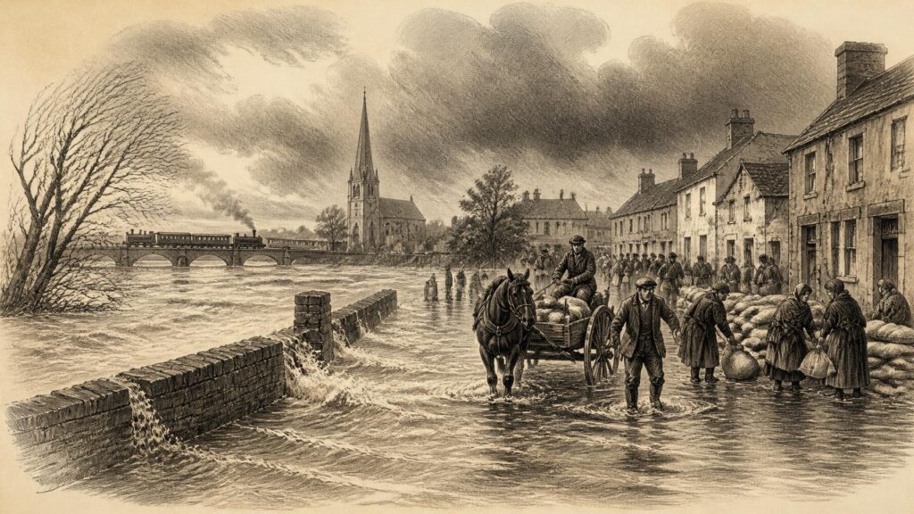
AI generated historical illustration, not a contemporary photograph.
At a Glance
Storm Chandra was not simply a day of fierce weather in Ireland, but a revealing event in the history of a wet and managed landscape. When the low-pressure system moved northwards across the island during the night of 26 January and on 27 January 2026, it encountered ground already saturated by weeks of rain, rivers close to bank-full level, and towns whose streets, drains, bridges and homes had long been shaped by the threat of flood. Its gravest effects came not from wind alone, but from accumulated water: rain falling upon a country that, in many places, could receive little more.
Storm Arrival
The storm was named by the United Kingdom Met Office on Monday, 26 January 2026, under the collaborative naming arrangements used by meteorological services in north-western Europe. Met Éireann did not treat the name as a novelty. Its public commentary described a low-pressure system expected to track northwards over Ireland from the Monday night into Tuesday, bringing heavy rain and strong winds, particularly around exposed coasts. The warning was clear that the danger could not be measured only by the rain then forecast. The land was saturated, many rivers were already approaching or exceeding bank-full level, and the added rainfall was expected to produce both local and river flooding.
The weather system formed in a wider Atlantic pattern. Met Éireann’s January climate statement recorded that, after a cold and comparatively dry beginning to the month, Atlantic low pressure dominated the latter weeks. A strong southerly-displaced jet stream directed a succession of systems towards Ireland from the south-west, while high pressure over northern and eastern Europe helped slow or stall them. Repeated frontal bands consequently moved across the island, with prolonged heavy rain concentrated especially in the south and east. Chandra rapidly deepened south of Ireland on 26 January and then moved north late that day and through 27 January.
This chronology matters. A named storm offers a convenient date and image, but it can wrongly imply a self-contained episode: wind rises, rain falls, the storm passes, and normality resumes. Chandra was instead the most visible part of a longer hydrological episode. The official record shows that the severe flooding which followed was produced by the interaction of a fast-deepening weather system with catchments, waterways and settlements already under strain. In historical terms, its story belongs as much to the preceding fortnight as to the storm itself.
January Burden
January 2026 was notably wet in large parts of Ireland. At Johnstown Castle in County Wexford, monthly rainfall reached 232.7 millimetres, or 230 per cent of the 1991–2020 long-term average. The station recorded its wettest January since 1996. Phoenix Park and Dublin Airport both experienced their wettest January since 1948, receiving 141 millimetres and 137.7 millimetres respectively. Such figures do not mean that every parish experienced the same conditions, but they establish the broad setting in which Chandra arrived: soils, drains and river systems in the south and east had absorbed repeated rainfall over an unusually persistent wet spell.
The concentration of rainfall was just as important as the monthly total. The Climate Change Advisory Council later noted that some parts of the south and east received three to four times their average rainfall between 22 and 28 January. In a speech to Seanad Éireann on 10 February, the Minister for Housing, Local Government and Heritage described the east as having received more than four times its usual weekly rainfall before the storm. The precise wording of public summaries differs, as it reflects differing areas and periods of measurement, but their common conclusion is firm: Chandra struck after exceptional antecedent rainfall, not upon dry ground.
Hydrologists use the language of antecedent conditions to describe this situation. It is a technical phrase, but one that captures an everyday reality. Once soil is waterlogged, further rain is less likely to seep downward and more likely to run across the surface or quickly enter drains, streams and rivers. Once watercourses are elevated, even rain that would otherwise be manageable can overtop banks or overwhelm local drainage. Coastal wind and high tide can compound the risk in estuaries and low-lying shore settlements. The effect is cumulative rather than spectacular at first: ditches remain full, fields hold water, gullies clog or surcharge, and the capacity for another wet day narrows.
That is why later discussion of Chandra should resist an overly simple comparison with earlier storms. Meteorological intensity, rainfall totals, catchment state, tide, river management, building location and the speed of emergency response all shape the final outcome. A storm with more dramatic gusts may cause less flooding than one that brings sustained rain at the end of a wet month. Chandra’s importance in Ireland lay substantially in this conjunction of conditions.
Rainfall Record
Documented evidence makes it possible to distinguish what was measured from what was felt. Met Éireann recorded strong winds and widespread heavy rain as Chandra tracked northwards. It also identified the rapid deepening of the system south of Ireland and the meteorological circumstances associated with the polar-front jet stream. These are observations and forecasts grounded in a national network of weather stations, radar, models and professional interpretation. They form the most reliable account of the physical event at national scale.
Yet measurements do not on their own reveal why water entered one home and not another, why one road became impassable, or why an ordinary journey turned dangerous. Those consequences depended on local topography and infrastructure. A station total can indicate an unusually wet month; it cannot fully represent the rapid rise of a small tributary, the condition of a culvert, the direction of a surface-water flow, or the vulnerability of a house built beside a river. Official warnings recognised this limitation by stressing localised as well as river flooding.
The January climate statement also provides a necessary corrective to the idea that the event was confined to a single county. Rainfall was above the long-term average in most places, though the south and east were especially affected. Rain days ranged from twenty-two at Casement Aerodrome in County Dublin to thirty at Newport in County Mayo and Valentia Observatory in County Kerry. The geographic spread of wet conditions helps explain why Chandra’s effects extended beyond the most widely reported flood locations. It was a national weather event with sharply unequal local impacts.
There is a further caution in interpreting records. The name “Storm Chandra” became a useful public shorthand, but the period of disruption did not end neatly when its central low moved away. Further unsettled weather followed. Local authorities, residents and businesses therefore experienced not merely a storm day but a prolonged emergency and recovery period. In administrative reports, the phrase “Storm Chandra and subsequent flooding” often describes this wider sequence more accurately than a narrow focus on 27 January alone.
Flooded Places
County Wexford was among the places most visibly affected. Enniscorthy, on the River Slaney, became a national symbol of the flooding. The Climate Change Advisory Council recorded that floodwaters there reached up to five feet in places, affecting an estimated twenty businesses and between thirty and forty homes. Such figures should be read as assessments made in the aftermath rather than timeless final totals, but they convey the immediate scale of damage to a town with a long and difficult relationship with flooding.
Enniscorthy’s significance did not arise solely from the distress caused in January 2026. It lay also in the town’s history of recurrent inundation and in the unfinished or delayed character of flood protection. The Advisory Council observed that an Enniscorthy Flood Relief Scheme had been allocated €55 million in 2014, that plans were publicly exhibited in 2019, and that the scheme remained stalled by planning issues while Chandra arrived. That sequence does not prove that any single engineering measure would have prevented every loss. It does, however, demonstrate how a weather event exposed the consequences of long decision-making timelines.
Elsewhere, Government statements identified serious impacts in Aughrim in County Wicklow, parts of south Dublin, Passage East in County Waterford, Graiguenamanagh in County Kilkenny, Carlow town and other communities. The list is important because it shows a pattern across distinct river basins and settlements rather than an isolated disaster. Some locations faced river flooding, some surface water, some coastal complications and some a mixture of these. What united them was the conjunction of heavy rainfall and systems already carrying too much water.
Dublin’s experience illustrated how flooding in a modern metropolitan area can become an infrastructure emergency. The Climate Change Advisory Council noted a major event on the M50, impassable roads in south Dublin and consequential disruption to bus services. It also recorded closures on the Rosslare rail line and at stations in Dublin and surrounding areas, including closures associated with flooding and severe wave overtopping. Flood-related damage to pumping infrastructure reportedly left some residents without a full water supply for as long as ten days. These effects widen the meaning of flood history: the event concerned not only water in homes and shops, but transport, communications, sanitation, access to work and the continuity of everyday public life.
Northern Effects
Storm Chandra also affected Northern Ireland, demonstrating that the weather system and its hazards disregarded the political boundary on the island. The Department for Infrastructure reported amber wind warnings for Counties Antrim, Down and Derry, with yellow rain and wind warnings across all counties on 27 January. By 4 p.m. that day, the Department had received 288 reports of road obstructions or fallen trees and branches, as well as 495 calls relating to flooding.
The Northern Ireland evidence is especially valuable because it records the practical work of public services while the event was still unfolding. Roads were closed or obstructed, and staff dealt with floodwater, debris and trees in hazardous conditions. Sandbags were deployed in Newry in anticipation of high flow on the Newry River and high tide, while flood barriers were used near Lough Neagh. These actions were precautionary and responsive: they did not eliminate danger, but they show how flooding is managed through continual decisions made on the ground.
For an all-island history, the Northern record also cautions against treating the Irish experience as a purely national story of the Republic. The same storm moved through shared weather systems, crossed overlapping river and coastal environments, and required public authorities on both sides of the border to communicate risk, manage roads and support affected communities. Administrative structures differed, but the material experience of saturated land, rising water and disrupted movement was recognisably connected.
Emergency Response
By 27 January, the National Emergency Co-ordination Group had been formally convened in the Republic. According to the subsequent Seanad debate, a Met Éireann technical briefing had already taken place on 26 January, attended by local authorities, principal response agencies, government departments, utilities and other essential stakeholders. Those present were advised about soil and river conditions and asked to monitor rivers and forecasts closely. This documented sequence challenges any claim that the flooding arrived without warning, while not diminishing the difficulty of protecting every exposed place once rain began falling on saturated catchments.
Local authorities were central to the response. They monitored water levels, issued local information, operated pumps and barriers, closed roads, distributed sandbags and co-ordinated with fire services, utilities, voluntary bodies and communities. The State’s language described councils as first responders in severe-weather emergencies. In practical terms, that role meant a broad range of tasks: keeping people away from dangerous water, helping to sustain access routes, identifying households in immediate need, and preparing the eventual clean-up even while some areas remained inundated.
Community support centres were opened in places including Aughrim and Enniscorthy. Their purpose was modest but essential: safe spaces where people could obtain information, food and hot drinks, charge devices and meet others during disruption. Such centres belong to the social history of disasters. Flooding damages property, yet it also isolates people by cutting roads, power, water and ordinary channels of contact. A warm room and a working phone can become part of emergency infrastructure.
Financial support followed. The Emergency Response Payment was made available to households directly affected in Wexford, Wicklow, Dublin, Carlow, Kilkenny, Waterford, Louth and Monaghan. Its initial stage was designed to meet immediate essential needs, while later stages could assist, subject to conditions and assessment, with essential household goods and structural repairs. For small businesses and community, voluntary and sporting organisations unable to secure flood insurance, the Government also moved to expand the Emergency Humanitarian Flooding Scheme. These measures were not full compensation for every loss; the official material expressly made that distinction. They were humanitarian interventions intended to reduce immediate hardship and help affected premises return towards usable condition.
Public Systems
Chandra revealed the dependence of modern communities on systems that are usually invisible: drainage networks, roads, bridges, railway embankments, pumping stations, electricity, telecommunications and the routines of local government. The event disrupted these interlocking systems at the same time. When floodwater closes a road, emergency access, school journeys, deliveries and work patterns are affected. When railway services stop, the geography of employment changes for a day or longer. When pumps fail or water infrastructure is damaged, flooding becomes a public-health and domestic hardship issue as well as a problem of property damage.
This is not an argument that every consequence can be removed by engineering. Rivers need room, rain cannot be legislated away, and defensive works may transfer rather than extinguish certain risks. It is instead an interpretation drawn from the event: resilience depends on the links between physical protection, maintenance, early warning, contingency planning and social support. A wall can protect a particular frontage; a clear route, an emergency hub and timely public information may protect people when water reaches elsewhere.
The response also highlighted the importance of local knowledge. National forecasts can predict a period of severe rain and wind, but councillors, residents, engineers, farmers and local-authority workers often know which lane floods first, where debris accumulates, how a river behaves near a bridge, and which households are least able to recover. Such knowledge should not be romanticised as a substitute for scientific measurement. Rather, it is one of the forms of evidence that helps turn a general warning into practical action.
Historical Context
Ireland has a long history of damaging storms and floods, though the available evidence varies greatly between centuries. Older events survive in annals, newspapers, official papers, insurance records, parish memories and oral accounts; recent ones are documented by gauges, satellite imagery, engineering surveys and digital communications. Direct numerical comparisons across those sources require care. A nineteenth-century description of a river “in furious spate” cannot simply be placed beside a twenty-first-century rainfall series, yet both can illuminate how communities understood and endured water.
The best-known Irish storm memory is the Night of the Big Wind of 6 January 1839, remembered in Irish as Oíche na Gaoithe Móire. Its cultural afterlife was immense, but it was principally remembered for wind damage and death rather than as a close equivalent to Chandra’s flood sequence. The comparison is useful only in a limited sense. Both events show how extreme weather enters public memory, but Chandra’s central historical questions are about prolonged rain, saturated catchments, floodplain settlement and the vulnerability of contemporary infrastructure.
Twentieth- and twenty-first-century Irish flood history has increasingly been shaped by the expansion of towns, changed patterns of land use, road building, drainage works, and the growth of assets located near rivers and coasts. Flood risk is therefore not merely a natural inheritance. It is produced at the meeting point of weather, geography and human choices made over long periods. The locations affected by Chandra were not all alike, but the event brought this general truth into unusually sharp focus.
It is tempting to tell such a story as one of simple official failure or simple natural inevitability. Neither is adequate. Flood management involves competing interests: the need for housing and economic development, the environmental consequences of river alteration, the cost of defences, planning and judicial processes, property rights, maintenance obligations, and uncertainty in modelling future extremes. Chandra did not settle these disputes. It made them more urgent and more visible.
Planning Questions
The condition of flood relief schemes became a prominent public concern after Chandra. In places such as Enniscorthy, Aughrim and Arklow, public discussion returned to schemes proposed, approved, planned or awaited over many years. The Office of Public Works announced €6.6 million in April 2026 for interim flood-protection measures across eight local authorities in response to the flooding. Its statement acknowledged that some of the communities affected had experienced flooding ahead of the delivery of relief schemes.
Interim measures should not be confused with permanent resolution. Sandbags, barriers, pumps, clearance work and temporary defences can buy time and lessen certain harms, but they are vulnerable to the scale and duration of an event. Permanent schemes, meanwhile, require surveys, environmental assessment, design, consultation, funding, land arrangements and statutory consent. Historical writing should recognise both truths: delay can have grave human consequences, and complex river works cannot responsibly be reduced to a single quick decision.
Chandra also revived attention to insurance. The Climate Change Advisory Council recorded that many of those affected in Enniscorthy had been unable to obtain flood insurance after previous extreme flooding, including flooding in 2015. This is a profound problem for households and businesses because repeated flood exposure changes the meaning of recovery. A first event may be framed as misfortune; recurrence can create debt, insecurity, loss of insurance and the prospect of rebuilding without confidence that the next severe rainfall will be survivable.
The question, then, was not simply whether Ireland should build more walls. It was how the country should decide where homes and businesses are placed, how existing settlements should be protected, what role rivers and floodplains require, how infrastructure can continue during emergencies, and how the costs of repeated flooding should be shared. These are historical questions because they arise from past development decisions, but they are also immediate civic questions because their answers will shape the damage caused by future storms.
Climate Evidence
Climate change entered public discussion almost at once, as it should when a severe weather event occurs. However, the distinction between evidence and assertion is crucial. It would be unsound to claim that climate change “caused” Storm Chandra in the simple sense that a single storm can be assigned to one factor. Weather systems arise through many interacting atmospheric processes. The documented evidence instead supports a more careful conclusion about rainfall conditions and changing risk.
The Climate Change Advisory Council referred to a rapid attribution study which found that the one-day rainfall directly associated with Chandra was not, by itself, particularly remarkable. It concluded, however, that the seven-day rainfall accumulation was nine per cent greater than it would have been in a climate 1.3 degrees Celsius cooler than pre-industrial conditions. It further assessed that a seven-day accumulation of this kind had become nearly three times as likely, shifting from an estimated one-in-150-year event to one-in-60-year event. This is evidence about altered probability and intensity, not a claim that every element of the disaster has one cause.
That distinction leads to a sober historical interpretation. Climate change may be increasing the background likelihood or severity of damaging rainfall episodes, while the actual social disaster still depends on existing exposure: saturated catchments, constrained waterways, vulnerable housing, stalled defences, inadequate drainage or disrupted infrastructure. Chandra therefore belongs simultaneously to climate history and to the history of planning, public works and local inequality.
The Advisory Council’s account used the storm to underline the urgency of adaptation. Adaptation means preparing communities and systems for conditions that cannot now be assumed to resemble the past. In Ireland this includes better flood-risk information, maintenance, emergency planning, protection of critical infrastructure, and decisions about where development can safely take place. These measures do not guarantee safety. They seek to reduce avoidable harm in an island where water has always shaped settlement and may do so more dangerously in the future.
Memory Evidence
In the immediate aftermath, the language of devastation, shock and exhaustion appeared in official statements, news reporting and local testimony. Such expressions are important evidence of human experience, but historians should distinguish them from quantified records. A resident describing a home, stock or livelihood as destroyed is conveying a truth about personal loss; an engineer’s damage assessment describes a different, administrative form of truth. Neither alone exhausts the event.
There is not yet a mature body of folklore attached to Storm Chandra comparable to the stories surrounding older Irish weather disasters. It would be misleading to manufacture one. What exists instead is the beginning of collective memory: photographs of inundated streets, reports of neighbours helping neighbours, accounts of sandbagging and clean-up, and the repeated recollection of earlier floods by residents of places affected more than once. Over time, some of these memories may become local tradition. At present they remain recent testimony, shaped by grief, anger, resilience and debate about responsibility.
The public archive is already substantial. It includes Met Éireann forecasts and climate data; local-authority records; ministerial announcements; Oireachtas proceedings; emergency-service and infrastructure updates; television and newspaper reports; photographs; and the administrative paper trail of relief schemes and assistance payments. Future historians will have more material for Chandra than for many earlier Irish storms. Their task will be to read it critically, recognising that official records privilege actions and statistics, while local testimony more readily conveys fear, disruption and the slow work of recovery.
Lasting Lessons
Storm Chandra’s historical significance lies in what it made plain. Ireland’s flood risk cannot be understood by looking at a storm in isolation. The January 2026 flooding resulted from a chain of conditions: persistent rain, waterlogged soil, elevated rivers, a deepening low-pressure system, exposed communities and interconnected infrastructure. The storm was the immediate trigger, but the disaster was cumulative.
It also showed that preparedness has several meanings. Forecasting and warnings matter; so do flood defences, maintained drains, workable roads, reliable pumps, shelters, financial supports and local knowledge. Emergency response can lessen suffering, but recovery is unequal. A household with insurance, savings and alternative accommodation faces a different future from one without them. A town awaiting a flood-relief scheme experiences each fresh warning in the shadow of previous damage.
For Emerald Archives, Chandra should be remembered neither as a sensational “weather bomb” nor as an abstract illustration of climate statistics. It was an Irish flood event of January 2026, documented in real time and felt unevenly across the island. Its record joins an older history in which Irish communities have lived beside rivers, coasts and wetlands, attempting to gain the benefits of those places while limiting their dangers. The essential lesson is not that water can be conquered. It is that the consequences of water are shaped, repeatedly and collectively, by the choices made before the next storm arrives.
Chandra is most striking not as an isolated storm, but as a test of how accumulated rainfall, delayed flood defences and interdependent infrastructure can turn familiar watercourses into a prolonged social emergency. The article’s contrast between national measurements and local knowledge is revealing: gauges establish wider hydrological burden, while residents and frontline workers understand culverts, access routes and vulnerable households. Its account of Enniscorthy also raises difficult questions about planning timescales, without assuming that any scheme offers complete protection. How should Ireland balance engineered flood relief, land-use decisions, maintenance, community knowledge and cross-border co-ordination when preparing for similarly saturated conditions?