

Shannon Currents
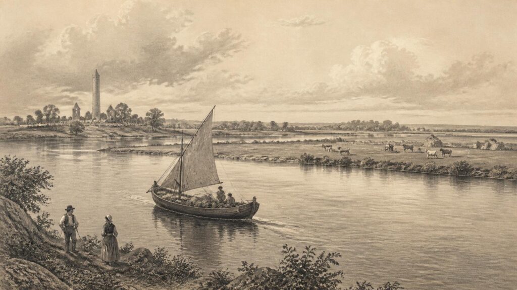
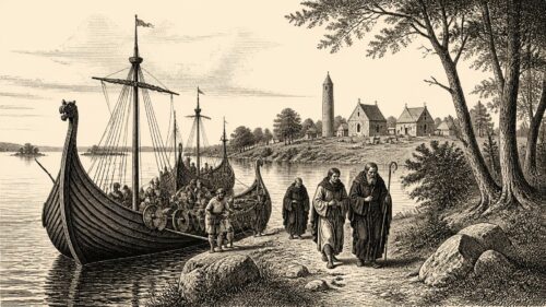
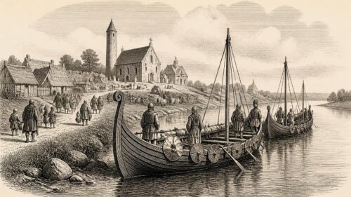
AI generated historical illustration, not a contemporary photograph.
At a Glance
The Shannon is not merely a river running through Ireland: it is a changing historical landscape, a means of movement and exchange, a perceived frontier, a source of food and work, and an object repeatedly reshaped by political power and engineering. Its history cannot be reduced to a tale of an ancient natural boundary. The waterway connected as often as it divided, and every generation that used it altered the meanings attached to it.
River Identity
The name Shannon is commonly used as if it described one simple geographical object, but historically it has covered a complex system of river, lakes, tributaries, marshes, islands, estuary, settlements and navigable works. In Irish the river is An tSionainn. The Placenames Database of Ireland records that form for the river and also preserves the Irish name Sionainn for the town of Shannon in County Clare. The distinction matters. The modern town, airport and industrial landscape near the estuary belong to recent history; the river system is immeasurably older, while the cultural names applied to it have accumulated over centuries.
The Shannon rises in the uplands of County Cavan and flows generally southwards through Lough Allen, Lough Ree and Lough Derg before reaching the wide tidal estuary below Limerick and entering the Atlantic between Counties Clare and Kerry. Its main channel is inseparable from its lakes and floodplains. In the middle reaches, seasonal water spreads across low-lying meadows known as callows. Further south, the estuary creates a different landscape again: tidal, saline in part, exposed to coastal weather and long capable of receiving sea-going vessels. A history of “the Shannon” must therefore move between local places rather than imagine a uniform riverbank.
Modern descriptions often call it Ireland’s longest river, and the managed Shannon Navigation is now presented as a route of approximately 238 kilometres. Such measurements are useful for administration and travel, but they are not a historical explanation. Earlier inhabitants encountered shallows, rapids, fords, lakes, fisheries, islands and seasonal floods. Their experience depended on season, vessel, social position and the purpose of a journey. A merchant carrying goods, a monastic community settled beside a crossing, a fisherman tending a weir and a farmer waiting for floodwater to fall did not inhabit the same Shannon, even when they lived within a few miles of one another.
That variety explains why the river has such a large place in Irish memory. It was long treated as the principal waterway of the island, but its importance was never only geographical. It helped organise routes between north and south, inland and coast, Connacht and the eastern or southern provinces. It brought distant people within reach of one another. At particular moments it also became a political line, especially when armies, governments or mapmakers wished to simplify Ireland into opposing sides. The historical record, however, reveals a lived corridor full of crossings, exchanges and contested access.
Named Waters
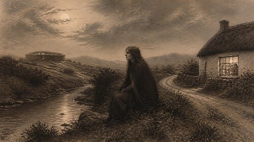
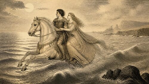
The Irish name Sionainn belongs to a rich body of medieval and later place-lore. The best-known explanation is a story concerning Sionann, a woman associated with the well of wisdom, often identified with Connla’s Well. In versions of the tradition, she seeks knowledge from the sacred hazels and the salmon that feed upon them; the waters rise, overwhelm her and run to the sea as the river that bears her name. The story is powerful, but it should not be mistaken for a literal account of the river’s origin or for direct evidence of prehistoric religious practice.
Folklore and literary tradition nevertheless matter historically. They show how people understood the relationship between knowledge, danger, water and landscape. The river in this account is not passive scenery. It is animate, overwhelming and morally charged. Sionann’s fate makes the flow of water a consequence of transgression, desire or dangerous curiosity, depending on the telling. Such themes are widespread in Irish medieval literature, where lakes, rivers and springs receive origin legends that place human or supernatural action within the land itself.
There is no secure basis for claiming that the Sionann narrative preserves an unchanged belief from a remote prehistoric age. Medieval texts were composed, copied and reshaped in literate Christian settings; they may contain older materials, but their surviving forms belong to the periods in which scribes and learned families recorded them. The responsible historical approach is to call the account tradition or folklore, not archaeology. Its value lies in the evidence it provides about remembered landscape and literary imagination, rather than in any claim to prove a specific ancient cult.
The name also travelled. Rivers acquire social identities through the towns, parishes and communities that use them, but the prestige of the Shannon made it available to modern institutions as well. Shannon Airport, Shannon town, the Shannon Scheme and the Shannon Navigation all draw authority from the same name while referring to very different enterprises. This is a reminder that a river can be a physical feature and a cultural resource. The use of “Shannon” in modern state and commercial language has helped turn a regional waterway into a national emblem.
Early Landscapes
The Shannon basin has been inhabited and worked for millennia, although the evidence is uneven and should not be forced into a continuous narrative. Archaeological sites occur throughout the wider catchment: settlement traces, ceremonial monuments, burial places, field systems, trackways and finds recovered from wet ground or water. Yet a river corridor is difficult archaeological terrain. Repeated flooding, drainage, peat growth, erosion and modern construction can obscure or destroy sites; equally, wetlands and waterlogged deposits can preserve organic materials that would vanish on dry land.
It is tempting to describe the Shannon as an ancient highway used in the same way from the first settlement of Ireland onwards. That is an interpretation, not a fact demonstrated for every period. Boats were clearly important in prehistoric and later Ireland, and waterways offered routes through heavily wooded or difficult terrain. But the surviving evidence does not permit a precise map of early traffic along every reach of the river. The National Monuments Service rightly treats archaeological knowledge as a continually revised inventory based on survey, excavation, reports and new discoveries. Absence from the record is not proof that a place lacked human activity.
What can be said more confidently is that the river’s margins offered resources attractive to communities over very long periods. Fish, wildfowl, reeds, timber, grazing, transport and fertile alluvial soils could all be obtained near water. In the callows, annual flooding deposited silt and shaped a distinctive pattern of grassland use. The seasonal rhythm of flood and recession was not simply an obstacle. It could support haymaking and grazing, provided communities adjusted work to water levels. This was an environmental relationship, but also a social one: rights of access, customary practices and the timing of labour mattered as much as the physical meadow.
The Shannon’s lakes and islands also made particular places conspicuous. A shoreline, island or ford could become a meeting point, a defensive site, a ritual focus or a place where routes converged. Such locations did not possess one permanent function. Their significance changed with political conditions and local settlement. The broad historical lesson is that the river did not create society by itself. Rather, people repeatedly selected, named, occupied and transformed parts of a watery landscape whose opportunities and dangers were unusually visible.
Monastic Shores
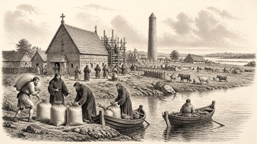
From the early medieval period, the Shannon became closely associated with monasteries. This association is not accidental. Religious communities needed land, labour, communications and patrons. A site on or near a river could be economically productive and accessible to travellers, while an island or enclosed peninsula might also offer symbolic separation from the ordinary world. The result was not a wilderness church detached from society, but a network of settlements linked to territories, dynasties and routes.
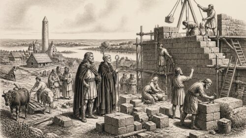
Clonmacnoise, on the eastern bank of the Shannon in the midlands, is the most celebrated example. Heritage Ireland dates its foundation by St Ciarán to the sixth century and identifies surviving churches, round towers, high crosses, grave slabs and a cathedral complex. Its historical importance derived in part from location. Positioned near a major crossing and within reach of the river system, it lay amid competing political zones rather than outside them. This helped make it a centre of learning, burial, craftsmanship and ecclesiastical authority, but also made it vulnerable to attack.
The ruins now encourage a quiet, isolated image of monastic Ireland. That image is misleading if taken too far. Clonmacnoise was integrated into the movement of people, manuscripts, goods and political claims. The famous Cross of the Scriptures, the churches and the clustered memorials speak of patronage and status as well as devotion. The monastic community existed beside a route that connected regions and carried threats. The river gave access to visitors and supporters, but access could also be exploited by raiders and rival powers.
Other religious sites demonstrate the same pattern. Inis Cealtra, or Holy Island, on Lough Derg, and Scattery Island in the estuary each occupied water-defined settings. Their built remains show that the Shannon’s religious geography stretched from lake to sea. These communities were never identical. Their local economies, patrons and relationships with nearby populations differed. Yet together they reveal a recurrent early medieval choice: water could offer communication, food, prestige and a degree of defensibility, without withdrawing a community from the wider political world.
The documentary record must be handled carefully. Annals often report spectacular events—burnings, deaths, raids and successions—rather than ordinary seasonal labour. They illuminate moments of danger but cannot tell the whole story of river life. Archaeology, architecture and landscape evidence therefore complement the texts. The surviving record supports the view that monasteries on the Shannon were important centres connected by water; it does not support the romantic fiction that the riverbank was a uniformly peaceful sacred realm before outside intruders arrived.
Viking Passage
The arrival of Scandinavian raiders and settlers made the strategic value of the Shannon painfully clear. Irish annals record Viking activity on inland waters during the ninth century, while later archaeological and historical research has increasingly emphasised that rivers and lakes were not barriers to maritime raiders. A fleet entering the Shannon estuary could gain access deep into the island. The waterway connected the Atlantic world to monastic centres, political territories and rich pastoral districts inland.
Accounts of Viking activity on the Shannon should not be flattened into a simple story of foreign destruction. Raiding was real, and monasteries were conspicuous targets because they held wealth, food, livestock, skilled people and political importance. A University College Cork study of the sources notes Viking presence on the Shannon in 837 and attacks on Inis Cealtra and neighbouring churches. The same documentary tradition records raids on Clonmacnoise. Such episodes demonstrate violence, captivity and disruption. They also demonstrate that the raiders understood how to use inland waters strategically.
Yet Vikings did not remain only transient raiders. Limerick developed as a major Hiberno-Norse settlement at the lower Shannon. The location around King’s Island, between the Shannon and Abbey rivers, provided a defensible position with access to the estuary and inland routeways. The exact character and earliest location of the settlement remain subjects of archaeological caution: physical evidence is more elusive than at Dublin or Waterford. Historical sources, however, make clear that Limerick was a significant centre by the tenth century and was involved in rivalries among Scandinavian and Irish powers.
The Shannon therefore served exchange as well as attack. Ships and smaller craft carried people, animals, foodstuffs, slaves, metals and imported goods through the river system and its connections to the Irish Sea and Atlantic coasts. Intermarriage, alliance, conflict and commercial dealings blurred any neat division between “Irish” and “Viking”. Hiberno-Norse Limerick was not an isolated foreign enclave facing a wholly separate native population. It was a node in a changing regional society where language, political allegiance and material culture could be mixed.
The river’s role in Viking history also complicates the older image of the Shannon as a defensive western boundary. In this period it was an avenue of penetration. A fleet could exploit it precisely because it crossed territories that land-based travel made harder to reach. The raids left deep marks on monastic memory, but they should be understood within a longer process in which waterways facilitated settlement and trade as well as warfare. The Shannon was dangerous because it connected distant places.
Medieval Frontiers
Medieval writers and later historians often treated the Shannon as a line between regions, especially between Connacht to the west and territories to the east. Such language has some geographical basis. Major rivers can channel movement towards bridges, ferries and fords; in military conditions, crossings become sites of surveillance and conflict. But a river is not a wall. It may restrict movement at certain points while drawing traffic towards others. The Shannon functioned as a frontier only when political and military circumstances made crossing a matter of power.
In the centuries after the Anglo-Norman invasion of 1169, western Ireland became especially significant to this idea of frontier. Norman lordships advanced rapidly in some regions, founded towns and castles, and established claims over land and revenues. Their influence was not uniform, and Gaelic dynasties remained powerful. Connacht, lying beyond or across much of the Shannon system, acquired an imagined position as a western sphere of refuge, resistance and royal ambition. That description contains a truth, but it risks making geography determine politics.
Crossings were the key. Athlone, situated at a major Shannon crossing, grew in importance because it linked routes between the eastern midlands and Connacht. Control of bridges, riverbanks and nearby settlements could shape campaigns and taxation. The strategic value of Athlone did not arise merely because the river happened to flow there; it came from the concentration of roads, people, markets and military interests around the crossing. Similar logic operated at smaller fords and ferry points throughout the system.
Clonmacnoise again illustrates the problem with rigid boundaries. Although the monastery lay beside a river later imagined as a divide, its influence and patronage extended across political regions. It was a meeting ground in a mobile world. Medieval kings, ecclesiastics and learned families could all use such places to assert legitimacy. The Shannon carried not only armies but messages, manuscripts, clerics and legal or ceremonial claims. To call it a boundary without calling it a route is to describe only half its historical role.
The estuary presented a different medieval geography. Limerick’s riverine location allowed it to participate in maritime trade and regional politics while also controlling a point of access inland. Its later medieval development under English and Anglo-Norman influence did not erase Gaelic power in the surrounding regions. The lower Shannon remained a zone of negotiation, conflict and commerce. In this sense, the medieval Shannon was best understood not as a fixed line on a map but as a chain of local frontiers, crossing places and connected markets.
Estuary Power
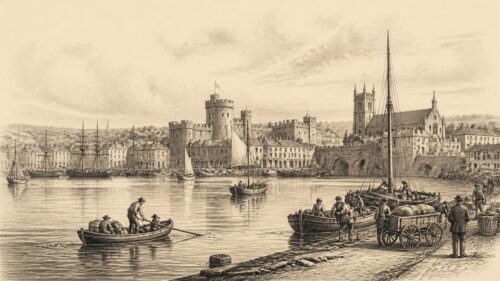
At Limerick, the Shannon became a tidal urban river. The city’s history cannot be separated from this fact. King’s Island and the adjacent channels gave the settlement advantages of defence and communication, while the estuary permitted contact with seaborne trade. Limerick’s position made it commercially attractive but also militarily exposed. Whoever controlled the approaches and crossings could influence a substantial part of the south-west.
Early modern conflict repeatedly confirmed that importance. During the Williamite War, Limerick’s defences and river position helped make the city a decisive objective. The sieges of 1690 and 1691 were not simply events in a city beside water; the Shannon’s channels, bridges, crossings and surrounding terrain formed part of the military problem. The Treaty of Limerick, concluded in 1691, has acquired a large place in Irish political memory, though its later symbolic meanings should not obscure the immediate military setting from which it emerged.
The lower river also supported fisheries, quays, shipping and the movement of agricultural produce. Salmon in particular was both food and commodity, but access to fish was never socially neutral. Fisheries involved rights, weirs, leases and disputes. The nineteenth-century legislation governing navigation specifically recognised existing fishery rights and made provision for claims and compensation where improvement works affected them. That legal detail is revealing: the river was already occupied by overlapping interests before engineers or commissioners attempted to make it serve a more orderly national economy.
The estuary’s openness to the sea made it a gateway, but not an effortless one. Tides, channels, mudbanks, weather and changing ship design all affected navigation. Limerick’s commercial fortunes were thus tied to wider economic patterns as well as local infrastructure. The ability of vessels to reach a port, the availability of rail links, competition from other harbours and shifts in trade could matter as much as the agricultural productivity of the hinterland. A river port depended on a living relationship between inland producers, maritime routes and public works.
Warrior Crossings
The Shannon became an overt military line in several later conflicts, but perhaps most famously during the Cromwellian conquest of Ireland. The phrase “To Hell or to Connacht”, associated with the transplantation of Irish Catholic landholders after the conquest, has encouraged a popular picture of the river as the edge of an enclosed western exile. The phrase has a complicated documentary history and should not be treated as a universally issued literal command. Nonetheless, the policy of land confiscation and transplantation made Connacht and the country beyond the Shannon central to the political geography of defeat.
In this context, the river acquired a grim symbolic power. It could be represented as a separating line between lands to be retained by Protestant settlers and lands allotted, under severe constraint, to displaced Catholics. But actual movement and settlement were more complicated than the slogan suggests. Families, soldiers, merchants, clergy and labourers continued to cross waterways; exemptions, evasion, local arrangements and changing policies qualified the scheme. Historical shorthand should not conceal the human variety beneath it.
Athlone again became crucial during the Williamite War. Its bridge and fortifications made it one of the principal crossing points in the struggle between Williamite and Jacobite forces. The capture of the town in 1691 opened a route towards the west and formed part of the campaign that culminated at Limerick. Here the river was unmistakably a military obstacle, but it was not impassable. Engineering, artillery, local knowledge and control of bridges could turn a water barrier into a route of invasion.
In the Napoleonic era, fears of French invasion prompted defensive thinking along the river. Shannonbridge’s notable multi-arched bridge belongs to this wider strategic landscape. Its construction was linked to the perceived need for dependable movement and defence across the central waterway. The fear of invasion did not become invasion, but it still shaped infrastructure. This is a useful reminder that historical landscapes are altered not only by events that happen, but by contingencies that people believed might happen.
Military episodes can dominate narrative because they leave dramatic records, yet they were interruptions in a river life sustained by ordinary crossings. Ferrymen, boatmen, market-goers, tenants, fishermen and seasonal workers knew the Shannon through practical routines. A bridge might serve an army in one year and cattle drovers, traders and parishioners for generations. The same physical crossing could therefore be a strategic asset, a commercial convenience and a local social space.
Navigation Ambitions
By the eighteenth century, governments and improvers increasingly imagined the Shannon as an economic system that could be engineered into greater usefulness. Their language stressed commerce, agriculture, prosperity and national improvement. Rapids, shallows and inconsistent channels were treated as defects to be corrected through locks, canals, dredging, weirs and embankments. This was not the beginning of navigation on the river; people had travelled and traded on it for centuries. It was the beginning of a more systematic attempt to regulate the river for larger-scale commercial movement.
Work began in earnest in the 1750s under the Commissioners of Inland Navigation. Waterways Ireland’s historical archive records the employment of engineers including Thomas Omer and William Ockenden, and the construction of lateral canals, locks and lockhouses between Lough Derg and Lough Ree. The lower river posed persistent difficulties around Killaloe, Doonass and Limerick. Engineering schemes succeeded in some places, failed in others and were repeatedly transferred between companies and public authorities. Improvement was not a single triumphant project but a long sequence of experiments, repairs, financial pressures and institutional changes.
The Limerick Navigation opened in 1799 after years of effort. Meanwhile, the middle and upper reaches were tied into wider canal ambitions, especially the projected connection between Dublin and the Shannon. Steamers later carried goods and passengers, and nineteenth-century maps advertised the river’s lakes, towns and scenery to travellers. The National Library of Ireland preserves an 1830 traveller’s map based on a government survey by John Grantham, evidence that the Shannon was being viewed not only as a working waterway but as a comprehensible route for visitors and investors.
These works transformed local conditions. Locks and canals standardised movement; dredging and channel works altered banks and currents; tolls and regulations brought river use within a formal administrative framework. Yet the old landscape did not vanish. Fishermen, landholders and local communities had rights and expectations that could conflict with navigational schemes. Nor did improved works guarantee commercial success. River transport depended on markets, costs, competition and connections beyond the river itself.
The Shannon Navigation Act of 1839 is especially important because it declared the river a public navigable river and vested care of the waterway and associated works in commissioners. It also set out powers relating to land, works, tolls, regulations and obstructions. The Act represents a nineteenth-century confidence that a large natural system could be rendered legible and productive through law and engineering. At the same time, its detailed provisions reveal the difficulty of that ambition. A river was not empty state property; it was a terrain of fisheries, private lands, existing structures and competing claims.
Commercial Decline
The nineteenth-century navigation works were substantial, but they reached maturity just as railways transformed transport. The railway between Dublin and Limerick, opened in 1849, reduced the relative advantage of moving freight and passengers through the Shannon system. Rail could offer speed, regularity and connections not dependent on water level, weather or the limitations of a long inland route. The change was not instantaneous, and river traffic continued, but the balance of transport increasingly shifted.
This decline was not evidence that the navigation had been pointless. For a period, the improved waterway carried significant quantities of turf, slate, agricultural produce and other goods. It linked local economies to markets and supported specialised skills among boatmen, lock keepers and workers. But transport technologies create winners and losers. Infrastructure designed for one commercial world may become marginal in another. By the mid twentieth century, commercial traffic on the Shannon had fallen dramatically, and the old freight system was no longer central to national economic life.
Decline did not mean abandonment. The river retained importance for fishing, local movement, drainage, water management and recreation. Its locks, quays, bridges and canals became inherited infrastructure whose purposes changed. In some places, buildings and structures that had once served commercial navigation later acquired heritage value. Their survival is therefore historical evidence in its own right: a reminder of an era when a boat moving through a lock could connect a rural landing place to the wider economy.
The shift from working waterway to leisure and heritage route should be viewed critically as well as appreciatively. Tourism can preserve structures, support local businesses and introduce people to river history. It can also smooth away harder stories of labour, land acquisition, maintenance and commercial failure. A lock is picturesque, but it was also a regulated workplace. A canal is scenic, but it may have required the diversion of water, the taking of land and decades of repair. Historical understanding is strongest when beauty and utility are allowed to coexist.
Electric Nation
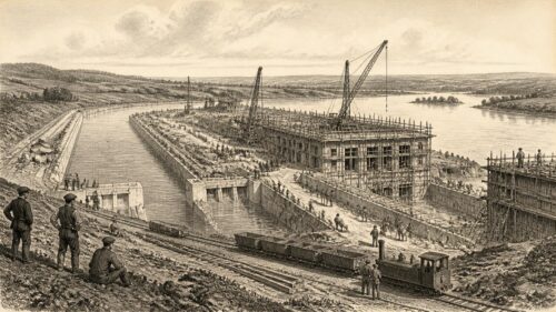
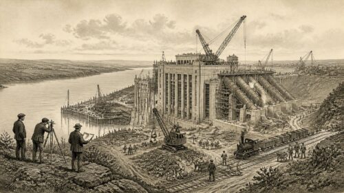
The most dramatic twentieth-century remaking of the Shannon came with the Shannon Scheme at Ardnacrusha. Conceived in the early years of the Irish Free State, the project harnessed the river to generate hydroelectricity on an unprecedented national scale. It was more than a power station. It involved a weir, headrace canal, penstocks, generating station, tailrace and a new national grid. In political imagination, it became proof that the new state could undertake an ambitious modern project using its own natural resources.
ESB Archives records that work began in 1925, that the project was completed in 1929 and that it was centred at Ardnacrusha in County Clare. The Electricity Supply Board was established in 1927, while the scheme was still under construction. The scale was striking: thousands of Irish and German workers were employed, Siemens played a major role, and the project’s cost represented an extraordinary commitment for a young state. It was simultaneously an engineering enterprise, a labour settlement, an international collaboration and a declaration of state ambition.
The scheme did not simply place turbines in the existing river. Water was diverted from the Shannon through a purpose-built canal after passing Parteen Weir, then released downstream of the power station. This altered the relationship between the old channel, navigation and fisheries. A navigation lock was included, but earlier routes and local water conditions were changed. The project’s history therefore includes gains in electricity generation alongside environmental and social consequences. It would be misleading to celebrate modernisation without acknowledging that the river was materially reconfigured.
For contemporaries, Ardnacrusha represented a new relationship between nation and landscape. Electricity promised light, domestic convenience, industrial capacity and rural improvement. The project offered a visible alternative to the image of an economically weak and technologically dependent state. Its architecture and machinery also made modernity tangible: concrete, steel, turbines, transmission lines and controlled water embodied a confidence that natural force could be organised for public purpose.
That confidence has to be historicised. The project succeeded as a landmark of electrification, but it belonged to a wider era in which large infrastructure was often presented as an uncomplicated public good. Today, historians can recognise the achievement while asking who bore the costs, how ecological systems were affected and how heritage was treated during construction. Research on medieval buildings affected by the scheme has shown that the project also intersected with emerging ideas of national heritage. The Shannon at Ardnacrusha was thus made to carry two versions of Irish modernity: technological progress and the protection, or reconstruction, of a valued past.
Living Floodplains
The Shannon’s environmental history is inseparable from its human history. The middle Shannon callows are floodplain grasslands shaped by seasonal inundation and by long-established farming practices. Their historical importance lies partly in that combination. Floodwater deposits nutrients; farmers cut hay and graze land in patterns adapted to the river; plants, insects and birds depend upon the resulting mosaic. The callows are not untouched wilderness, nor are they merely improved farmland. They are cultural landscapes produced through recurring negotiation with water.
The National Parks and Wildlife Service identifies the Middle Shannon Callows as a Special Protection Area extending across parts of Galway, Offaly, Tipperary, Westmeath and Roscommon. Its qualifying interests include species such as whooper swan, corncrake, lapwing, golden plover, black-tailed godwit and black-headed gull, alongside wetland and waterbirds generally. This designation is modern, but it recognises an older reality: the river’s seasonal processes have created habitats that are historically unusual and ecologically valuable.
There is no simple opposition between conservation and traditional use. Research supported by the National Parks and Wildlife Service notes that species-rich meadow communities in the callows rely on annual mowing to sustain their diversity. That does not mean every past agricultural practice was harmless, or that all present land use is compatible with conservation. It means that the historical landscape cannot be protected by pretending that people were absent from it. Labour, grazing, haymaking and flood management are part of the ecological story.
Flooding has also shaped settlement and memory. It can be destructive, especially where homes, roads and farms occupy vulnerable land, but it has long been an expected feature of the river regime. Modern efforts to drain, embank, regulate or develop floodplains often seek to reduce risk. They may also transfer risks elsewhere or diminish habitats created by periodic water. The Shannon’s history offers no easy prescription for contemporary policy, but it does provide a warning against treating floodwater as an entirely abnormal intrusion into a landscape that has always been defined by it.
Heritage Futures
Since 1999, responsibility for the Shannon Navigation has rested with Waterways Ireland, one of the North/South implementation bodies established under the British-Irish Agreement. The arrangement is historically significant in itself. The Shannon is entirely within the Republic of Ireland, but its administration within a cross-border waterways body reflects the practical and historical interconnection of Ireland’s inland navigation systems. It also marks the change from a primarily commercial waterway to one managed substantially for navigation, amenity, heritage and environmental responsibility.
Modern management depends on structures inherited from earlier centuries: gates, sluices, locks, weirs, bridges, embankments and cuts. Waterways Ireland’s present water-level information makes clear that levels are managed through outlets at the major lakes and through structures at places including Jamestown, Roosky, Tarmonbarry, Meelick and the New Cut. Such management is a continuation of the long effort to make the river predictable. Yet predictability is always partial. Rainfall, catchment conditions, lake storage, tides and climate all exceed the control of any single institution.
Historical preservation along the Shannon must therefore include more than monumental sites. Clonmacnoise and Ardnacrusha are rightly recognised as major places, but lock houses, quays, ferry locations, fishing stations, vernacular boats, flood meadows and local oral traditions also record human relationships with the waterway. Some evidence is documentary, some archaeological, some architectural and some held in family or community memory. These forms of evidence do not carry identical authority. Oral testimony may preserve experiences absent from official records, while requiring careful corroboration where it makes precise factual claims.
Folklore retains a place in this future, provided it is named honestly. The story of Sionann is not a survey report, and a tale of hidden treasure beneath a reach of river is not proof of buried wealth. Yet such stories are evidence of attachment. They show that the Shannon has remained a place where people locate danger, knowledge, loss, hope and imagination. A historical article should neither dismiss that material nor turn it into false fact. The task is to recognise the different kinds of truth a river can carry.
The Shannon’s enduring significance comes from this plurality. It is at once a drainage basin and a remembered world; a public navigation and a collection of local waters; a source of national symbolism and a lived environment shaped by individual communities. Its currents have carried monks, raiders, traders, armies, engineers, workers, fishers and visitors. The evidence rarely supports a simple story of progress or decline. What it supports is a history of continual remaking, in which Ireland’s largest river has never ceased to be both a route through the island and a force that makes the island’s regions distinct.
The article presents the Shannon as both a lived ecological system and a political instrument, rather than a fixed natural boundary. Its callows sustained seasonal labour, while monasteries, Viking fleets, medieval crossings and later engineering projects turned the waterway into a route for influence, trade and conflict. This layered history suggests that environmental change and human power cannot easily be separated: navigation works and hydroelectric development altered livelihoods as well as movement. How might comparing upper-river, callow and estuary communities deepen understanding of who benefited or lost when national schemes remade the Shannon across different historical periods and social positions?