Derryvree Marsh31894 BCE
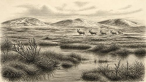
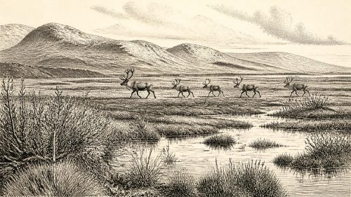
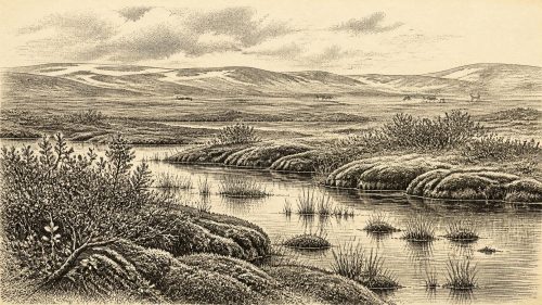
Around 31,894 BCE, Ireland lay within the unstable Late Pleistocene environment of Marine Isotope Stage 3. Derryvree, County Fermanagh, preserves a marshy, treeless tundra deposit between older and later glacier tills, indicating a temporary ice-free interval. Mosses, grasses, sedges, juniper, herbs and insects supported productive wetland ecosystems despite severe cold and seasonal freezing. Elsewhere, cave remains show that mammoths, giant deer, reindeer, bears, hyaenas and other mammals occupied Ireland during the broader period, though not necessarily simultaneously. Ice-sheet extent, coastlines and migration routes remain uncertain. No secure evidence demonstrates human settlement; possible butchery marks suggest only a tentative, brief visit.
Dateline
Modern calendar-year precision is not available for Ireland in 31,894 BCE. The date is a useful point on a modern timeline, not an event recorded by people living then. In archaeological terms it falls in the Late Pleistocene, within Marine Isotope Stage 3 and the Middle Midlandian part of the last cold stage in Irish terminology. The most responsible picture is therefore regional and approximate: calibrated ranges, fossil assemblages, pollen, insect remains, sediments and the evidence of advancing ice illuminate conditions over centuries or millennia, not one particular year.
The closest unusually informative Irish sequence is at Derryvree, near Maguiresbridge in County Fermanagh. Roadworks exposed organic silts and fine sands sealed between two thick till sheets in a drumlin. A conventional radiocarbon determination of 30,500 BP from the deposit has been recalibrated in later discussion to a broad interval of roughly 36,900–31,700 calibrated years BP. Converted approximately from the 1950 ‘present’ used in radiocarbon dating, that span includes 31,894 BCE. It does not prove that every layer formed exactly in that numbered year; it does make Derryvree the best local archive for reconstructing Ireland at about this time.
A Wetland Between Ice Advances
The Derryvree sediments show that this part of Fermanagh was, for a time, free of overriding glacier ice. They also show that the interval lay between glacial episodes: older till beneath the organic deposit records an earlier advance, while younger till above it records ice that later crossed and incorporated the wetland. This is an important corrective to any simple image of an Ireland either wholly frozen or wholly open. The island’s glacial history was uneven, with local ice, ice-free ground, changing margins and environments that could be buried or destroyed by subsequent ice movement.
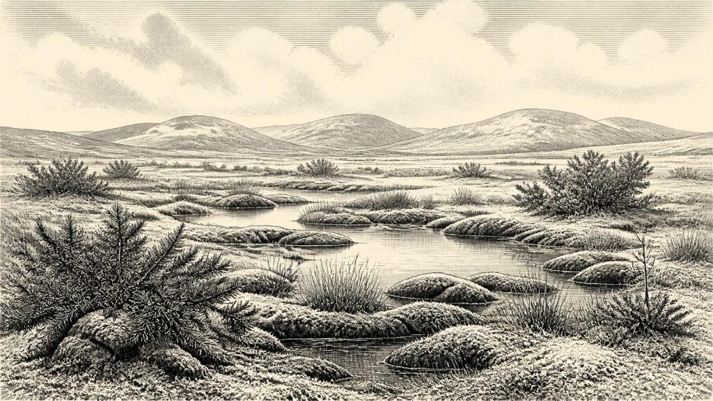
The deposit has been interpreted as a treeless muskeg or marshy tundra, with pools, waterlogged ground and abundant mosses rather than woodland. Pollen and plant remains indicate grasses, sedges, juniper and other herbs; insect evidence is likewise consistent with cold, open, plant-rich wetland conditions. This was no modern bog, forest or farmed landscape. Long winters, short growing seasons and periglacial processes—repeated freezing and thawing of the ground—would have structured the year. Yet it was biologically productive enough to sustain vegetation, invertebrates and grazing animals. Small pools and wet hollows preserved a record that most exposed ground did not.
Animals in a Changing Country
Fossil caves, especially Castlepook Cave near Doneraile in County Cork, provide the principal evidence for the larger animals of Ice Age Ireland. Radiocarbon dates on individual bones demonstrate that a varied mammal fauna occurred on the island between at least about 45,000 and 20,000 years ago. At Castlepook, remains include woolly mammoth, giant deer, reindeer, brown bear and spotted hyaena; later deposits also include wolf, Arctic fox and lemmings. The list gives a vivid impression of an open, cold-adapted world very different from the present Irish fauna.
Care is essential, however. A cave bone assemblage is not a census taken on a single day, season or even century. Castlepook accumulated remains over a long period, and water disturbance has mixed or obscured parts of the deposits. Hyaenas may themselves have carried some bones into the cave. Individual dated animals therefore demonstrate that species were present in Ireland within particular date ranges; they do not establish that mammoths, giant deer, reindeer and hyaenas all stood together outside the cave in 31,894 BCE. The strongest conclusion is that suitable open habitats and food webs existed in parts of Ireland during this broad phase.
At Derryvree, the evidence points to a colder wetland habitat rather than a mammoth-steppe scene copied wholesale from continental Europe. At Castlepook, several hundred kilometres to the south-west, caves lay within a different limestone landscape and drew in remains by natural and animal processes. Together, the sites reveal regional variation. Ireland was not environmentally uniform, and the evidence does not warrant assigning one exact temperature, coastline or vegetation map to the modern calendar year.
Ice, Sea and Uncertain Boundaries
31,894 BCE also belongs to a critical, still debated phase in the growth of the British–Irish Ice Sheet. Recent large-scale reconstructions begin at 31,000 years ago because earlier constraints are sparse. They model accumulating ice in Northern Ireland and upland ice masses in southern Ireland by that point, followed by rapid expansion. Other research argues from raised beaches, ice-rafted material and older deposits that substantial ice may have developed and fluctuated earlier in Marine Isotope Stage 3. These are competing reconstructions of a fragmentary record, not a reason to force a false certainty.
For Derryvree’s broad dated interval, the directly observed fact remains the organic wetland sealed between tills. The wider inference is that an ice margin had retreated or failed to cover this locality long enough for freshwater sediment, plants and insects to accumulate, before ice returned. Across Ireland, later glaciers eroded many earlier deposits, which is why surviving sites carry disproportionate weight. The ice sheets also reshaped valleys, redistributed rock and sediment, and helped create the physical foundations for many later Irish lakes, lowlands and wetlands.
Sea level was lower than today because considerable water was stored in global ice sheets, but the geography of travel around Ireland cannot be reconstructed in simple terms from that fact alone. Changing sea levels, deep channels, ice fronts and coastal erosion make the former shorelines difficult to recover. Animal populations reached Ireland at various points in the Pleistocene, but the precise routes, duration of habitable corridors and degree of isolation remain subjects for research rather than settled detail.
People: A Possibility, Not a Society
There is no securely documented settlement, house, hearth, tool assemblage, burial or human skeleton from Ireland that can be assigned to 31,894 BCE. Consequently there is no evidence for an Irish polity, leaders, diplomacy, warfare, territory, religion, language, art, trade network or system of learning at this date. There was no writing from which names or events could survive. Agriculture, domestic livestock, pottery and permanent farming settlements lay tens of millennia in the future.
A modified reindeer bone from Castlepook has been proposed as possible evidence of human butchery around 33,000 radiocarbon years ago. If the marks are ultimately accepted as stone-tool cut marks, they would indicate a brief Upper Palaeolithic human visit or activity episode, not a proven resident population. That claim is important precisely because it is exceptional and because natural damage, carnivore action and excavation history can complicate interpretation. It should not be enlarged into an Ice Age Irish community with invented customs. The next substantial evidence for settled human lifeways in Ireland belongs much later, with Mesolithic hunter-gatherers after about 8000 BC.
It is reasonable to say that, if people did enter Ireland during this earlier period, they would have faced formidable practical problems: cold exposure, highly seasonal resources, mobile large game, dangerous predators and a landscape altered by frost and ice. Comparisons with Upper Palaeolithic groups elsewhere may suggest mobile foraging, hunting and the skilled use of organic and stone equipment. They cannot supply direct evidence for the social organisation or beliefs of people in Ireland. At Derryvree itself, the record is environmental, not archaeological.
What This Date Can Mean
Ireland around 31,894 BCE was not yet a historical society in the usual sense, but it was not an empty stage. Marsh vegetation persisted at Derryvree during an ice-free interval between glacial advances. Large mammals occupied at least some Irish landscapes during the broader Late Pleistocene, while glaciers and changing sea margins set hard limits on where life could flourish. The principal story is one of environmental resilience and instability: living communities occupied temporary ecological opportunities in a country whose ground, waters and coastlines were being repeatedly remade. That is the evidence-based Ireland to which this modern year label can responsibly point.
Source References
Hover over a number to see the source. Select it to open the source.

- [1] Middle Midlandian Freshwater Series at Derryvree, Maguiresbridge, County Fermanagh, Northern Ireland
- [2] The Irish Quaternary Fauna Project
- [3] Cork County Geological Site Report: Castlepook Cave
- [4] Figure 6: The Subdivision of the Quaternary Period in Ireland
- [5] Trimlines, Blockfields and the Vertical Extent of the Last Ice Sheet in Southern Ireland
- [6] Growth and Retreat of the Last British–Irish Ice Sheet, 31,000 to 15,000 Years Ago: the BRITICE-CHRONO Reconstruction
- [7] The Timing and Magnitude of the British–Irish Ice Sheet Between Marine Isotope Stages 5d and 2
- [8] Sedimentology and Chronology of the Advance and Retreat of the Last British-Irish Ice Sheet on the Continental Shelf West of Ireland
- [9] Exploring Controls of the Early and Stepped Deglaciation on the Western Margin of the British Irish Ice Sheet
- [10] The IntCal20 Northern Hemisphere Radiocarbon Age Calibration Curve (0–55 cal kBP)
- [11] Bayesian Analysis of Radiocarbon Dates
- [12] Quaternary Geomorphology
- [13] Ireland Through Geological Time
- [14] The Mesolithic in Ireland: When Was It?
- [15] Prehistoric Details
- [16] Archaeological Heritage of County Cork
- [17] Quaternary Site Descriptions
- [18] Occurrence of Mammalia Relicts at Site Castlepook Cave
- [19] Could Brown Bears (Ursus arctos) Have Survived in Ireland During the Last Glacial Maximum?
- [20] New Insights on the Fauna of Ireland's Younger Dryas and Early Holocene from Alice & Gwendoline Cave
- [21] The Wonder Cabinet: Natural History
- [22] Irish Quaternary Association Publications
Primary Sources
- Middle Midlandian Freshwater Series at Derryvree, Maguiresbridge, County Fermanagh, Northern Ireland
- The Irish Quaternary Fauna Project
- Cork County Geological Site Report: Castlepook Cave
- Figure 6: The Subdivision of the Quaternary Period in Ireland
- Trimlines, Blockfields and the Vertical Extent of the Last Ice Sheet in Southern Ireland
- Growth and Retreat of the Last British–Irish Ice Sheet, 31,000 to 15,000 Years Ago: the BRITICE-CHRONO Reconstruction
- The Timing and Magnitude of the British–Irish Ice Sheet Between Marine Isotope Stages 5d and 2
- Sedimentology and Chronology of the Advance and Retreat of the Last British-Irish Ice Sheet on the Continental Shelf West of Ireland
- Exploring Controls of the Early and Stepped Deglaciation on the Western Margin of the British Irish Ice Sheet
- The IntCal20 Northern Hemisphere Radiocarbon Age Calibration Curve (0–55 cal kBP)
- Bayesian Analysis of Radiocarbon Dates
- Quaternary Geomorphology
- Ireland Through Geological Time
- The Mesolithic in Ireland: When Was It?
- Prehistoric Details
- Archaeological Heritage of County Cork
- Quaternary Site Descriptions
- Occurrence of Mammalia Relicts at Site Castlepook Cave
- Could Brown Bears (Ursus arctos) Have Survived in Ireland During the Last Glacial Maximum?
- New Insights on the Fauna of Ireland's Younger Dryas and Early Holocene from Alice & Gwendoline Cave
- The Wonder Cabinet: Natural History
- Irish Quaternary Association Publications