

Derryvree’s Sedge Archive31538 BCE
The retrospective date 31,538 BCE denotes a broad Marine Isotope Stage 3 interval, not a documented Irish year. At Derryvree, County Fermanagh, freshwater organic silts between glacial tills, dated roughly 36,900–31,700 cal BP, preserve a treeless periglacial mosaic of sedges, mosses, herbs and shallow water during an ice-free episode. Castlepook Cave, County Cork, contains Pleistocene fauna, including mammoth, reindeer, giant deer and predators, accumulated over long periods. A marked reindeer femur may indicate stone-tool butchery by people, but cannot prove settlement. Ireland was volatile and intermittently habitable before later extensive British–Irish Ice Sheet expansion, while evidence remains fragmentary and uncertain.
Dateline
31,538 BCE is a modern retrospective label, not a date that can be attached to a known Irish event, person or community. At this depth of time, calendar-year precision is unavailable. The label converts approximately to 33,488 years before AD 1950 (cal BP), but its historical value lies only in locating a point within a much longer late Pleistocene interval. Radiocarbon determinations must be calibrated because atmospheric carbon-14 levels changed through time, and their results remain ranges with statistical uncertainty rather than exact anniversaries. Ireland around this notional year belongs broadly to Marine Isotope Stage 3, a climatically unstable part of the last Ice Age.
A Landscape Known in Ranges
The most relevant Irish record is at Derryvree townland, near Maguiresbridge in County Fermanagh. Road works in 1969 exposed a remarkable sequence within a drumlin: freshwater silts and fine sands, including organic material, lay between two separate sheets of glacial till. This is direct stratigraphic evidence that an earlier ice advance had deposited the lower till, that an ice-free interval then allowed water and organic sediment to accumulate, and that later glacier ice buried the deposit beneath the upper till. The organic material gave a conventional radiocarbon age of 30,500 +1,170/−1,030 BP. Modern calibration has expressed that broad result as roughly 36,900–31,700 cal BP. The nominal year considered here falls within that wide span, but cannot be pinpointed to a particular layer, season or generation.
That distinction matters. Derryvree does not provide a weather report for all of Ireland in 31,538 BCE, nor does it prove that every Irish valley was ice-free simultaneously. It documents one surviving environmental window in Fermanagh. Other evidence shows that the growth of the British–Irish Ice Sheet was geographically uneven and remains imperfectly dated in several sectors, especially in Northern Ireland. Reconstructions begin at 31,000 years BP precisely because the build-up of the ice sheet was a long, regional process rather than a single island-wide switch from open land to total ice cover.
Wet Tundra Beneath a Future Drumlin
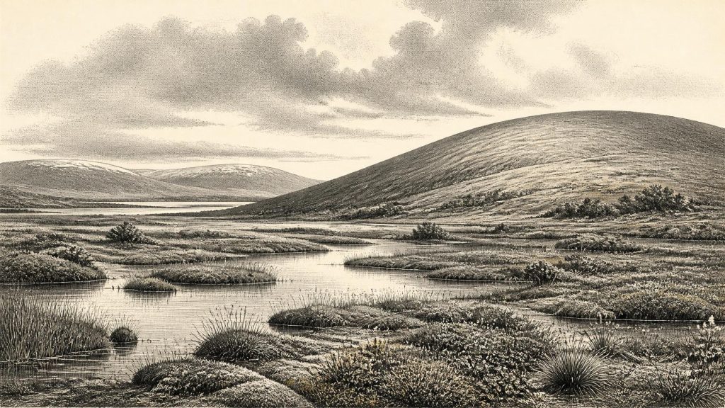
The Derryvree fossils point to an open, treeless and periglacial environment. Periglacial does not simply mean “frozen solid”: it describes ground and landforms affected by severe cold, frost, thaw and seasonal freezing outside, or at the edge of, glacier ice. Plant remains, pollen, mosses and insects recovered from the freshwater deposits indicate sedges, grasses, herbs, low shrubs and wet hollows rather than closed woodland. Older scholarship used the term muskeg for this moss-rich, waterlogged landscape. Pools and channels could support aquatic plants and insects during a short growing season, while exposed ground and bitter winters placed sharp limits on productivity.
The scene should not be pictured as a uniform white wilderness. Even a cold, largely treeless terrain could have contained contrasting microhabitats: shallow freshwater, sedge margins, damp moss beds, gravelly ground and sheltered slopes. Yet it was an exacting world, increasingly vulnerable to renewed glaciation. The two tills enclosing the Derryvree deposits are the essential evidence. They show that this biological landscape survived between episodes of ice occupation, then was sealed and reshaped by a later advance. Much evidence of comparable landscapes will have been eroded, moved or buried by ice, which helps explain why Ireland’s record is so fragmentary.
Animals and the Cave Record
For animal life, Castlepook Cave near Doneraile in north County Cork is the principal Irish archive relevant to this broad pre-Last Glacial Maximum era. Also known historically as Mammoth Cave, it has produced more than 2,000 bones and has a long series of dates extending from about 45,700 to 19,950 years BP. Its fauna includes woolly mammoth, giant deer, reindeer, brown bear and spotted hyaena; later cold-stage deposits include lemmings, Arctic fox and wolf. These remains demonstrate that Ireland was intermittently accessible to, and capable of supporting, substantial Pleistocene animal communities.
They do not, however, amount to a single photograph of a Cork valley in 31,538 BCE. Cave deposits accumulate over long periods and through many processes. Carnivores may carry bones into dens; animals may die naturally; water can sort and redeposit remains; and historic excavations can disturb original relationships. Castlepook’s deposits were also affected by water movement and early collecting. Revised radiocarbon work has shown why older cave dates require re-examination using improved pretreatment and measurement methods. It would therefore be unsafe to place every familiar Ice Age species together at the same moment, or to assume that each bone marks a local breeding population.
Still, the combined Derryvree and Castlepook evidence supports an important conclusion. Ireland was not biologically empty during parts of later MIS 3. Cold-adapted herbivores and carnivores had routes into this north-western European margin, and freshwater habitats existed in at least some inland districts during intervals free of overriding ice. The precise nature of those routes remains uncertain. Lower global sea levels altered the surrounding shelf, but ice extent, sea level, coastlines and local land movements all changed through time. Faunal evidence alone cannot map a stable land bridge or a particular crossing route.
The Reindeer Femur Question
The possibility of people in Ireland is concentrated in one striking but limited object: a fragmentary reindeer femur from Castlepook. Public reporting and project documentation identify a deep mark on the bone that zooarchaeologist Ruth Carden has interpreted as damage made by a sharp stone tool during butchery. The bone has been reported as about 33,000 years old. If the mark is securely anthropogenic, it may represent an exceptionally early indication that Upper Palaeolithic people handled a reindeer in Ireland during the broad period before the ice sheet reached its later maximum extent.
Its potential importance is matched by its limitations. The femur came from an old cave collection, not from a modern excavation of an intact occupation floor. A date on an animal bone records the animal’s death, not automatically the moment when a surface mark was made or the location where the animal was killed. No securely associated hearth, stone-tool assemblage, dwelling surface, burial, food store or repeated butchered assemblage of comparable age has yet established a settled Upper Palaeolithic community at Castlepook. Recent research has appropriately sought such evidence—charcoal, lithics, cave art and further modified bone—rather than treating the femur alone as conclusive.
No Polities, No Proven Society
There is consequently no responsible basis for narrating Irish political affairs, diplomacy, warfare, named peoples, languages, religious observances or social ranks for this date. There were no written records, and archaeology has not identified a contemporary settlement from which institutions or everyday customs can be reconstructed. Labels such as Gaelic, Celtic or Irish belong to vastly later historical contexts and should not be projected back into the Ice Age. Even a confirmed butchery mark would show an action by people, not their ethnicity, political organisation, religion or permanence on the island.
Nor can an economy or trade network be demonstrated. At most, the marked-femur interpretation raises the possibility of a brief hunting or scavenging visit in which a valuable animal was processed for meat, marrow, hide, sinew or bone. Those are reasonable general possibilities for large-animal butchery, but Castlepook does not reveal what was taken, how many people were involved, whether they camped nearby, or whether they returned. The responsible account is therefore one of evidence and restraint: a cold, changing landscape; animals moving through it; a possible human trace; and many unanswered questions.
Before the Major Advance
The principal development around this point in deep Irish time was environmental change, not politics. The major British–Irish Ice Sheet maximum came later, conventionally around 27,000 years BP for the ice sheet as a whole, while the global Last Glacial Maximum is commonly defined as 26,500–19,000 years BP. Geological evidence indicates that much of the ice sheet expanded from more limited or ice-free conditions after about 34,000 years ago, reaching southern Ireland only after about 24,000 years ago. These are broad reconstructions, not a licence to assign a precise ice margin to 31,538 BCE.
Derryvree’s sedges, mosses and freshwater silts survive because later ice entombed them. Castlepook’s bones survive because caves preserved fragments of animals otherwise lost from exposed ground. Together, they make this nominal year intelligible: Ireland was a climatically volatile Atlantic-edge land, with open cold-country habitats appearing in parts of the island before more extensive glaciation transformed the terrain. The archive is thin, but it is not silent. It tells of water beneath a drumlin, tundra vegetation around it, Pleistocene animals in the wider landscape, and a tantalising possibility—still short of proof—that people may briefly have reached Ireland as well.
Primary Sources
- A Middle Midlandian Freshwater Series at Derryvree, Maguiresbridge, County Fermanagh, Northern Ireland
- Irish Pleistocene biostratigraphy
- Palaeoecology
- Figure 6.— The subdivision of the Quaternary Period in Ireland
- Trimlines, blockfields and the vertical extent of the last ice sheet in southern Ireland
- Growth and retreat of the last British–Irish Ice Sheet, 31,000 to 15,000 years ago: the BRITICE-CHRONO reconstruction
- Early deglaciation of the British-Irish Ice Sheet on the Atlantic shelf northwest of Ireland driven by glacioisostatic depression and high relative sea level
- Timing and pace of ice-sheet withdrawal across the marine–terrestrial transition west of Ireland during the last glaciation
- Maximum extent and dynamic behaviour of the last British–Irish Ice Sheet west of Ireland
- A reconsideration of the radiocarbon dating of the Marine Isotope Stage 3 fauna from southern Ireland
- Castlepook Cave
- Archaeology Research Excavation Grant 2022
- The Irish Quaternary Fauna Project
- The IntCal20 Northern Hemisphere Radiocarbon Age Calibration Curve (0–55 cal kBP)
- The Last Glacial Maximum British-Irish ice sheet: a reconstruction using digital terrain mapping
- Pattern and timing of retreat of the last British-Irish Ice Sheet
- New insights on the fauna of Ireland’s Younger Dryas and Early Holocene from Alice & Gwendoline Cave
- Introduction to the Late Quaternary and Holocene of Northern Ireland
- Ireland's Palaeolithic Archaeology – Fleeting Footprints in a Frozen Land
- Archaeological excavations at Killuragh Cave, Co. Limerick: a persistent place in the landscape from the Early Mesolithic to the Late Bronze Age