BIRM-166’s Bogbean Layer31387 BCE
Circa 31,387 BCE, Ireland lacked written history and precise annual chronology. At Derryvree, County Fermanagh, organic sediments between glacial tills record an ice-free MIS 3 interval, broadly dated to 36,900–31,700 calendar years BP. The site preserved a treeless, cold wetland of pools, sedges, mosses, herbs, insects and plants including bogbean, amid seasonal periglacial conditions. Ireland was approaching greater glaciation, although conditions varied regionally and no certain land bridge is known. Castlepook Cave, County Cork, contains time-averaged remains of mammoth, hyaena, reindeer and other fauna. A possibly cut-marked reindeer bone suggests, but cannot confirm, possible early human visitation or settlement there.

Dateline
Modern calendar-year precision is not available for Ireland in 31,387 BCE. There was no written record, no named polity and no archaeological sequence capable of identifying a particular year, season or generation. The label is therefore a modern point on a much longer timescale: roughly 33,300 calendar years before AD 1950, in the Late Pleistocene, during Marine Isotope Stage 3 (MIS 3). The responsible history of this moment is one of calibrated ranges, buried sediments and cautiously interpreted animal remains.
The closest important Irish evidence is the Derryvree deposit near Maguiresbridge in County Fermanagh. Organic silts and fine sands were exposed in a road cutting through a drumlin and lay between two tills: compact sediments left by separate episodes of glacial ice. The organic layer was radiocarbon dated as BIRM-166 to 30,500 ± 1,100 radiocarbon years BP. Calibrated chronologies place its age broadly at about 36,900–31,700 calendar years BP; a later regional model centres it around 33,500 ± 1,200 calendar years BP. The nominal year considered here falls within those wide estimates. It does not mark the beginning, peak or end of the deposit’s formation.
A Wetland Between Ice Advances
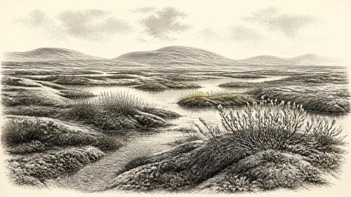
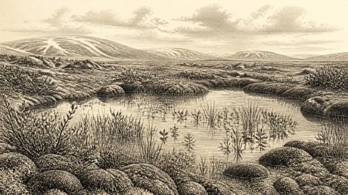
Derryvree matters because the order of its layers is unequivocal even when its absolute age remains broad. First came glacial deposition, then an interval in which freshwater and wet ground developed, then renewed ice movement that buried and preserved the evidence. At some point within that intervening cold-stage window, this part of Fermanagh was not overridden by glacier ice. It supported shallow pools, waterlogged ground and a moss-rich, treeless wetland often described as muskeg: saturated tundra-like terrain with peaty vegetation rather than a forest or a settled river valley.
Plant pollen, macrofossils, mosses and insect remains make this a rare Irish environmental archive. Grasses and sedges were important, alongside juniper and small herbs. Fossils attributed to mountain avens, bogbean and lesser clubmoss reinforce the picture of open ground and cold freshwater habitats. Insect evidence points to pools rich in plant material amid mossy margins. These are observations from the sediment; the larger reconstruction of a harsh, highly seasonal periglacial climate is an interpretation built from their combined ecological preferences and geological setting.
Nothing in this evidence suggests the familiar green, wooded Ireland of later millennia. Trees were absent locally or too scarce to register as a forest landscape. The ground would have been exposed to strong seasonal contrasts, frost action and limited growing seasons. Yet it was not lifeless. Water remained available in places, plants colonised wet hollows and open soils, and insect communities occupied the mosaic of pool, sedge bed and moss. The phrase “tundra” is useful shorthand, but Derryvree should not be imagined as a uniform modern Arctic plain. It records one local wetland, not an island-wide photograph.
An Island in Transition
Ireland’s wider geography was changing rapidly on geological timescales. Around this period, the last Irish Ice Sheet had not yet achieved the maximum extent reached later in the Last Glacial Maximum. Current syntheses indicate that substantial ice growth followed around 32,000 calendar years BP, while the maximum ice sheet eventually covered Ireland and the surrounding shelf between roughly 27,000 and 23,000 calendar years BP. Derryvree is therefore particularly valuable evidence against the simple assumption that all of Ireland was continuously ice-covered throughout the Late Pleistocene.
That does not mean that the whole island was hospitable or even ice-free in 31,387 BCE. Ice margins, uplands, coastlines and lowlands responded differently to climate and topography. The stratigraphy at Derryvree establishes an ice-free interval in its own district before later glaciation; it cannot be extended uncritically to every county. Other Irish deposits, including those at Greenagho, Hollymount and Aghnadarragh, preserve fragments of earlier or differently dated cold-stage environments. Together they reveal repeated environmental change, but their chronological resolution is insufficient to turn them into a single map for a single year.
Sea level was much lower globally during the ice age because water was held in continental ice sheets. Even so, the precise configuration of land, sea ice, coastal plains and possible crossing routes around Ireland remains uncertain. Relative sea level depended not merely on global ocean volume but also on the weight of ice depressing the Earth’s crust and later rebound. It would be wrong to present a firm land bridge to Britain for this date. Any potential movement between Ireland and neighbouring regions must be understood through a shifting, difficult-to-reconstruct maritime and glacial landscape.
Animals in the Southern Caves
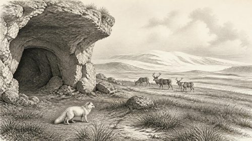
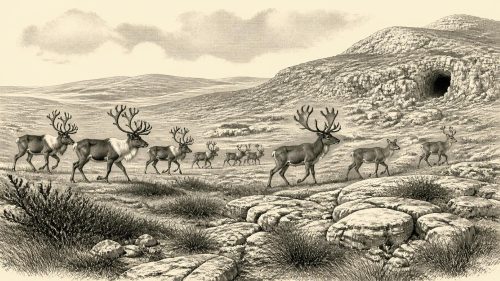
The other major Irish body of evidence lies far south, at Castlepook Cave near Doneraile in County Cork. Its cave deposits and museum collections contain remains of cold-stage animals, including mammoth, spotted hyaena, reindeer, giant deer, wolf and brown bear. Earlier radiocarbon work associated mammoth and hyaena material with the broader Derryvree cold-phase interval, and the cave offers compelling evidence that large mammals reached Ireland during MIS 3.
But Castlepook is not a neatly layered campsite. The cave’s bones were accumulated by more than one process, including animal deaths, carnivore use, water movement and later disturbance. Large antiquarian excavations also removed much of the original deposit before modern recording standards existed. Direct re-dating has shown that some older Castlepook determinations required substantial revision, while the fauna itself accumulated over a long span. A mammoth bone or hyaena bone from the collection may demonstrate that the species was present in Pleistocene Ireland; it does not automatically prove that all species met one another, or that they occupied the cave in the same decade.
The animal record nevertheless gives Derryvree’s open country a wider ecological context. Reindeer could exploit sparse vegetation; mammoths and giant deer imply substantial grazing landscapes at least at some times; predators and scavengers indicate food webs more varied than the surviving Irish record first suggests. These remains must be treated as a time-averaged fauna, however. They support an image of periodically accessible, open Irish landscapes, not a complete census of the island’s wildlife in 31,387 BCE.
The Human Question
A reindeer femur from Castlepook has made this date especially consequential. It has been publicly reported as approximately 33,000 years old and as bearing a deep incision interpreted as a stone-tool cut mark, potentially made during butchery. If that interpretation is confirmed and if the mark is contemporary with the animal’s death, it would be evidence that people reached Ireland in the Upper Palaeolithic far earlier than the formerly accepted terminal-Pleistocene evidence.
The appropriate conclusion remains deliberately limited. There is no securely associated hearth, stone-tool assemblage, dwelling, burial, occupation surface or repeated series of butchered bones from Castlepook of this age. Nor is there evidence for a resident population, a named cultural group or continuous settlement. A single modified bone, particularly one from an old and disturbed cave collection, cannot disclose the size, origin, language, kinship structure or duration of any human visit. It is best described as a significant but unresolved indication of possible human activity.
This uncertainty also defines what cannot responsibly be written about political affairs, warfare, diplomacy, religion, learning or trade. No Irish evidence identifies chiefs, territories, alliances, ritual sites, artistic traditions, exchange networks or domestic households around this point. It would be tempting to import the well-known art, technologies and social practices of contemporary Upper Palaeolithic communities elsewhere in Europe. Such comparisons can suggest possibilities, but they cannot establish that the same practices occurred in Ireland.
Life Without a Yearly Chronicle
If people did make a brief visit to Ireland during this cold interval, survival would have depended on intimate knowledge of terrain, weather and mobile animal resources. That is a reasonable general inference from the climate and fauna, not direct evidence for a particular party of hunters at Derryvree or Castlepook. The same distinction applies to economic language. A cut mark, if genuine, may indicate carcass processing; it does not demonstrate a developed Irish hunting economy, regular trade or permanent seasonal rounds.
The strongest history for 31,387 BCE is therefore environmental. In Fermanagh, a freshwater wetland formed during a pause between ice advances, preserving a small but remarkably detailed community of sedges, mosses, herbs, pools and insects. Across the island, ice and climate were moving towards a more extensive glacial regime. In Cork, cave remains show that cold-adapted and open-country mammals had entered this changing world, while one reindeer bone raises a difficult question about early human presence.
Far from being an empty prelude to later Irish history, this was a formative deep-time landscape. It shaped which deposits survived, which animals could enter, and which traces of people might endure. Yet its evidence is fragmentary by nature. The lesson of Derryvree’s bogbean layer is not that historians can narrate one Irish year 33 millennia ago. It is that a few silts sealed beneath ice can still reveal a living, changing landscape—and show exactly where certainty must stop.
Primary Sources
- The IntCal20 Northern Hemisphere Radiocarbon Age Calibration Curve (0–55 cal kBP)
- Irish Pleistocene biostratigraphy
- The last Irish Ice Sheet: extent and chronology
- Pattern and timing of retreat of the last British-Irish Ice Sheet
- Early deglaciation of the British-Irish Ice Sheet on the Atlantic shelf northwest of Ireland driven by glacioisostatic depression and high relative sea level
- Timing and pace of ice-sheet withdrawal across the marine–terrestrial transition west of Ireland during the last glaciation
- Exploring controls of the early and stepped deglaciation on the western margin of the last British–Irish Ice Sheet
- A reconsideration of the radiocarbon dating of the Marine Isotope Stage 3 fauna from southern Ireland
- The Irish Quaternary Fauna Project
- Phylogeographic, ancient DNA, fossil and morphometric analyses reveal ancient and modern introductions of a large mammal: the complex case of red deer (Cervus elaphus) in Ireland
- The colonization of Ireland: A human ecology perspective
- First evidence of a Late Upper Palaeolithic human presence in Ireland
- New insights on the fauna of Ireland’s Younger Dryas and Early Holocene from Alice & Gwendoline Cave
- Ireland: Submerged Prehistoric Sites and Landscapes
- Deglaciation, Earth crustal behaviour and sea-level changes in the determination of insularity: A perspective from Ireland
- Dimensions and chronology of the last ice sheet in western Ireland
- Radiocarbon constraints on the age of the maximum advance of the British-Irish Ice Sheet in the Celtic Sea
- Figure 6.— The subdivision of the Quaternary Period in Ireland
- Outreach and Education Resources
- Menyanthes trifoliata
- Dryas octopetala
- Selaginella selaginoides