BIRM-166’s Freshwater Tundra31358 BCE
31,358 BCE is a modern reference within a broad calibrated range derived from Derryvree’s BIRM-166 radiocarbon date, not a recoverable Irish year. Organic silts beneath a Fermanagh drumlin show that, between glacial advances, freshwater wetlands occupied locally ice-free, open tundra. Pollen, plants and insects indicate sedges, grasses, mosses, juniper, bogbean, water-milfoil, dwarf willow and mountain avens in harsh periglacial conditions. Cave faunas demonstrate that cold-adapted mammals and predators reached Ireland during MIS 3, although not necessarily simultaneously. Human presence remains unproven: a possibly cut reindeer bone is insufficient evidence. Later ice sheets obscured records, leaving environmental, rather than societal, history.
Dateline
The label 31,358 BCE is useful only as a modern point of reference. It does not identify a recoverable year in Ireland’s past: there are no written records, annual layers securely tied to that calendar year, named communities or datable events. In the usual archaeological convention, it falls about 33,307 years before AD 1950, within the Late Pleistocene, Marine Isotope Stage 3 (MIS 3), and the Irish Midlandian glacial cycle. At this depth in time, radiocarbon determinations must be calibrated against changing atmospheric carbon-14 levels, producing broad ranges rather than dates of annual precision. The responsible history of Ireland around this point is therefore one of deposits, fossils, landforms and carefully limited inference.
The most important evidence lies not in a settlement but beneath a drumlin at Derryvree, near Maguiresbridge in County Fermanagh. Roadworks in 1969 cut through the hill and exposed organic silts and fine sands enclosed between two thick sheets of glacial till. This simple geological arrangement matters greatly. The lower till records an earlier advance of ice; the freshwater sediments record an intervening period when ice was absent from that locality; and the upper till records later renewed glaciation. Derryvree is consequently a rare survival from a landscape whose deposits were repeatedly overridden, eroded or buried by subsequent ice.
A Date Within a Range
The organic material from Derryvree produced the radiocarbon determination BIRM-166: 30,500 radiocarbon years BP, with a substantial uncertainty of +1,170 and −1,030 years. Modern calibration places that measurement broadly at about 36,900–31,700 calibrated years BP. The modern year 31,358 BCE sits within this wide interval, but it is not the date of a particular pool, plant, snowfall or animal. Indeed, it lies close to the younger end of the range, where the uncertainties themselves are part of the evidence. Calibration curves improve and archaeological chronologies are revised; an honest account should preserve that uncertainty rather than turn it into a falsely exact Ice Age anniversary.
Even so, the Derryvree sequence securely establishes a crucial point. North-central Ireland was not continuously smothered by ice throughout the whole later Pleistocene. During the episode represented by its silts, a freshwater environment existed at this Fermanagh site between glacial advances. This does not mean that every part of Ireland was simultaneously ice-free, nor that conditions were mild. It means that an exposed landscape, with liquid water and living plant and animal communities, occupied at least this part of the island during a cold stage before the great expansion of the last Irish Ice Sheet.
Water Beneath the Drumlin
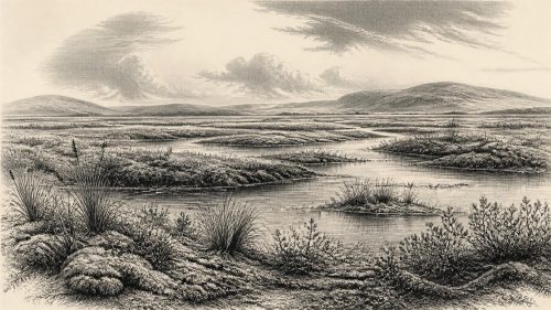
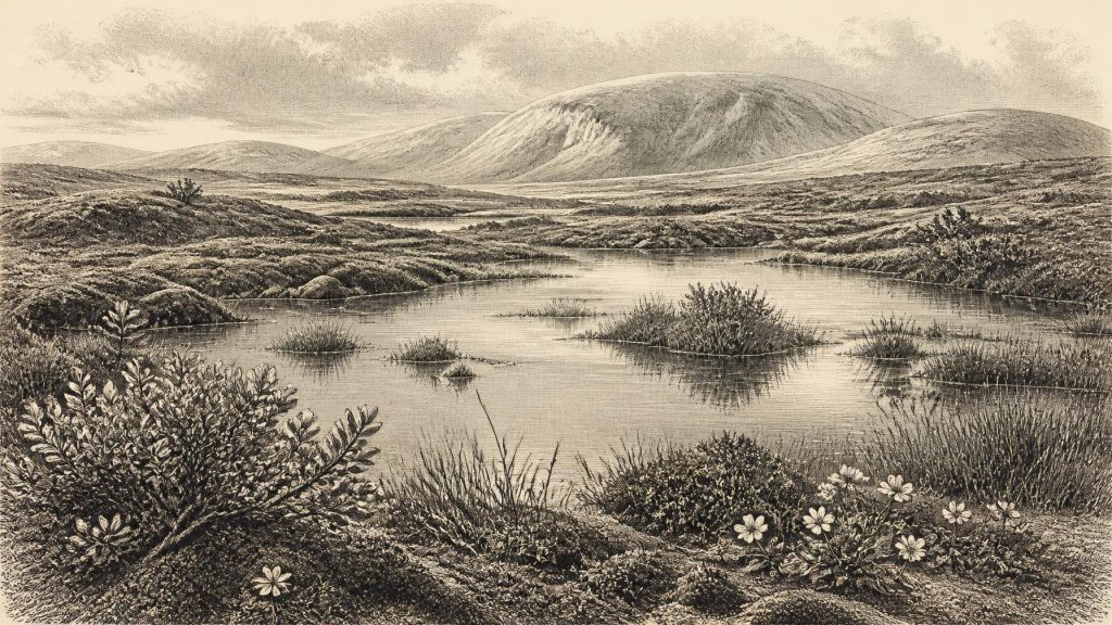
The plant remains, pollen and insects preserved in the Derryvree sediments provide the closest available view of everyday ecology around the broad period in question. Their original investigators described a full-glacial flora and fauna, while later syntheses characterise the setting as open tundra or muskeg: wet, treeless ground with shallow pools and waterlogged margins. Grasses, sedges, juniper and herbs were important elements of the pollen record. Mosses and insect remains reinforce the impression of plant-rich wet ground rather than a sterile expanse of snow and bare rock.
Several identifiable plants make the picture more concrete. Fossil bogbean, an aquatic or marsh plant, points to freshwater margins; alternate water-milfoil suggests water in pools or slow-moving channels. Mountain avens and dwarf willow are hardy Arctic-alpine plants, adapted to short growing seasons and exposed ground. Their presence is direct evidence that suitable local habitats existed. The broader reconstruction—a patchwork of wet hollows, sedge-rich ground, low shrubs and open mineral soils—is interpretation, but it is a restrained interpretation rooted in those remains. There is no basis for imagining woodland, cultivated fields or a settled rural landscape. Trees were absent or extremely scarce in the local record.
“Periglacial” is the useful term for this world. It denotes terrain strongly affected by severe cold, frozen ground and seasonal freezing and thawing, but not necessarily terrain immediately beside an ice front. Water could gather in hollows during warmer seasons while winter cold reshaped soil and sediment. The Derryvree basin may therefore have been locally productive in summer, even though its annual climate was harsh. This was a landscape in which survival depended on the timing of thaw, plant growth, standing water and renewed frost—not one that can be reduced to a single unchanging temperature or weather condition.
Before the Last Great Advance
At around 33,300 calibrated years BP, Ireland was approaching but had not yet reached the global Last Glacial Maximum, usually dated to roughly 26,500–19,000 years ago. Later ice sheets profoundly remodelled the island, extending across its western and southern shelves and joining with ice nourished from Britain in parts of the wider British–Irish Ice Sheet. Modern work on Irish glacial chronology indicates that the principal late expansion of the last Irish Ice Sheet grew from more limited ice cover around 34,000 years ago to a much wider extent after that. Derryvree, and the older Greenagho organic deposits elsewhere in Fermanagh, are central to this conclusion.
The implication is regional and chronological, not a licence for an overconfident map of all Ireland in 31,358 BCE. Ice margins fluctuated, and evidence is unevenly preserved. Open water in adjacent Donegal Bay at intervals before the major westward advance adds to the case for a complex, changing geography. Yet neither sea-level change nor the occurrence of animals can prove a particular route across the Irish Sea at this exact time. Connections to Britain and continental Europe changed with ice, water and land elevation; the available evidence does not permit a simple claim that travellers could walk into Ireland from the continent.
Animals of an Unsettled Country
The principal Irish archive for larger Pleistocene mammals is Castlepook Cave, also called Mammoth Cave, near Doneraile in north County Cork. Excavations there in the early twentieth century recovered a remarkable collection including reindeer, woolly mammoth, giant deer, brown bear, wolf, foxes, hare, lemmings and spotted hyaena. The National Museum of Ireland’s Castlepook hyaena skull is a vivid reminder that Ireland’s Ice Age fauna could include predators now associated with Africa. Reindeer and hyaena, however, must not be imagined as symbols of a single simultaneous ecosystem. Cave deposits accumulated over long spans, and much early excavation disturbed their original contexts.
Radiocarbon work by the Irish Quaternary Fauna Project showed that a varied mammal community reached Ireland at different times between at least about 45,000 and 20,000 years ago. Some Castlepook dates and older classifications place parts of its fauna broadly near the Derryvree Cold Phase, conventionally centred around 33,000 years ago. This allows a cautious ecological conclusion: Ireland was, during parts of MIS 3, within the wider north-west European range of cold-adapted and open-country mammals. It does not establish a herd at Doneraile in 31,358 BCE, a reindeer migration timetable, or the precise appearance of every Irish region.
The animals nevertheless help explain what the vegetation evidence implies. Reindeer and mammoth are consistent with expanses of open country capable of supporting grazing or mixed herbivory; lemmings, Arctic foxes and hares fit cold environments. Carnivores such as wolves and spotted hyaenas reveal food webs more varied than the phrase “frozen wilderness” suggests. Their bones are evidence of animal presence, not of human hunting. Natural deaths, scavenging, carnivore denning, water movement and later disturbance can all contribute bones to a cave deposit.
The Human Question
No securely excavated house, hearth, occupation floor, tool assemblage, burial, artwork or human skeleton from Ireland can be assigned to around 31,358 BCE. Consequently, political affairs, conflict, diplomacy, social rank, language, religion, formal learning, trade and artistic traditions cannot responsibly be described for an Irish population at this date. These are not simply missing details about a known society. A resident human community in Ireland during this part of MIS 3 remains unproven.
A reindeer bone from Castlepook has been interpreted as carrying a fresh-bone incision made by a stone tool during butchery and has been publicised as possible evidence of a human visit around 33,000 years ago. If that interpretation were eventually secured, it would be of enormous importance. At present, however, a modified bone from an old and disturbed cave collection is not equivalent to a settlement. It cannot identify the visitor, demonstrate repeated occupation, reveal a hunting party’s route, or support claims about kinship, belief or political organisation. The National Museum of Ireland continues to state that no clear evidence of human presence has emerged for the Irish Palaeolithic, and that institutional caution remains appropriate.
What Can Be Said
Ireland around this notional date was shaped above all by environmental change. At Derryvree, cold-climate plants, insects and freshwater sediments demonstrate an active wetland ecosystem within open, treeless country. Elsewhere, cave faunas show that large mammals and predators entered the island’s shifting Ice Age landscapes over broad spans of time. The later growth of the Irish Ice Sheet would destroy or conceal much of the evidence that people and animals might once have left. That destructive history explains why the record is fragmentary.
There was no Irish state, no diplomacy, no known battle, no market and no demonstrable religious institution to narrate. There may not have been people on the island at all. But the absence of human history does not make this a blank page. BIRM-166 preserves a precise kind of history: freshwater under a future drumlin; sedges, mosses and low Arctic-alpine plants; insects in wet ground; and a landscape briefly available between episodes of ice. It is a deep past measured not by kings or calendar dates, but by the survival of a thin organic layer beneath the glacial debris.
Primary Sources
- A Middle Midlandian Freshwater Series at Derryvree, Maguiresbridge, County Fermanagh, Northern Ireland
- The Irish Quaternary Fauna Project
- Irish Pleistocene Biostratigraphy
- Figure 6.— The Subdivision of the Quaternary Period in Ireland
- The Quaternary of Fermanagh
- Trimlines, Blockfields and the Vertical Extent of the Last Ice Sheet in Southern Ireland
- New Data for the Last Glacial Maximum in Great Britain and Ireland
- Dimensions and Chronology of the Last Ice Sheet in Western Ireland
- Last Glacial Maximum Cirque Glaciation in Ireland and Implications for Reconstructions of the Irish Ice Sheet
- Oscillating Retreat of the Last British-Irish Ice Sheet on the Continental Shelf Offshore Galway Bay, Western Ireland
- Radiocarbon Constraints on the Age of the Maximum Advance of the British–Irish Ice Sheet in the Celtic Sea
- Ice Sheet Extension to the Celtic Sea Shelf Edge at the Last Glacial Maximum
- Spotted Hyena Skull
- Prehistoric Details
- The Mesolithic in Ireland: When Was It?
- Phylogeographic, Ancient DNA, Fossil and Morphometric Analyses Reveal Ancient and Modern Introductions of a Large Mammal: The Complex Case of Red Deer (Cervus elaphus) in Ireland
- New Insights on the Fauna of Ireland's Younger Dryas and Early Holocene from Alice & Gwendoline Cave
- The IntCal20 Northern Hemisphere Radiocarbon Age Calibration Curve (0–55 cal kBP)
- A Stratigraphic Framework for Abrupt Climatic Changes During the Last Glacial Period Based on Three Synchronized Greenland Ice-Core Records: Refining and Extending the INTIMATE Event Stratigraphy
- BSBI: Menyanthes trifoliata
- BSBI: Myriophyllum alterniflorum
- BSBI: Salix herbacea
- BSBI: Dryas octopetala