Derryvree’s Freshwater Series30622 BCE
Around 30,622 BCE, a modern reference date within a broad radiocarbon range, Ireland was a climatically unstable Late Pleistocene landscape. At Derryvree, County Fermanagh, freshwater sediments between two glacial tills record an ice-free interval of tundra, wetlands, mosses, sedges and arctic-alpine vegetation, before renewed glaciation. Cave remains at Castlepook, County Cork, show cold-adapted mammals, including reindeer and mammoth. A marked reindeer bone may indicate Upper Palaeolithic butchery, although it cannot establish permanent settlement. Lower sea levels enlarged surrounding land, yet Ireland remained separated from Britain. Evidence supports changing environments and possible brief human activity, not precise annual or social history.

Dateline
The label 30,622 BCE is a modern chronological convenience, not a year that anyone in Ireland could have named or recorded. No written evidence, securely dated settlement, burial or historical event can be fixed to it. In radiocarbon terms it falls about 32,571 years before AD 1950, within the Late Pleistocene, in Marine Isotope Stage 3 (MIS 3), a climatically volatile phase of the last Ice Age. The responsible history of this point is therefore an account of a broad environmental interval, reconstructed from buried sediments, fossil remains and glacial landforms rather than a conventional annual chronicle.
The most illuminating Irish evidence is the Derryvree freshwater series near Maguiresbridge, County Fermanagh. It cannot tell us what happened in one particular year, but it preserves a rare local record of life between successive episodes of glaciation. Together with cave faunas in County Cork and the wider reconstruction of the British–Irish Ice Sheet, it shows an Ireland in transition: cold, exposed and regionally varied, with habitats that could briefly sustain wetland plants and grazing animals before later ice reshaped or buried much of the evidence.
A Date Within a Wide Range
The principal Derryvree organic deposit yielded the conventional radiocarbon determination Birm-166: 30,500 years BP, with a substantial uncertainty of +1,170/−1,030 years. A radiocarbon age is not identical to a calendar age. The amount of atmospheric carbon-14 has changed through time, so measurements must be calibrated against independently dated records; at this depth in time, calibration produces broad and sometimes complex probability ranges rather than a precise answer. The Derryvree date has commonly been expressed as broadly c. 36,900–31,700 calibrated years BP, or approximately 34,950–29,750 BCE.
30,622 BCE lies within that broad interval, but it must not be mistaken for the date of the pond, a plant bed, an animal death or human visit. The useful conclusion is chronological and environmental: Derryvree represents part of the later Middle Midlandian cold stage, during a period when its particular locality was free of glacier ice long enough for freshwater sediment and organic material to accumulate. The numbered year gives a point of reference; the evidence describes millennia.
Fresh Water Between Glaciers
Road works in 1969 cut through a drumlin in Derryvree townland, about two kilometres north-east of Maguiresbridge. The exposure revealed a striking sequence. A thick lower till — unsorted debris deposited directly by glacier ice — was overlain by fine sands, silts and organic freshwater sediments, themselves capped by a second thick till. This order is more secure than any detailed map of Ireland at the time. Ice had occupied the place; later, a non-glacial interval allowed shallow water, wet ground and vegetation to develop; then ice returned and sealed the deposit.
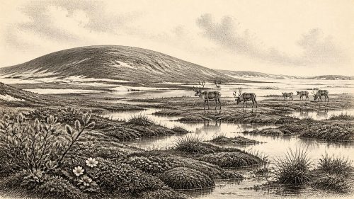
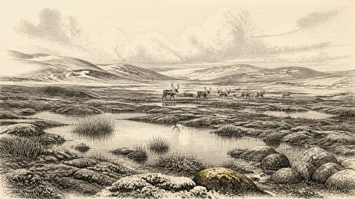
The intervening beds contained a flora and fauna described by their excavators as having a full-glacial character. Plant and insect remains indicate open tundra vegetation and a periglacial regime: an environment shaped by severe frost, short growing seasons and largely treeless ground. Mosses, sedges and aquatic or waterside plants show that this was not a uniform desert of ice or bare gravel. In and around sheltered freshwater lay a patchwork of shallow pools, saturated sediments and low vegetation. Dwarf shrubs and arctic-alpine plants could occupy better-drained patches, while summer thaw supplied the water on which the wetland depended.
This does not mean that all of Ireland resembled Derryvree. A sedimentary basin records its own catchment, not an entire island. Uplands, western coasts and areas closer to ice margins may have experienced different conditions at the same time. Yet the sequence is exceptionally important precisely because later glaciation has removed, disturbed or hidden so many older Irish land surfaces. Its two tills also warn against a simple image of a permanently frozen island: ice cover expanded and contracted, while locally ice-free environments existed during some intervals.
An Island Approaching Greater Glaciation
At this approximate horizon, the eventual Last Glacial Maximum still lay ahead. Recent British–Irish Ice Sheet reconstructions are strongest from 31,000 calibrated years BP onwards, slightly later than 30,622 BCE, and show major ice accumulation across the following millennia. By 31,000 years BP, modelling indicates a substantial northern Irish ice cap spanning from the Derryveagh to the Sperrin Mountains, alongside smaller ice fields and glaciers in several Irish upland regions. The ice sheet continued to grow overall between 31,000 and 26,000 years BP, while its maximum volume came much later, around 23,000 years BP.
Those reconstructions should not be projected backwards with false confidence. The pre-31,000-year history of the ice sheet remains debated, and the Derryvree beds themselves demonstrate that local conditions had changed more than once. Still, the best interpretation is of a landscape entering a phase of more extensive glaciation, not of a settled temperate country awaiting a single sudden freeze. Ice, permafrost-like ground conditions, seasonal meltwater and open tundra habitats formed parts of a changing regional mosaic.
Sea level was considerably lower than today because vast quantities of water were locked in northern ice sheets. The Irish Sea was narrower and the exposed continental shelves enlarged the surrounding land area, but Ireland was separated from Britain by sea during this part of the Pleistocene. Any human arrival would therefore have required a sea crossing, not simply a walk across a dry land bridge. No boat, landing place or route has been found for this early period.
Animals, Food and a Possible Human Trace
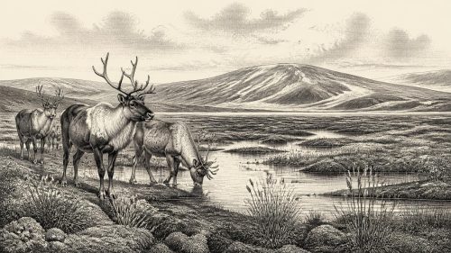
Irish cave deposits provide another, less neatly dated window. The collections from Castlepook Cave near Doneraile, County Cork, include remains of cold-stage mammals, notably reindeer and woolly mammoth, as well as large deer and carnivores or scavengers. Such material demonstrates that Ireland could sustain, or at least be reached by, sizeable mammals during parts of the last glacial cycle. Reindeer in particular fit the picture of open, cold landscapes where grazing and browsing could be obtained from sparse tundra vegetation.
One Castlepook reindeer femur has become central to discussion of Ireland’s earliest people. It has been reported as about 33,000 years old and carries a deep mark interpreted by zooarchaeologist Ruth Carden as damage made by a sharp stone implement during carcass processing. If that interpretation is confirmed, it is evidence that a person handled a freshly killed or scavenged reindeer in Ireland during the Upper Palaeolithic, far earlier than the island’s well-attested post-glacial settlement.
It is not, however, proof of a permanent community in 30,622 BCE. The bone came from an old cave collection rather than a modern excavation of an intact occupation surface. It is not accompanied by a securely associated hearth, stone-tool assemblage, dwelling, cemetery, human remains or stratified camp floor. Its radiocarbon age dates the animal’s death, not necessarily the precise moment the mark was made. The scientifically sound conclusion is narrower but still significant: a possible early episode of human carcass processing belongs to roughly the same broad period as the Derryvree record.
Society Beyond the Evidence
There is no basis for describing political affairs, chiefs, territorial groups, warfare, diplomacy, religion or formal learning in Ireland at this date. Nor can archaeologists identify a language, ethnicity or enduring population. No settlement has been securely demonstrated, and the available evidence cannot distinguish a short visit by a very small hunting party from repeated seasonal use or an entirely animal-dominated landscape.
If people did reach the island, their immediate economy would have depended on practical knowledge rather than agriculture: movement through dangerous cold terrain, the exploitation of animal carcasses and perhaps the use of stone tools, fire and skins. These are reasonable inferences from Upper Palaeolithic life elsewhere in north-west Europe, not direct observations from an Irish camp. There is no evidence for farming, livestock, fields, monuments, metalworking, trade networks or maritime exchange at Derryvree or Castlepook. Even a successful crossing would not by itself demonstrate regular commerce or sustained contact.
Religious belief and cultural expression are equally beyond recovery. No art, personal ornament, burial rite or ceremonial place from this Irish horizon is known. The absence matters, although it is partly an effect of preservation: mobile people leave light traces, while later ice can scour, redeposit or conceal them. Archaeology can responsibly recover landscapes and occasional actions; it cannot turn silence into a detailed social world.
A Fragmentary Beginning
Ireland around 30,622 BCE was not yet a historical society in the usual sense, but it was not without history. The Derryvree silts preserve a moment when cold freshwater wetlands and open tundra existed between glacial advances. Castlepook preserves evidence of large mammals and a provocative, still limited indication of human action. The wider ice-sheet record places both within a long transformation that culminated in more extensive glaciation.
The enduring lesson is one of scale and caution. A single modern calendar year cannot be recovered from deposits whose dates span thousands of years. Yet those deposits disclose a recognisable Irish past: Fermanagh wet ground under a hard climate, Cork caves receiving the remains of cold-adapted animals, and a changing island whose later ice would erase much of what had come before.
Primary Sources
- A Middle Midlandian Freshwater Series at Derryvree, Maguiresbridge, County Fermanagh, Northern Ireland
- The Irish Quaternary Fauna Project
- The colonization of Ireland: A human ecology perspective
- The IntCal20 Northern Hemisphere Radiocarbon Age Calibration Curve (0–55 cal kBP)
- Growth and Retreat of the Last British–Irish Ice Sheet, 31,000 to 15,000 Years Ago: the BRITICE-CHRONO Reconstruction
- Growth and Retreat of the Last British–Irish Ice Sheet, 31,000 to 15,000 Years Ago: the BRITICE-CHRONO Reconstruction
- The Timing and Magnitude of the British–Irish Ice Sheet Between Marine Isotope Stages 5d and 2: Implications for Glacio-Isostatic Adjustment, High Relative Sea Levels and ‘Giant Erratic’ Emplacement
- Dimensions and Chronology of the Last Ice Sheet in Western Ireland
- Deglaciation Chronology of the Donegal Ice Centre, North-West Ireland
- Timing and Pace of Ice-Sheet Withdrawal Across the Marine–Terrestrial Transition West of Ireland During the Last Glaciation
- The Deglaciation of the Western Sector of the Irish Ice Sheet
- Pattern and Timing of Retreat of the Last British-Irish Ice Sheet
- Timing, Pace and Controls on Ice Sheet Retreat: an Introduction to the BRITICE-CHRONO Transect Reconstructions of the British–Irish Ice Sheet
- BRITICE-CHRONO: Introduction
- BritIce Modelling Project
- Dating Constraints on the Last British-Irish Ice Sheet: a Map and Database
- The Late Quaternary History of East-Central Ireland
- Quaternary Glaciations of Northern Europe
- The Mesolithic in Ireland: When Was It?
- Heritage Artefacts of County Cork 2021
- References and Recommended Reading