Derryvree’s Fringed Sandwort31482 BCE
Around 31,482 BCE, Ireland has no recoverable written or event history, but environmental evidence indicates varied Late Pleistocene conditions. At Derryvree, County Fermanagh, freshwater sediments between tills, dated broadly to 36,900–31,700 cal BP, preserve tundra plants, mosses, insects and wetland habitats during an ice-free interval. Climate fluctuated sharply as the Irish Ice Sheet expanded towards its later maximum. Castlepook Cave, County Cork, contains time-averaged remains of mammoth, reindeer, giant deer, predators and fauna. A cut-marked reindeer bone may indicate human butchery, but disturbed deposits and absent artefacts leave this unconfirmed. The evidence depicts dynamic, biologically active landscapes, not settled society.

Dateline
The label 31,482 BCE gives a useful position in a modern chronological sequence, but it must not be mistaken for a year that can be recovered from Irish evidence. No written record, calendar, named community or event history exists for Ireland at this depth of time. In archaeological terms it falls roughly 33,430 calendar years before AD 1950, within the Late Pleistocene and Marine Isotope Stage 3 (MIS 3). Radiocarbon determinations from this period have substantial uncertainties and require calibration. The responsible history of this notional year is therefore not a narrative of events, but an account of environmental records, animal remains and a very limited, contested indication of human activity.
A Freshwater Interval at Derryvree
The strongest Irish evidence relevant to this broad horizon lies at Derryvree, near Maguiresbridge in County Fermanagh. Roadworks in 1969 cut through a drumlin and exposed an exceptional sequence: freshwater silts and fine sands, including organic material, lay between two thick sheets of till. Till is the unsorted debris deposited by glacier ice. The order of the deposits is consequently clear. An earlier glacial phase had covered or influenced the locality; then water, sediment and plants accumulated in an ice-free interval; later glacier ice buried the record beneath a new till sheet.
The Derryvree material produced the conventional radiocarbon determination BIRM-166, 30,500 +1,170/−1,030 radiocarbon years BP. Later calibration places the deposit broadly in the range c. 36,900–31,700 cal BP, or approximately 34,950–29,750 BCE. The requested date lies within that wide calibrated span, but this does not mean that a particular pool, plant or animal can be assigned to 31,482 BCE. The deposit accumulated across time, and its date is a range for the evidence, not a timestamp for an annual occurrence.
What Derryvree demonstrates is locally powerful. Part of south Fermanagh supported standing or slow-moving freshwater and wet ground during a cold stage of the last glaciation. It does not demonstrate that all Ireland was ice-free, nor that conditions in Fermanagh precisely matched those in Cork, the west coast or the Irish Sea basin. Ireland’s glaciers were dynamic, and an island-scale map for any single century would be an overstatement. Yet the freshwater bed is decisive evidence against a picture of an entirely lifeless or uniformly ice-covered land.
Tundra, Pools and Short Summers
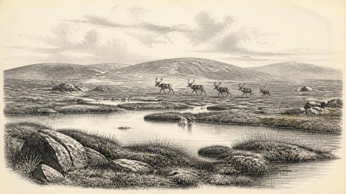
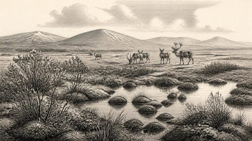
Plant macrofossils, pollen and invertebrate remains from Derryvree were interpreted as evidence for open tundra vegetation and a periglacial climate. Periglacial does not mean permanently buried beneath a glacier. It describes a landscape strongly governed by freezing, thawing, frost disturbance and severe seasonality at the margin of, or beyond, active ice. The scene was unlike the later Irish countryside of oak woods, hazel scrub, enclosed pasture and peatland. Trees were absent or exceedingly limited locally; exposed ground, frost-heaved soils, wet hollows and shallow pools were more important features.
The surviving plant evidence includes cold-adapted species and mosses. Mountain avens and lesser clubmoss are among the better-known fossils, while fringed sandwort provides a particularly evocative reminder that apparently delicate plants could persist in a harsh environment. Sedges, aquatic plants and moss-rich ground would have grown where moisture, local shelter and the brief growing season allowed. Insect evidence has been read as consistent with a muskeg-like wetland: waterlogged, organic ground interrupted by open pools. Such reconstructions remain interpretations, but they rest on identifiable biological remains rather than on imaginative scenery.
Climate was not static. Greenland ice-core records and Irish cave calcite demonstrate abrupt millennial-scale swings during MIS 3. In south-west Ireland, speleothems in Crag Cave grew episodically when liquid water could percolate through the shallow cave system, offering independent evidence that climatic ameliorations occurred during the wider glacial period. Derryvree represents one such environmentally viable interval, although neither archive can resolve conditions on a particular day or year. Its lesson is variability: cold Ireland contained changing local habitats, not a single unaltered ‘Ice Age’ landscape.
Ice Was Advancing, Not Yet at Its Maximum
At roughly 33,430 cal BP, the last Irish Ice Sheet had not reached its later maximum extent. Reviews of sub-till organic evidence suggest that much of Ireland was still ice-free until about 32,000 years ago, after which the ice sheet expanded and thickened. The eventual maximum was asynchronous across the British–Irish Ice Sheet system, with different marine and terrestrial sectors reaching their limits at different times, principally between about 27,000 and 23,000 years ago. Thus 31,482 BCE belongs to a phase of mounting glacial pressure rather than to the fully developed Last Glacial Maximum.
That distinction matters for regional history. The Derryvree sands and silts show that its Fermanagh locality had not been continuously entombed by ice. Conversely, the tills above and below them prove that glacier activity was integral to the wider sequence. Ice could reshape drainage, strip soils and reroute habitats; meltwater and frost could alter the surface even beyond an ice margin. Much of the earlier landscape has been removed, reworked or sealed beneath later deposits. The scarcity of evidence is therefore itself part of the story: subsequent glaciation made this period exceptionally difficult to investigate.
Sea levels were far lower globally because large quantities of water were stored in ice sheets. However, low sea level should not be simplified into a guaranteed land bridge to Ireland. The geography of the Irish Sea region was governed by changing ice margins, local sea level, land depression beneath ice and irregular coastlines. For animals or people moving westwards from Britain or continental Europe, access was an environmental problem whose answer changed over millennia. There is no evidence for a settled transport route, trade corridor or diplomatic contact network in Ireland at this date.
Castlepook and the Animal World
County Cork supplies a complementary, though very different, archive. Castlepook Cave near Doneraile—also known as Mammoth Cave—has produced more than 2,000 bones and is Ireland’s richest known cave assemblage for the period leading towards the Last Glacial Maximum. Direct dates on individual bones extend widely, from about 45,700 to 19,950 years BP. That range is important: Castlepook was a repository used or entered across many millennia, not a single living surface belonging to one moment.
Its Ice Age fauna includes woolly mammoth, reindeer, giant deer, brown bear and spotted hyaena; Arctic fox, wolf and lemmings are also represented in the broader cave record. These bones prove that such animals reached Ireland at various times during the glacial period. They do not prove that every listed species lived together in north Cork in 31,482 BCE. Water movement, carnivore activity and early twentieth-century excavation disturbed parts of the assemblage, while advances in collagen pretreatment have shown that some older radiocarbon measurements need reassessment.
Nonetheless, Castlepook makes the ecological implications of Derryvree more tangible. Cold-open habitats could support grazing and browsing mammals, alongside predators and scavengers. Reindeer were especially well suited to seasonal, treeless environments, while hyaenas could transport and modify bones in caves. The cave is therefore not evidence of a peaceful pastoral landscape. It records animal movement, predation, scavenging, death and the selective preservation of remains within limestone passages.
A Possible Human Trace
One Castlepook specimen has particular significance: a reindeer femur from an old collection, reported as around 33,000 years old and bearing a deep linear mark interpreted by zooarchaeologist Ruth Carden as the result of cutting fresh tissue with a sharp stone tool. County Cork heritage publications have presented it as a possible sign that Palaeolithic people butchered reindeer in the Doneraile area around 31,000 BCE. If that interpretation is confirmed, it would be dramatically earlier than Ireland’s formerly accepted evidence for human activity.
The qualification is essential. The femur’s radiocarbon age dates the animal’s death, not automatically the mark, the location of carcass processing or the identity of the maker. The item did not come from a newly excavated, securely stratified camp with associated tools, hearths, shelters or repeated butchered refuse. Castlepook’s deposits were affected by water, carnivores and antiquarian excavation, and recent work has recovered no cultural artefacts from surviving deposits. The proposed human modification has been widely reported but has not yet received the full published specialist assessment needed to settle the question.
Accordingly, no population, settlement, ethnicity or cultural tradition can responsibly be asserted for Ireland in this year. There is no evidence for government, warfare, diplomacy, organised religion, art, formal learning, farming, permanent houses, exchange networks or trade. If people did reach the island, the most that may presently be inferred is a brief visit by one or a few highly mobile Upper Palaeolithic foragers capable of using sharp stone edges and exploiting animal resources. Even hunting is not certain: the marked reindeer could have been scavenged rather than killed by people.
History Before History
The principal development illuminated around 31,482 BCE is therefore environmental opportunity amid instability. Derryvree preserves an ice-free freshwater wetland in Fermanagh, inhabited by cold-adapted vegetation and invertebrates, during a broad interval later sealed by ice. Castlepook preserves a time-averaged record of large mammals and carnivores in southern Ireland, with one potentially transformative but still unconfirmed clue to human carcass processing. Together they reveal a biologically active Ireland at the north-western edge of Upper Palaeolithic Europe.
This is not yet Ireland as a society with recoverable institutions or remembered ancestors. It is Ireland as a shifting assemblage of tundra plants, wetland pools, migrating mammals, limestone caves and advancing ice. The evidence is fragmentary, but its restraint is valuable. It shows not a blank prehistoric void, nor an invented community of Ice Age ‘Irish’, but a landscape capable at times of sustaining life—and perhaps, fleetingly, human visitors—long before durable settlement became visible in the archaeological record.
Primary Sources
- A Middle Midlandian Freshwater Series at Derryvree, Maguiresbridge, County Fermanagh, Northern Ireland
- A Reconsideration of the Radiocarbon Dating of the Marine Isotope Stage 3 Fauna from Southern Ireland
- New Insights on the Fauna of Ireland’s Younger Dryas from Alice and Gwendoline Cave, Co. Clare
- Castlepook Cave: Cork County Geological Site Report
- 2022:564 – Castlepook Cave, Castlepook South, Cork
- Archaeology Research Excavation Grant 2022: Castlepook Cave Project Final Report
- Archaeological Heritage of County Cork
- Heritage Artefacts of County Cork
- Our Ancient Landscapes: Hunter-Gatherers in Ireland
- Dimensions and Chronology of the Last Ice Sheet in Western Ireland
- The Last Irish Ice Sheet: Extent and Chronology
- Pattern and Timing of Retreat of the Last British-Irish Ice Sheet
- Growth and Retreat of the Last British–Irish Ice Sheet, 31,000 to 15,000 Years Ago: the BRITICE-CHRONO Reconstruction
- Maximum Extent and Dynamic Behaviour of the Last British–Irish Ice Sheet West of Ireland
- Radiocarbon Constraints on the Age of the Maximum Advance of the British-Irish Ice Sheet in the Celtic Sea
- Episodic Speleothem Deposition Tracks the Terrestrial Impact of Millennial-Scale Last Glacial Climate Variability in SW Ireland
- Trimlines, Blockfields and the Vertical Extent of the Last Ice Sheet in Southern Ireland
- Exploring Controls of the Early and Stepped Deglaciation on the Western Margin of the British Irish Ice Sheet
- Palaeoecology
- Selaginella selaginoides: Fossil Record in Fermanagh