

Derryvree’s Long Thaw31462 BCE
31,462 BCE is a notional date within the later Middle Midlandian, not a precisely datable Irish event. Derryvree, County Fermanagh, preserves freshwater sediments between glacial tills, indicating a cold, treeless, sedge-rich wetland with liquid water and seasonal tundra conditions during an ice-free or ice-distal interval. Ireland’s ice margins varied regionally before the later Last Glacial Maximum. Cave fauna, especially at Castlepook, records mammoth, reindeer, giant deer, predators and Arctic species, showing ecological links with north-western Europe. A possibly tool-marked reindeer bone suggests, but does not confirm, early human visits. No evidence supports settlement, polities, farming or culture; evidence is fragmentary.
Dateline
The label “31,462 BCE” supplies a convenient position on a modern timeline, not a date at which an Irish event can be assigned. No community in Ireland recorded years at this depth of time, and the scientific evidence cannot distinguish one calendar year from the next. In radiocarbon terms, the notional year lies about 33,400 years before AD 1950. It belongs broadly to the later Middle Midlandian, Ireland’s regional name for part of the last glacial cycle, and to Marine Isotope Stage 3. The responsible history of Ireland at this point is therefore not a chronicle of rulers or battles, but a carefully qualified reconstruction from buried mud, plant remains, insects, animal bones and the traces left by moving ice.
A Date Within Ranges
Scientific dating is expressed as ranges because every measurement has uncertainty and because radiocarbon years are not identical to calendar years. The most important Irish deposit for this general interval is at Derryvree, near Maguiresbridge in County Fermanagh. There, organic freshwater sediments were sealed between two tills, deposits made by glaciers. A conventional radiocarbon age of about 30,500 years BP, with a sizeable error margin, calibrates to approximately 36,900–31,700 calendar years BP. The notional date of 31,462 BCE falls within that broad calibrated span, but it must not be treated as the date of the Derryvree wetland, still less as the date of a particular season or occurrence there.
The wider chronology reinforces the need for caution. At Greenagho, also in Fermanagh, organic deposits beneath till produced a date that indicates an ice-free freshwater environment around 37,200–35,700 calibrated years BP. Farther west and south, cave faunas and coastal sequences show that conditions and ice margins changed substantially across Ireland and through time. These records establish that some parts of the island could support terrestrial and freshwater environments before the Last Glacial Maximum. They do not prove that every region was simultaneously ice-free, nor that temperatures, vegetation or animal populations were uniform from Cork to Donegal.
The Fermanagh Wetland
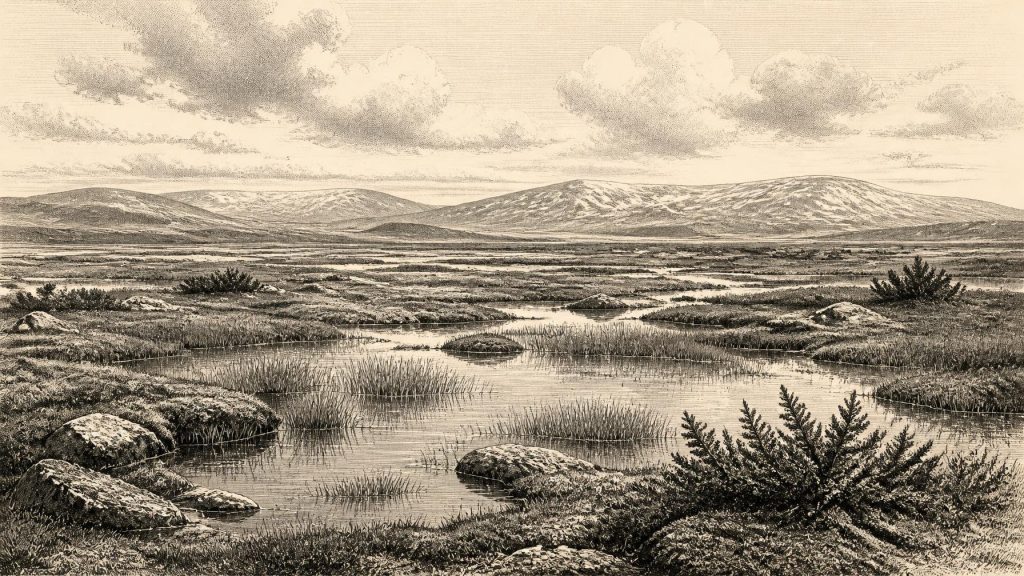
Derryvree is unusually valuable because later glaciation removed or deeply disturbed so much earlier Pleistocene ground surface. Its freshwater mud preserved an assemblage of pollen, plant macrofossils, mosses and insects. Together these are material evidence for standing or slow-moving fresh water, wet ground and a treeless landscape. Sedges and grasses formed a major part of the vegetation. Aquatic or wetland plants, including bogbean and water-milfoil, indicate pools or shallow water; juniper and dwarf-shrub vegetation suggest sheltered patches amid more open terrain. Mosses and herbs adapted to northern or alpine conditions add to the picture.
This was not a familiar modern Irish bog surrounded by woodland. The evidence is more consistent with cold, exposed tundra or muskeg: a mosaic of waterlogged hollows, sedge-rich margins, sparse vegetation and frost-affected ground. The climate was harsh and strongly seasonal. Yet the freshwater indicators matter because they demonstrate liquid water and functioning local ecosystems. Even during a glacial age, Ireland was not simply an unchanging white expanse. In some localities, water, plants, invertebrates and grazing animals occupied temporary ecological opportunities between phases of more extensive ice.
Ice in Motion, Not a Fixed Frontier
The phrase “Ice Age” can misleadingly imply a single, stable ice sheet. In reality, the British–Irish Ice Sheet waxed and waned, and its different sectors did not necessarily grow or retreat together. The Derryvree organic layer lies above older glacial sediment and below younger till, a direct indication that an ice-free or ice-distal interval separated glacial episodes at that locality. By about 27,000–23,000 calibrated years BP, the later ice sheet would reach a much more extensive maximum, covering Ireland and extending across adjoining continental shelves. That maximum lay thousands of years after the date considered here.
Exactly when ice began to expand into each part of Ireland before that maximum remains debated. Some reconstructions place major ice-sheet build-up after roughly 35,000–32,000 years ago; others emphasise the regional complexity revealed by newer offshore mapping and dating. Around 31,462 BCE, then, Ireland should be envisaged as a changing periglacial and glacial borderland, not mapped with a sharp national ice edge. North-central Fermanagh had recently, or still, preserved wetland conditions within the dated interval; elsewhere, mountain ice, expanding lowland ice or ice-fed rivers may have reshaped the terrain.
The later glacier also explains why the surviving record is so fragmentary. Ice eroded surfaces, incorporated older material, redeposited sediment and buried valleys beneath till. A bone or pollen grain may be securely ancient without remaining in its original landscape position. Stratigraphy—what lies above and below a deposit—therefore matters as much as a numerical date. It is the reason Derryvree, sealed between tills, carries exceptional weight in reconstructions of this period.
Animals of the Open Country
Irish cave collections show that a distinctive cold-stage fauna reached the island during the wider period from at least about 45,000 to 20,000 years ago. Castlepook Cave near Doneraile, County Cork, is the best-known concentration. Its finds include woolly mammoth, reindeer, giant deer, brown bear, spotted hyaena, wolf, Arctic fox, hare and lemmings. Not every species is demonstrably contemporary, and animals accumulated in caves through different processes: carnivores dragged in carcasses, natural deaths occurred, sediment washed bones from outside, and nineteenth- and early twentieth-century excavations often removed deposits without modern recording standards.
Nevertheless, the species list is powerful environmental evidence. Reindeer, Arctic fox and lemmings fit an open, cold landscape; mammoth and giant deer indicate that sizeable herbivores could at times exploit Irish habitats. Hyaenas and wolves reveal a predator guild rather than an empty wilderness. Their presence does not mean that these animals were visible everywhere at once, or that Castlepook represents all Ireland. It does show that Ireland was linked ecologically to north-western European Pleistocene faunal movements during the broad period in which the Derryvree wetland existed.
The Human Question
Human history at this date is tantalising but unconfirmed in the way later archaeology is confirmed. A reindeer femur from the historic Castlepook collection has been reported as bearing marks consistent with cutting or chopping by a stone tool and as dating to about 33,000 years ago. If the modification is demonstrated to be human-made and securely associated with the bone’s age, it would be evidence for an Upper Palaeolithic visit to Ireland long before the island’s documented post-glacial settlement.
That conditional language is essential. The Castlepook material was excavated in the early twentieth century from a complex cave system, rather than recovered from a recently excavated, tightly controlled occupation layer. There is no securely dated hearth, stone-tool assemblage, dwelling floor, burial or sequence of repeated camps from around 31,462 BCE. Nor can a single modified bone establish whether people lived locally, crossed briefly in pursuit of animals, scavenged a carcass, or reached the cave only once. It cannot identify their language, kinship, beliefs or group name.
Consequently, Ireland’s possible human presence should not be confused with permanent settlement. The best-supported account is that groups of Homo sapiens may have entered an ecologically challenging island or near-island landscape during favourable windows, but that the archaeological proof is extraordinarily thin. Sea level was lower than today, and the geography of the Irish Sea differed markedly, yet the existence and usefulness of any dry route between Ireland and Britain at this particular time cannot be assumed. Animal dispersal demonstrates connections of some kind; it does not by itself describe a human pathway.
No Polities, No Diplomacy
There is no evidence for political institutions, named communities, diplomacy, organised warfare, territorial boundaries, farming, trade networks or formal religion in Ireland at this date. It would be misleading to manufacture equivalents for them. If people did visit, their practical economy would have depended on immediate knowledge of weather, water, animal movement, stone and shelter. Reindeer or other large animals may have offered meat, fat, hide, sinew and bone, but even that remains an inference from the faunal record and the disputed Castlepook marks, rather than a documented Irish hunting economy.
Culture and learning are visible only indirectly. The capacity to travel through a cold and volatile northern environment would have required social co-operation and accumulated ecological knowledge, but neither survives as an Irish artefact assemblage from this year. Likewise, no cave art, ornament, ritual deposit or burial can responsibly be attached to 31,462 BCE. The absence is partly real and partly archaeological: later ice, erosion, rising seas and early excavation methods have all narrowed the evidence available to modern research.
An Ireland of Evidence
The central development around this notional date was environmental rather than political: Ireland contained, at least in some districts, cold but viable habitats between larger glacial advances. Derryvree’s freshwater deposits provide the clearest local window—treeless, wet, sedge-rich ground under a severe climate. Castlepook’s bones reveal a wider animal world in which large herbivores and carnivores crossed or occupied the island. The possible humanly modified reindeer bone invites an important question, but not a settled answer. For 31,462 BCE, the most accurate Irish history is one of long thaw, open country and precarious evidence.
Primary Sources
- A Middle Midlandian Freshwater Series at Derryvree, Maguiresbridge, County Fermanagh, Northern Ireland
- Middle Midlandian Interstadial Deposits at Greenagho, Near Belcoo, County Fermanagh, Northern Ireland
- The Irish Quaternary Fauna Project
- Extent and Timing of the Last Glacial Maximum (LGM) in Britain and Ireland: A Review
- Trimlines, Blockfields and the Vertical Extent of the Last Ice Sheet in Southern Ireland
- Late Pleistocene Chronostratigraphy and Ice Sheet Limits, Southern Ireland
- Maximum Extent and Dynamic Behaviour of the Last British–Irish Ice Sheet West of Ireland
- Timing and Pace of Ice-Sheet Withdrawal Across the Marine–Terrestrial Transition West of Ireland During the Last Glaciation
- Growth and Retreat of the Last British–Irish Ice Sheet, 31,000 to 15,000 Years Ago: The BRITICE-CHRONO Reconstruction
- Stratigraphic and Palaeo-Geomorphological Evidence for the Glacial-Deglacial History of the Last British-Irish Ice Sheet in the North-Western Irish Sea
- A Stratigraphic Framework for Abrupt Climatic Changes During the Last Glacial Period Based on Three Synchronized Greenland Ice-Core Records: Refining and Extending the INTIMATE Event Stratigraphy
- The Problem of a Late Quaternary Landbridge Between Britain and Ireland
- Deglaciation, Earth Crustal Behaviour and Sea-Level Changes in the Determination of Insularity: A Perspective from Ireland
- Ireland: Submerged Prehistoric Sites and Landscapes
- New Insights on the Fauna of Ireland's Younger Dryas and Early Holocene from Alice & Gwendoline Cave
- The Archaeological Heritage of County Cork
- Ireland’s Palaeolithic Archaeology – Fleeting Footprints in a Frozen Land
- Introduction to the Glacial Sand and Gravel Landscapes of Northern Ireland
- Menyanthes trifoliata L.
- Myriophyllum alterniflorum DC.
- A Critical Review and Re-Investigation of the Pleistocene Deposits Between Cranfield Point and Kilkeel, Northern Ireland: Implications for Regional Sea-Level Models and Glacial Reconstructions of the Northern Irish Sea Basin