

Maguirebridge’s Trifoliate Seed31496 BCE
Around 31,496 BCE, Ireland’s history is reconstructed from environmental evidence rather than recorded events. At Derryvree, County Fermanagh, freshwater silts between glacial tills preserve bogbean, dwarf willow and other cold-adapted plants, indicating temporary wetlands within open tundra-steppe conditions. Castlepook Cave, County Cork, yielded remains of reindeer, mammoth, giant deer and predators, though accumulated deposits cannot prove contemporaneous fauna. A cut-marked reindeer bone may indicate an exceptionally early human visit, but cannot establish settlement or population continuity. Ireland’s climate, ice cover, coastlines and possible access routes were changing. The evidence depicts a productive yet precarious landscape before more extensive later glaciation.
Dateline
31,496 BCE is not a date at which Ireland can be assigned a recorded event, ruler, battle or settlement. No community on the island used a calendar that can be related to a modern year, and neither archaeology nor palaeoclimate can identify happenings to this degree of precision. The label is a modern chronological convenience, roughly 33,400 calendar years before AD 1950. It belongs to the later part of the Pleistocene, within the unstable climatic world conventionally called Marine Isotope Stage 3. A responsible account must therefore use dated ranges, deposits and probabilities rather than turn one notional year into a story of named people.
A Date Within a Range
The distinction between radiocarbon and calendar time is especially important at this depth. A laboratory result expressed as years BP means years before 1950 and is not automatically a calendar age. Atmospheric radiocarbon levels varied markedly in the Ice Age, so a radiocarbon determination must be calibrated against an internationally maintained curve. Even then, the answer is commonly a span of calendar years rather than one point. Dates from old cave collections also date the death of an animal or the formation of organic material, not necessarily the later movement of a bone, the making of a surface mark, or an episode of human activity.
For this reason, 31,496 BCE should be read as falling broadly within an Irish environmental interval, not as the anniversary of a prehistoric occurrence. The closest major local environmental record is at Derryvree, near Maguiresbridge in County Fermanagh. There, roadworks exposed a remarkable body of freshwater silts and fine sands sealed between two distinct till deposits within a drumlin. The organic deposit produced a conventional radiocarbon determination of 30,500 ± 1,100 BP. Subsequent calibration places its formation broadly in the later Middle Midlandian, overlapping a wide portion of the period around the assigned year rather than pinpointing it.
Water Beneath the Drumlin
Derryvree is valuable because it preserves evidence that ice later buried. Its silts, plant remains and pollen indicate that, for a time, freshwater existed in a small basin amid a cold, open landscape. The deposit does not supply a panoramic view of all Ireland; it is one locality, and pollen can travel farther than plants themselves. Nevertheless, it offers a rare direct glimpse of the habitats available in the north of the island during a phase when later glaciation removed or obscured much of the terrestrial record.
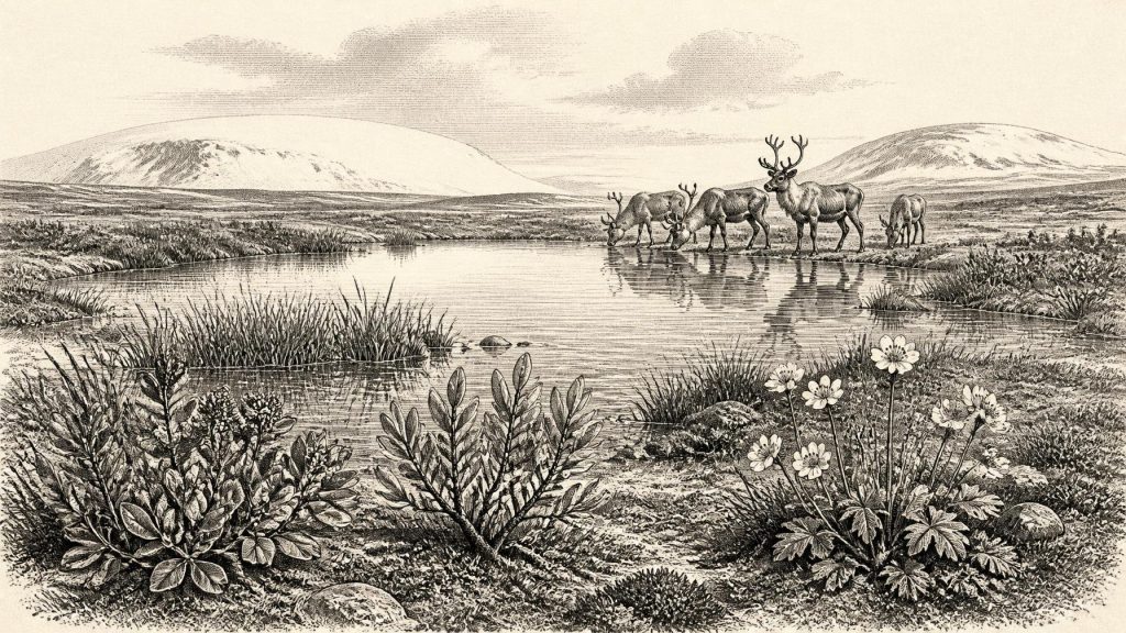
The plant evidence is strikingly northern in character. Fossil remains include bogbean, Menyanthes trifoliata, a wetland plant with three leaflets, as well as mountain avens, dwarf willow, sedges, mosses and other taxa suited to cold, exposed conditions. These finds support the interpretation of damp ground beside shallow freshwater, surrounded not by the familiar oak woodland of much later prehistoric Ireland but by treeless or almost treeless tundra-steppe vegetation. Low shrubs and herbs could exploit brief growing seasons, while pools, wet hollows and sedge-rich margins created small but important ecological refuges.
It would be wrong, however, to imagine an unchanging white wilderness. The plant assemblage shows that liquid water and a functioning wetland ecosystem were possible. Climate across the North Atlantic during Marine Isotope Stage 3 shifted repeatedly and abruptly between colder stadials and relatively milder interstadials. Derryvree’s organic layer records one such window in which vegetation and freshwater organisms established themselves before renewed glacial conditions laid down the upper till. It is evidence for environmental change, not proof that every part of Ireland had the same weather, ground cover or ice margin at the same moment.
Animals of Open Country
County Cork provides the other principal line of evidence relevant to this distant horizon. Castlepook Cave, near Doneraile in the Awbeg valley, produced a large collection of Late Pleistocene animal remains during nineteenth- and early twentieth-century excavations. Later radiocarbon research demonstrated that the wider Irish cave record includes mammals living between at least about 45,000 and 20,000 radiocarbon years ago. Castlepook’s fauna includes reindeer, woolly mammoth, giant deer, brown bear, wolf, Arctic fox, mountain hare, lemmings and spotted hyaena. It establishes beyond doubt that Ireland at various times in this broad pre-Last Glacial Maximum period supported a far richer cold-climate fauna than the modern island.
These animals should not be arranged into a single, simultaneous herd grazing outside the cave. The collection accumulated over a very long interval, and cave deposits have complicated histories. Carnivores brought in prey; animals died naturally; water and gravity moved material; excavators working to standards now superseded removed many bones; and some deposits were mixed. The scientifically secure conclusion is that particular species reached Ireland during the Late Pleistocene. It is a further interpretation, sometimes plausible but always provisional, to reconstruct precisely which species shared one valley, season or generation.
Even so, the animal list and the Derryvree flora make ecological sense together. Reindeer and mammoth were adapted to open landscapes with grasses, sedges and herbs; lemmings, Arctic fox and mountain hare indicate cold-country habitats; hyaenas and wolves were predators and scavengers within that food web. Giant deer and brown bear point to a varied mosaic rather than a featureless plain. Valleys, limestone shelter, wetlands and wind-exposed higher ground would have offered contrasting conditions over relatively short distances. The Ireland of this broad period was not a precursor of modern pastoral scenery but part of a north-west European Ice Age zone.
The Castlepook Question
A single object gives this era exceptional importance for Irish human history: a reindeer femur from the Castlepook collection bears a deep linear mark that zooarchaeological examination has interpreted as damage made by a sharp stone tool on fresh bone. County Cork heritage material has presented it as a possible sign of hunters processing reindeer around 31,000 BCE. If this interpretation is sustained by continuing study, it may represent the earliest known evidence of human action in Ireland by a very large margin.
That possibility must be stated with its limits. The bone itself can be radiocarbon dated, but the date is the age of the animal, not a timestamp for the incision. The specimen came from an old and complex cave collection, rather than a modern excavation recovering a tool, hearth, butchered carcass and occupation surface together in undisturbed layers. Stone-tool cuts must also be distinguished from damage caused by carnivore teeth, trampling, sediment abrasion, breakage, weathering and excavation. No securely associated lithic assemblage, dwelling, burial or repeated occupation deposit of comparable age has yet been identified in Ireland.
The mark therefore cannot demonstrate a permanent population, a camp inside Castlepook Cave, or continuous settlement of the island. Nor can it identify the makers’ language, ancestry, gender, beliefs or political relationships. The strongest cautious interpretation is narrower: people may have entered the Irish landscape during this broad interval and used a sharp stone edge while handling a reindeer carcass. In north-western Europe, mobile Upper Palaeolithic hunter-gatherers certainly possessed such technologies and organised their movements around seasonal resources. Applying that wider context to Ireland is an informed comparison, not direct proof of a local community.
Society at the Edge of Evidence
Consequently, political affairs, diplomacy and organised conflict cannot be recovered for Ireland around 31,496 BCE. There are no settlements, territorial boundaries, monuments, weapons caches or human remains from which to infer them. The same silence applies to religion, ceremonial life, art, language and formal learning. It would be misleading to fill the gap with generic images of “tribes”, shamans or chiefs. Such institutions may have existed among contemporaries elsewhere, but Irish evidence does not reveal them here.
Everyday life is only slightly less elusive. Were the Castlepook modification human-made, it implies practical knowledge: a cutting implement, access to a carcass and an ability to obtain meat, hide, sinew or marrow. It does not show whether the animal was hunted, scavenged, butchered where found or transported. There is no evidence for farming, herding, pottery, metalworking, houses, long-distance exchange or seafaring at this horizon. “Economy” can responsibly mean only the possible direct use of wild resources, set within a landscape whose plants and animals were shaped by severe climatic pressure.
Ice, Sea and Change
The broad date also lay before the best-established maximum of the last British–Irish Ice Sheet. Modern reconstructions show that ice growth and maximum extent varied between sectors: ice was building and reorganising in the wider archipelago around and after 31,000 years ago, while the greatest overall ice volume occurred later, around 23,000 years ago. At 31,496 BCE, one should therefore envisage a changing glacial landscape rather than say simply that Ireland was either wholly ice-covered or wholly ice-free. Derryvree’s lower and upper tills are physical reminders that an organic wetland interval was bracketed by glacial advances.
Sea level was lower than today because large quantities of water were stored in ice sheets, altering coasts and the geography of the Irish Sea basin. Yet lower sea level alone does not prove an easy, continuous land route at a specified date. Ice, rivers, marine channels and changing shorelines all mattered, while the routes followed by animals and any people remain unresolved. The faunal record proves arrivals, not their exact paths. Ireland was connected to wider ecological processes across Britain, the Irish Sea and Atlantic shelf, but the character of those connections changed through time.
The most revealing historical development near this assigned year is thus not a human event but a fragile environmental opportunity. At Derryvree, bogbean and other cold-adapted plants grew beside freshwater before later ice sealed their record within a drumlin. At Castlepook, bones preserve the presence of animals that later vanished from Ireland and raise, in one contested incision, the prospect of a very early human visit. Together they show an island in motion: habitable in places and at times, ecologically productive but climatically precarious, and approaching far more extensive glaciation. That is as close as the evidence allows us to come to Ireland in 31,496 BCE.
Primary Sources
- A Middle Midlandian Freshwater Series at Derryvree, Maguiresbridge, County Fermanagh, Northern Ireland
- The Irish Quaternary Fauna Project
- Heritage Artefacts of County Cork
- Irish Pleistocene Biostratigraphy
- Growth and Retreat of the Last British–Irish Ice Sheet, 31,000 to 15,000 Years Ago: the BRITICE-CHRONO Reconstruction
- Maximum Extent and Dynamic Behaviour of the Last British–Irish Ice Sheet West of Ireland
- The Timing and Magnitude of the British–Irish Ice Sheet Between Marine Isotope Stages 5d and 2
- Extent and Timing of the Last Glacial Maximum in Britain and Ireland: a Review
- New Data for the Last Glacial Maximum in Great Britain and Ireland
- BRITICE Glacial Map, Version 2: a Map and GIS Database of Glacial Landforms of the Last British–Irish Ice Sheet
- Pattern, Style and Timing of British–Irish Ice Sheet Advance and Retreat Over the Last 45,000 Years: Evidence From NW Scotland and the Adjacent Continental Shelf
- Stratigraphic and Palaeo-Geomorphological Evidence for the Glacial-Deglacial History of the Last British-Irish Ice Sheet in the North-Western Irish Sea
- Early Midlandian–Middle Midlandian, Pleistocene, Northern Ireland
- Palaeoecology
- Menyanthes trifoliata
- Dryas octopetala
- First Evidence of a Late Upper Palaeolithic Human Presence in Ireland
- New Insights on the Fauna of Ireland’s Younger Dryas and Early Holocene From Alice & Gwendoline Cave
- Revisiting Alice and Gwendoline Cave, Co. Clare: New Light on the 1902 Excavations
- The IntCal20 Northern Hemisphere Radiocarbon Age Calibration Curve (0–55 cal kBP)