The BIRM-166 Landscape31497 BCE
Around 31,497 BCE, Ireland was a climatically unstable Late Pleistocene landscape rather than a datable year. Derryvree, County Fermanagh, preserves freshwater sediments between successive glacial tills, indicating cold, open periglacial wetlands during part of MIS 3. Castlepook Cave, County Cork, produced remains of reindeer, giant deer, bears, wolves, Arctic foxes, hyaenas and possibly mammoths, though cave contexts are disturbed and revised dating is essential. An incised reindeer bone may indicate butchery but cannot prove settlement. No evidence supports resident communities, agriculture, trade, polities or culture. Later glaciation erased much evidence, leaving a treeless, intermittently accessible Ice Age frontier for fauna.
Dateline
The label 31,497 BCE is useful only as a modern point of reference. It does not identify an event that anybody in Ireland could have dated, recorded or remembered in a calendar. There were no written sources, named rulers, settlements with continuous chronologies or recoverable annual records. In archaeological terms, the date lies roughly 33.4 thousand calendar years before AD 1950, within the Late Pleistocene and Marine Isotope Stage 3 (MIS 3), a long and climatically volatile part of the last Ice Age. At this depth of time, even scientific dates are ranges with margins of error, not anniversaries. The most responsible history of Ireland at this point is therefore a reconstruction from sediments, fossils, landforms and a very small number of disputed traces of human activity.
A Date Within a Range
The nearest Irish evidence does not belong to 31,497 BCE in the modern sense. It belongs to wider environmental phases. Radiocarbon laboratories report ages in years “before present”, conventionally before AD 1950, and those measurements must then be calibrated because atmospheric radiocarbon has varied through time. A measurement may therefore convert into a broad span of calendar dates rather than one year. Calibration curves themselves are periodically refined as new records become available.
The best-known northern Irish sequence relevant to this era is at Derryvree, near Maguiresbridge in County Fermanagh. Roadworks exposed organic freshwater sediments sandwiched between two tills: dense, unsorted deposits left by glacier ice. The succession is striking. First came an ice advance; then there was an interval in which water, plants and mud accumulated; finally, a later advance buried the deposit beneath fresh glacial material. The site demonstrates changing conditions across a long period, but it cannot tell us what occurred in one particular year.
A legacy radiocarbon determination from Derryvree, BIRM-166, returned 30,500 ± 1,100 radiocarbon years BP from moss-rich mud. Published calibrations and stratigraphic discussion place the deposit broadly between about 36,900 and 31,700 cal BP. That wide interval includes the approximate chronological position represented by this article. It should not be mistaken for a precise date for a pond, a plant bed or a human visit. The scientific importance of BIRM-166 lies in showing that, during part of MIS 3, northern Ireland supported an ice-free freshwater environment between glacial episodes.
Freshwater Between the Ice Sheets
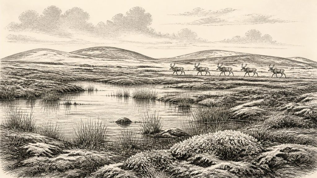
Derryvree was not the green, wooded landscape familiar from later Irish prehistory. Its preserved plant remains, pollen and other environmental indicators point instead to a cold, open, periglacial setting. Mosses, sedges and wet-ground plants grew around shallow freshwater. Bogbean, water-milfoil and dwarf-shrub or tundra-type vegetation have all been important in reconstructions of such Irish cold-stage deposits. The word “wetland” must not suggest an easy refuge: the ground was likely seasonally frozen or affected by permafrost, drainage could be unstable, and long winters imposed severe limits on plant growth.
Yet this was not a uniform desert of permanent ice. The organic layers record liquid water, vegetation and invertebrate habitats. Their position beneath later till is equally important. They preserve a landscape that was subsequently overwhelmed or transformed by ice. Most traces that may once have lain on open ground were vulnerable to erosion, transport and burial during later glaciation. This is a major reason why Ireland’s record for the earlier Upper Palaeolithic is so much thinner than that of regions farther south or places where later ice did less damage.
Other sites in Ulster, notably Hollymount, Greenagho and Aghnadarragh near Lough Neagh, show that Ice Age Ireland contained a succession of changing cold-stage environments rather than a single unbroken glaciation. They also underline a necessary caution: individual deposits may belong to different millennia, and correlations made under older regional names have been revised as dating methods improve. Together they establish environmental variability; they do not create a detailed map of every valley, coast or mountain at 31,497 BCE.
Animals in the Cork Caves
The clearest evidence for large animals in Ireland around the broader MIS 3 period comes from limestone caves in the south, especially Castlepook Cave near Doneraile in north County Cork. Cave collections there contain remains attributed to animals suited to cold, open country, including reindeer, giant deer, brown bear, wolf, Arctic fox and spotted hyaena; mammoth material has also been reported. Such assemblages make sense in a landscape that included grassland, herb-rich open ground, rocky shelter and seasonally productive wetlands rather than dense forest.
These caves were not necessarily places where all the animals died, and they should not be read as a simple census of a local herd. Carnivores may have dragged bones inside; running water, collapse and later excavation disturbed deposits; and early twentieth-century investigations did not record contexts to current standards. Recent re-dating using improved collagen pretreatment has shown that several older cave dates were substantially too young. At Castlepook, some bones proved between roughly 5,000 and 12,000 radiocarbon years older than the results obtained in the 1990s. The revision has strengthened the case for a significant Irish MIS 3 fauna, while also demonstrating why each specimen needs renewed testing.
Reindeer are especially relevant to this article’s date because a Castlepook reindeer femur has been publicised as dating to around 31,000 BCE and as bearing a deep incision consistent with a sharp stone tool used on fresh bone. If that interpretation is correct, it indicates that a person processed part of a reindeer carcass during the Late Pleistocene. It does not establish that hunters killed the animal, that butchery occurred inside the cave, or that a permanent community lived nearby. A discarded limb could have been moved by scavengers after human activity elsewhere.
The Human Question
The Castlepook mark is important precisely because Ireland has no securely excavated camp, hearth, stone-tool assemblage, dwelling floor, grave or artwork of comparable antiquity. The femur came from a cave collection shaped by antiquarian excavation and complicated natural processes. Dating the bone establishes the age of the animal, not automatically the timing or cause of every mark on its surface. The mark’s identification as a human cut therefore remains an interpretation requiring continued microscopic study and, ideally, confirmation from better-contextualised finds.
There is a sounder way to state the position. People occupied parts of north-west Europe during the Upper Palaeolithic, and lower sea levels altered the geography of the seas and plains between Ireland, Britain and continental Europe. Ireland was not demonstrably sealed off in the way it would be after post-glacial sea-level rise. Animals evidently reached the island during favourable windows. It is plausible that highly mobile hunter-gatherers could also have reached it. Plausibility, however, is not evidence of an Irish population. Around 31,497 BCE, the archaeological record allows the possibility of brief human incursions; it does not demonstrate settlement, continuity or a resident society.
That distinction matters when describing everyday life. In continental and British Upper Palaeolithic contexts, people made sophisticated stone and organic tools, used fire, shared knowledge across social networks and sometimes produced symbolic objects and cave art. None of that evidence can responsibly be transferred wholesale to Ireland. No Irish find of this date proves a particular language, kin group, technology, costume, dwelling type, ritual practice or artistic tradition. A possible butchered bone is not a basis for inventing an Irish hunting band, much less a named people.
No Polities, No Proven Trade
Political history is silent here. There is no evidence for chiefs, territories, alliances, warfare, diplomatic exchange or institutions in Ireland at this date. Nor is there evidence for agriculture, herding, stored grain, villages or managed fields. If humans did visit, their likely subsistence would have depended on wild resources: especially large mammals, smaller game, fish or birds where locally available, and seasonally gathered plant foods. But this is an ecological inference from comparable hunter-gatherer worlds, not a documented Irish economy.
Trade and long-distance contact are equally unproven. Ireland has yielded no securely associated imported stone, ornament or tool kit from this period. The low sea levels of the Ice Age may have made movement across parts of the surrounding region less difficult than today, but a route is not proof that anyone used it. The reindeer and carnivore remains show faunal movement and suitable habitats; they do not reveal human exchange networks.
Religion, learning and culture likewise remain beyond direct recovery. People elsewhere in Ice Age Europe undoubtedly possessed social knowledge, stories and beliefs, but archaeology cannot identify their equivalents in Ireland from Derryvree’s silts or Castlepook’s cave bones. The absence of evidence should not be mistaken for evidence that visiting people, if any, lacked culture. It marks the boundary between what the material record can illuminate and what it cannot.
A Landscape Before the Maximum Cold
This date falls before the fullest expansion of the last Irish ice sheet, generally placed later, during the Last Glacial Maximum and its complex regional phases. Ireland’s climate was already cold and unstable, but local ice extent changed through time and remains the subject of active research. In some areas ice, meltwater and frost had already reshaped the land; in others, open cold-country ecosystems persisted long enough for wetlands to form and large mammals to range. Later glaciers would scour and bury much of that terrain, leaving the scattered archives now studied by geologists, palaeoecologists and archaeologists.
The most important development around 31,497 BCE was therefore environmental, not political: Ireland occupied an unsettled Ice Age frontier. At Derryvree, freshwater life existed during an interval between ice advances. At Castlepook and related caves, cold-adapted animals attest to a more varied fauna than Ireland would later possess. One marked reindeer bone raises an intriguing possibility of human activity, but does not yet resolve it. The evidence supports a demanding, treeless and changeable island landscape, occasionally accessible to animals and perhaps people, while firmly resisting the false precision of a year-by-year historical narrative.
Primary Sources
- A Middle Midlandian freshwater series at Derryvree, Maguiresbridge, County Fermanagh, Northern Ireland
- Quaternary Deposits and Glacial Stratigraphy in Ireland
- Irish Pleistocene Biostratigraphy
- The Irish Quaternary Fauna Project
- A Reconsideration of the Radiocarbon Dating of the Marine Isotope Stage 3 Fauna from Southern Ireland
- HERITAGE ARTEFACTS of County Cork
- The Archaeological Heritage of County Cork
- Archaeology Research Excavation Grant 2022
- Castlepook Cave, Co. Cork, 2022 Excavation Report
- Aghnadarragh
- Quaternary Geology of Ireland
- Ireland Through Geological Time
- Last Glacial Maximum Cirque Glaciation in Ireland and Implications for Reconstructions of the Irish Ice Sheet
- Trimlines, Blockfields and the Vertical Extent of the Last Ice Sheet in Southern Ireland
- Restricted Cirque Glaciers in the Wicklow Mountains, Ireland, During the Nahanagan Stadial
- The IntCal20 Northern Hemisphere Radiocarbon Age Calibration Curve (0–55 cal kBP)
- OxCal Calibration Curves
- New Insights on the Fauna of Ireland's Younger Dryas and Early Holocene from Alice & Gwendoline Cave
- The Colonization of Ireland: A Human Ecology Perspective
- Introduction to Prehistoric England
- Sites of Early Human Activity Scheduling Selection Guide
- Goat's Hole Cave, Paviland: Site Record