
Rangifer Beneath Fermanagh Ice31372 BCE
Around 31,372 BCE, a modern label rather than a recoverable year, Ireland experienced fluctuating Late Pleistocene conditions during MIS 3. Derryvree, County Fermanagh, preserves freshwater organic deposits between glacial tills, indicating cold, open tundra wetlands with pools, mosses, grasses, sedges, juniper and insects during an ice-free interval. Crag Cave confirms episodic milder, wetter conditions in south-west Ireland. Ice advances and retreats created a changing regional patchwork. Castlepook Cave yields remains of mammoth, reindeer, giant deer, predators and other fauna, though deposits are mixed. A marked reindeer bone may indicate human activity, but no evidence demonstrates permanent settlement, society or polity.
Dateline
“31,372 BCE” is a modern chronological label, not a recoverable year in Ireland’s past. No people in Ireland kept calendars at this depth of time, and neither archaeology nor earth science can distinguish events within a particular twelve-month span more than thirty-three millennia ago. Counted conventionally from AD 1950, the label falls about 33,321 years before present. It belongs to the Late Pleistocene, in the climatically volatile Marine Isotope Stage 3 (MIS 3), within the Irish Midlandian cold stage. The responsible subject is therefore an interval, not an annual chronicle: a changing island of cold ground, wet hollows, animals and advancing ice.
A Date Within a Broad Window
The most informative evidence reasonably close to this notional date comes from Derryvree, near Maguiresbridge in County Fermanagh. Road works there exposed a sequence buried within a drumlin: freshwater sands, silts and organic deposits lay between two layers of till, the unsorted debris left by glacier ice. The order of the deposits establishes an important sequence. Ice had crossed the district and laid down the lower till; a non-glacial phase then permitted standing or slow-moving freshwater, sediment and plant remains to accumulate; later ice covered the deposit with another till. The survival of this small archive is remarkable because subsequent glaciation erased, disturbed or buried so much older evidence elsewhere.
Organic material from Derryvree produced a conventional radiocarbon determination of about 30,500 radiocarbon years before present, with a substantial error range. Radiocarbon ages are not calendar ages. Atmospheric carbon-14 has fluctuated over time, and calibration of such an old measurement produces a wide probability range rather than a neat conversion. Published reassessments place the deposit broadly around 36,900–31,700 calibrated years before present, approximately 34,950–29,750 BCE. Thus 31,372 BCE lies within the broad temporal horizon illuminated by Derryvree, but it cannot be assigned to a particular layer, season, pool or event there.
That distinction matters. Derryvree is evidence for environmental conditions during a lengthy part of the Late Pleistocene, not proof that its plants and insects were present on one named day in 31,372 BCE. It is also a local record from Fermanagh, not a weather report for every part of Ireland. Yet it offers the best grounded starting point for understanding an island whose human history is otherwise almost silent at this date.
Wet Tundra Between Glacial Advances
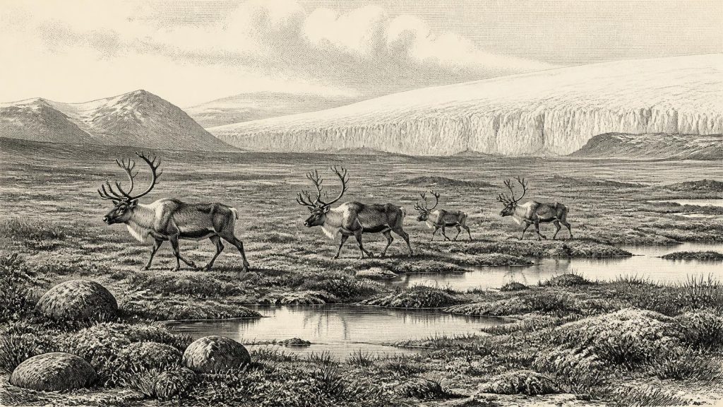
The fossils in the Derryvree organic silts point to open, treeless country. Grasses, sedges, juniper and herbaceous plants, together with a varied moss flora, indicate a cold muskeg or tundra-like wetland rather than woodland. Fossil insects add local texture: they support an interpretation of shallow open pools, plant-rich water margins and mossy ground. This was not simply a white, lifeless wilderness. Water was available during at least part of the year, vegetation occupied sheltered or wet places, and invertebrates completed their life cycles. But it was a severe environment, with cold winters, exposed ground and a short effective growing season.
Such evidence corrects two tempting but misleading pictures. Ireland was not necessarily covered everywhere by a single uninterrupted ice sheet throughout MIS 3; Derryvree itself documents a freshwater interval between glacial episodes. Nor should the interval be romanticised as a familiar green Ireland populated by forest and permanent settlements. The evidence supports an open, cold and highly seasonal landscape. Its appearance would have varied sharply from hollow to ridge, from sheltered basin to wind-scoured upland, and across the long climatic oscillations of the last Ice Age.
Crag Cave in County Kerry supplies a separate kind of environmental evidence. Uranium-thorium dating of cave calcite shows that speleothems formed episodically during MIS 3. Because their growth requires liquid water moving through the cave, these deposits show that south-west Ireland experienced intervals in which local conditions permitted infiltration and calcite deposition. They do not provide a temperature reading for Derryvree or identify a precise Irish climate in 31,372 BCE. Together with the Fermanagh deposits, however, they demonstrate that the cold stage contained interruptions, regional contrasts and environmental change rather than one unvarying freeze.
The Ice Sheet Was Growing
This was also an age of expanding and shifting ice. Older syntheses, drawing on sub-till organic beds, stressed that parts of Ireland remained ice-free until roughly 34,000 years ago. More recent work on the British–Irish Ice Sheet has strengthened the case for substantial glaciation before the better-known Last Glacial Maximum, with dynamic advances and retreats already occurring in MIS 3. These interpretations are not easily reduced to a single map for 31,372 BCE. The dating evidence is uneven, individual sectors of the ice sheet behaved differently, and later ice destroyed much of the record needed to reconstruct its earlier margins.
The secure conclusion is regional change, not a simple national condition. In some places, freshwater basins and cold vegetation survived between ice advances; elsewhere glaciers or ice masses may already have dominated the terrain, depressed the land and altered drainage. The great island-wide expansion associated with the Last Glacial Maximum lay ahead, reaching its principal extent later, broadly during the period after about 27,000 years ago. At this earlier point, Ireland was a patchwork whose boundaries between ice, periglacial ground, wetlands and open water could move on geological timescales that were nevertheless rapid for ecosystems.
Sea level was lower globally than it is today because so much water was held in continental ice. That fact did not create a straightforward, permanent land bridge or an easy route into Ireland. Relative sea level around Ireland was affected as well by the weight of nearby ice and by changes in the crust. The coastlines and channels of the Irish Sea world must therefore be treated as changing physical landscapes, not projected backwards from the modern map.
Castlepook’s Animal Evidence
Far to the south, Castlepook Cave near Doneraile in north County Cork preserves Ireland’s most evocative evidence for a Late Pleistocene animal world. Collections from its narrow limestone galleries include remains attributed to woolly mammoth, reindeer, giant deer, brown bear, wolf, Arctic fox, lemmings and spotted hyaena. Older radiocarbon programmes dated several specimens to the broad pre-Last Glacial Maximum period, including mammoth, reindeer, giant deer, bear and hyaena. Taken cautiously, the assemblage shows that Ireland could support, at different times during MIS 3, a far richer large-mammal fauna than the modern island.
It does not show that every listed species stood together outside the cave in 31,372 BCE. Castlepook’s deposits accumulated over a long period and were subsequently disturbed and re-sorted, probably in part by water. Much of the cave was excavated by antiquarians in the early twentieth century, when recording standards were unlike those now expected. Later reassessment has additionally shown that some older radiocarbon measurements on Irish cave bone require caution because improved pretreatment methods can give markedly different results. Cave collections remain essential evidence, but their age, original position and route into a chamber must be tested specimen by specimen.
Even with those limits, the ecological implication is powerful. Reindeer evoke open feeding grounds and seasonal movement; mammoths and giant deer imply substantial herbivore biomass; hyaenas, wolves and bears show that predators and scavengers were also part of the wider food web. A cave may have acted as a trap, den, shelter, bone-collecting hollow or conduit for waterborne material, so it cannot be treated as a census of ordinary life on the surrounding plain. It nevertheless preserves evidence that animal life persisted through demanding conditions.
The Single Human Question
One reindeer femur from Castlepook has made this remote period especially important to Irish archaeology. The bone has been publicly reported as bearing a deep linear modification interpreted by zooarchaeologist Ruth Carden as a fresh-bone cut or chop made with a sharp stone implement during carcass processing. It has also been presented as being about 33,000 years old. If that interpretation is confirmed, it would indicate that a person handled a reindeer in Ireland in the Upper Palaeolithic, far earlier than the long-established evidence for post-glacial human colonisation.
The evidence must not be made to say more than it can. A modified bone would not identify the person responsible, establish whether the animal was hunted or scavenged, reveal where it died, or demonstrate a permanent population. The animal’s date is not automatically the date of the incision, and a mark needs to be distinguished carefully from damage produced by carnivores, sediment movement, excavation or later handling. Crucially, there is no securely associated hearth, stone-tool assemblage, dwelling floor, burial, food store or repeated occupation sequence from Ireland that proves a settled community in this period. The Castlepook find is a significant possibility of human activity, not a foundation for an invented Ice Age society.
No Polities, No Proven Trade
There is no evidence for political affairs, diplomacy, named leaders, warfare between communities, farming, herding, exchange networks or organised religion in Ireland at this date. Nor is there evidence for monuments, pottery, writing, formal learning or a resident population able to leave a recognisable social landscape. These are not gaps that can responsibly be filled with analogy from much later Irish prehistory. Any visitors suggested by the Castlepook bone would have been extremely mobile foragers, but even that describes a possibility rather than a documented Irish community.
The history of Ireland around 31,372 BCE is instead preserved through scientific learning in the present: stratigraphy records the order of ice and water; pollen, seeds, mosses and insects reconstruct habitats; animal bones reveal parts of a lost fauna; radiocarbon and uranium-thorium dating place those traces in broad chronological relation. Their combined lesson is both modest and remarkable. Ireland was neither an empty calendar page nor a knowable nation. It was a changing north-west European environment where wet tundra could form beneath later drumlins, large mammals ranged through open country, ice margins shifted, and perhaps—on the slender evidence of one marked reindeer bone—people briefly entered the story.
Primary Sources
- A Middle Midlandian Freshwater Series at Derryvree, Maguiresbridge, County Fermanagh, Northern Ireland
- Irish Pleistocene Biostratigraphy
- The Irish Quaternary Fauna Project
- Episodic Speleothem Deposition Tracks the Terrestrial Impact of Millennial-Scale Last Glacial Climate Variability in SW Ireland
- Trimlines, Blockfields and the Vertical Extent of the Last Ice Sheet in Southern Ireland
- The Timing and Magnitude of the British–Irish Ice Sheet Between Marine Isotope Stages 5d and 2
- Growth and Retreat of the Last British–Irish Ice Sheet, 31,000 to 15,000 Years Ago: the BRITICE-CHRONO Reconstruction
- Radiocarbon Constraints on the History of the Western Irish Ice Sheet Prior to the Last Glacial Maximum
- Timing and Pace of Ice-Sheet Withdrawal Across the Marine–Terrestrial Transition West of Ireland During the Last Glaciation
- Oscillating Retreat of the Last British-Irish Ice Sheet on the Continental Shelf Offshore Galway Bay, Western Ireland
- The IntCal20 Northern Hemisphere Radiocarbon Age Calibration Curve (0–55 cal kBP)
- IntCal Publications
- Quaternary Site Descriptions
- The Quaternary of Ireland: References and Recommended Reading
- Figure 6: The Subdivision of the Quaternary Period in Ireland
- New Insights on the Fauna of Ireland’s Younger Dryas and Early Holocene from Alice & Gwendoline Cave
- Heritage Artefacts of County Cork
- 32564: Castlepook Cave, County Cork
- Reindeer Bone Found in Cork Cave Shows Human Activity in Ireland 33,000 Years Ago
- The Castlepook Cave Project
