
BIRM-166 and the Coming Ice31321 BCE
At approximately 31,321 BCE, Ireland lay in the unstable cold conditions of Marine Isotope Stage 3, not entirely under a uniform ice sheet. The date is only a broad calibrated approximation, linked to the BIRM-166 freshwater deposit at Derryvree, Fermanagh. Silts between glacial tills record locally ice-free tundra, wetlands, plants, insects and animals before renewed glaciation. Castlepook Cave, Cork, preserves diverse fauna, including mammoth, reindeer, giant deer, hyaena and cold-adapted species, accumulated across a lengthy period. A possibly cut-marked reindeer bone suggests transient human presence, not settlement. Advancing British-Irish ice later reshaped landscapes and obscured this ecologically varied pre-maximum world.
Dateline
The label 31,321 BCE creates an impression of precision that the evidence cannot sustain. It is a modern calendar position, approximately 33,270 years before AD 1950, within the Late Pleistocene and Marine Isotope Stage 3 (MIS 3). No written record, settlement sequence, or securely dated artefact permits historians to recover an event, a person, or even a particular generation in Ireland at this point. What can responsibly be described is a changing Ice Age landscape, reconstructed from buried sediments, fossil remains, cave deposits and the geology of later glacial advance.
A Date Within a Range
Radiocarbon years are not calendar years. Measurements on ancient organic material must be calibrated against independently dated records of past atmospheric carbon-14, and uncertainty becomes substantial at this depth of time. The nearest especially useful Irish chronology is the BIRM-166 determination from Derryvree, near Maguiresbridge in County Fermanagh: about 30,500 radiocarbon years before present, with a large error range. Published calibrations place the deposit broadly at c. 36,900–31,700 calibrated years BP. The nominal year 31,321 BCE falls inside that broad span, but it must not be treated as the date of the deposit’s formation, still less as a date at which an identifiable occurrence took place.
In Irish terminology this was part of the Midlandian, the last major cold stage; in wider north-west European discussion it belongs to the Middle or Late Devensian. It preceded the fullest expansion of the last British–Irish Ice Sheet. That distinction matters. The familiar Ireland of glacially sculpted valleys, drumlin swarms and widespread till was being shaped across repeated advances and retreats. Around this date, conditions were neither uniform across the island nor fixed from century to century. A cold, locally ice-free habitat could coexist with expanding ice elsewhere in the wider British–Irish region.
Freshwater Under a Drumlin
Derryvree is the most direct environmental window on this part of Irish deep history. Road works in February and March 1969 cut obliquely through a drumlin two kilometres north-east of Maguiresbridge. Investigators found organic freshwater silts and fine sands lying between two thick, distinct sheets of till: unsorted sediment deposited by glacier ice. The stratigraphic order is powerful evidence. An earlier glacier had deposited the lower till; a freshwater environment then existed long enough for sediments, plants and animals to accumulate; a later advance buried the deposit beneath another till.
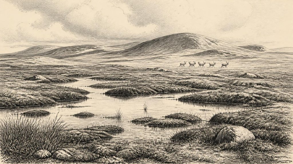
The Derryvree material contained a cold-stage flora and fauna. Its investigators concluded that open tundra vegetation and a periglacial climatic regime prevailed locally. “Periglacial” does not simply mean snowy. It indicates a land affected by severe freezing and thawing, sparse or absent woodland, unstable soils and a short productive season. The freshwater silts point to pools or slow water with abundant organic matter; pollen, plant macrofossils and insects allow a more detailed reading of environmental conditions than bare glacial gravel could provide. Mosses, sedges, herbs and aquatic plants could exploit sheltered, wet ground even where exposure, frost and winter cold made forest impossible.
This was not a timeless white wilderness. In summer, low-growing vegetation, shallow water and wet ground could support insects and grazing animals; in winter, frozen soil, snow cover and long darkness sharply restricted biological activity. Derryvree therefore preserves an ecological mosaic rather than an empty interval between ice sheets. Yet it is a local archive. It demonstrates that north-central Ireland was ice-free when its organic layer accumulated; it cannot, by itself, turn every part of Ireland into the same wetland, or establish the weather of a particular year.
Ice Was Approaching, Not Yet at Its Height
The larger setting was one of unstable climate and mounting glaciation. Modern reconstructions of the British–Irish Ice Sheet emphasise that its growth was asynchronous: ice sectors advanced at different times, with topography, snowfall, sea level, marine margins and internal ice dynamics all affecting their behaviour. Evidence from Derryvree and another interstadial deposit at Greenagho, also in Fermanagh, indicates ice-free conditions in north-central Ireland during part of MIS 3. Glacial modelling and dated landforms nevertheless suggest that major ice-sheet expansion followed after roughly 34,000–32,000 years BP.
At approximately 33,270 calibrated years BP, Ireland was therefore close to a major transition rather than securely within the later glacial maximum. The maximum volume and extent of the British–Irish Ice Sheet came much later, with different sectors peaking at different dates; major southern and western offshore advances belong chiefly to c. 27,000–23,000 years BP. It would be misleading to picture the whole island at 31,321 BCE under one continuous, fully developed ice cover. It would be equally misleading to picture a benign, wholly open island. The responsible conclusion is regional variability amid a worsening long-term cold phase.
Changing ice also changed the map. Sea level was far lower globally than today because so much water was held in continental ice sheets, exposing wider coastal plains around the north-west European shelf. But the precise routes between Ireland, Britain and continental Europe varied with sea level, local ice, rivers and marine conditions. There is no basis for asserting a simple, permanent land bridge available to people or animals at this precise date. Movement may have been possible only intermittently and through challenging coastal, marine or ice-marginal landscapes.
The Cave Fauna of North Cork
Castlepook Cave, near Doneraile in County Cork, provides the other indispensable Irish body of evidence. It is the richest known Irish site for vertebrate remains from the period leading up to the Last Glacial Maximum. Excavations and later finds have produced more than 2,000 bones. The assemblage includes woolly mammoth, giant deer, reindeer, brown bear and spotted hyaena, while Arctic fox, wolf, Norwegian lemming and collared lemming belong among the cold-adapted fauna reported from the cave.
These animals should not be imagined as one neatly contemporary herd. Cave deposits commonly accumulate over long periods, and Castlepook’s deposits were disturbed by water and by older excavation. Modern redating has shown that some earlier radiocarbon results underestimated the age of bones, while the cave’s fauna spans a long interval. The evidence establishes that these species occurred in Ireland during parts of MIS 3; it does not prove that every listed animal occupied County Cork in 31,321 BCE. Still, the assemblage makes a compelling case for recurring open-country habitats capable of sustaining large herbivores, carnivores and scavengers.
The presence of spotted hyaena is especially revealing. Its bones and traces of carnivore activity show that caves were not merely shelters awaiting human use: they were part of animal territories, dens and scavenging networks. A mammoth or reindeer carcass could draw predators, scavengers and, potentially, people. The cave record is consequently evidence for an ecosystem under pressure from cold and seasonal scarcity, not for a settled pastoral landscape.
People: A Possibility, Not a Polity
A reindeer femur from Castlepook has been reported as bearing a deep mark consistent with cutting by a stone tool and as dating to roughly 33,000 years ago. If that interpretation is upheld, it would indicate a human visit or butchery episode in Ireland before the Last Glacial Maximum, far earlier than the formerly accepted evidence for Late Upper Palaeolithic activity. It would not demonstrate continuous settlement. No associated hearth, dwelling, stone-tool assemblage, human burial or securely stratified processing floor of this age has yet been recovered from the cave.
Accordingly, political affairs, diplomacy, named communities and warfare are beyond the evidence. There were no states, kingships, borders, written languages or institutions known from Ireland at this time. If people did reach the island, they were almost certainly small, mobile hunter-gatherer groups within wider north-west European networks, equipped with perishable clothing and shelters as well as stone tools. That is a reasoned comparison with contemporary Upper Palaeolithic societies elsewhere, not a direct description of an Irish community. Their numbers, routes, languages, beliefs and duration of residence remain unknown.
Culture, Economy and What Endured
There is no responsible evidence for ritual sites, art, formal religion, farming, metalworking, trade goods or permanent villages in Ireland at this date. Nor can foodways be reconstructed beyond the possibility that any human visitors may have targeted or scavenged large game. The economic foundation visible in the record is ecological: wetlands generated plant and insect life; tundra supported grazers; caves concentrated animal remains; and seasonal movement determined opportunity. A cut-mark, if genuinely human-made, is evidence of an action upon an animal bone, not evidence of an organised reindeer-hunting economy.
The enduring significance of this period is environmental. The Derryvree freshwater layer and the Castlepook fauna preserve rare fragments of a pre-maximum Ireland later buried, eroded or rearranged by ice. They show that the island’s Ice Age history included habitable patches, productive wet ground and a much richer mammal fauna than survives today. They also foreshadow destruction: advancing ice would transform the terrain, erase many earlier surfaces and leave the glacial deposits that now dominate Ireland’s Quaternary landscape. For 31,321 BCE, that approaching transformation is the central story—not an invented human event, but the precarious persistence of life before renewed ice remade the island.
Primary Sources
- A Middle Midlandian Freshwater Series at Derryvree, Maguiresbridge, County Fermanagh, Northern Ireland
- Middle Midlandian Interstadial Deposits at Greenagho, Near Belcoo, County Fermanagh, Northern Ireland
- A Reconsideration of the Radiocarbon Dating of the Marine Isotope Stage 3 Fauna from Southern Ireland
- Castlepook Cave
- 2022:564 – Castlepook Cave, Castlepook South, Cork
- Occurrence of Mammalia Relicts at Site Castlepook Cave
- The Irish Quaternary Fauna Project
- Growth and Retreat of the Last British–Irish Ice Sheet, 31,000 to 15,000 Years Ago: The BRITICE-CHRONO Reconstruction
- Pattern and Timing of Retreat of the Last British-Irish Ice Sheet
- Trimlines, Blockfields and the Vertical Extent of the Last Ice Sheet in Southern Ireland
- Last Glacial Maximum Cirque Glaciation in Ireland and Implications for Reconstructions of the Irish Ice Sheet
- Late Pleistocene Chronostratigraphy and Ice Sheet Limits, Southern Ireland
- Radiocarbon Constraints on the Age of the Maximum Advance of the British-Irish Ice Sheet in the Celtic Sea
- Advance and Retreat of the Marine-Terminating Irish Sea Ice Stream into the Celtic Sea During the Last Glacial: Timing and Maximum Extent
- Maximum Extent and Readvance Dynamics of the Irish Sea Ice Stream and Irish Sea Glacier Since the Last Glacial Maximum
- The IntCal20 Northern Hemisphere Radiocarbon Age Calibration Curve (0–55 cal kBP)
- IntCal Publications
- Quaternary
- Quaternary Geomorphology Map Service
- Prehistoric Details
- Ice Age Ireland: Cool Fossils!
- Guide to the National Museum of Ireland – Natural History
- First Evidence of a Late Upper Palaeolithic Human Presence in Ireland
- The Colonization of Ireland: A Human Ecology Perspective
- New Insights on the Fauna of Ireland's Younger Dryas and Early Holocene from Alice & Gwendoline Cave
