BIRM-166’s Calendar Problem31314 BCE
31,314 BCE is a modern label rather than a recoverable Irish year. Derryvree, County Fermanagh, preserves a freshwater organic layer between glacial deposits, dated broadly within late Marine Isotope Stage 3, indicating locally ice-free, treeless wetland amid an increasingly unstable cold climate. Castlepook Cave, County Cork, contains a complex, multi-period fauna including mammoth, giant deer, reindeer, bear and hyaena. A marked reindeer femur may indicate exceptionally early human handling, but its context prevents firm conclusions about settlement or hunting. Ireland was environmentally dynamic as ice expanded; human presence remains possible, not established during this poorly resolved interval of deep prehistory.
Dateline
31,314 BCE is a modern label, not a year that can be recovered from Ireland’s prehistoric record. No community then used a calendar known to us, and neither archaeology nor Quaternary science can identify an Irish event within one numbered year so remote in time. The responsible subject is therefore a broad late-Pleistocene interval. In conventional calendar terms, 31,314 BCE is about 33,264 years before the 1950 reference point used for ‘BP’ dating. It falls within the published calibrated range of a remarkable Fermanagh deposit at Derryvree, but that does not mean the sediment represents this exact year. It offers a window on conditions across many centuries or millennia.
The evidence belongs to the later part of Marine Isotope Stage 3, a fluctuating cold phase before the Last Glacial Maximum. Radiocarbon results must be calibrated because atmospheric carbon-14 levels changed through time; calibration produces probability ranges rather than an annual timestamp. The Derryvree organic layer produced BIRM-166, conventionally dated to 30,500 ± 1,200 radiocarbon years BP and published as approximately 36.9–31.7 thousand calibrated years BP. The broad range encompasses the notional year in this article, while its breadth is itself an essential part of the story.
A Freshwater Layer Between Ice
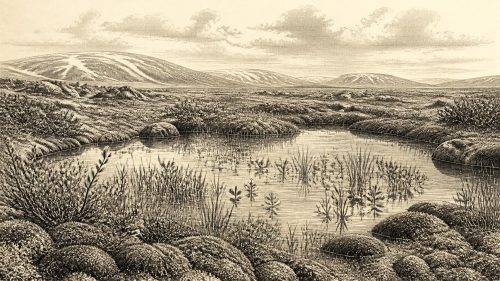
Derryvree lies near Maguiresbridge in County Fermanagh. There, a road cutting through a drumlin exposed a rare tripartite sequence: glacial sediment below, an organic freshwater deposit in the middle, and glacial sediment above. The middle layer was described as moss-rich mud with freshwater silts and fine sands. Its value is straightforward but profound: living plants, shallow water and sediment could accumulate there before later ice or ice-related deposits sealed the record.
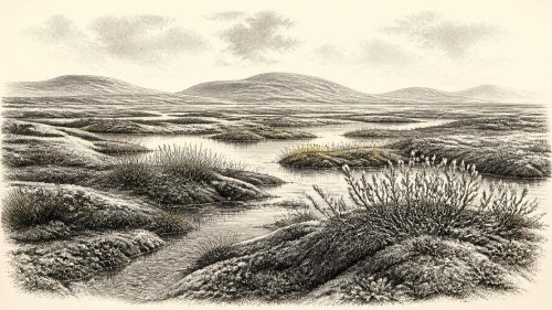
Pollen, plant macrofossils and insect evidence from this kind of deposit do not provide a photograph of the whole island. They are local evidence, influenced by a particular basin and its catchment. Yet Derryvree is among Ireland’s best evidence that north-central parts of the island were ice-free during an earlier cold interval, before the major expansion of the last Irish Ice Sheet. The original interpretation envisaged treeless muskeg: waterlogged, peaty ground, pools and wet hollows rather than a closed forest or a fertile lowland. Later syntheses continue to treat the deposit as a key constraint, whilst recognising that the chronology and sequence of Irish glaciation remain difficult to resolve.
Treeless Country, Not Empty Country
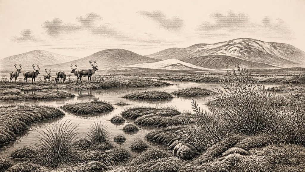
At and around this point in time, Ireland’s climate was cold, strongly seasonal and unstable on scales far beyond an ordinary human lifetime. The plant record supports an open landscape with mosses, sedges and other cold-tolerant vegetation; dwarf willow and fir clubmoss are among fossils reported from Derryvree. Such evidence supports the existence of wetlands bordered by tundra-like or steppe-tundra vegetation. It does not warrant a claim that every Irish valley looked identical. Elevation, local drainage, exposure to Atlantic weather and proximity to growing ice all mattered.
There were no oak woods, fields, hedges, villages or bogs in the familiar later Irish sense. In a treeless terrain, wind would have been a major physical force. Frost, thaw, saturated ground and seasonal snow would have shaped travel and animal movement. The freshwater layer makes an important correction to the tempting image of an island uniformly entombed beneath ice: at some stage within its date range, this locality supported an active wetland ecology. But it was an ecological opening bounded in the geological record by glacial conditions, not a promise of long-term stability.
The wider trajectory was towards severe glaciation. Reviews of the British–Irish Ice Sheet place its build-up after roughly 35–32 thousand years ago, with maximum extent later, broadly between 27 and 21 thousand years ago. The precise timing, thickness and limits of Irish ice remain debated, especially in southern and western areas. For 31,314 BCE, the safest conclusion is not that Ireland was either wholly ice-free or wholly ice-covered, but that its landscapes were changing within an expanding glacial system.
Animals in the Cave Archive
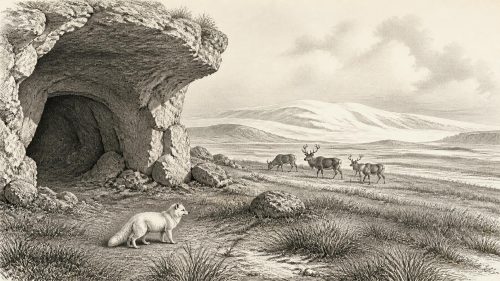
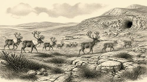
County Cork supplies the other major body of directly relevant evidence. Castlepook Cave, near Doneraile, was explored in the early twentieth century and has since proved exceptionally important for Irish Pleistocene fauna. Its deposits and museum collections include remains attributed to woolly mammoth, giant deer, reindeer, brown bear and spotted hyaena, as well as smaller cold-adapted animals in parts of the wider assemblage. These names convey a striking point: during portions of the late Pleistocene, Ireland supported or received mammals now extinct locally or globally.
Nevertheless, a cave collection is not a single living community. Bones may have been brought in by hyaenas, water, scavengers or natural deaths; early excavation also disturbed context and dispersed material. Direct dating shows that the Castlepook material spans more than one period. Improved pretreatment and radiocarbon dating have revised several specimens substantially older than their earlier dates, placing some fauna in MIS 3 and indicating that giant deer and spotted hyaena may have disappeared from southern Ireland before the Last Glacial Maximum. The scientifically defensible picture is of recurring animal use of an accessible landscape over long spans, not a claim that mammoths, bears, reindeer and every listed species stood together outside the cave in 31,314 BCE.
The Reindeer Femur Question
Castlepook also matters because one reindeer femur has been presented as carrying a deep mark made by a sharp stone tool while fresh tissue was being removed. County Cork’s heritage publication dates the object to about 31,000 BC and identifies it as part of the National Museum of Ireland’s Natural History collection. If the mark is correctly recognised as a cut mark and is contemporary with the animal’s death, it would indicate that a person, or a very small party, handled a reindeer in Ireland during this remote interval. That would be momentous: it would extend evidence for human activity far beyond Ireland’s later, much better documented hunter-gatherer record.
‘If’ is indispensable. The specimen derives from an old cave collection, not from a newly excavated occupation floor with associated tools, hearths, food waste, shelters or human remains. A date on the bone dates the animal, while the diagnosis of a surface groove requires a separate taphonomic judgement. One marked bone cannot establish a permanent settlement, population size, language, kin group, route of arrival or cultural tradition. Nor can it demonstrate an organised hunt: a carcass might have been found, scavenged or processed after an unsuccessful pursuit.
Thus the evidence supports possibility, not a settled narrative. It is reasonable to say that mobile Upper Palaeolithic hunter-gatherers may have made brief incursions into Ireland when conditions allowed. It is not responsible to populate the island with a named people or to describe a camp at Castlepook. The contrast is instructive: the terminal-Pleistocene bear bone from Alice and Gwendoline Cave in County Clare has been published as evidence of human modification, but even that later evidence has prompted debate about context and ecological viability. Ireland’s earliest human story remains unusually fragile because its traces are few and often recovered by antiquarian excavation.
Society Beyond the Evidence
There is no evidence for political institutions, diplomacy, warfare, leadership, formal religion, art, writing, monuments, agriculture or trade networks in Ireland at this date. Those absences matter. To invent rival groups, alliances or ritual practices would turn an environmental archive into fiction. If people did visit, comparison with contemporary European hunter-gatherers suggests small, flexible groups whose work could include watching animal movements, making and maintaining stone tools, sharing meat and hides, and moving as weather and resources changed. These are informed analogies, not observed Irish facts.
Likewise, low sea level may have extended coastal plains and reduced some distances, but it does not prove a reliable dry land bridge from Britain to Ireland at this particular time. The sea crossings, shorelines and ice conditions remain central uncertainties in any account of arrival. A short-lived visit, whether by sea, across seasonal ice, or by a route no longer visible, is a question for future evidence rather than a conclusion already won.
What This Date Can Mean
The significance of 31,314 BCE lies in restraint. Derryvree preserves a scientifically dated freshwater environment between phases of glaciation; Castlepook preserves a deep and complicated archive of Ice Age fauna; one reindeer bone raises the prospect of exceptionally early human activity. Together they show an Ireland that was ecologically dynamic and increasingly vulnerable to ice-sheet growth. They do not yield an annual chronicle.
For this notional year, the most secure historical statement is that Ireland formed part of a cold north-west European world in which wetlands could persist locally, large mammals ranged through at least some accessible terrain, and glaciation was becoming the dominant long-term force. Whether people were present remains an important, testable possibility rather than an established national beginning. That distinction is not a weakness in the story. It is the discipline that makes Ireland’s deep past intelligible.
Primary Sources
- A Middle Midlandian Freshwater Series at Derryvree, Maguiresbridge, County Fermanagh, Northern Ireland
- Trimlines, Blockfields and the Vertical Extent of the Last Ice Sheet in Southern Ireland
- Exploring Controls of the Early and Stepped Deglaciation of the British-Irish Ice Sheet
- Figure 6—The Subdivision of the Quaternary Period in Ireland
- A Reconsideration of the Radiocarbon Dating of the Marine Isotope Stage 3 Fauna from Southern Ireland
- The Irish Quaternary Fauna Project
- Castlepook Cave: County Geological Site Report
- Heritage Artefacts of County Cork
- Castlepook Cave, Castlepook South, Cork: Excavation Report 2022:564
- The Exploration of Castlepook Cave, County Cork
- Occurrence of Mammalia Relicts at Site Castlepook Cave
- Extent and Timing of the Last Glacial Maximum in Britain and Ireland: A Review
- Late Pleistocene Chronostratigraphy and Ice Sheet Limits, Southern Ireland
- Last Glacial Maximum Cirque Glaciation in Ireland and Implications for Reconstructions of the Irish Ice Sheet
- Reconstructing the Last Irish Ice Sheet 2: A Geomorphologically-Driven Model of Ice Sheet Growth, Retreat and Dynamics
- Pattern and Timing of Retreat of the Last British-Irish Ice Sheet
- Growth and Retreat of the Last British–Irish Ice Sheet, 31,000 to 15,000 Years Ago: The BRITICE-CHRONO Reconstruction
- The Colonization of Ireland: A Human Ecology Perspective
- The Island of Ireland: Drowning the Myth of an Irish Land-Bridge?
- The IntCal20 Northern Hemisphere Radiocarbon Age Calibration Curve (0–55 cal kBP)
- First Evidence of a Late Upper Palaeolithic Human Presence in Ireland
- New Insights on the Fauna of Ireland’s Younger Dryas and Early Holocene from Alice & Gwendoline Cave