

Derryvree Beneath Renewed Ice31290 BCE
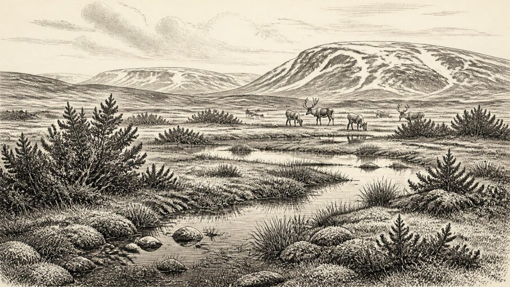
At 31,290 BCE, Ireland cannot be described through a precisely dated historical event, but through a Late Pleistocene environmental horizon. Derryvree, County Fermanagh, preserves freshwater sediments and organic remains between glacial tills, indicating an ice-free periglacial mosaic of tundra, wetlands, grasses, sedges and juniper during MIS 3. Its radiocarbon date spans a broad calibrated range, including this notional year. Crag Cave records milder episodic conditions, while Castlepook Cave documents cold-adapted fauna, including mammoth, reindeer, giant deer, hyaena and Arctic fox. Human presence remains possible, based on a potentially butchered reindeer bone, but settlement is unproven. Evidence reveals ice and water.
Dateline
The label 31,290 BCE cannot responsibly be treated as a dated year in Irish history. It corresponds approximately to 33,239 calendar years before AD 1950, within the Late Pleistocene and Marine Isotope Stage 3 (MIS 3), a long and climatically unstable part of the last glacial cycle. No Irish document, settlement sequence or archaeological layer can be assigned to this particular calendar year. The evidence instead permits a carefully bounded account of an interval: an Ireland of cold open ground, freshwater hollows, roaming large mammals and changing ice margins, known through sediments, fossil remains and cave deposits.
The most informative Irish site for this broad horizon is Derryvree, near Maguiresbridge in County Fermanagh. In 1969, roadworks cut through a drumlin and exposed fine sands, freshwater silts and organic material trapped between two substantial bodies of till, the unsorted debris deposited by glacier ice. The sequence is important because its order is clear. Ice had crossed the locality and left the lower till; subsequently, water, sediment and plant material accumulated; later glacial activity covered the deposit with a second till. Derryvree is therefore evidence for major environmental change, not a snapshot of a single season or year.
A Broad Dating Window
Organic material from the Derryvree deposits produced radiocarbon determination BIRM-166: 30,500 radiocarbon years before present, with a considerable laboratory uncertainty of +1,170 and −1,030 years. Radiocarbon ages are not calendar ages. The amount of atmospheric carbon-14 has changed through time, so results must be calibrated using internationally maintained curves. At more than 30,000 years ago, calibration has wide uncertainty ranges and depends on several independently dated archives. Scholarship accordingly places the Derryvree deposit broadly within later MIS 3, with calibrated estimates spanning roughly 36,900 to 31,700 calendar years before present.
31,290 BCE falls within that wide calibrated interval, but it cannot be pinned to an individual Derryvree bed, an animal visit or a human action. Its value is as a point within a dated environmental horizon. This distinction matters especially in Ice Age Ireland, where later glaciers eroded, redeposited or buried vast quantities of earlier evidence. The archaeological record is exceptionally thin not necessarily because nothing occurred, but because the island’s subsequent glacial history was highly destructive to exposed landscapes.
Water Between the Tills
Derryvree contradicts any simple picture of an island locked continuously beneath an unbroken ice sheet. Its freshwater sediments show that, during part of the last glacial cycle, this Fermanagh locality was ice-free enough for standing or slow-moving water and organic material to accumulate. The fossil evidence points to a periglacial setting: a harsh landscape shaped by prolonged frost, thaw, saturated ground and a short but biologically productive growing season. It was not a modern peatland, forest or farmed countryside.
Pollen, plant macrofossils, mosses and insects recovered from the deposit indicate open tundra or muskeg. Grasses, sedges, herbs and juniper formed much of the terrestrial vegetation, while wet places supported aquatic and marsh plants. A fossil seed of bogbean, Menyanthes trifoliata, is particularly evocative. Bogbean needs freshwater conditions; its presence confirms that cold did not mean a wholly dry, lifeless surface. Mossy margins, shallow pools and plant-rich watercourses could sustain insects and small animals even where woodland was absent.
The evidence supports local ecological variety rather than a uniform plain. Low hollows could collect meltwater and sediment; slightly better-drained ridges might carry sparse grass and herb cover; exposed ground would have been vulnerable to wind and frost. Winters were severe, and frozen soil may have restricted drainage, but summer sunlight could briefly energise vegetation. Such mosaics are significant because they created forage and shelter for animals and, potentially, for any people moving through the region.
Ice, Climate and Changing Geography
This was not yet the Last Glacial Maximum, when the British–Irish Ice Sheet later expanded to its greatest extent, chiefly between about 27,000 and 23,000 calendar years ago in different sectors. Reconstructions of the sheet’s growth remain under refinement, and Ireland was not necessarily covered in the same way at the same time. Derryvree’s inter-till sequence is direct local evidence that ice conditions had changed before the later advance which sealed its freshwater archive.
South-west Ireland offers a complementary, though different, climate record. At Crag Cave in County Kerry, uranium-thorium dating shows that stalagmites grew episodically during MIS 3. Stalagmite growth requires liquid water moving through rock and cave passages, so these episodes indicate intervals when local mean annual conditions were sufficiently mild for that circulation. They do not prove that every district was warm, wooded or hospitable, but they demonstrate that the Irish climate responded sharply to the millennial-scale swings recorded across the North Atlantic.
Sea level was far lower than today because so much water was stored in continental ice. Ireland’s coasts and the surrounding shelf therefore had a different shape, and the Irish Sea was not the fixed maritime barrier familiar in the modern world. Yet it would be wrong to turn this into a simple land-bridge story. Ice, rivers, marine channels, shifting shorelines and seasonal conditions all affected movement. Fossils establish that animals reached Ireland during portions of this wider period; they do not identify a single route, date or crossing.
The Castlepook Fauna
For animal life near this broad timescale, Castlepook Cave in County Cork is indispensable. Excavated principally in the early twentieth century, it has yielded more than 2,000 bones and is Ireland’s richest known cave archive for fauna from before the Last Glacial Maximum. Its deposits include remains attributed to woolly mammoth, reindeer, giant deer, brown bear, wolf, Arctic fox, mountain hare, collared and Norwegian lemmings, and spotted hyaena. This was a recognisably north-west European Ice Age fauna, but one represented in Ireland by a small and complicated survival.
The assemblage should not be imagined as a single herd gathered on one day. Cave sediments were disturbed by water, earlier excavations removed much of the original stratigraphy, and bones from different periods may have become mixed. Radiocarbon programmes have substantially revised the chronology of some specimens, demonstrating both the importance of modern pretreatment methods and the fragility of older assumptions. Geological Survey Ireland describes dates from individual Castlepook bones spanning a long interval, approximately 45,700 to 19,950 years before present. Thus Castlepook establishes that these species occupied or visited Ireland over portions of the Middle and Late Devensian, not that every species was present in 31,290 BCE.
Spotted hyaena is especially revealing. Its bones and tooth-marked prey remains suggest that caves could be used as carnivore dens or repositories, rather than as natural cemeteries. Hyaenas may have carried in bones from scavenged or hunted carcasses; carnivores, water and later sediment movement all shaped what survives. Mammoth, reindeer and giant deer testify to open-country grazing opportunities, while Arctic foxes and lemmings reinforce the cold character of at least some phases. The absence of animals from the collection is less decisive: preservation, discovery and past collecting methods all determine what can be found.
People: A Possible Trace, Not a Population
There is no securely demonstrated settlement, house, hearth, cemetery, tool-making floor or human skeleton from Ireland that can be assigned to this date. Accordingly, there can be no evidence-based account of political affairs, diplomacy, leaders, institutions or organised conflict. There are no grounds for describing tribes, territories, languages, religious practices or social ranks in Ireland at 31,290 BCE. Those familiar categories belong to much later human societies and should not be projected backwards onto a nearly silent record.
A reindeer bone from Castlepook has been reported as carrying marks consistent with stone-tool butchery and dating to around 33,000 years ago. If further analysis confirms that the marks were made by people rather than carnivore teeth, sediment movement or damage during excavation, it would be important evidence that Upper Palaeolithic humans handled an animal in Ireland during MIS 3. It would not, by itself, demonstrate permanent residence, a large population or a named cultural group. A single modified bone could represent a short visit by mobile hunters, or material brought to the cave through complex processes. The proper conclusion remains cautious: human presence is possible, not securely established as a settled Irish population.
Everyday Life Without an Archive
If people did enter Ireland in this period, their most plausible economy would have been highly mobile foraging: watching animal movements, obtaining meat and hides where opportunities arose, and exploiting seasonal plants, birds, fish or small game where local conditions allowed. That is an inference from Upper Palaeolithic lifeways elsewhere in north-west Europe, not direct evidence from an Irish camp. Neither Derryvree nor Castlepook has yielded the domestic debris needed to reconstruct food preparation, clothing, family life, ritual or learning in detail.
The more secure story is environmental. Derryvree records freshwater life persisting between glacial advances. Castlepook preserves the bones of animals adapted to or able to use cold open landscapes. Crag Cave records pulses of liquid-water circulation during climatic improvement. Together they show that Ireland around the notional date was neither a timeless frozen void nor a landscape ready for later farming and settlement. It was a volatile frontier of ice, tundra, wetlands and mobile fauna. The deepest historical lesson is methodological: at this depth of time, the responsible history of Ireland is a history of evidence—what a seed, a silt layer, a bone or a calcite drip can show, and what they cannot.
Primary Sources
- A Middle Midlandian Freshwater Series at Derryvree, Maguiresbridge, County Fermanagh, Northern Ireland
- The Irish Quaternary Fauna Project
- A Reconsideration of the Radiocarbon Dating of the Marine Isotope Stage 3 Fauna from Southern Ireland
- Castlepook Cave, Castlepook South, County Cork: County Geological Site Report
- The Exploration of Castlepook Cave, County Cork, Being the Third Report from the Committee Appointed to Explore Irish Caves
- The Exploration of Castlepook Cave, Co. Cork. With 3 Plates.
- Pleistocene Vertebrates in the British Isles
- Spotted Hyena Skull
- Castlepook Cave Excavation 2022
- Archaeological Heritage of County Cork: A Heritage Plan for County Cork 2020–2026
- Episodic Speleothem Deposition Tracks the Terrestrial Impact of Millennial-Scale Last Glacial Climate Variability in SW Ireland
- Growth and Retreat of the Last British–Irish Ice Sheet, 31,000 to 15,000 Years Ago: The BRITICE-CHRONO Reconstruction
- Trimlines, Blockfields and the Vertical Extent of the Last Ice Sheet in Southern Ireland
- British–Irish Ice Sheet and Polar Front History of the Goban Spur, Offshore Southwest Ireland Over the Last 250,000 Years
- Maximum Extent and Dynamic Behaviour of the Last British–Irish Ice Sheet West of Ireland
- Timing and Pace of Ice-Sheet Withdrawal Across the Marine–Terrestrial Transition West of Ireland During the Last Glaciation
- The Timing and Magnitude of the British–Irish Ice Sheet Between Marine Isotope Stages 5d and 2
- A Stratigraphic Framework for Abrupt Climatic Changes During the Last Glacial Period Based on Three Synchronized Greenland Ice-Core Records
- The IntCal20 Northern Hemisphere Radiocarbon Age Calibration Curve (0–55 cal kBP)
- IntCal20: Radiocarbon Calibrations
- New Insights on the Fauna of Ireland's Younger Dryas and Early Holocene from Alice & Gwendoline Cave
- BSBI: Menyanthes trifoliata
- Regional Pleistocene Geology
- The Late Quaternary History of East-Central Ireland