

Fermanagh’s Intertill Flora31340 BCE
At the notional date of 31,340 BCE, Ireland lay within the climatically unstable MIS 3 glacial interval, not a datable historical year. Evidence from Derryvree in Fermanagh records a freshwater tundra episode between glacial tills, with mosses sedges dwarf shrubs and cold-adapted plants. Castlepook Cave in Cork preserves diverse pre-Last Glacial Maximum fauna, including mammoth reindeer and predators, though its disturbed deposits prevent a single chronology. Ireland was variably ice-covered, connected to north-west Europe, and productive in places. No evidence establishes human settlement; a possibly marked reindeer bone suggests tentative MIS 3 human activity. Later ice buried much surviving evidence.
Dateline
31,340 BCE is not a date at which Ireland can be given an annual chronicle. No written record, settlement sequence or archaeological horizon can be resolved to that individual modern calendar year. The number is best treated as a position within the later part of the Last Glacial period, broadly within Marine Isotope Stage 3 (MIS 3). It lies roughly 33,300 calendar years before AD 1950, the conventional reference point for calibrated radiocarbon dating, but scientific dating at this depth has margins measured in centuries or millennia. The responsible history of Ireland at this point is therefore an account of an environmental interval: changing ice, cold freshwater, sparse vegetation, animals and the uncertain possibility of very occasional people.
Calendar Years and Deep Time
Modern BCE notation can create a false sense of precision. A radiocarbon measurement does not produce a calendar year directly: atmospheric radiocarbon has varied through time, so the result must be calibrated against an independently constructed curve. Older samples also have substantial statistical uncertainty, while deposits may contain material transported from elsewhere or mixed by water, ice, animals and earlier excavation. A date of 31,340 BCE should not be attached to a particular Irish mammoth, reindeer, pond or human action.
The relevant Irish regional terminology is also less straightforward than it first appears. The Midlandian is the name often used in Ireland for the last glacial cycle; MIS 3 is a wider climatic stage recognised from global marine and ice-core records. These were not uniformly cold or uniformly ice-covered ages. They contained abrupt climatic swings, and the growth of the British–Irish Ice Sheet was regionally varied. Research on the ice sheet’s 31,000–15,000-year history expressly acknowledges uncertainty over conditions around 31,000 years ago: particular parts of Ireland may have been ice-free, while others may have supported glacier ice. The far more extensive Last Glacial Maximum lay later, chiefly after about 27,000 years ago.
An Exposed, Cold Landscape
Around this broad interval, Ireland was not the green, wooded Atlantic island familiar today. Sea level was lower than at present because vast quantities of water were stored in continental ice sheets. Ireland’s connections with Britain and the wider north-west European landmass changed repeatedly as sea level, glaciers and drainage systems altered. It is unsafe to picture a simple, permanent land bridge, but Ireland was not yet the enduring island it became after the later glacial retreat and rising seas. Animals, and potentially people, could in some periods move through a geographically more connected north-west European world.
The strongest direct environmental indication comes from Derryvree townland, about two kilometres north-east of Maguiresbridge in County Fermanagh. Roadworks in 1969 cut across a drumlin and exposed freshwater silts and fine sands sandwiched between two distinct sheets of till, the poorly sorted debris left by glacier ice. The sequence tells a powerful relative story: glaciation had occurred; a freshwater environment subsequently existed at this locality; and renewed ice advance later buried it. It does not demonstrate that every part of Ireland followed the same history at the same moment.
Organic sediments at Derryvree produced a conventional radiocarbon determination of 30,500 +1,170/−1,030 BP, known as Birm-166. That is a radiocarbon age rather than a precise calendar date. Its calibrated possibilities are broad, and the measurement cannot establish conditions in 31,340 BCE itself. Yet it makes Derryvree exceptionally relevant to the period: it is one of the rare Irish deposits showing that a living freshwater tundra landscape existed during the Middle Midlandian, before it was sealed beneath later till.
The Derryvree Wetland
The Derryvree plants are more informative than the sparse and degraded pollen alone might suggest. Pollen was mainly from herbaceous vegetation, and plant macrofossils and spores included taxa adapted to cold, open ground and wet margins. These include mountain avens (Dryas octopetala), dwarf willow (Salix herbacea), lesser clubmoss (Selaginella selaginoides) and bogbean (Menyanthes trifoliata). Moss remains were especially important. Together, they indicate treeless tundra and a periglacial regime: ground shaped by severe frost, seasonal thaw and low-growing vegetation rather than forest.
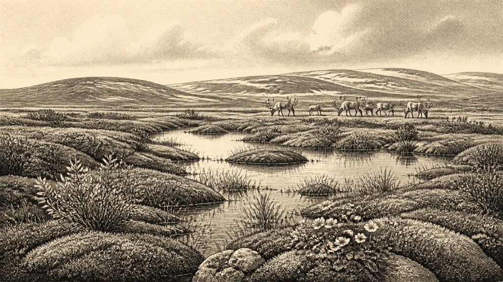
This was not an empty polar desert. The freshwater component matters. Bogbean and water-milfoil evidence points to standing or slowly moving water, while sedges, grasses and mosses imply damp ground around it. The most useful reconstruction is a patchwork of shallow pools, wet hollows, sedge-rich margins and exposed mineral ground, with sparse herbs and dwarf shrubs beyond. Snow cover, frozen soil and short growing seasons would have made annual conditions harsh, but the summer landscape could still have supported plants, insects and grazing animals. Derryvree is thus evidence for ecological productivity under cold conditions, not evidence for a mild climate.
Nor should its flora be turned into an exact map. The deposit samples a particular basin in south Fermanagh. Pollen can travel long distances, preservation is selective, and sediments accumulate over time. The few pine and hazel pollen grains reported from the deposit are generally treated with caution; they may be reworked from older sediments rather than proof of local woodland. The secure interpretation rests instead on the wider dominance of herbs, mosses and cold-adapted plant remains.
Animals at the Atlantic Edge
Castlepook Cave, also called Mammoth Cave, near Doneraile in north County Cork supplies the chief faunal counterpart to the Fermanagh wetland. Its long limestone galleries yielded Ireland’s richest known collection of vertebrate remains from before the Last Glacial Maximum. Woolly mammoth, reindeer, giant deer, brown bear, wolf, Arctic fox, mountain hare, lemmings and spotted hyaena are among the animals documented there. This combination shows that parts of Ireland could support a much more varied cold-stage fauna than the island’s later isolation would suggest.
There are important qualifications. Castlepook was excavated extensively in the early twentieth century, long before modern excavation, recording and sampling standards. Water movement, carnivores, disturbed cave sediments and antiquarian collecting all complicate the deposits. Direct dates on individual bones span a long interval; they do not show that every listed animal lived together, visited the cave together or belonged to one landscape moment. Modern redating has also demonstrated that several earlier measurements were too young, pushing some fauna much further back into MIS 3. Castlepook is therefore compelling evidence for the regional availability of these species, but not a single frozen tableau of Irish life in 31,340 BCE.
Its carnivores are particularly revealing. Spotted hyaenas may have used caves as dens or scavenging places and could have carried bones into the passages. A mammoth or reindeer bone inside a cave need not indicate a human hunt, or even an animal dying nearby. Equally, the presence of sizeable herbivores indicates that enough seasonally available forage existed within the wider landscape to sustain them. Predators, scavengers and grazers formed an ecological community in which carcasses could be moved, consumed and repeatedly modified before burial.
The Human Question
No securely excavated house, hearth, stone-tool assemblage, burial or settled campsite in Ireland is known from around 31,340 BCE. Political institutions, warfare, diplomacy, named communities, religion and formal learning are consequently beyond recovery. There is no basis for imagining Irish tribes, leaders or territories at this date. The most that can responsibly be said about society is conditional: if people reached Ireland in this phase, they would probably have been highly mobile Upper Palaeolithic foragers, familiar with seasonal movement through cold, open landscapes. That is an inference from better documented contemporary societies elsewhere in Europe, not a demonstrated Irish social history.
Castlepook nevertheless raises an important possibility. A reindeer femur from the cave collection has been reported as bearing a deep linear mark interpreted as made on fresh bone with a sharp stone implement, and the specimen has been associated with an age of about 33,000 years ago. If that interpretation is confirmed, it would indicate that a person processed a reindeer in Ireland during MIS 3. It would not prove a permanent population, a settlement at Castlepook, a hunting party’s size, or continuous occupation of the island. The absence of a directly associated lithic assemblage or intact occupation floor makes the distinction essential.
The evidence is best described as suggestive rather than conclusive. Cut marks must be separated from tooth scoring, trampling, sediment abrasion, damage during recovery and other natural processes through detailed taphonomic examination. Current work at Castlepook seeks undisturbed, stratified deposits and securely associated artefacts or further modified bones. Until such evidence is recovered, the reindeer femur should be treated as a significant research lead, not as a licence to populate Ireland with an assured Upper Palaeolithic community.
What Can Be Said Responsibly
Ireland around the notional year 31,340 BCE was part of a climatically unstable, cold north-west European frontier. Derryvree shows an ice-free freshwater tundra episode in Fermanagh, with mosses, sedges, wetland plants and small pools set amid open ground. Castlepook shows that a formidable fauna, including reindeer and mammoth, ranged in southern Ireland over a long part of MIS 3. Later ice expansion would profoundly reshape and bury many landscapes, helping to explain why the archaeological record is so meagre.
This was neither a historical year nor a recoverable national story in the later sense. Its economy was an ecosystem of grazing, predation and seasonal plant growth, not a documented system of exchange. Its culture is unknown; its religion and politics are unknowable. The durable achievement of the evidence is more modest and more remarkable: buried freshwater mud in Fermanagh and cave bones in Cork show that Ice Age Ireland was not simply a blank beneath ice. It was, at intervals, a severe but inhabited landscape for plants and animals, and perhaps—still uncertain—for brief human visitors.
Primary Sources
- A Middle Midlandian Freshwater Series at Derryvree, Maguiresbridge, County Fermanagh, Northern Ireland
- The Irish Quaternary Fauna Project
- A Reconsideration of the Radiocarbon Dating of the Marine Isotope Stage 3 Fauna from Southern Ireland
- Growth and Retreat of the Last British–Irish Ice Sheet, 31,000 to 15,000 Years Ago: The BRITICE-CHRONO Reconstruction
- The Timing and Magnitude of the British–Irish Ice Sheet Between Marine Isotope Stages 5d and 2: Implications for Glacio-Isostatic Adjustment, High Relative Sea Levels and ‘Giant Erratic’ Emplacement
- Timing and Pace of Ice-Sheet Withdrawal Across the Marine–Terrestrial Transition West of Ireland During the Last Glaciation
- Maximum Extent and Dynamic Behaviour of the Last British–Irish Ice Sheet West of Ireland
- Oscillating Retreat of the Last British-Irish Ice Sheet on the Continental Shelf Offshore Galway Bay, Western Ireland
- Late Pleistocene Chronostratigraphy and Ice Sheet Limits, Southern Ireland
- Castlepook Cave: County Geological Site Report
- Areas of Scientific Interest in County Cork: Castlepook Caves
- 2022:564 — Castlepook Cave, Castlepook South, Cork
- Archaeology Research Excavation Grant 2022: Final Report
- Palaeoecology: The Middle Midlandian Palaeoenvironment of South Fermanagh
- BSBI: Menyanthes trifoliata
- BSBI: Salix herbacea
- BSBI: Dryas octopetala
- BSBI: Selaginella selaginoides
- BSBI: Myriophyllum alterniflorum
- First Evidence of a Late Upper Palaeolithic Human Presence in Ireland
- The Colonization of Ireland: A Human Ecology Perspective
- New Insights on the Fauna of Ireland’s Younger Dryas and Early Holocene from Alice & Gwendoline Cave
- Pleistocene Vertebrates in the British Isles
- Heritage Artefacts of County Cork 2021





