Elusive Landscape31224 BCE
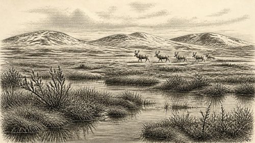
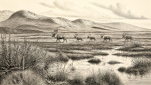
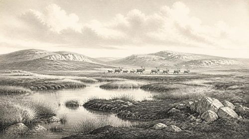
31,224 BCE cannot be reconstructed as a precise Irish year, because evidence is sparse and chronologies broad. Derryvree, County Fermanagh, preserves a freshwater deposit indicating locally ice-free, tundra-like wetland conditions before later glaciation. Castlepook Cave in County Cork contains varied cold-stage fauna, including reindeer, mammoth, giant deer, predators and smaller animals, accumulated over millennia rather than one event. A cut-marked reindeer femur may indicate very early human butchery, but does not prove settlement or a permanent population. Changing ice, sea levels and uncertain routes governed access. Ireland was an environmentally varied, highly archaeologically elusive Late Pleistocene landscape at this time.
Dateline
The label “31,224 BCE” is a modern way of locating a point deep in the Late Pleistocene, not a date at which Ireland can be described year by year. There are no written records, settlements with annual sequences, or archaeological deposits that can be tied responsibly to that single calendar year. By the conventional conversion from “before present” (where present is AD 1950), it corresponds nominally to about 33,173 calendar years BP. That arithmetic is useful for orientation, but it must not be mistaken for chronological precision. Radiocarbon dates of this age have wide calibrated ranges, and environmental layers may have formed over generations or centuries.
The closest evidence belongs to the later part of Marine Isotope Stage 3, a fluctuating cold phase before the Last Glacial Maximum. Ireland was neither a familiar green island nor uniformly a blank sheet of ice. Its landscapes, coastlines and ice margins changed repeatedly over long periods. The most responsible picture for this point is therefore one of sparse but important evidence: a buried wetland in Fermanagh, cold-stage animal remains in southern caves, and a disputed clue to human activity at Castlepook near Doneraile in north County Cork.
A Date Without an Anniversary
Chronology is the first difficulty. The Derryvree deposits near Maguiresbridge, County Fermanagh, produced the conventional radiocarbon determination BIRM-166, 30,500 years BP with an uncertainty of roughly a thousand years. The date comes from organic sediment, not from a person, tool or campfire. When calibrated, such a result belongs broadly in the mid-to-late thirties of thousands of calendar years BP; published modelling and recalibration underline that its uncertainty is substantial. It nevertheless demonstrates something fundamental: before later ice overrode the locality, freshwater sediments, plants and small animals accumulated there during an ice-free interval.
That does not prove that Derryvree looked exactly the same in 31,224 BCE, or that the whole island shared its conditions. Nor can it fix the duration of a particular thaw, summer or season. It is evidence for a regional environmental window. The requested year lies close enough to this poorly resolved horizon for the deposit to be highly relevant, but not close enough to license an imagined diary of events.
The Derryvree Wetland
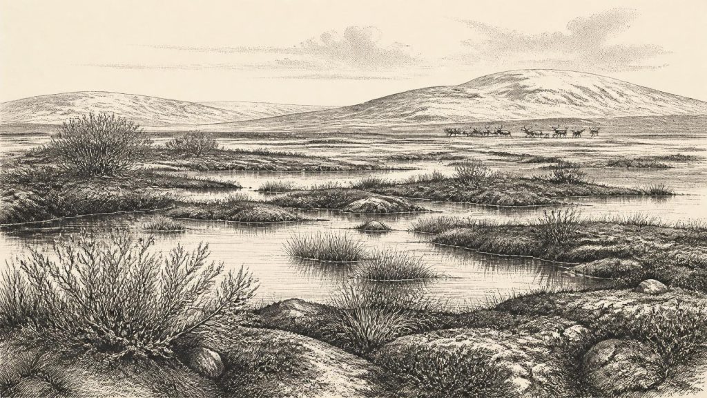
Derryvree is exceptional because later glacial deposits sealed an older freshwater layer between two tills within a drumlin. Road works exposed silts, fine sands and organic mud that preserved pollen, plant macrofossils, mosses and insect remains. These traces point to an open, treeless, periglacial landscape: cold ground, short growing seasons, sparse dry-land vegetation and wet hollows or shallow pools rich enough to support aquatic and marsh plants. Sedges and grasses were important, while dwarf shrubs and herbs formed a low cover rather than woodland.
The flora included cold-adapted elements such as mountain-avens and alpine clubmoss, alongside mosses and wetland plants including bogbean and water-milfoil. Such finds should be read carefully. They establish that suitable habitats existed locally; they do not provide a complete inventory of all Irish plants at one moment. Pollen can travel, preservation is selective, and a road-cut sample represents one basin rather than an island-wide survey. Even so, the combined record makes the main conclusion secure: this was tundra-like country, not forest, farm or peat bog in the later Irish sense.
The insects strengthen that conclusion. Beetle and other invertebrate evidence has been interpreted as indicating mossy, waterlogged ground with open pools and exposed terrain nearby. The practical landscape was likely difficult but biologically varied: frozen or frost-shattered ground in winter, meltwater and saturated soils in warmer months, and small sheltered niches among sedges, mosses and low vegetation. It was a living environment rather than a sterile ice desert.
Animals in the Southern Caves
Castlepook Cave, also known as Mammoth Cave, preserves the richest known Irish assemblage of mammals from this part of the last cold stage. Excavations between 1904 and 1908 recovered a very large collection, now much reduced and dispersed by the history of collecting, from passages with names such as Elephant Hall, Hyaena Hall and the Gallery of Irish Elk. Radiocarbon dating undertaken by the Irish Quaternary Fauna Project showed that bones from the cave did not all belong to one episode. They accumulated over many thousands of years, and some deposits were disturbed or re-sorted. Consequently, Castlepook is a crucial faunal archive but not a single, neatly sealed hunting floor.
The dated fauna demonstrates that Ireland supported, at different times before the Last Glacial Maximum, reindeer, woolly mammoth, giant deer, brown bear, wolf, Arctic fox, mountain hare, lemmings and spotted hyaena. Reindeer, mammoth and giant deer indicate extensive open feeding grounds; hyaenas and wolves show that large predators shared them. The image is often called mammoth-steppe, but that shorthand should not erase local variation. Limestone caves, sheltered valleys, wet basins and wind-exposed uplands would have offered different resources. Derryvree’s wetland and Castlepook’s animal bones together suggest a patchwork of open cold-climate habitats rather than one uniform plain.
The presence of spotted hyaena is particularly striking. It is known in Ireland from Castlepook, and its bones and coprolites show that the cave system was used by carnivores as well as serving as a trap, shelter or collecting place for bones. A cave assemblage therefore cannot automatically be treated as a list of animals hunted by people. Carnivore scavenging, natural deaths, water movement and early excavation methods all complicate the story. The evidence proves a rich animal community; it does not measure herd sizes, establish annual migrations, or show that every species lived together at the exact same time.
The Reindeer Mark
The most consequential human question concerns a reindeer femur from Castlepook. Re-examination of the bone identified a deep mark interpreted by palaeozoologist Ruth Carden and presented by Cork County Council as damage made by a stone tool during butchery. It has been assigned broadly to about 31,000 BC in heritage interpretation. If that reading and association are sustained, it would extend evidence for human handling of an animal in Ireland far beyond the formerly accepted Late Upper Palaeolithic evidence from Alice and Gwendoline Cave in County Clare, dated to around 12,800–12,600 cal BP.
Its importance requires restraint. A modified bone may demonstrate that a person cut or processed a reindeer; it does not establish a permanent population, a named group, a camp, a voyage route or a settlement at Castlepook. No securely associated hearth, occupation surface, stone-tool assemblage, dwelling, burial or repeated butchery concentration has yet been demonstrated for this horizon. Moreover, the animal bone’s age and the moment when a surface mark was made are separate analytical questions. Castlepook’s mixed and historically excavated deposits make context especially important.
The fair conclusion is therefore provisional but significant. Ireland may have received very early Upper Palaeolithic visits or short-lived incursions while cold-stage fauna occupied the island. The femur is not proof of a settled Irish society in 31,224 BCE. It is, rather, a reason to search for one and to reassess an archaeological record heavily damaged, buried or removed by later glaciation.
People, Society and Silence
There is no evidence from Ireland at this date for political institutions, leaders, territories, diplomacy, warfare, formal religion, writing, agriculture, villages or trade networks. Those subjects should not be filled with later Celtic traditions or with general images of “Ice Age tribes”. If people reached Ireland, they were mobile hunter-gatherers whose material traces have not survived in a securely dated Irish context beyond the possible reindeer butchery mark. Their social organisation, language, beliefs, clothing, dwellings and family life are unknown.
Comparison with contemporary Upper Palaeolithic communities in Britain and continental Europe can suggest possibilities, not Irish facts. Elsewhere, people used stone, bone, antler, hide and fire; they moved through seasonal landscapes and exchanged knowledge across large areas. Such comparisons make a stone-tool interpretation at Castlepook plausible, but cannot supply Ireland with an art tradition, ritual site or economic system for which no evidence has been recovered. The most defensible cultural history here is the history of absence, preservation and inference.
Ice, Sea and Connection
Regional change was the overriding political force only in a metaphorical sense: ice, climate and sea level determined what routes and habitats could exist. Research on the British–Irish Ice Sheet increasingly shows a complex history of growth and retreat before the Last Glacial Maximum. Derryvree proves local ice-free conditions before the site was covered by later till, while wider evidence suggests that ice sheets were developing dynamically around Ireland. There is no warrant for drawing a single coast outline for the exact requested year.
Lower global sea levels altered the Irish Sea region, but whether particular routes between Ireland and Britain were open land, narrow-water crossings or ice-affected barriers changed through time and remains debated. The pre-Last Glacial Maximum fauna demonstrates that animals reached Ireland during this broader period. It does not by itself identify the route taken by a reindeer, hyaena or person. For human movement, the essential result is modest: Ireland was not necessarily beyond reach, but it remained peripheral, environmentally demanding and archaeologically elusive.
Thus 31,224 BCE belongs not to a year of known Irish kings, battles or monuments, but to a deep environmental chapter. A Fermanagh wetland records cold-water life beneath a future drumlin; Cork caves retain fragments of an unexpectedly diverse fauna; and one marked reindeer bone poses a serious, unresolved question about early people. Together they reveal an Ireland of tundra, animals and changing ice—a place known principally through the survival of small, difficult pieces of evidence.
Source References
Hover over a number to see the source. Select it to open the source.

- [1] A Middle Midlandian Freshwater Series at Derryvree, Maguiresbridge, County Fermanagh, Northern Ireland
- [2] The Irish Quaternary Fauna Project
- [3] Irish Pleistocene Biostratigraphy
- [4] Palaeoecology
- [5] Spotted Hyena Skull
- [6] Heritage Artefacts of County Cork
- [7] Archaeological Heritage of County Cork
- [8] First Evidence of a Late Upper Palaeolithic Human Presence in Ireland
- [9] New Insights on the Fauna of Ireland's Younger Dryas and Early Holocene from Alice & Gwendoline Cave
- [10] The Colonization of Ireland: A Human Ecology Perspective
- [11] Ireland: Submerged Prehistoric Sites and Landscapes
- [12] Growth and Retreat of the Last British–Irish Ice Sheet, 31,000 to 15,000 Years Ago: the BRITICE-CHRONO Reconstruction
- [13] The Timing and Magnitude of the British–Irish Ice Sheet Between Marine Isotope Stages 5d and 2: Implications for Glacio-Isostatic Adjustment, High Relative Sea Levels and ‘Giant Erratic’ Emplacement
- [14] Exploring Controls of the Early and Stepped Deglaciation on the Western Margin of the British Irish Ice Sheet
- [15] Oscillating Retreat of the Last British-Irish Ice Sheet on the Continental Shelf Offshore Galway Bay, Western Ireland
- [16] Using Novel Methods to Track British and Irish Ice Sheet Dynamics Since the Late Pleistocene, Along the West Porcupine Bank, NE Atlantic
- [17] The Problem of a Late Quaternary Landbridge Between Britain and Ireland
- [18] The IntCal20 Northern Hemisphere Radiocarbon Age Calibration Curve (0–55 cal kBP)
- [19] The IntCal20 Approach to Radiocarbon Calibration Curve Construction: A New Methodology Using Bayesian Splines and Errors-in-Variables
- [20] IntCal
Primary Sources
- A Middle Midlandian Freshwater Series at Derryvree, Maguiresbridge, County Fermanagh, Northern Ireland
- The Irish Quaternary Fauna Project
- Irish Pleistocene Biostratigraphy
- Palaeoecology
- Spotted Hyena Skull
- Heritage Artefacts of County Cork
- Archaeological Heritage of County Cork
- First Evidence of a Late Upper Palaeolithic Human Presence in Ireland
- New Insights on the Fauna of Ireland's Younger Dryas and Early Holocene from Alice & Gwendoline Cave
- The Colonization of Ireland: A Human Ecology Perspective
- Ireland: Submerged Prehistoric Sites and Landscapes
- Growth and Retreat of the Last British–Irish Ice Sheet, 31,000 to 15,000 Years Ago: the BRITICE-CHRONO Reconstruction
- The Timing and Magnitude of the British–Irish Ice Sheet Between Marine Isotope Stages 5d and 2: Implications for Glacio-Isostatic Adjustment, High Relative Sea Levels and ‘Giant Erratic’ Emplacement
- Exploring Controls of the Early and Stepped Deglaciation on the Western Margin of the British Irish Ice Sheet
- Oscillating Retreat of the Last British-Irish Ice Sheet on the Continental Shelf Offshore Galway Bay, Western Ireland
- Using Novel Methods to Track British and Irish Ice Sheet Dynamics Since the Late Pleistocene, Along the West Porcupine Bank, NE Atlantic
- The Problem of a Late Quaternary Landbridge Between Britain and Ireland
- The IntCal20 Northern Hemisphere Radiocarbon Age Calibration Curve (0–55 cal kBP)
- The IntCal20 Approach to Radiocarbon Calibration Curve Construction: A New Methodology Using Bayesian Splines and Errors-in-Variables
- IntCal