Frosted Wetland31223 BCE
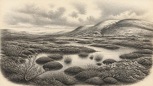
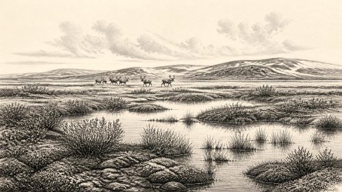
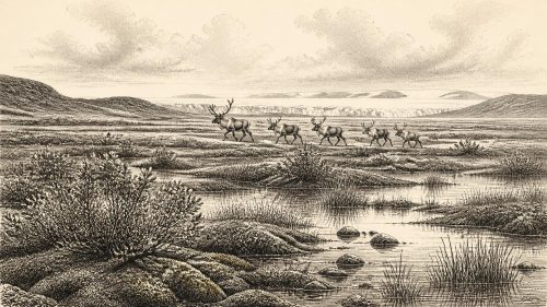
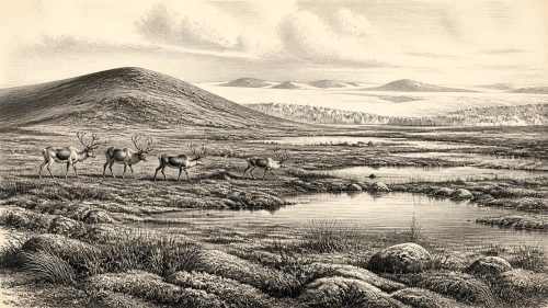
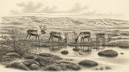
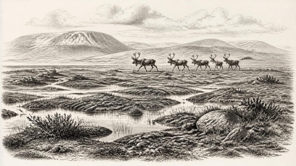
Although 31,223 BCE cannot identify an Irish event, it falls within unstable Marine Isotope Stage 3. Derryvree, County Fermanagh, preserves freshwater sediments dated broadly to 36,900–31,700 years before present, between glacial tills, demonstrating a local ice-free interval. Plant and insect remains reconstruct treeless, frost-affected tundra wetland with pools, sedges and mosses. Castlepook Cave fauna indicates periodic access for reindeer, mammoth, giant deer, predators and scavengers. No secure evidence proves human settlement; a possibly tool-marked reindeer bone suggests only tentative brief visitation. Later ice expansion destroyed or buried landscapes, leaving sparse evidence of ecological change rather than society, politics or culture.
Dateline
31,223 BCE is a modern chronological label, not a recoverable year in Ireland’s human past. No community on the island is known to have kept a calendar that can be aligned to it, and neither archaeology nor palaeoclimate can identify an occurrence in that particular year. The responsible perspective is a broad one: this notional date falls about 33,173 years before AD 1950, within Marine Isotope Stage 3, a long and climatically unstable part of the Late Pleistocene. The closest Irish evidence is dated in wide ranges, not annual points. Most importantly, freshwater sediments at Derryvree, near Maguiresbridge in County Fermanagh, have been calibrated broadly to c. 36,900–31,700 calendar years before present. They permit a cautious reconstruction of an Irish Ice Age environment that could include this date, but cannot describe a single season or day.
An Island in a Changing Ice Age
Ireland was not yet the green, wooded island familiar from later prehistory and history. It lay within the northern Atlantic fringe of Europe during a cold stage in which glaciers expanded and contracted, sea levels stood far below their modern level, and climates shifted sharply over centuries and millennia. The Last Glacial Maximum, when the British–Irish Ice Sheet reached its greatest Late Pleistocene extent, lay ahead rather than fully established at this point. Its build-up was neither simple nor uniform. Different parts of Ireland experienced different combinations of ice cover, periglacial frost action, bare ground, wet hollows and open vegetation.
The numerical year therefore should not imply that all Ireland shared one weather pattern. A deposit in Fermanagh records local conditions; a cave fauna in Cork records animals that entered, died near, or whose remains accumulated in a particular limestone system. Together, such archives show that parts of the island were intermittently capable of supporting life between glacial advances. They do not supply a complete map of the island, still less a political or cultural map.
Freshwater Beneath a Drumlin
Derryvree is the clearest window onto this broad interval. Roadworks in 1969 cut through a drumlin, exposing organic-rich freshwater silts and fine sands trapped between two substantial layers of till: debris laid down by moving glacier ice. The sequence establishes an important relative order. Glacial ice deposited the lower till; afterwards, the locality supported freshwater and wetland deposits; later ice laid down the upper till. The organic bed is therefore evidence for an ice-free interval at that place, rather than proof that the whole island was free of ice at once.
Its plant and insect remains indicate a treeless, waterlogged landscape often described as muskeg or tundra wetland. Mosses, sedges, grasses, dwarf shrubs and herbs grew around shallow pools and saturated ground. Plants such as bogbean and water-milfoil are particularly valuable because their remains show that standing or slow-moving freshwater existed locally. The evidence does not conjure a lush marsh. It instead suggests a demanding environment with short growing seasons, hard winters, frost-disturbed soils and vegetation low to the ground. Open water, mossy margins and sedge-rich patches would have made a varied but fragile habitat.
This is direct environmental evidence: it comes from preserved sediments, pollen, plant macrofossils and insects. The wider portrait of a cold, highly seasonal climate is an interpretation built from those remains and comparisons with northern and alpine environments. It is a strong interpretation, but it must retain its local scale. Derryvree was not a weather station for every valley, coast and upland in Ireland.
Animals of the Open Country
Late Pleistocene animal remains from Irish caves show that the island periodically supported a fauna far more varied than that of later millennia. Castlepook Cave, near Doneraile in north County Cork, is especially important. Its historic excavations produced remains attributed to woolly mammoth, reindeer, giant deer, brown bear, wolf, foxes, hares, lemmings, stoat and spotted hyaena. Some dates and cave contexts have been reassessed as laboratory techniques improved, so the assemblage cannot safely be imagined as one simultaneous herd-and-predator scene outside the cave. Yet the broad conclusion is secure: cold-adapted and open-country mammals repeatedly reached southern Ireland during the middle part of the last glacial cycle.
Reindeer are particularly eloquent indicators of open terrain, although their presence at a cave cannot establish the exact appearance of the surrounding countryside in one year. Mammoth and giant deer likewise imply that, at least in suitable episodes and districts, the island contained enough forage and access routes for large herbivores. Hyaena, wolf and bear remains reveal a food web with scavengers and predators as well as prey. Such animals moved through a landscape where seasonality mattered: summer grazing, winter shelter, migration corridors and the availability of unfrozen water would all have shaped their ranges.
The Human Question
There is no securely excavated settlement, hearth, house, tool assemblage or burial from Ireland that can be assigned to 31,223 BCE. Consequently, it would be wrong to describe an Irish population, a tribe or a settled hunting camp at this date. The absence is meaningful, but it is not conclusive proof that nobody ever visited. Later glaciation eroded landscapes, rearranged sediments and buried older surfaces beneath till, while cave collections were often excavated before modern standards of recording and dating.
A reindeer femur from Castlepook has nevertheless made the question more interesting. One deep mark has been interpreted as damage made to fresh bone by a sharp stone implement, potentially during carcass processing. If that reading is confirmed, it would indicate a brief Upper Palaeolithic human presence in Ireland around the wider period represented by the animal remains—far earlier than the previously accepted terminal-Pleistocene evidence from County Clare. However, the bone lacks the securely dated archaeological context that would transform a single marked specimen into proof of a camp or enduring occupation. Carnivore activity, breakage, sediment movement and the limitations of older excavation records all require caution.
The most responsible conclusion is therefore deliberately modest. People may have made short visits to Ireland during favourable episodes of Marine Isotope Stage 3, perhaps following game or exploiting a carcass. That remains a hypothesis under investigation, not an established annual event. There is no evidence from which to infer named individuals, kin groups, languages, political leadership or a permanent population.
Society Without States
Political affairs, diplomacy and organised warfare cannot be reconstructed for Ireland at this depth of time. There are no written records, monuments, territorial boundaries or assemblages demonstrating conflict. Nor is there evidence for farming, stock keeping, permanent villages, formal trade routes or ritual institutions. Terms such as “Ireland” and “island” are geographical conveniences here, not labels for a prehistoric polity. Sea levels were lower, coastlines lay farther out in many areas, and the land’s connections with Britain and continental Europe altered through time. Animal movements demonstrate that access was possible in some intervals, but they do not prove a simple, continuous land bridge usable by people at every moment.
If humans were present, comparison with Upper Palaeolithic groups elsewhere in north-west Europe suggests that mobility, close knowledge of animal behaviour, seasonal planning and portable equipment would have mattered more than fixed settlement. This is analogy, not Irish evidence. Ireland has not yielded stone tools, worked bone, dwellings or art that can establish such practices for this horizon. The only firm cultural statement is negative but important: no demonstrable indigenous cultural tradition can yet be assigned to the year or to the Derryvree interval.
Resources, Movement and Risk
For animals—and for any occasional human visitors—the economy of survival was ecological rather than agricultural. Reindeer, giant deer and other herbivores converted sparse vegetation into meat, fat, hide, sinew, antler and bone; predators and scavengers competed for the same carcasses. Wetlands provided water and specialised plant communities, but also impeded movement. In a cold landscape, access to sheltered ground, fuel, fresh water and reliable hunting opportunities could determine whether a short visit was viable. These are reasonable deductions from the environment, not discoveries of a particular camp’s activities.
There is equally no evidence for exchange or commerce. Materials might have moved with travellers if people reached Ireland, but no identified imported stone, ornament or other artefact demonstrates this. The appropriate image is not of trade between communities but of a changing north-west European landscape in which glaciers, low seas, animal ranges and severe seasons created temporary possibilities and severe constraints.
Renewed Ice and Lost Landscapes
The Derryvree wetlands did not endure unchanged. The upper till that sealed them records a later return of glacier ice. Across Ireland, the growth of the British–Irish Ice Sheet would reshape valleys, scour rock, redirect drainage and remove or conceal many earlier deposits. That destructive history explains why evidence for the deeper Palaeolithic is so scarce. It also makes surviving sequences unusually valuable: a buried freshwater bed beneath a Fermanagh drumlin and a faunal cave deposit in Cork preserve fragments of a world otherwise largely overwritten by ice.
For this point around 31,223 BCE, then, Ireland cannot be narrated through kings, battles or foundations. Its history is one of ecological change. Derryvree’s sedges and mosses, shallow pools and frost-bound ground show a locally ice-free wetland during a wider cold stage. Castlepook’s animals show that large mammals could reach and use parts of the island. The possible marked reindeer bone keeps open, but does not settle, the question of early human visitation. The evidence is sparse; its limits are part of the story.
Source References
Hover over a number to see the source. Select it to open the source.

- [1] A Middle Midlandian Freshwater Series at Derryvree, Maguiresbridge, County Fermanagh, Northern Ireland
- [2] Irish Pleistocene Biostratigraphy
- [3] The Irish Quaternary Fauna Project
- [4] A Reconsideration of the Radiocarbon Dating of the Marine Isotope Stage 3 Fauna from Southern Ireland
- [5] Trimlines, Blockfields and the Vertical Extent of the Last Ice Sheet in Southern Ireland
- [6] Growth and Retreat of the Last British–Irish Ice Sheet, 31,000 to 15,000 Years Ago: the BRITICE-CHRONO Reconstruction
- [7] The IntCal20 Northern Hemisphere Radiocarbon Age Calibration Curve (0–55 cal kBP)
- [8] Castlepook Cave, County Cork: County Geological Site Report
- [9] Castlepook Cave, Co. Cork, Excavation Report 2022
- [10] Figure 6: The Subdivision of the Quaternary Period in Ireland
- [11] Soils of County Waterford
- [12] New Insights on the Fauna of Ireland's Younger Dryas and Early Holocene from Alice & Gwendoline Cave
- [13] Occurrence of Mammalia Relicts at Site Castlepook Cave
- [14] Growth and Retreat of the Last British–Irish Ice Sheet, 31,000 to 15,000 Years Ago: British Antarctic Survey Record
- [15] The Mesolithic in Ireland: When Was It?
- [16] Heritage Artefacts of County Cork
- [17] Ireland’s Earliest Settlers: Evidence for an Irish Palaeolithic
- [18] New Data for the Last Glacial Maximum in Great Britain and Ireland
- [19] Freshwater Organic Deposits and Stratified Sediments Between Early and Late Midlandian (Devensian) Till Sheets, at Aghnadarragh, County Antrim, Northern Ireland
- [20] References and Recommended Reading: Irish Quaternary Association Guide
- [21] Dimensions and Chronology of the Last Ice Sheet in Western Ireland
Primary Sources
- A Middle Midlandian Freshwater Series at Derryvree, Maguiresbridge, County Fermanagh, Northern Ireland
- Irish Pleistocene Biostratigraphy
- The Irish Quaternary Fauna Project
- A Reconsideration of the Radiocarbon Dating of the Marine Isotope Stage 3 Fauna from Southern Ireland
- Trimlines, Blockfields and the Vertical Extent of the Last Ice Sheet in Southern Ireland
- Growth and Retreat of the Last British–Irish Ice Sheet, 31,000 to 15,000 Years Ago: the BRITICE-CHRONO Reconstruction
- The IntCal20 Northern Hemisphere Radiocarbon Age Calibration Curve (0–55 cal kBP)
- Castlepook Cave, County Cork: County Geological Site Report
- Castlepook Cave, Co. Cork, Excavation Report 2022
- Figure 6: The Subdivision of the Quaternary Period in Ireland
- Soils of County Waterford
- New Insights on the Fauna of Ireland's Younger Dryas and Early Holocene from Alice & Gwendoline Cave
- Occurrence of Mammalia Relicts at Site Castlepook Cave
- Growth and Retreat of the Last British–Irish Ice Sheet, 31,000 to 15,000 Years Ago: British Antarctic Survey Record
- The Mesolithic in Ireland: When Was It?
- Heritage Artefacts of County Cork
- Ireland’s Earliest Settlers: Evidence for an Irish Palaeolithic
- New Data for the Last Glacial Maximum in Great Britain and Ireland
- Freshwater Organic Deposits and Stratified Sediments Between Early and Late Midlandian (Devensian) Till Sheets, at Aghnadarragh, County Antrim, Northern Ireland
- References and Recommended Reading: Irish Quaternary Association Guide
- Dimensions and Chronology of the Last Ice Sheet in Western Ireland