Cave Earth at Castlepook30932 BCE
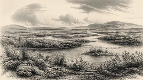
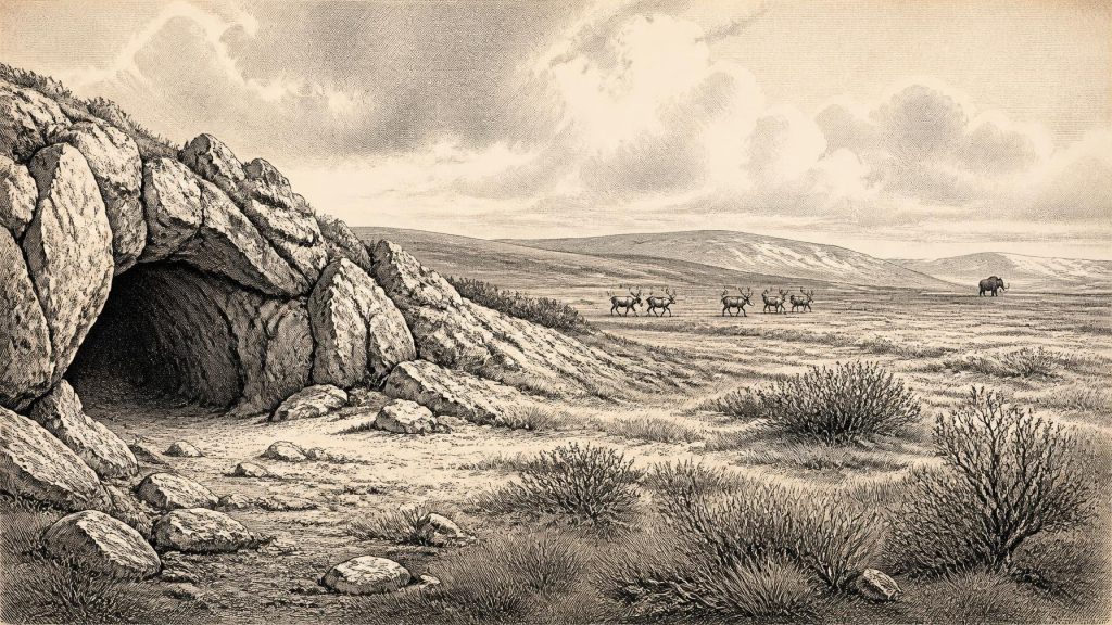
About 30,932 BCE, Ireland lay within the unstable Late Pleistocene climate of Marine Isotope Stage 3, not a precisely recoverable year. Evidence from Derryvree, County Fermanagh, records a locally ice-free interval between glacial advances, with freshwater wetlands, tundra vegetation and cold-adapted insects. Cave deposits at Castlepook, County Cork, preserve a diverse fauna including reindeer, mammoth, giant deer, predators and smaller mammals, though species were not necessarily contemporary. A marked reindeer femur, dated around 33,000 years ago, may indicate human butchery, but proves neither settlement nor population. Climate, ice, water and animal movements, rather than politics or culture, shaped this landscape.
Dateline
The label 30,932 BCE gives an appearance of annual precision that the evidence cannot sustain. No written calendar, named community, political boundary or dated human event survives from Ireland at this depth of time. In conventional archaeological arithmetic, the nominal year falls about 32,881 years before AD 1950, within the later part of the Late Pleistocene and Marine Isotope Stage 3 (MIS 3). It is best treated as a point within a broad environmental horizon, not as a recoverable twelve-month chapter. The responsible history of Ireland at this moment is therefore one reconstructed from cave bones, freshwater sediments, fossil plants, insects and the traces left by advancing and retreating ice.
A Date Within Deep Time
Radiocarbon measurements do not translate directly into modern calendar years. The amount of carbon-14 in the atmosphere has changed through time, while very old samples carry substantial measurement and calibration uncertainties. Modern calibration curves make better comparisons possible, but they do not turn a deposit formed over centuries or millennia into a dateable diary entry. The most relevant Irish sequences provide ranges. They can show that a landscape or animal community existed during a particular phase of the last Ice Age; they cannot establish what happened in Ireland in the notional year 30,932 BCE.
This was a world before the Last Glacial Maximum, rather than one after it. The island was not yet defined by the familiar green, wooded and maritime landscape of later prehistory. Nor should it be imagined as uniformly buried beneath ice. Climate in north-west Europe changed sharply during MIS 3, and Irish evidence records local differences between ice, meltwater, exposed ground and cold wetlands. A landscape may have been open and habitable in one district while glaciers, permanent snowfields or barren ground dominated another. The British–Irish Ice Sheet was developing unevenly, and its eventual large-scale expansion lay in the future.
Derryvree Between the Tills
The strongest Irish environmental evidence close to this broad date comes from Derryvree near Maguiresbridge in County Fermanagh. Roadworks in 1969 cut through a drumlin and revealed a remarkable sequence. A lower till, deposited by glacier ice, was overlain by freshwater silts, fine sands and organic material; these in turn were sealed beneath a later till. The order is crucial. It proves that ice had occupied the locality, that an interval followed in which standing or slow-moving freshwater and wetland vegetation developed, and that later glaciation again overrode and buried the deposits.
Organic material from the Derryvree sequence produced a radiocarbon determination of about 30,500 radiocarbon years before present, with a wide uncertainty. Calibrated treatment places the deposit broadly within later MIS 3, rather than securely in a single century. Its significance is nevertheless considerable. The sediments preserve plant macrofossils, pollen, insects and freshwater evidence from an Irish landscape largely erased elsewhere by subsequent ice. They demonstrate a cold, locally ice-free Fermanagh environment during part of the period, not an all-Ireland climatic map and not proof that people occupied the district.
Wetlands, Tundra and Animals
Derryvree’s biological remains point towards sparse, open vegetation with wet ground, pools and sedge-rich margins. Mosses, sedges, bogbean, water-milfoil, dwarf willow, mountain avens and other cold-adapted plants indicate conditions very different from later Irish woodland. The exact mixture changed according to drainage, exposure and season. A sheltered hollow beside freshwater could sustain more plant growth than an exposed ridge, while permafrost and repeated freezing disturbed soils. The evidence supports a patchwork of wetland and tundra-like ground rather than a featureless frozen plain.
Such habitats mattered because vegetation governed the movement and survival of animals. Ireland’s MIS 3 fossil record, especially from limestone caves in Cork, includes reindeer, woolly mammoth, giant deer, brown bear, wolf, Arctic fox, mountain hare, lemmings and spotted hyaena. These remains were not necessarily all contemporary, and they do not prove that every species stood together in one valley in 30,932 BCE. Yet collectively they show that the island could support a much richer cold-stage fauna than modern Ireland. Reindeer and mammoth especially evoke broad grazing country; predators and scavengers reveal a food web in which carcasses, caves and seasonal movement were important.
An Island in Climatic Transition
The physical geography of Ireland was changing as decisively as its vegetation. Glacial ice had already shaped parts of the land, and renewed ice would later destroy or conceal much of the evidence now sought by archaeologists. The later British–Irish Ice Sheet grew rapidly between roughly 31,000 and 26,000 years ago, although its timing and extent varied from sector to sector. That wider reconstruction should not be projected too simply onto every Irish valley. Derryvree itself is valuable precisely because it records a non-glacial interval between tills, preserving a local environmental window amid an unstable glacial history.
Lower sea levels altered coastlines and shallow seas, but they did not automatically make Ireland a simple extension of Britain or continental Europe. The precise geography of routes across the Irish Sea changed with sea level, crustal movement, sediment and ice margins. There is no evidence for regular maritime traffic, organised migration corridors or sustained interregional exchange at this date. If animals and perhaps people reached Ireland, their movements occurred in a changing north-west European landscape whose barriers and connections cannot be reconstructed in detail for one nominal year.
The Castlepook Question
Castlepook Cave near Doneraile, County Cork, gives this period its most arresting archaeological possibility. Excavations begun in the early twentieth century recovered a large and mixed assemblage of Ice Age animal remains from the cave system once known as Mammoth Cave. Subsequent research by the Irish Quaternary Fauna Project and later radiocarbon reassessment showed that the southern Irish fauna was older and more chronologically complex than had once been supposed. Cave deposits are invaluable but difficult evidence: carnivores carry bones into dens, animals die in fissures, water moves sediments, and early excavation rarely preserved the contextual information expected today.
One reindeer femur from Castlepook has been dated to approximately 33,000 years ago and carries a deep surface mark interpreted by zooarchaeologist Ruth Carden as damage from a sharp stone implement during butchery. If that interpretation is confirmed, it would be Ireland’s earliest known indication that a person processed an animal, vastly earlier than the secure evidence for post-glacial settlement. The bone is therefore directly relevant to the broad period around 30,932 BCE. But it is not a settlement site in the usual archaeological sense: no securely associated hearth, stone-tool assemblage, dwelling floor, human burial or undisturbed occupation surface has yet demonstrated a camp of this age.
People: Possibility, Not Population
The marked femur permits a carefully limited conclusion. It may record a human encounter with a reindeer in Ice Age Ireland, perhaps during carcass processing. It cannot identify the number of people involved, their sex, age, language, ancestry, homeland, route of arrival or length of stay. It does not establish an enduring population on the island. A small, mobile hunting party could leave little material evidence, particularly where later glaciation and cave disturbance have removed or mixed deposits; equally, further work may revise the interpretation of the mark or its archaeological implications.
If people were present, comparisons with Upper Palaeolithic hunter-gatherers elsewhere in north-west Europe suggest a mobile life shaped by animal movements, weather and access to sheltered places. That is an interpretation from wider regional evidence, not a demonstrated social portrait of Castlepook. Reindeer could potentially provide meat, marrow, hide, sinew, antler and bone, while wood was likely scarce in an open cold landscape. Yet there is no Irish evidence from this horizon for specific hunting weapons, clothing, tents, food stores or seasonal camps. The past must remain smaller than the possibilities it invites.
No Politics, No Diplomacy
Political affairs, diplomacy and warfare cannot responsibly be reconstructed for Ireland at this date. There were no known states, rulers, territorial institutions, written agreements or named peoples. Nor is there evidence for organised conflict. The closest equivalent to a regional history of power is environmental constraint: ice sheets redirected movement; freshwater and plant cover concentrated animal life; caves offered shelter to predators and perhaps passing humans. Any social relationships that existed are archaeologically invisible. It would be misleading to supply tribes, chiefs or rival groups merely because later Irish history contains them.
Culture Without Records
Religion, art and learning are likewise beyond direct recovery in Ireland around this point. No ritual site, grave, figurative art or musical object has been securely assigned to this Irish horizon. The cave fauna and the Derryvree wetland sequence are cultural evidence only in the broadest modern sense: they show the environmental setting in which cultural acts may have occurred. The absence of evidence is partly a consequence of preservation. Organic objects, temporary shelters and surface activity are especially vulnerable to decay, erosion and glacial disturbance. Still, absence cannot be converted into claims about beliefs or ceremonies.
Economy and Regional Change
There was no agriculture, animal husbandry, market economy, metalworking or demonstrated long-distance trade in Ireland. If the Castlepook mark is human-made, it points to direct acquisition or processing of wild animal resources rather than farming. The principal economic facts were ecological: animals required forage; predators followed prey; freshwater wetlands created local resources; and cold conditions restricted plant growth and travel. Ireland’s regional variation was pronounced. Fermanagh preserves a freshwater tundra archive beneath a drumlin, while north Cork preserves cave accumulations from a faunally rich, open-country setting. Neither locality stands for the whole island.
For 30,932 BCE, then, Ireland’s history is best understood as a threshold landscape. Fossil wetlands show that life persisted locally between episodes of glaciation. Cave deposits show that cold-adapted mammals reached the island. A single marked reindeer bone raises the serious possibility of a human visit, but not yet of settlement. The most important development was not a recorded event but the continuing remaking of the land by climate, water, animals and ice.
Primary Sources
- The Irish Quaternary Fauna Project
- A Reconsideration of the Radiocarbon Dating of the Marine Isotope Stage 3 Fauna from Southern Ireland
- Growth and Retreat of the Last British–Irish Ice Sheet, 31,000 to 15,000 Years Ago: The BRITICE-CHRONO Reconstruction
- The IntCal20 Northern Hemisphere Radiocarbon Age Calibration Curve (0–55 cal kBP)
- IntCal Publications
- Palaeoecology: IQUA Field Guide
- Heritage Artefacts of County Cork
- The Archaeological Heritage of County Cork
- Ireland's Palaeolithic Archaeology – Fleeting Footprints in a Frozen Land
- Irish Pleistocene Biostratigraphy
- Freshwater Organic Deposits and Stratified Sediments Between Early and Late Midlandian (Devensian) Till Sheets, at Aghnadarragh, County Antrim, Northern Ireland
- The Timing and Pattern of British–Irish Ice Sheet Growth and Decay: Constraints on the Last Glacial Cycle
- Trimlines, Blockfields and the Vertical Extent of the Last Ice Sheet in Southern Ireland
- The Last Glacial Maximum in Great Britain and Ireland
- A New Chronology for the Last Glacial Maximum in the Irish Sea Basin
- New Insights on the Fauna of Ireland's Younger Dryas and Early Holocene from Alice & Gwendoline Cave
- Our Ancient Landscapes: Hunter-Gatherers in Ireland
- BRITICE-CHRONO Maps and GIS Data of the Last British-Irish Ice Sheet 31 to 15 ka
- Understanding Irish Landscape Evolution: Pollen Assemblages from Neogene and Pleistocene Palaeosurfaces in Western Ireland
- Freshwater Organic Deposits and Stratified Sediments Between Early and Late Midlandian Till Sheets, at Aghnadarragh, County Antrim