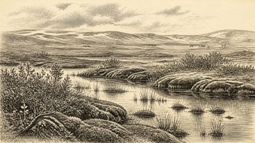
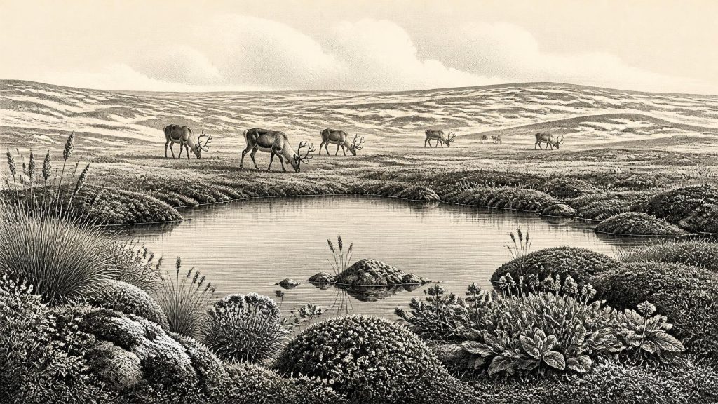
Derryvree’s Winter Pond30933 BCE
The nominal date 30,933 BCE cannot support an annual Irish history, but falls within a broad MIS 3 range of climatic fluctuation. Derryvree in County Fermanagh preserves freshwater sediments between tills, showing a cold, ice-free wetland with tundra vegetation before glaciation. Castlepook Cave fauna demonstrates diverse cold-adapted animals, including reindeer, mammoth and predators. A cut-marked reindeer bone suggests brief Upper Palaeolithic human visits, not settlement. No polities, farms, trade or cultural remains are known. Last Glacial Maximum ice reshaped Ireland and destroyed evidence, leaving protected deposits to reveal a dynamic landscape of water, open ground, animals and possible human movement.
Dateline
30,933 BCE is a modern chronological label, not a year that can be recovered from an Irish archive. No contemporary calendar, written record, settlement sequence or securely dated human event allows Ireland to be described at annual resolution so far back. The responsible frame is therefore a broad one: approximately 32,880 years before AD 1950, in the Late Pleistocene, during Marine Isotope Stage 3 (MIS 3), a cold but highly variable interval of the last Ice Age. Radiocarbon results of this antiquity must be calibrated and expressed as ranges. The evidence can illuminate environments, animals and the possibility of human movement; it cannot supply a king, battle, treaty or named community for this particular numbered year.
A Date Inside a Range
The most valuable Irish environmental record close to this nominal date lies at Derryvree, near Maguiresbridge in County Fermanagh. Roadworks in 1969 cut into a drumlin and exposed a remarkable sequence: freshwater silts and fine sands, containing organic material, lay between two thick deposits of till. Till is unsorted debris laid down by glacier ice. The order of the layers is decisive evidence that ice had earlier affected the site, that an ice-free interval then permitted water, sediment and living things to accumulate there, and that a later advance buried the deposit beneath further glacial material.
Organic material from the Derryvree freshwater bed produced a conventional radiocarbon determination of 30,500 years BP, with a wide uncertainty of +1,170/−1,030 years. “BP” means before AD 1950, the standard reference point for radiocarbon dating; it does not mean calendar years. Published calibration has placed the deposit broadly around 36,900–31,700 calibrated years BP, approximately 34,950–29,750 BCE. The notional year 30,933 BCE falls inside that broad span, but it cannot be tied to a particular sediment layer, season, animal or human action. Derryvree is a time-averaged natural archive, not a diary.
This distinction matters. The date supports an interpretation of northern Ireland during part of the Middle Midlandian cold stage; it does not prove that every Irish region had identical weather, vegetation or ice cover in 30,933 BCE. Nor can a range spanning millennia decide whether one individual animal and one patch of sediment were contemporaneous. Yet the sequence provides unusually direct evidence that, before the Last Glacial Maximum, at least part of Ireland contained a cold, ice-free freshwater landscape.
Open Ground and Shallow Water
Derryvree was not woodland. Pollen, seeds, mosses and other plant macrofossils point instead to open tundra or periglacial wetland: a landscape influenced by severe cold, repeated freezing and thawing, short growing seasons and seasonally saturated ground. The assemblage included sedges, grasses and herbs, alongside plants associated with cold open environments. Fossil remains of bogbean, a wetland plant, and mountain avens, a familiar Arctic-alpine species, are especially vivid indicators of shallow freshwater, marshy margins and exposed mineral ground.
Such a setting should not be reduced to an empty white wilderness. The freshwater silts imply pools or slow-moving water; mosses and sedges indicate ground that could retain moisture through the brief productive season. In summer, insect life and plant growth would have concentrated around wet places. Away from them, bare sediment, frost-shattered ground and sparse vegetation may have been common. Winter conditions were undoubtedly hard, but the Derryvree evidence shows ecological variety rather than uninterrupted ice. The older term “muskeg”, sometimes applied to this type of moss-rich, wet terrain, conveys something of its uneven, waterlogged character.
Crag Cave in County Kerry supplies a separate kind of environmental evidence. Uranium-thorium dating shows that speleothems there formed episodically during MIS 3. Because cave calcite needs liquid water moving through the rock, these growth episodes indicate intervals in which local conditions permitted groundwater circulation rather than continuous deep freezing. They do not demonstrate a uniformly mild Ireland, and Crag Cave is far from Fermanagh, but they reinforce the central point: the island experienced pronounced climatic oscillations during this long cold age.
Cave Fauna in County Cork
At Castlepook Cave, near Doneraile in north County Cork, fossil assemblages preserve another window onto this world. The cave, also known historically as Mammoth Cave, yielded remains attributed to animals of cold open country, including reindeer, woolly mammoth, giant deer, wolf, Arctic fox, mountain hare, lemmings, brown bear and spotted hyaena. Redating programmes have shown that several older radiocarbon determinations from southern Irish caves were too young, placing part of the Castlepook fauna securely within MIS 3, before the Last Glacial Maximum.
These remains must be handled carefully. A cave is not a simple snapshot of one living community. Carnivores could drag carcass parts inside; water, sediment movement, excavation methods and later disturbance could mix material from different episodes. The presence of a mammoth bone, for example, does not prove that mammoth, reindeer, hyaena and every other recorded species stood together in one Cork valley in a single year. What the broader assemblage securely demonstrates is that Ireland supported, at intervals during MIS 3, a cold-adapted fauna more diverse than that of the island today.
For everyday ecology, the implication is powerful. Reindeer and giant deer required forage across open ground; carnivores followed prey and scavenging opportunities; caves could serve as dens, shelters or traps in the landscape. Animals themselves moved through territories far larger than any modern county. Their routes would have followed the seasonal availability of browse, grasses, sedges and water. This was not an agricultural countryside and there is no evidence for managed herds, fields, permanent villages or domesticated animals.
The Castlepook Human Question
A reindeer femur from Castlepook has made this period particularly significant. It has been reported as bearing a deep mark interpreted as damage made by a sharp stone tool while the bone was fresh, and it has been publicised as dating to roughly 33,000 years ago. If that interpretation is sustained, it is evidence that people processed a reindeer in Ireland during the Upper Palaeolithic, much earlier than the well-established post-glacial record of human settlement.
It is nevertheless evidence of a very limited kind. The bone is not a house floor, a hearth, a burial, a camp, a stone-tool assemblage or a human skeleton. No unquestioned Palaeolithic occupation site of comparable age has yet been found in Ireland. Nor can the mark establish whether one person, a small hunting party or a recurring group visited the island. The cave context also leaves open the possibility that carnivores later transported or disturbed discarded bone. A reported cut mark and a dated animal bone are important observations; the reconstruction of a hunt, a camp or a population is an interpretation that needs further corroboration.
The cautious historical conclusion is that short human incursions are plausible, not that Ireland possessed a continuous resident population. Modern humans were present elsewhere in western Europe during this broad period, and a reindeer-focused visit would fit a mobile foraging economy. But Ireland’s record does not yet reveal the technologies used, the route taken, the duration of a stay, the size of any group or its cultural affiliations. Continued work at Castlepook, including renewed excavation and scientific examination of stored and newly recovered material, is important precisely because the original evidence is so fragmentary.
No Polities, but Real Connections
Political affairs, diplomacy and organised warfare cannot responsibly be written into this Irish horizon. There are no known states, chiefs, territorial boundaries, monuments or formal institutions. Even if people reached Ireland, their social world would have been that of small, highly mobile foraging groups whose connections were expressed through kinship, seasonal movement, shared practical knowledge and access to animal and plant resources. That is a general inference from Upper Palaeolithic lifeways elsewhere, not a fact demonstrated by a settlement in Ireland.
The same caution applies to religion, learning and culture. No Irish art, ornament, grave, shrine or symbolic object securely belongs to around 30,933 BCE. It would be unreasonable to infer an absence of belief, teaching, language or ritual from this absence: such practices rarely survive without favourable archaeological contexts. Yet there is no basis for describing their local forms. The surviving record is environmental and faunal, with one tantalising possible trace of butchery; it does not disclose an Irish spiritual or artistic tradition.
Economy and exchange were likewise governed by landscape rather than markets. The accessible evidence suggests no trade network, production centre or seaborne commerce. If a small group entered the island, food procurement would have depended on seasonal knowledge, hunting, scavenging, gathering and the transport of portable equipment. The possible worked reindeer bone points towards animal processing, perhaps for meat, marrow, hide or other products, but none of those uses can be proved from the mark alone. The most substantial economy visible at Derryvree and Castlepook is ecological: plants, herbivores, predators, water and ice interacting in a demanding northern environment.
Before the Great Ice Advance
Regional change is the main story. Around this broad period, Ireland was approaching the more extensive glaciation of the Last Glacial Maximum, conventionally placed later, around 26,000–21,000 years ago. Research on Irish landforms, coastal deposits and offshore sediments shows that the eventual Irish Ice Sheet was large and dynamic. Its later growth and movement eroded landscapes, reworked deposits and destroyed much evidence that might once have documented earlier animal and human activity. The rarity of Irish MIS 3 sites is therefore partly a history of preservation as well as discovery.
Derryvree’s freshwater bed survived because later sediment sealed it between tills. Castlepook’s bones survived because a limestone cave protected at least some material from the most destructive surface processes. Together they offer a restrained but compelling view of Ireland around the notional date: not a land with recoverable annual history, but a changing cold landscape of wetlands, open ground, grazing animals and predators, with a possible fleeting human encounter. The evidence is sparse, but it is enough to replace the idea of an unchanging, wholly ice-bound island with a more dynamic and scientifically honest picture.
Primary Sources
- A Middle Midlandian Freshwater Series at Derryvree, Maguiresbridge, County Fermanagh, Northern Ireland
- Palaeoecology: Irish Quaternary Association Field Guide
- A Reconsideration of the Radiocarbon Dating of the Marine Isotope Stage 3 Fauna from Southern Ireland
- Red Deer in Ireland: A Palaeoecological and Genetic Study
- New Insights on the Fauna of Ireland’s Youngest Cave Deposits: Alice and Gwendoline Cave, County Clare
- Episodic Speleothem Deposition Tracks the Terrestrial Impact of Millennial-Scale Last Glacial Climate Variability in SW Ireland
- A 10Be-Dated Record of Glacial Retreat in Connemara, Ireland, Following the Last Glacial Maximum and Implications for Regional Climate
- Late Pleistocene Chronostratigraphy and Ice Sheet Limits, Southern Ireland
- Dimensions and Chronology of the Last Ice Sheet in Western Ireland
- Trimlines, Blockfields and the Vertical Extent of the Last Ice Sheet in Southern Ireland
- New Data for the Last Glacial Maximum in Great Britain and Ireland
- Britain and Ireland: Glacial Landforms from the Last Glacial Maximum
- Character of Advance and Retreat of the Southwest Sector of the British-Irish Ice Sheet During the Last Glaciation
- Oscillating Retreat of the Last British-Irish Ice Sheet on the Continental Shelf Offshore Galway Bay, Western Ireland
- The IntCal20 Northern Hemisphere Radiocarbon Age Calibration Curve (0–55 cal kBP)
- Heritage Artefacts of County Cork
- 2022:564 – Castlepook Cave, Castlepook South, Cork
- Menyanthes trifoliata L. in Fermanagh
- Dryas octopetala L. in Fermanagh
- The Mammoth Caves of Castlepook, Near Doneraile