
Derryvree’s Frozen Ledger30956 BCE
Around 30,956 BCE, Ireland lay within the climatically unstable Marine Isotope Stage 3. Derryvree, near Maguiresbridge, preserves freshwater organic sediments between glacial tills, showing that Fermanagh was locally ice-free long enough for cold wetland ecosystems. Radiocarbon calibration dates this interval broadly to 34,950–29,750 BCE, though not to a specific year or event. Mosses, sedges, pollen, plant remains and insects indicate open, treeless, waterlogged terrain with severe winters and short growing seasons. Castlepook Cave preserves fragmentary cold-stage fauna, including reindeer and mammoth, but its deposits are chronologically complex. A cut-marked reindeer bone suggests early human visitation, not settled occupation or institutions.
Dateline
30,956 BCE is a modern chronological label, not a date that people then living in Ireland could have named or recorded. No written calendar, settlement sequence or excavated event permits history at the precision of a single year. In archaeological terms, it falls roughly 32,905 calendar years before AD 1950, within the Late Pleistocene and broadly within Marine Isotope Stage 3 (MIS 3), an interval of abrupt climatic fluctuations. The responsible approach is therefore to use evidence with calibrated ranges that overlap this notional year, rather than to invent a ruler, migration, battle or human community for it.
The clearest Irish evidence relevant to this horizon comes from Derryvree, near Maguiresbridge in County Fermanagh. Roadworks exposed a sequence inside a drumlin: glacial till below, freshwater sands and organic silts in the middle, and a later till above. This is an unusually eloquent geological order. Ice had deposited the lower till; at some later point the place was free of overriding ice long enough for shallow freshwater, sediment and living communities to develop; renewed glaciation then buried the record. Derryvree is not an annual chronicle, but it is a rare archive of an Irish landscape between glacial advances.
Dating a Deep-Time Landscape
Organic material from the Derryvree freshwater deposits produced a conventional radiocarbon age of 30,500 +1,170/−1,030 radiocarbon years before present. Radiocarbon years are not calendar years: atmospheric carbon-14 has varied through time, and laboratory determinations must be calibrated against independently dated records. Published calibration places the Derryvree material broadly at about 36,900–31,700 calibrated years BP, approximately 34,950–29,750 BCE. The requested year lies within that broad range. It cannot, however, be attached to a particular season, individual plant, animal movement or phase of use of the water body.
This distinction matters because the last Ice Age was neither a single winter nor a uniform blanket of ice. MIS 3 contained sharp oscillations between colder stadial conditions and relatively milder interstadials. At Derryvree, the organic bed demonstrates local ice-free conditions and freshwater life; it does not prove that every Irish region was simultaneously ice-free, nor that the island’s later familiar coastlines and river systems existed in their modern form. Equally, the later Last Glacial Maximum had not yet reached its principal Irish extent. Large-scale British–Irish Ice Sheet growth and maximum conditions lay ahead, though ice margins and upland ice could already have made the wider region highly variable.
Water, Mosses and Sedges
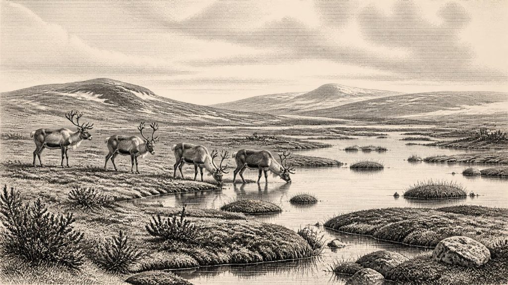
Derryvree’s importance lies in the biological detail trapped in its sediments. Freshwater mosses and sedges, together with pollen, plant remains and insects of cold northern character, indicate open, treeless or almost treeless wet ground. Earlier researchers used the term “muskeg” for this waterlogged setting: a mosaic of shallow pools, organic mud, saturated vegetation and frost-affected ground rather than an unbroken snowy waste. Such a landscape could include sedge beds and mossy margins, low herbs and dwarf shrubs, with patches of open water where fine sediment settled.
The fossils support a picture of short growing seasons, severe winters and low vegetation. They do not provide a complete species list for the whole island. Pollen can travel long distances on the wind, be redeposited, or represent vegetation beyond the immediate basin; a local wetland is not a weather station for Ireland. Nevertheless, the combined plant and insect evidence securely shows that one part of Fermanagh sustained a cold freshwater ecosystem during an interval between ice incursions. In environmental terms, this is the most substantial story available for the date: life persisted in sheltered, wet and locally ice-free ground while climate and ice cover changed on larger scales.
An Animal Landscape
Southern Irish caves add a separate, more fragmentary record. Castlepook Cave near Doneraile, County Cork, has produced remains attributed to a Late Pleistocene fauna including reindeer, woolly mammoth, giant deer, brown bear, wolf, Arctic fox, mountain hare, lemmings and spotted hyaena. This assemblage conveys the ecological breadth of open cold-country habitats: grazing and browsing herbivores, smaller prey animals, scavengers and predators. Reindeer are especially compatible with the idea of mobile herds moving through exposed seasonal country, while lemmings and Arctic fox point towards cold conditions.
Yet Castlepook must be handled with care. Many bones were recovered in early excavations from complicated cave deposits, and the cave accumulated material over long spans of time. Improved radiocarbon pretreatment has shown that some fossils are considerably older than earlier determinations implied, but it does not make every specimen contemporary. A dated bone establishes the age of that animal within a range; it does not automatically date every bone nearby, the formation of the cave sediment, or an episode of human activity. Derryvree and Castlepook can therefore be placed in a broadly comparable MIS 3 world without being compressed into one imagined day in the life of Ireland.
The Human Question
The possibility of people in Ireland at this depth of time is important but unsettled. A reindeer femur from Castlepook has been reported as bearing a mark interpreted as having been made by a sharp stone tool during carcass processing, and it has attracted attention as possible evidence for human activity around 33,000 years ago. If the diagnosis survives continued microscopic, chronological and contextual scrutiny, it would suggest that Upper Palaeolithic people reached Ireland far earlier than the securely dated Late Upper Palaeolithic evidence from Alice and Gwendoline Cave in County Clare, dated to roughly 12,810–12,590 calibrated years BP.
For 30,956 BCE, however, the Castlepook find cannot responsibly be converted into a settled population, a named hunting band or a permanent occupation. No securely associated hearth, stone-tool assemblage, dwelling floor, burial or repeated camp has yet demonstrated such a community in Ireland at this time. The cut-mark interpretation concerns the modification of one bone; the radiocarbon result concerns the animal’s age; the excavated context is an older cave collection requiring further testing. At most, the evidence raises the prospect of a brief human visit or butchery episode on the western edge of the wider European Upper Palaeolithic world.
No Politics, No Monuments
There is no basis for describing political affairs, diplomacy, warfare, law, religious institutions or learning in Ireland at this date. There are no chiefs, territories, alliances or sacred monuments recoverable from the evidence. Nor is there evidence for agriculture, domesticated animals, pottery, metalworking, weaving, writing or long-distance trade. These absences are not minor gaps in an otherwise familiar history: they define the limits of the record. The Ireland illuminated by Derryvree was tens of millennia before the Mesolithic hunter-gatherer settlements, Neolithic farming communities and monuments normally associated with Irish prehistory.
If people did occasionally reach the island, their social world cannot be reconstructed from Ireland alone. Comparisons with Upper Palaeolithic societies elsewhere in north-west Europe may suggest small, mobile groups able to exploit animal resources and move through dangerous seasonal environments, but comparison is interpretation, not direct Irish evidence. The same caution applies to sea crossings and routes. Lower sea level altered the surrounding shelf, while ice, changing relative sea level and shifting coastlines complicated access. The mere presence of animals in Ireland does not demonstrate a simple, continuously dry land bridge or identify how humans, if present, travelled.
Regional Change as History
The most meaningful regional history around this point is one of changing habitability. In Fermanagh, sediments between tills record freshwater conditions after an earlier glacial phase and before a later one. In Cork, cave deposits preserve a cold-stage animal record whose chronology has been repeatedly revised. Across the Irish sector of the British–Irish Ice Sheet, researchers continue to debate the timing, extent and behaviour of pre-maximum ice. This is why firm statements must remain local: Derryvree proves an ice-free wetland at Derryvree during its dated interval, not a wholly ice-free Ireland.
It is tempting to make prehistoric history depend upon a dramatic first arrival, but the better evidence gives a different emphasis. Derryvree preserves the underlying conditions that made any animal or human movement possible: unfrozen freshwater, vegetation, insects, exposed ground and ecological corridors amid instability. Its silts are a ledger of persistence rather than a record of events. Around 30,956 BCE, Ireland was not yet a political landscape. It was a climatically volatile, sparsely documented environment in which ice, water, plants and animals left the durable traces from which the earliest chapters of Irish history must be written.
Primary Sources
- A Middle Midlandian Freshwater Series at Derryvree, Maguiresbridge, County Fermanagh, Northern Ireland
- Early Midlandian–Middle Midlandian, Pleistocene, Northern Ireland
- Middle Midlandian Interstadial Deposits at Greenagho, Near Belcoo, County Fermanagh, Northern Ireland
- Freshwater Organic Deposits and Stratified Sediments Between Early and Late Midlandian (Devensian) Till Sheets, at Aghnadarragh, County Antrim, Northern Ireland
- Figure 6.— The Subdivision of the Quaternary Period in Ireland
- The Timing and Magnitude of the British–Irish Ice Sheet Between Marine Isotope Stages 5d and 2
- Growth and Retreat of the Last British–Irish Ice Sheet, 31,000 to 15,000 Years Ago: the BRITICE-CHRONO Reconstruction
- BRITICE-CHRONO Maps and GIS Data of the Last British-Irish Ice Sheet 31 to 15 ka
- Stratigraphic and Palaeo-Geomorphological Evidence for the Glacial-Deglacial History of the Last British-Irish Ice Sheet in the North-Western Irish Sea
- A Reconsideration of the Radiocarbon Dating of the Marine Isotope Stage 3 Fauna from Southern Ireland
- The Irish Quaternary Fauna Project
- Occurrence of Mammalia Relicts at Site Castlepook Cave
- The Exploration of Castlepook Cave, Co. Cork
- 2022:564 – Castlepook Cave, Castlepook South, Cork
- New Insights on the Fauna of Ireland's Younger Dryas and Early Holocene from Alice & Gwendoline Cave
- The Island of Ireland: Drowning the Myth of an Irish Land-Bridge?
- The Problem of a Late Quaternary Landbridge Between Britain and Ireland
- The IntCal20 Northern Hemisphere Radiocarbon Age Calibration Curve (0–55 cal kBP)
- A Stratigraphic Framework for Abrupt Climatic Changes During the Last Glacial Period Based on Three Synchronized Greenland Ice-Core Records
- The Geological Heritage of County Leitrim
