Derryvree Wetland30976 BCE
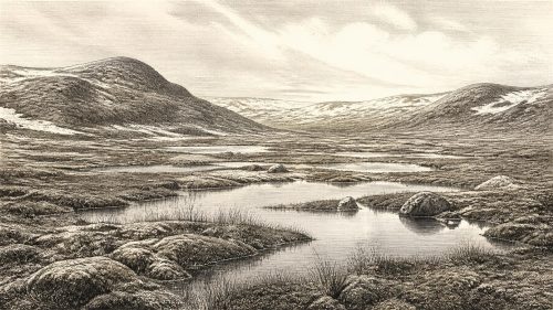
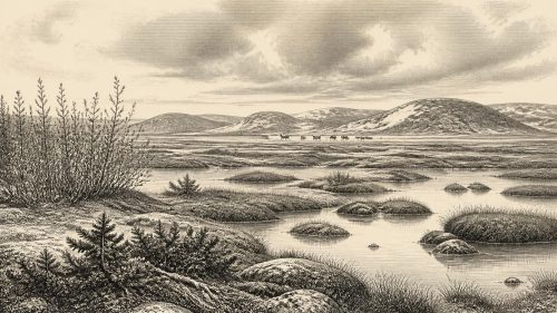
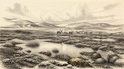
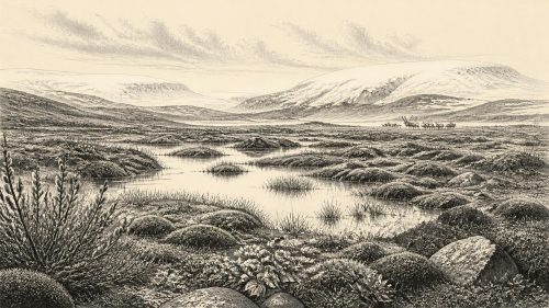
The modern label 30,976 BCE denotes a broad MIS 3 interval, not a recorded Irish year. Derryvree, County Fermanagh, preserves freshwater sediments between glacial tills, indicating an ice-free episode with wet, treeless tundra, pools, sedges, mosses and arctic-alpine plants. Castlepook Cave, County Cork, yielded mammoth, reindeer, giant deer, brown bear and spotted hyaena remains, though disturbed deposits prevent reconstruction of a single fauna or moment. A marked reindeer bone may indicate brief human butchery, but cannot prove settlement. Changing climate, coastlines and ice margins shaped access and habitats before advancing ice transformed Ireland during approach to the Last Glacial Maximum.
Dateline
The label 30,976 BCE is a modern chronological convenience, not a recoverable Irish year. Nobody in Ireland recorded it, and neither archaeology nor environmental science can isolate a particular season, journey, hunt or death at such depth in time. Expressed against the conventional radiocarbon baseline of AD 1950, it is roughly 32,925 calendar years before present. The responsible setting is therefore a broad part of the Late Pleistocene, within Marine Isotope Stage 3 (MIS 3), rather than an annual chronicle.
The evidence is sparse, local and uneven. It consists chiefly of sediments, fossil plants and insects sealed beneath later ice, cave-bone collections whose formation histories are complicated, and reconstructions of glaciers and ancient coastlines. These sources reveal much more about climates, habitats and animals than they do about people. They provide no basis for naming an Irish community, leader, political territory, religion or language at this date.
A Date Within a Wide Range
The closest Irish chronological anchor is Derryvree, near Maguiresbridge in County Fermanagh. Road-cutting in 1969 exposed a remarkable sequence inside a drumlin: a lower glacial till, organic-rich freshwater silts and fine sands, and a second, later till above. The order of the deposits is the crucial evidence. Ice had covered the locality, then retreated or ceased to occupy it long enough for standing or slow-moving freshwater, plants and sediment to accumulate; later glacier ice buried the whole wetland archive.
Organic material from the Derryvree deposit produced a radiocarbon determination of 30,500 radiocarbon years BP, with a large uncertainty. Calibration is essential because radiocarbon years are not identical to calendar years: atmospheric carbon-14 has varied through time. Published discussion places the result broadly at about 36,900–31,700 calibrated years BP, approximately 34,950–29,750 BCE. The notional year 30,976 BCE falls within that broad range. It does not, however, identify a specific layer, living plant or event within it. The range itself, and the distinction between a measurement and its calendar-age interpretation, are more historically meaningful than any artificial single-year precision.
Derryvree is not a weather station for all Ireland. It records one Fermanagh locality during one ice-free interval, and its conditions cannot automatically be projected to Cork, Kerry, the western seaboard or the Irish Sea basin. Yet it is exceptionally valuable because later glaciers eroded, mixed or sealed so much of Ireland’s older landscape. It demonstrates that parts of Ireland could contain terrestrial and freshwater habitat during the unstable middle part of the last cold stage, before the greatest expansion of the last British–Irish Ice Sheet.
Wet Tundra Under a Changing Sky
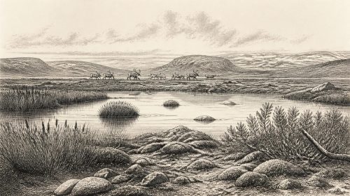
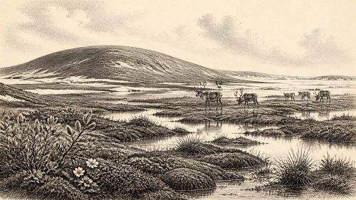
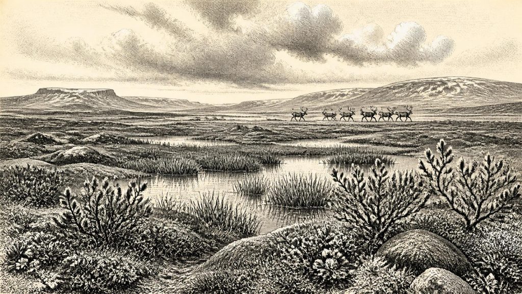
The Derryvree fossils indicate an open, treeless and waterlogged environment often described as tundra or muskeg: moss-rich wet ground with shallow pools, sedges and low herbaceous vegetation. Plant evidence includes grasses, sedges, juniper, bogbean, water-milfoil, dwarf willow, mountain-avens and arctic-alpine mosses. Insects add detail, pointing to open wetland conditions, exposed ground and a severe periglacial regime. This was not an evergreen forest nor an empty white waste, but a patchwork whose appearance altered with drainage, season and climate.
That reconstruction is evidence-based, but it must be kept at the right scale. Fossil plant remains show that suitable habitats existed near the Derryvree pool; they do not supply a complete map of Irish vegetation in 30,976 BCE. Likewise, the word “tundra” is a useful ecological comparison, not a claim that every part of the island resembled modern Arctic terrain. Ireland lay at the Atlantic edge of north-west Europe, where oceanic influences, relief and the proximity of ice could create strong regional contrasts.
Climate in MIS 3 was not stable. Greenland ice-core records reveal abrupt warmer interstadials and colder stadials across the North Atlantic world. Irish cave flowstones and intertill organic deposits independently show that cold-stage conditions included intervals when liquid water moved through caves and wetlands developed. Around the date in question, the best interpretation is of a harsh but changing environment, with cold winters, short growing seasons and recurring shifts in the extent of snow, frozen ground, vegetation and local ice. It was not yet the full Last Glacial Maximum: large-scale reconstructions indicate that the British–Irish Ice Sheet grew substantially from about 31,000 to 26,000 years BP, before reaching its greatest volume later, around 23,000 years BP.
Castlepook and the Animal Record
County Cork’s Castlepook Cave, also called Mammoth Cave, provides the other major Irish window onto this broad period. Excavated mainly between 1904 and 1918, it yielded more than 2,000 animal bones and remains of woolly mammoth, reindeer, giant deer, brown bear and spotted hyaena, alongside smaller cold-adapted animals in other parts of the sequence. Geological Survey Ireland describes it as Ireland’s richest vertebrate-fauna site for the period leading towards the Last Glacial Maximum.
The cave’s importance should not turn its collection into a single imagined scene. Bones accumulated over a long interval, water disturbance affected deposits, and early excavation methods removed much of the original context. Modern re-dating has shown that several old radiocarbon results underestimated the age of bones by thousands of years. The revised evidence places some Castlepook fauna firmly in MIS 3; for spotted hyaena and giant deer, the research suggests local disappearance before the Last Glacial Maximum. A mammoth, a hyaena and a reindeer bone from the site are direct evidence that such animals reached Ireland at different points in this extended cold-stage world. They are not proof that all stood together beside one Fermanagh pool in 30,976 BCE.
Nevertheless, the combined Derryvree and Castlepook record gives Ireland an unexpectedly varied ecological history. Large herbivores would have depended on open vegetation, while predators and scavengers used the same wider landscapes in different ways. Reindeer are especially associated with open cold country; woolly mammoth evokes steppe-tundra grazing; spotted hyaena demonstrates that Pleistocene Ireland included carnivores wholly absent from its later fauna. Cave bones reveal presence and, sometimes, the action of predators or water. They do not reveal herd sizes, migration routes or a balanced food web with certainty.
People: A Possibility, Not a Population
A reindeer femur from Castlepook has made this period especially important for the history of human presence in Ireland. The bone has been presented in Cork heritage material as dating to about 31,000 BC and as bearing a deep mark interpreted as having been made on fresh bone by a sharp stone tool during butchery. If that interpretation is sustained, it would be a striking indication that a person handled a reindeer in Ireland far earlier than the well-established evidence for terminal Pleistocene activity.
Its implications must be expressed conditionally. The date concerns the death of the animal, not a calendar date for the incision. A single marked bone does not establish a camp, a resident population, a family group, a crossing route or recurring occupation. No securely associated hearth, stone-tool assemblage, dwelling surface, burial, food store or concentration of butchered animals has been published for Castlepook at this age. The cave’s complex history makes context especially important. At most, the evidence presently permits the possibility of brief, mobile human activity in Ireland during MIS 3.
This restraint matters because the usual historical categories do not yet apply. There is no evidence for government, diplomacy, territorial rule, warfare or organised trade. Nor can archaeology recover named kin groups, language, religious observance, stories, art or systems of learning for Ireland at this date. Small hunter-gatherer parties elsewhere in Upper Palaeolithic Europe certainly possessed rich social and cultural lives, but that wider knowledge cannot be converted into a description of a documented Irish society. Absence of evidence is not proof that no person ever arrived; it is, however, decisive against inventing an Irish people or culture from one disputed trace.
Land, Sea and Access
Lower global sea level exposed more of the continental shelf than exists today, changing coastlines and the extent of lowland terrain. But “lower sea level” should not be simplified into a guaranteed land bridge or an easy route. Ice margins, proglacial water, changing drainage, sea ice, exposed shelf surfaces and the Irish Sea basin all affected access differently over time. Ireland’s physical relationship with Britain and continental Europe was dynamic, and the precise route available at one moment cannot be read from a cave bone or wetland silt.
For animals, the practical economy was ecological rather than commercial: survival depended on seasonal forage, freshwater, shelter and movement through habitats that could vanish as ice advanced. If people did visit, they would have lived by mobile foraging, hunting and the careful use of animal and plant resources, not by farming, permanent villages or exchange networks known from later prehistory. That is an inference from the environmental setting and comparable Upper Palaeolithic lifeways, not direct evidence from an Irish settlement.
Approaching the Ice Maximum
The major development around 30,976 BCE was therefore environmental change, not a datable public event. Derryvree preserves a rare moment when wet tundra and freshwater life existed between separate episodes of glaciation. Castlepook preserves a longer, difficult animal archive from a land intermittently used by mammals ranging from reindeer to hyaena. Together they show that Ireland before the Last Glacial Maximum was neither permanently ice-covered nor simply hospitable. It was a changing northern landscape in which habitable pockets could emerge, contract and disappear.
Within a few millennia, expanding ice would transform the island and destroy or conceal many traces of this earlier world. The surviving sediments and bones are consequently not marginal curiosities: they are the principal witnesses. They support a history of cold wetlands, open ground, remarkable fauna and possible fleeting human contact, while firmly withholding the political and cultural narrative that later Irish history makes familiar.
Primary Sources
- A Middle Midlandian Freshwater Series at Derryvree, Maguiresbridge, County Fermanagh, Northern Ireland
- The Irish Quaternary Fauna Project
- A Reconsideration of the Radiocarbon Dating of the Marine Isotope Stage 3 Fauna from Southern Ireland
- New Insights on the Fauna of Ireland's Younger Dryas and Early Holocene from Alice & Gwendoline Cave
- Growth and Retreat of the Last British–Irish Ice Sheet, 31,000 to 15,000 Years Ago: the BRITICE-CHRONO Reconstruction
- BRITICE-CHRONO Maps and GIS Data of the Last British-Irish Ice Sheet 31 to 15 ka, Including Model Reconstruction, Geochronometric Age Spreadsheet, Palaeotopographies and Coastline Positions
- The IntCal20 Northern Hemisphere Radiocarbon Age Calibration Curve (0–55 cal kBP)
- Ireland: Submerged Prehistoric Sites and Landscapes
- Maximum Extent and Dynamic Behaviour of the Last British–Irish Ice Sheet West of Ireland
- Dimensions and Chronology of the Last Ice Sheet in Western Ireland
- Late Pleistocene Chronostratigraphy and Ice Sheet Limits, Southern Ireland
- Relative Sea-Level Change Around the Irish Coast
- Advances in Irish Quaternary Studies
- Castlepook Cave: Cork County Geological Site Report
- Heritage Artefacts of County Cork
- Archaeological Heritage of County Cork
- The Exploration of Castlepook Cave, County Cork
- Spotted Hyena Skull
- Learn About: The Ice Age
- Exhibition Galleries: National Museum of Ireland – Natural History
- Figure 6: The Subdivision of the Quaternary Period in Ireland
- Quaternary Site Descriptions
- Soils of County Waterford
- 2022:564 – Castlepook Cave, Castlepook South, Cork
- Archaeology Research Excavation Grant Report: Castlepook Cave Geophysical Survey