
The Derryvree Bogbean Seed30937 BCE
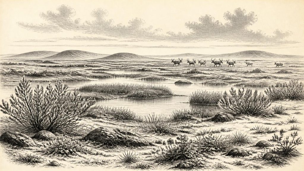
Around 30,937 BCE, Ireland’s history is reconstructed from environmental evidence rather than dated events. At Derryvree, County Fermanagh, organic freshwater deposits between glacial tills reveal a locally ice-free interval during the Middle Midlandian cold stage. Bogbean seeds, mosses, sedges and cold-adapted plants indicate treeless, tundra-like wetlands amid frost-affected terrain. Castlepook Cave, County Cork, preserves diverse pre-Last Glacial Maximum fauna, including mammoth, reindeer, giant deer, bears, wolves and hyaenas, demonstrating ecological links with north-west Europe. A possibly butchered reindeer bone may suggest brief human visitation, but remains inconclusive. Together, these archives show a cold landscape altered by ice, water and climate.
Dateline
30,937 BCE is not a year that can be recovered from the Irish record as an eventful point on a calendar. It is a modern calendrical label, approximately 32,886 years before AD 1950, used here to examine a much broader prehistoric interval. No annals, objects with inscribed dates, settlements or graves permit an annual history. The responsible framework is the later part of the Pleistocene, within Marine Isotope Stage 3 and the Irish “Middle Midlandian” cold stage. The most useful evidence is environmental and geological: freshwater deposits sealed beneath glacial sediments in County Fermanagh, and animal remains preserved in caves, particularly in north County Cork.
The closest dated Irish sequence is at Derryvree near Maguiresbridge, County Fermanagh. A conventional radiocarbon measurement from its organic deposits, BIRM-166, gave 30,500 ± 1,100 radiocarbon years BP. Radiocarbon years are not calendar years: changing atmospheric carbon levels mean that they must be calibrated, and at this depth of time the result is necessarily a broad probability range. Modern recalibration places the Derryvree horizon broadly around 36,900–31,700 calibrated years BP, or approximately 34,950–29,750 BCE. Thus 30,937 BCE can reasonably be treated as lying within the wider period illuminated by Derryvree, but not as the date when a particular seed fell, an animal passed by, or a human act occurred.
A Freshwater Interval Between Ice Advances
Derryvree matters because of its physical arrangement. Roadworks exposed a section through a drumlin: a lower deposit of till, laid down by glacier ice; fine sands, silts and organic freshwater sediments above it; and another body of till sealing the sequence. This was not a normal soil horizon. It was a buried environmental archive, formed after one phase of glaciation and before another. The organic bed establishes that, for a period, this locality was not overridden by ice and contained standing or slow-moving fresh water. Subsequent glacier advance then covered and protected the deposit.
That simple sequence is the strongest evidence available for regional change around this notional year. It shows alternation rather than a single, uniform “Ice Age” landscape. Ireland was not necessarily either entirely ice-covered or entirely ice-free. Local ice margins shifted, drainage changed and exposed ground could support ponds, wet hollows and vegetation before renewed glaciation transformed the terrain. The later Last Glacial Maximum was still to come: reconstructions indicate major expansion of the British–Irish Ice Sheet in the following millennia, with maximum ice extent broadly in the period after about 27,000 years ago. Derryvree is therefore a rare glimpse of a cold but locally ice-free phase before that more extensive glaciation.
Wet Ground in a Treeless Country
The most vivid detail from Derryvree is modest in scale: a fossil seed of bogbean, Menyanthes trifoliata. Bogbean is a plant of wet ground and freshwater margins. Alongside it, the deposit has yielded evidence of mosses, sedges, aquatic plants and cold-adapted species including mountain avens and dwarf willow. These remains support a picture of pools and marshy fringes set within open, frost-affected ground. They do not justify imagining Ireland as a continuous bog, nor do they provide a botanical map for the whole island. They document conditions in and close to one northern basin.
Pollen and plant macrofossils are especially valuable because they correct later, familiar images of Ireland. This was not the green, wooded island of the recent past. The evidence points instead to a largely treeless landscape, with herbaceous cover, low shrubs and wetland communities able to survive short growing seasons and severe cold. “Tundra-like” is a useful comparison, provided it is not treated as an exact modern analogue. The island’s Atlantic setting, local relief, watercourses and nearby ice would have created a mosaic of exposed slopes, sediment-laden channels, marshes and shallow water.
Seasonal freezing and thawing probably shaped exposed surfaces. Periglacial conditions do not mean that the ground lay under a glacier; they describe the intense cold, frost action and sparse cover associated with terrain near ice or within a cold-stage climate. In such settings, meltwater could be vital. The freshwater sediments at Derryvree record a functioning local ecosystem, not a sterile wasteland, yet it was an ecosystem vulnerable to abrupt climatic and glacial change.
Animals at Ireland’s Western Edge
County Cork supplies a different body of evidence. Castlepook Cave, also known as Mammoth Cave or Doneraile Cave, near the Awbeg Valley, produced Ireland’s richest known assemblage of pre-Last Glacial Maximum vertebrate remains. The cave material includes mammoth, reindeer, giant deer, brown bear, wolf, fox, Arctic fox, mountain hare, lemmings and spotted hyaena. Together, these fossils demonstrate that Ireland was connected ecologically to the wider north-west European world. Large mammals and predators could reach, or persist in, parts of the island during favourable phases.
But a cave assemblage must not be read as a census from one day. Castlepook’s bones accumulated through complex processes: animals may have died naturally, been dragged in by carnivores, entered through openings, or been moved by water and sediment. Much of the material was excavated in the late nineteenth and early twentieth centuries, before modern recording methods. Later material entered parts of the system too. Radiocarbon dates and species identifications are therefore essential, but they cannot eliminate every problem of mixing and context. The secure conclusion is that a varied cold-stage fauna occupied Ireland over a considerable span; it is not that all listed animals shared one landscape at 30,937 BCE.
Nevertheless, Castlepook makes Derryvree’s wetland less isolated. Reindeer and mammoth imply open country with substantial grazing resources somewhere in the wider region, while hyaenas and wolves show that large carnivores were present. These animals did not create a human economy, but their remains reveal the ecological possibilities of a periodically accessible western peninsula. The sea was much lower than today during glacial conditions, and the geography of the Irish Sea basin differed greatly from the modern island setting. Connections to Britain and continental Europe changed as ice, sea level and coastlines changed.
The Human Question
There is no securely excavated house, hearth, stone-tool assemblage, burial, artwork or settlement in Ireland that can be assigned to 30,937 BCE. Accordingly, there is no basis for describing a resident population, a language, a tribe, political authority or an Irish Upper Palaeolithic society at this date. Political affairs, diplomacy and organised conflict are simply beyond the evidence. So too are religion, formal learning, exchange systems and social rank. Their absence from this account is not an invitation to fill the silence with Celtic myth, later folklore or assumptions drawn from other countries.
There is, however, an important and unresolved clue. A reindeer femur from the Castlepook material has been reported as bearing a sharp mark interpreted as stone-tool butchery, and it has been associated with an age of roughly 33,000 years ago. If that interpretation is upheld by continuing specialist study, it would indicate that a person, or a very small party, handled and perhaps processed a reindeer in Ireland during this broad interval. It would be a major extension of the island’s human record.
Yet the claim must remain provisional. One possible cut mark on a bone recovered from an old, complicated cave excavation cannot establish permanent occupation. It cannot identify a cultural group, prove a camp nearby, or show that people returned regularly. Carnivore damage, trampling, breakage, excavation disturbance and the challenge of tying a specimen to a precise layer all demand caution. Recent excavation at Castlepook has sought surviving deposits that may improve the chronology and context. Until fuller published evidence resolves the question, the most accurate formulation is that brief human visitation is possible, while settled human presence in Ireland around this time remains unproven.
Everyday Life, If Visitors Came
It is possible to offer a carefully limited comparison. In north-west Europe, Upper Palaeolithic people were generally mobile hunter-gatherers whose lives depended on knowledge of animals, seasons, stone, shelter and routes through changing landscapes. If people reached Ireland during the Derryvree–Castlepook horizon, they would probably have travelled in very small groups and made short-term decisions around food, weather and movement. This is an inference from the wider European archaeological record, not a demonstrated account of an Irish community.
No trade can be shown in the ordinary sense. There are no known imported ornaments, exchanged raw materials or recognisable tool industries from Ireland at this date. Nor can farming, herding, pottery, metalworking or monument-building be projected backwards from later prehistory. The only economy directly visible is the ecology of the landscape: vegetation taking hold in wet ground; herbivores feeding across open terrain; carnivores hunting or scavenging; water carrying silt; and ice repeatedly remaking the land.
The cultural significance of caves is equally unknowable here. Later Irish communities used caves for burial, ritual, storage and shelter, but later practice cannot be transferred to the Pleistocene. Castlepook was certainly a place where bones accumulated; whether any people regarded it as shelter, a butchery location, a landmark or simply a hazard in the landscape cannot yet be said.
What This Date Can Mean
The most important development around 30,937 BCE was environmental instability. In Fermanagh, a freshwater wetland existed long enough to preserve bogbean, mosses and other cold-adapted life between episodes of glaciation. In Cork, cave deposits preserve evidence that substantial mammals and formidable predators had reached Ireland during the wider cold stage. These two archives are separated by geography and formed through different processes, but together they replace the misleading image of an unchanging frozen island with one of regional variety and repeated transformation.
Derryvree’s bogbean seed is therefore a better guide to this date than an invented human drama. It is direct evidence for water, plants and a locally ice-free interval; it is not evidence for a named event. Castlepook’s fauna is direct evidence for animals; a human presence remains a serious but unsettled interpretation. The broader lesson is one of preservation as much as history. Later ice sheets eroded, buried and rearranged much of the earlier record. What remains is fragmentary, but it is enough to show that Ireland, nearly thirty-three millennia before AD 1950, was a cold, open, environmentally dynamic place at Europe’s far western edge.
Primary Sources
- A Middle Midlandian Freshwater Series at Derryvree, Maguiresbridge, County Fermanagh, Northern Ireland
- The Irish Quaternary Fauna Project
- The Exploration of Castlepook Cave, County Cork
- Irish Pleistocene Biostratigraphy
- The IntCal20 Northern Hemisphere Radiocarbon Age Calibration Curve (0–55 cal kBP)
- Exploring Controls of the Early and Stepped Deglaciation on the Western Margin of the British Irish Ice Sheet
- Growth and Retreat of the Last British–Irish Ice Sheet, 31,000 to 15,000 Years Ago: the BRITICE-CHRONO Reconstruction
- New Age Constraints for the Maximum Extent of the Last British-Irish Ice Sheet (NW Sector)
- Early Deglaciation of the British-Irish Ice Sheet on the Atlantic Shelf Northwest of Ireland
- The Glacial Deposits of the Maguiresbridge Area, County Fermanagh, Northern Ireland
- Figure 6: The Subdivision of the Quaternary Period in Ireland
- Irish Quaternary Association Field Guide: References and Recommended Reading
- Menyanthes trifoliata L. — Fermanagh Flora
- Dryas octopetala L. — Fermanagh Flora
- Archaeological Heritage of County Cork
- Heritage Artefacts of County Cork
- Castlepook Cave, County Cork — Excavation Report 2022
- Preliminary Assessment of the Archive of Faunal Remains from Excavated Irish Cave Sites
- The Archaeology of Caves in Ireland
- The Colonization of Ireland: A Human Ecology Perspective
