BIRM-166’s Periglacial Ledger30936 BCE
30,936 BCE is not a recoverable Irish year but falls broadly within Late Pleistocene MIS 3, a climatically unstable phase of the Midlandian cold stage. At Derryvree, Fermanagh, BIRM-166 organic sediments between tills indicate a locally ice-free, tundra-like freshwater wetland, dated imprecisely to approximately 36,900–31,700 calibrated years BP. Castlepook Cave, Cork, preserves varied cold-stage fauna, showing intermittent animal movement through open landscapes, although species need not have coexisted. A cut-marked reindeer bone may indicate fleeting human activity, but lacks secure contextual evidence for settlement. Changing ice, sea levels and routes created regional contrasts. The evidence supports cautious environmental reconstruction only.
Dateline
30,936 BCE is a modern chronological label, not a recoverable year in Irish history. No calendar, written record, named person, settlement surface or annual environmental sequence can tell us what happened in Ireland in that particular year. In the conventional archaeological system it lies roughly 32,885 years before AD 1950, but that arithmetic does not make it a precise prehistoric date. The evidence comes instead from deposits and bones measured with substantial uncertainty, then compared with calibration curves. The responsible subject is therefore a broad Late Pleistocene interval, within Marine Isotope Stage 3 (MIS 3), rather than an event of 30,936 BCE itself.
This was part of the Midlandian cold stage: a long, uneven episode of the last Ice Age, marked by sharp climatic shifts, changing sea levels and repeated advances and retreats of ice. Ireland was not simply a white, permanently frozen island. Nor was it a familiar green island inhabited by established communities. Its surviving record indicates a variable and often severe environment in which locally ice-free ground, wet hollows, caves, animals and glaciers existed at different times and in different regions. Later ice movement destroyed, buried or reworked much of the evidence. What remains is fragmentary, but exceptionally informative when read cautiously.
A Date Within a Range
The closest major Irish environmental archive is the Derryvree freshwater series near Maguiresbridge in County Fermanagh. Road construction in 1969 cut through a drumlin and exposed organic silts and fine sands between two layers of till, the unsorted debris deposited directly by glacier ice. The stratigraphy establishes an important sequence: ice had affected the locality; then freshwater, sediment and vegetation accumulated during an interval when ice was absent locally; later ice advanced again and sealed the deposit.
Organic material from this intervening bed, catalogue number BIRM-166, produced a conventional radiocarbon determination of 30,500 +1,170/−1,030 radiocarbon years BP. Radiocarbon years are not calendar years. Using modern calibration, discussions of the deposit place it broadly at about 36,900–31,700 calibrated years BP. That is a wide span, and the notional date of 30,936 BCE falls within it only in the broadest chronological sense. It cannot be assigned to a particular pool, plant, animal, season or human action represented at Derryvree.
The distinction is more than technical. A sediment bed may have formed over generations or centuries; its organic matter can be mixed, transported or imperfectly preserved; and calibration curves at this depth of time retain wide uncertainties. Derryvree is consequently not an annual diary. It is evidence that south Fermanagh contained a freshwater and periglacial environment during part of later MIS 3, between glacial episodes. It is one of the clearest Irish windows onto the environmental world relevant to this date.
Fresh Water Beneath a Drumlin
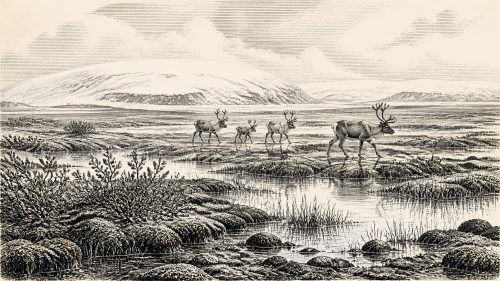
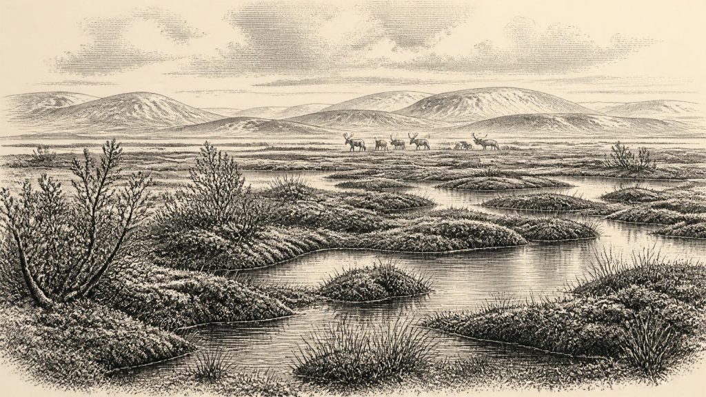
The Derryvree plant and animal evidence points to an open, treeless landscape of cold wet ground rather than forest. Pollen was poorly preserved, but the dominant signal is herbaceous. Mosses, grasses and sedges occurred with plants associated with cold or alpine conditions and shallow freshwater habitats, including mountain-avens, dwarf willow, lesser clubmoss, bogbean and water-milfoil. A bogbean seed is especially evocative: it confirms standing or slow-moving fresh water in a landscape otherwise shaped by cold and frost.
Researchers have interpreted the setting as tundra-like muskeg or fen: saturated ground, mossy vegetation, pools, sedge-rich margins and low plants able to endure short growing seasons. Periglacial does not mean that a glacier lay over the spot. It means a landscape strongly influenced by freezing and thawing, frost action and a cold climate near ice. The freshwater bed itself proves that Derryvree was not continuously ice-covered. It does not prove that all of Ireland was ice-free, or that the same vegetation extended without interruption across the island.
This regional qualification matters because Ireland’s terrain, coastlines and ice margins were changing. Geological reconstructions show that the British–Irish Ice Sheet was entering a phase of major growth around and after 31,000 years ago. The later maximum was not reached until much later, but the approach to it was neither neat nor synchronous. Ice centres, valley glaciers and marine margins could expand or contract at different rates. A cold wetland in Fermanagh therefore belongs beside, rather than replaces, evidence for ice elsewhere.
Caves, Carrion and Grazing Animals
Southern Irish caves provide a second, quite different archive. Castlepook Cave near Doneraile in north Cork has yielded an important collection of Late Pleistocene bones, much of it excavated in the late nineteenth and early twentieth centuries and later reassessed by the Irish Quaternary Fauna Project and more recent investigators. The assemblage includes remains attributed to reindeer, woolly mammoth, giant deer, brown bear, wolf, Arctic fox, mountain hare, lemmings and spotted hyaena. These animals demonstrate that Ireland could support, or at least be reached by, varied cold-stage fauna during MIS 3.
That list should not be turned into a single painted scene. Cave deposits can accumulate through scavenging, carnivore denning, water movement, natural deaths, excavation disturbance and collection practices extending over a long period. The fauna at Castlepook does not establish that every species lived together, at one moment, around 30,936 BCE. It does, however, undermine the notion of an ecologically empty Ireland before the last glacial maximum. Open country supplied grazing for herbivores, while predators and scavengers used the same wider landscapes and caves.
Reindeer are particularly compatible with a cold, largely open setting, though their bones do not disclose the route, size or seasonal behaviour of a particular herd. Mammoths and giant deer likewise signal substantial animal movement through Ireland at some points in the Late Pleistocene, not permanent residence in every region. Spotted hyaena remains are a reminder that caves were not neutral shelters: they could be places where carnivores carried prey, gnawed bones and created deposits later difficult to disentangle.
The Castlepook Human Question
The most consequential possible human evidence is a reindeer femur from Castlepook, reported as dating to roughly 33,000 years ago and bearing a deep mark interpreted as a stone-tool cut made while fresh tissue was being removed. If that interpretation and association are confirmed, it would indicate that a person or very small group processed a reindeer in Ireland during MIS 3, far earlier than the formerly accepted evidence for human presence.
Yet the limits are decisive. The specimen derives from an old cave collection rather than a modern excavation of an intact occupation floor. No securely associated hearth, lithic assemblage, dwelling, burial, food-preparation area or repeated activity surface of comparable age has been identified. A modified bone may record a brief visit; it cannot demonstrate a permanent settlement, continuous population, named cultural group, language or migration route. The cut-mark interpretation is a taphonomic judgement requiring continued scrutiny, separate from the laboratory age of the bone itself.
Accordingly, society and everyday life cannot be reconstructed directly for Ireland at this date. If people reached the island, their subsistence may plausibly have involved highly mobile hunting and butchery, as among Upper Palaeolithic groups elsewhere in north-west Europe, but that is an inference from wider comparison, not a fact observed at Castlepook. There is no responsible evidence for Irish villages, families, leadership, territory, clothing traditions, art or ceremonial practice in this specific period.
No Polities, No Trade Network
There were no recorded political affairs, warfare, diplomacy or institutions to describe. Even the existence of a durable human population remains unproven. Nor can archaeology identify an Irish economy in the later historical sense. There is no evidence for farming, herding, metalworking, exchange systems or organised trade. The only secure economic processes were ecological ones: plants exploiting brief growing seasons, herbivores feeding across open terrain, carnivores and scavengers competing for carcasses, and glacier ice repeatedly transforming drainage and landforms.
Low global sea levels exposed areas now submerged around north-west Europe, but that does not licence a simple picture of an easy land bridge from Britain to Ireland. The Irish Sea basin, local ice, sea level, islands and marine channels formed a changing and still debated geographical problem. Animal arrivals demonstrate that routes existed at intervals, whether across exposed ground, ice, short water crossings or combinations of these. They do not establish one continuous corridor, and they say still less about any route used by people.
Learning From an Incomplete Record
The principal development illuminated around this notional year was environmental instability. Derryvree records a locally ice-free freshwater refuge in Fermanagh; Castlepook documents an intermittently rich fauna in Cork; Crag Cave in County Kerry preserves speleothem evidence for repeated milder episodes during MIS 3; and ice-sheet research shows a rapidly changing glacial system moving towards larger expansion. Together these sources describe an Ireland of regional contrasts, not a uniform island-wide climate.
There was no religion or learning in a recoverable documentary sense, and no material evidence from this horizon securely identifies ritual or symbolic culture in Ireland. The intellectual achievement belongs to modern research: stratigraphy establishes the order of deposits; palaeobotany identifies plant remains; zooarchaeology reads animal bones; radiocarbon and uranium-thorium methods provide chronologies; and glacial geomorphology reconstructs ice movement. Each method has limits, but together they permit a disciplined account of a landscape otherwise almost erased.
For 30,936 BCE, then, Ireland’s history is not a narrative of rulers or events. It is the history of cold water held between tills, low vegetation surviving on frost-worked ground, animals entering a shifting Atlantic borderland, and possible human contact that remains tantalising rather than proven. BIRM-166 is valuable precisely because it teaches restraint: it preserves a real Ice Age environment, but not an exact year, and certainly not a lost prehistoric society waiting to be named.
Primary Sources
- A Middle Midlandian Freshwater Series at Derryvree, Maguiresbridge, County Fermanagh, Northern Ireland
- Palaeoecology
- The Irish Quaternary Fauna Project
- Growth and Retreat of the Last British–Irish Ice Sheet, 31,000 to 15,000 Years Ago: The BRITICE-CHRONO Reconstruction
- Timing, Pace and Controls on Ice Sheet Retreat: An Introduction to the BRITICE-CHRONO Transect Reconstructions of the British-Irish Ice Sheet
- The Timing and Magnitude of the British–Irish Ice Sheet Between Marine Isotope Stages 5d and 2: Implications for Glacio-Isostatic Adjustment, High Relative Sea Levels and ‘Giant Erratic’ Emplacement
- Exploring Controls of the Early and Stepped Deglaciation on the Western Margin of the British Irish Ice Sheet
- Pattern and Timing of Retreat of the Last British-Irish Ice Sheet
- Episodic Speleothem Deposition Tracks the Terrestrial Impact of Millennial-Scale Last Glacial Climate Variability in SW Ireland
- Spatio-Temporal Dynamics of Speleothem Growth and Glaciation in the British Isles
- The IntCal20 Northern Hemisphere Radiocarbon Age Calibration Curve (0–55 cal kBP)
- The Problem of a Late Quaternary Landbridge Between Britain and Ireland
- The Island of Ireland: Drowning the Myth of an Irish Land-Bridge?
- First Evidence of a Late Upper Palaeolithic Human Presence in Ireland
- New Insights on the Fauna of Ireland’s Younger Dryas and Early Holocene from Alice & Gwendoline Cave
- Ireland’s Palaeolithic Archaeology – Fleeting Footprints in a Frozen Land
- Archaeological Heritage of County Cork
- Heritage Artefacts of County Cork 2021
- Castlepook Cave, Castlepook South, Cork
- The Mesolithic in Ireland: When Was It?
- Figure 6.—The Subdivision of the Quaternary Period in Ireland
- Irish Pleistocene Biostratigraphy